
Official X account for the National Weather Service Jacksonville. ⛈️ Details: https://t.co/Xz9ubcZPoO
Serving NE FL & SE GA.
https://t.co/PTDjF4rJYY
 Hurricane & Tropical Storm Warnings remain in effect. Best chance for hurricane force gusts will be along the I-75, Suwannee Valley & Inland SE GA.
 🌀 Strong Tropical Storm force winds will begin to push into north-central FL this evening with Gusts to Hurricane strength along the Atlantic Coast possible tomorrow
 💧Torrential Rainfall & Flash Flooding Potential Today into Friday
 🌀𝐓𝐫𝐨𝐩𝐢𝐜𝐚𝐥 𝐒𝐭𝐨𝐫𝐦 𝐖𝐚𝐭𝐜𝐡𝐞𝐬 & 𝐖𝐚𝐫𝐧𝐢𝐧𝐠𝐬 in Effect for Atlantic coast & portions of inland NE FL & SE GA
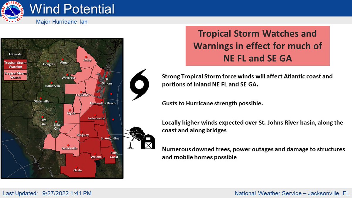
 🌊🌊🌊 The MAIN THREAT with Dorian will be the life threatening storm surge along the east coast and coastal flooding further inland which will begin AHEAD of the storm.