NWS Pittsburgh Profile picture
Official Twitter Account for National Weather Service Pittsburgh. Details: http://t.co/KKTK7cZlhK
Jan 22 7 tweets 2 min read
Similar to earlier this week we are still looking at two main scenarios for the upcoming winter storm. Steadier snowfall is expected to begin Saturday afternoon and evening and continue into Monday. The scenarios will be broken down further in comments on this post. A graphic depicting scenario #1 a snowier possible outcome with possible snow amounts for this scenario laid out.
A graphic depicting scenario #2 a icier and lower snowfall scenario for the Mon Valley with possible ice amounts in this scenario.
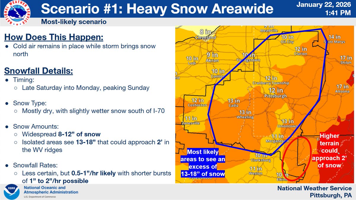
(1/6) Scenario #1 Heavy snow occurs areawide.

If the colder air stays locked into the region, then heavy snowfall upwards of 8-12" with localized accumulations possibly as high as 18" becomes increasingly likely for much of the area.
Jan 21 13 tweets 3 min read
(1/12) "What's the forecast for this weekend?" If you recall from yesterday, we had a discussion about long range snowfall forecasting. We discussed the closer you get to an event, the more we can narrow down the amount of potential scenarios that may play out.... A graphic showing a low pressure and fronts for the less snowy, southern track scenario #1.
A graphic showing a low pressure and fronts for the more snowy, northern track scenario #2.
The probability of exceeding 6" of snow on a map spanning 7pm Saturday to 7pm Monday.
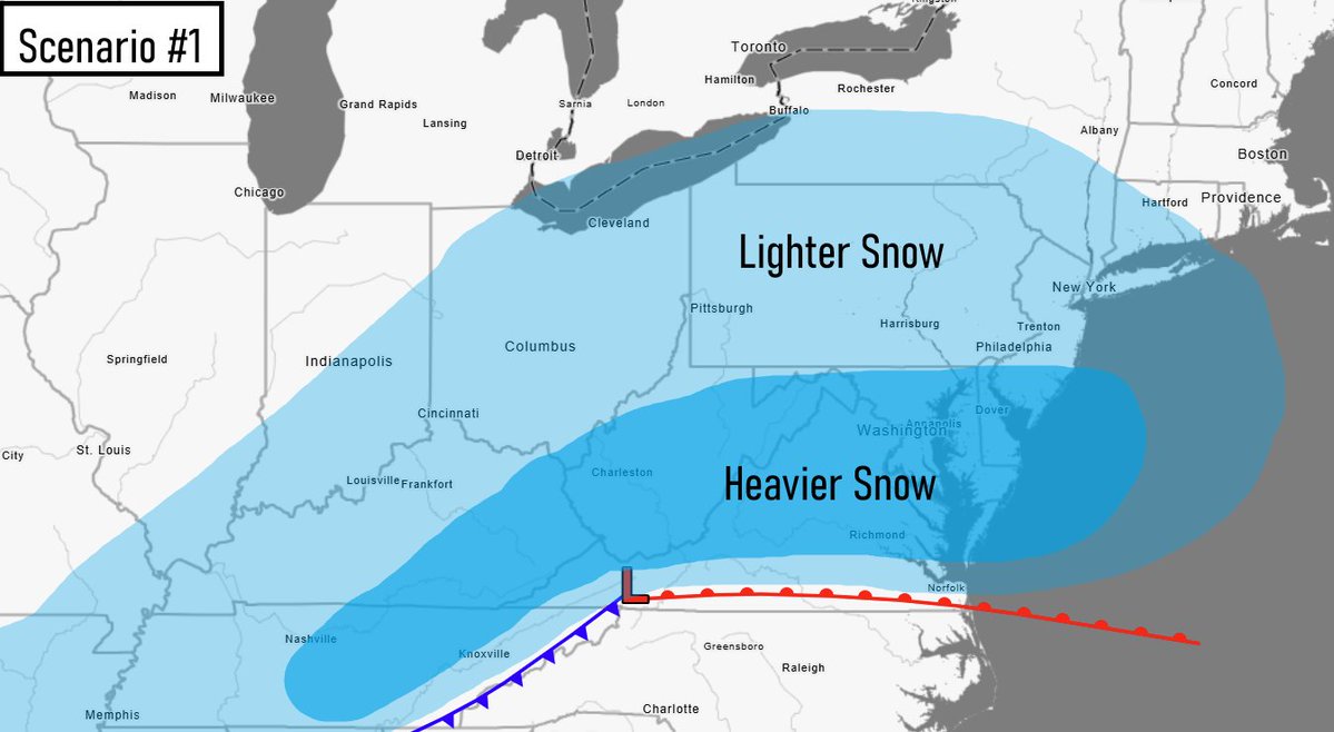
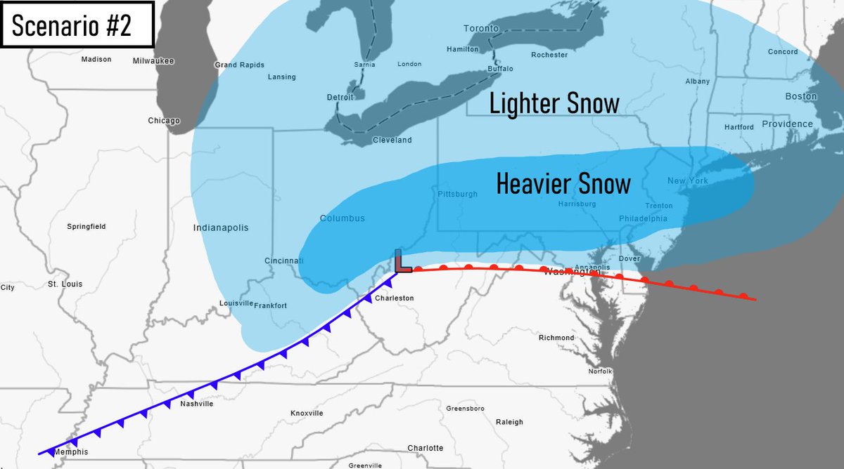
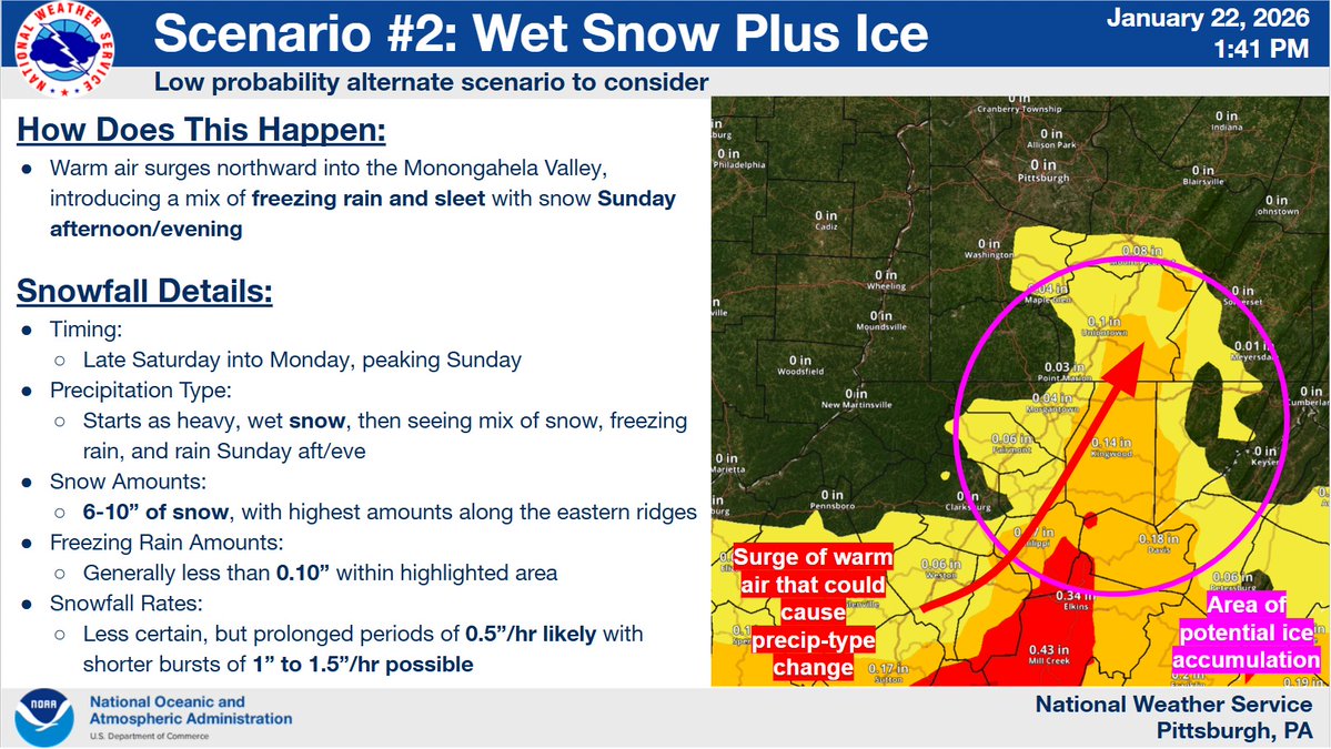
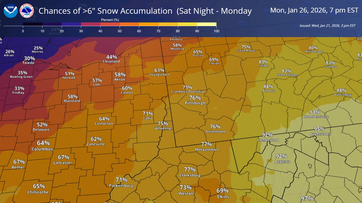
(2/12) Over the last 24 hours, the scenario with no snow has been completely thrown out. Only 2 scenarios remain out of the original 3. Let's call these our new scenario #1 and our new scenario #2. In both scenarios we receive snowfall, but the main question is how much?
Dec 22, 2022 8 tweets 2 min read
With wind chills forecast to drop to between -15°F and -35°F Friday and Saturday, frostbite is possible in as little as 10-30 minutes to exposed skin. If possible, plan to avoid any outdoor exposure. If you must go outside, use extreme caution. Bundle up and cover up. A chart showing expected wind chills resulting from various Here are some precautionary actions you can take now to keep you and your family safe:
Dec 20, 2022 7 tweets 2 min read
(1/7) ...so you may have heard that we're going to have a winter storm at the end of the week. How is it going to affect us? Are we going to have a White Christmas? Read below and let's find out. ❄️(2/7) Very cold and rapidly falling temperatures! A strong cold front will move through our region Friday morning. Temperatures will quickly drop from the upper 30s and lower 40s before dawn to the 10s... by noon! 🥶