 Geolocation| (0:00-0:12) PRCS personnel treating an injured child [GRAPHIC] on Munir Al-Rayes Street near the Barcelona Park in the Tel Al-Hawa neighborhood.
 @GeoConfirmed (1:44-2:03) The second part of the video is filmed roughly 530 meters NW of this location, showing vast destruction east of Salah Al-Din Street, including the destroyed Jabalia Martyrs Elementary School for Boys.
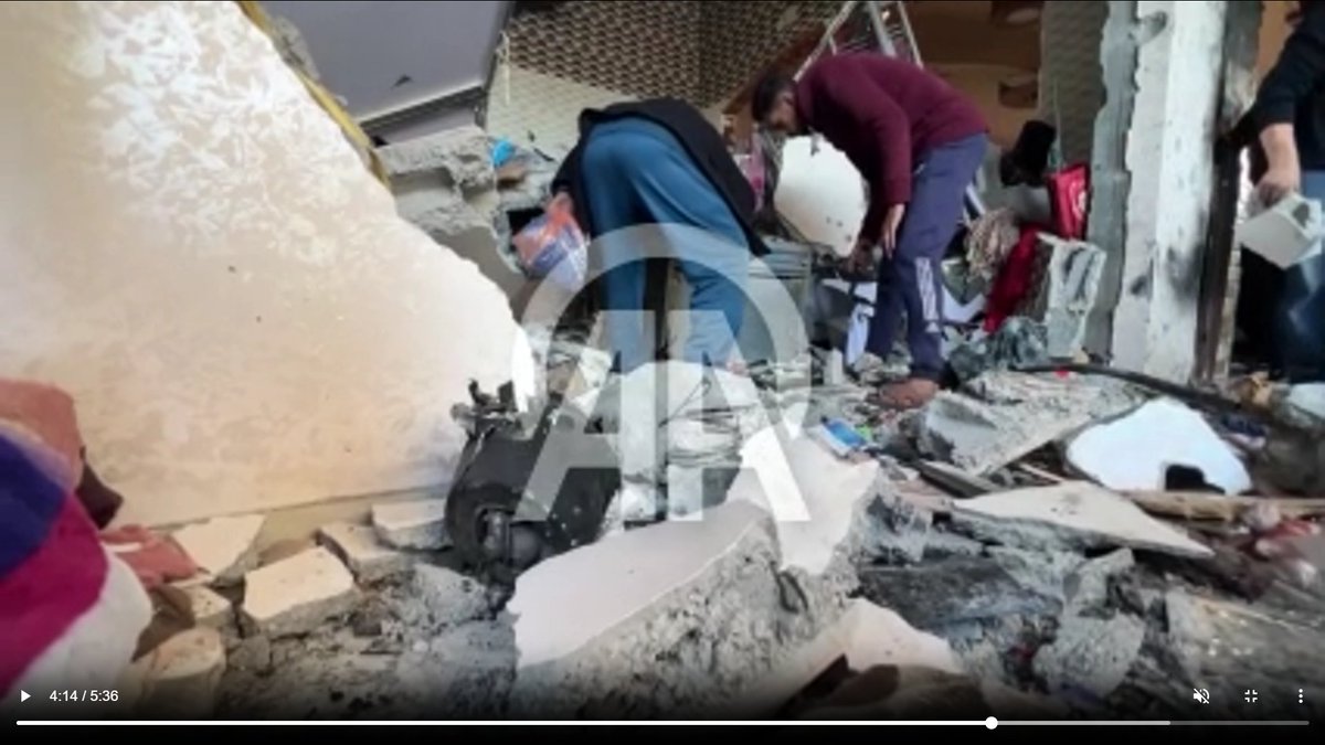
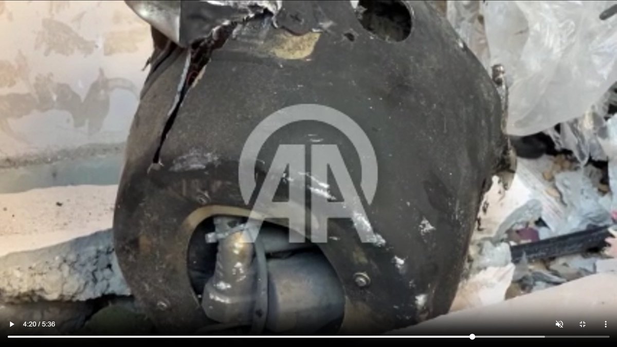
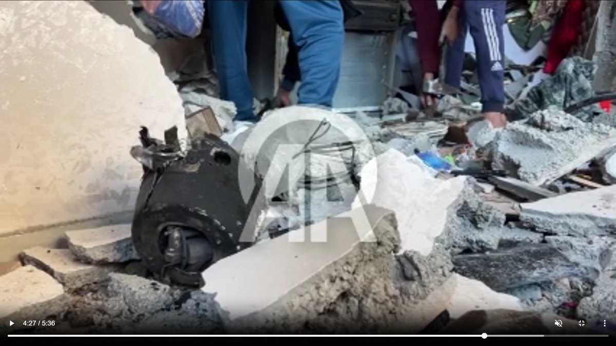
 Daylight footage appears to show a munition remnant amid the rubble at the heavily damaged house.
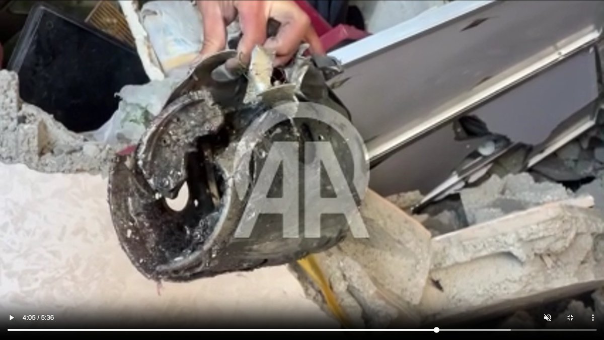
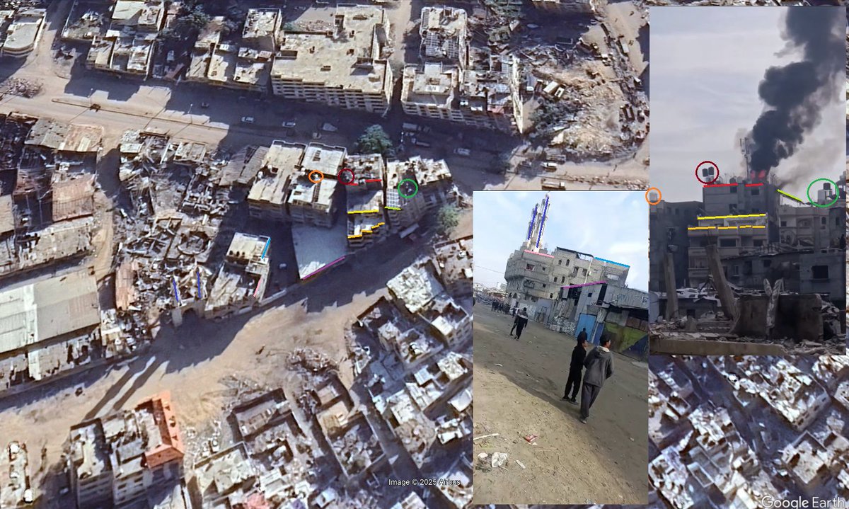 @GeoConfirmed Some technical equipment appears visible at the fire. Several textual reports mention a mobile phone transmission point (t.me/safypress90/33…) or an electricity generator being hit.
 The post mentions "a robot" (likely a remotely operted explosive-laden M113 vehicle) being detonated "yesterday" (5 Dec.): t.me/Nuseirat1/1520…


 Based on the imagery, involved organisations include: the Ministry of Tourism and Antiquities, the Centre for Cultural Heritage Preservation & the ALIPH Foundation.
 More footage shows the injured woman as well as the crashed drone after it hit her.


 This is in the same area as were previous footage related to the milita has been geolocated to.
 (0:07-0:43) Al-Nasr area, near the destroyed Fayrouz Towers in northwestern Gaza City.
 (1:45-1:57) The casualties were brought to the Al-Shifa Hospital where another video also shows at least 6 killed children (some also visible in PRCS video).

 At least 2 shots are visible in the video. While the second appears to have been in the air, the first is lower.

 Based on 2 Google Earth satellite images the video appears to have been taken between 4 June 2024 and 1 December 2024.
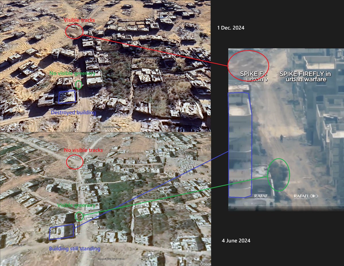


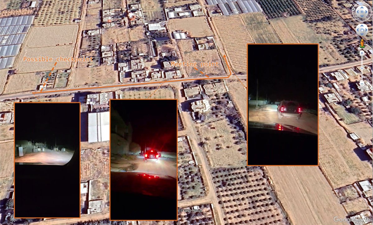
 @GeoConfirmed Israeli forces at a, reportedly closed, checkpoint on the road between Hableh and Qalqilya, Qalqilya Governorate.


 @GeoConfirmed [VERY GRAPHIC] footage shows at least 3 bodies being pulled from the rubble, including 2 children.
 @GeoConfirmed The damaged warehouse, next to the destroyed structure, appears to have been established in Sep/Oct. 2024, reportedly with support from @KSRelief

 @GeoConfirmed Initial pieces of footage show destroyed pavement and a possible crater in front of the entrance to the emergency department of the hospital.


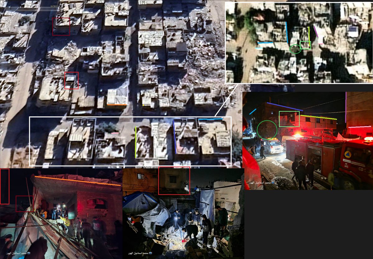
 @GeoConfirmed A video posted by the Gaza Civil Defense shows rescue efforts a night. At least 2 casualties, including a child [GRAPHIC] are visible at the location.
 Other footage also shows an Israeli Caterpillar 349 armored excavator amid destroyed road infrastructure at the beginning of the street in the center of the Nur Shams Camp, Tulkarm, occupied #WestBank
 2/ The Israeli military first entered the area around 21 Nov. 2023 as shown by geolocations.