
Official account of the Philippine Space Agency (PhilSA). Empowering the Filipino nation through a robust Philippine space ecosystem.
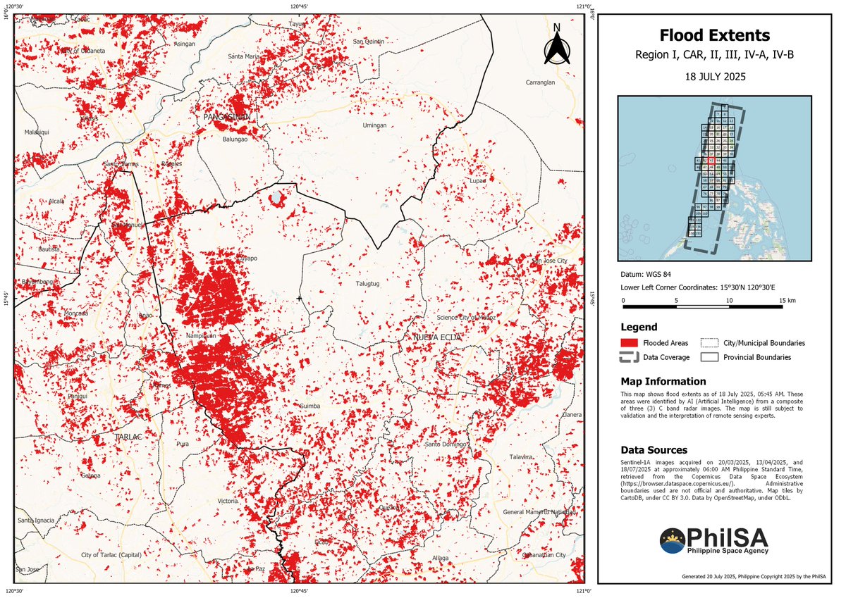 Please be advised that the accuracy of these maps is still subject to field validation. Floods, which may have subsided before this time period, will not be visible in the available imagery.