
Lecturer in Atmospheric Science @EarthSciStA. Co-Editor-in-Chief @RMetS Weather. Large-scale weather & climate variability, prediction & change.

 Despite using different methods, different datasets, computed over different time periods, there is very good agreement (r = 0.92) with the multidecadal variability well-captured. However, ERA5's SLP NAO pegs 2018 as negative (-0.32), whereas CPC have it at +1...


 This scenario would obliterate maximum temperature records across western Europe.

 Seasonal-mean maps at climate.copernicus.eu/charts/c3s_sea… where you can also compare with previous initialisation dates.

 This vortex weakening event is forecast to be a wavenumber-1 disturbance, with the stratospheric vortex shunted toward Eurasia. In some ways this is a "Canadian warming" (doi.org/10.1175/1520-0…)
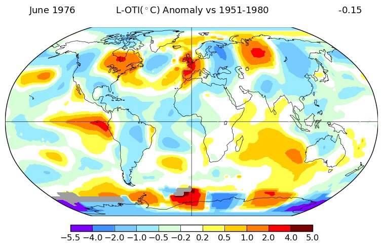
 Wow, this got far more exposure than I was anticipating! I’m glad this has made the global warming picture make sense for so many. Data and maps from the excellent @NASAGISS website, where you can plot similar maps (with whatever base period you like!).