Monitoring the infamous Lake Erie microclimate.
NWS Skywarn.
#ONstorm #OnWx
Dec 1, 2024 • 9 tweets • 3 min read
FINALLY!!
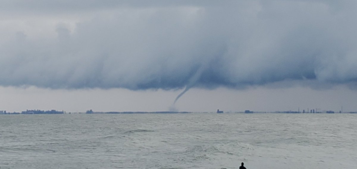
Excellent winter waterspout just off the shore from South Buffalo, NY.
12:31 pm EST.
@ICWR @NWSBUFFALO
#Onstorm #nywx
More video and pics of the big spout on Lake Erie while surfers watched.
Viewed from Crystal Beach, ON.
@ICWR @ECCCWeatherON
Dec 19, 2022 • 12 tweets • 4 min read
SEICHE WATCH-
The storm heading to the area Friday is continually trending more severe.
As of now, models suggest over 40 CONTINUOUS HOURS of wind gusts in excess of 100kmh.
While SSW winds will reduce maximum potential effect, a seiche of 10ft or more is possible. 1/ #ONstorm
Flooding and shoreline erosion is likely. Icing in flooded areas likely.
Blizzard conditions will make escape difficult.
Make plans now if you are in low lying or shoreline areas.
If the 2019-2021 seiches impacted you, this one will too.
Times: Fri 10am to Mon 10am.
Mar 15, 2020 • 7 tweets • 2 min read
Thread-
This week will be our last chance to keep this manageable. It is mathematically dead on the same path as Europe. But we have a delay in North America of 5 days or so. So we stop the spread now, or we all get a reminder of how exponential systems work. 1/
That means if we do not all stay away from each other, in four weeks it goes to the upper (worse) 10% of prediction models.
Got 1,000 followers? 15 won't live to see Easter.
Of those 15, very few will be kids. Thankfully. But those kids will be cancer or CF patients. 2/