
Weather and climate scientist focused on extreme events like floods, droughts, & wildfires on a warming planet.
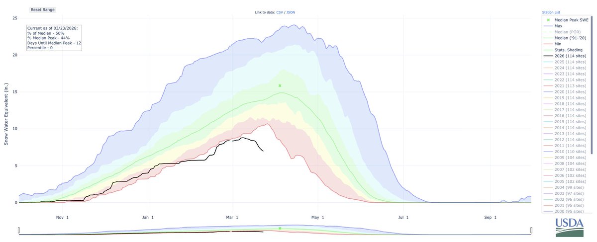 I now believe it is likely that the West will face record-low April 1 snowpack concurrently across many watersheds concurrently. This year may also bring unprecedented divergence between precipitation & runoff due to record-shattering warmth and extreme evaporative demand.
 Folks are remarking on how this persistent Central Valley fog is "unprecedented." But that is *very* far from reality! While Nov is fairly early season for this pattern, dense & frigid "tule fogs" actually used to be *more* common, lasting days or even weeks in decades past. #CAwx
 Over the next few days, balmily warm temperatures will occur across western North America, including California (where temperatures into the 90s are likely in SoCal). Some record warm daytime temperatures are possible, & notably warm overnight temperatures will continue as well.
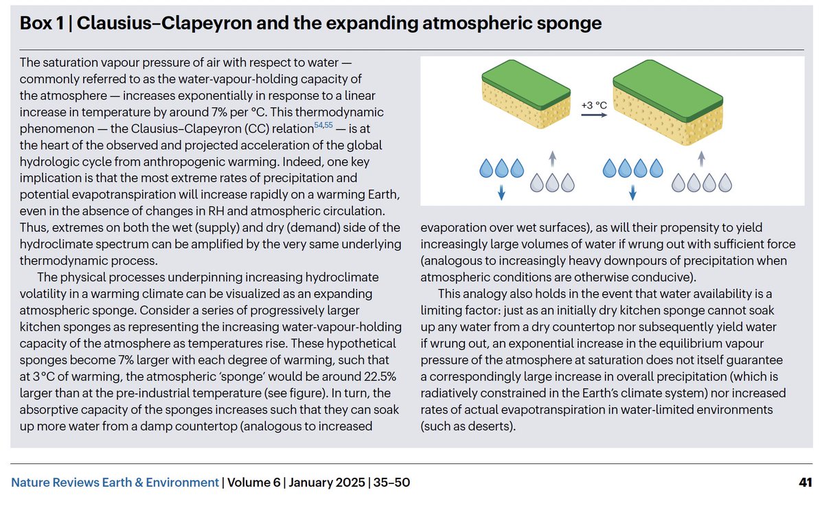
 First and foremost, it's absolutely true that every tenth of a degree matters; each increment of global warming will bring a relatively larger increase in adverse societal and ecological impacts than the last.
 In fact, the past ~30 days have actually been near record-warm (yes, yet again!) across a substantial portion of the foothills & higher mountains ringing Central Valley, plus the Imperial Valley (which is a very hot place to begin with!) However... #CAwx #CAfire
 Temps in 80s will be widespread in SoCal, & even 90s are possible. T-shirt and shorts weather will also extend into NorCal and beyond (well into 70s), as well as desert SW (where late spring-like temps in 90s are likely). Late Feb records may be broken in some places. #CAwx #AZwx
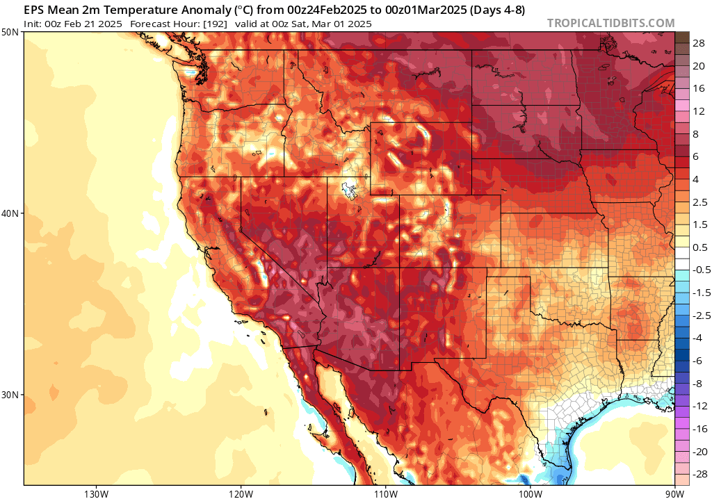


 First, a low pressure system west of OR and WA will undergo explosive deepening (rapid strengthening, known as "bombogenesis") over the next 2 days. It may become one of the strongest low pressure systems on record in this region. (~940mb) #CAwx #ORwx #CAwater [2/6]
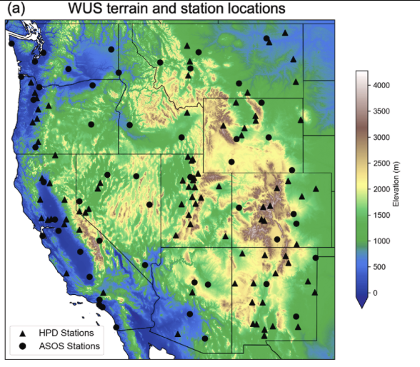
 First, it's important to consider the broader context. This autumn to date has been very (anomalously) dry across most of CA (except for far northern parts of state), but much less so in PacNW. It has also been broadly warmer than average across the West. #CAwx #ORwx [2/6]
