
Asst Prof @berkeleyhaas, NBER FRF, @MITsloan PhD. Innovation, entrepreneurship, digital, data & maps. Dad to 2 girls. he/him/his.

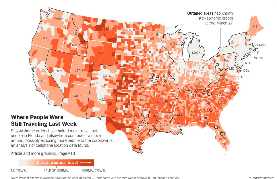
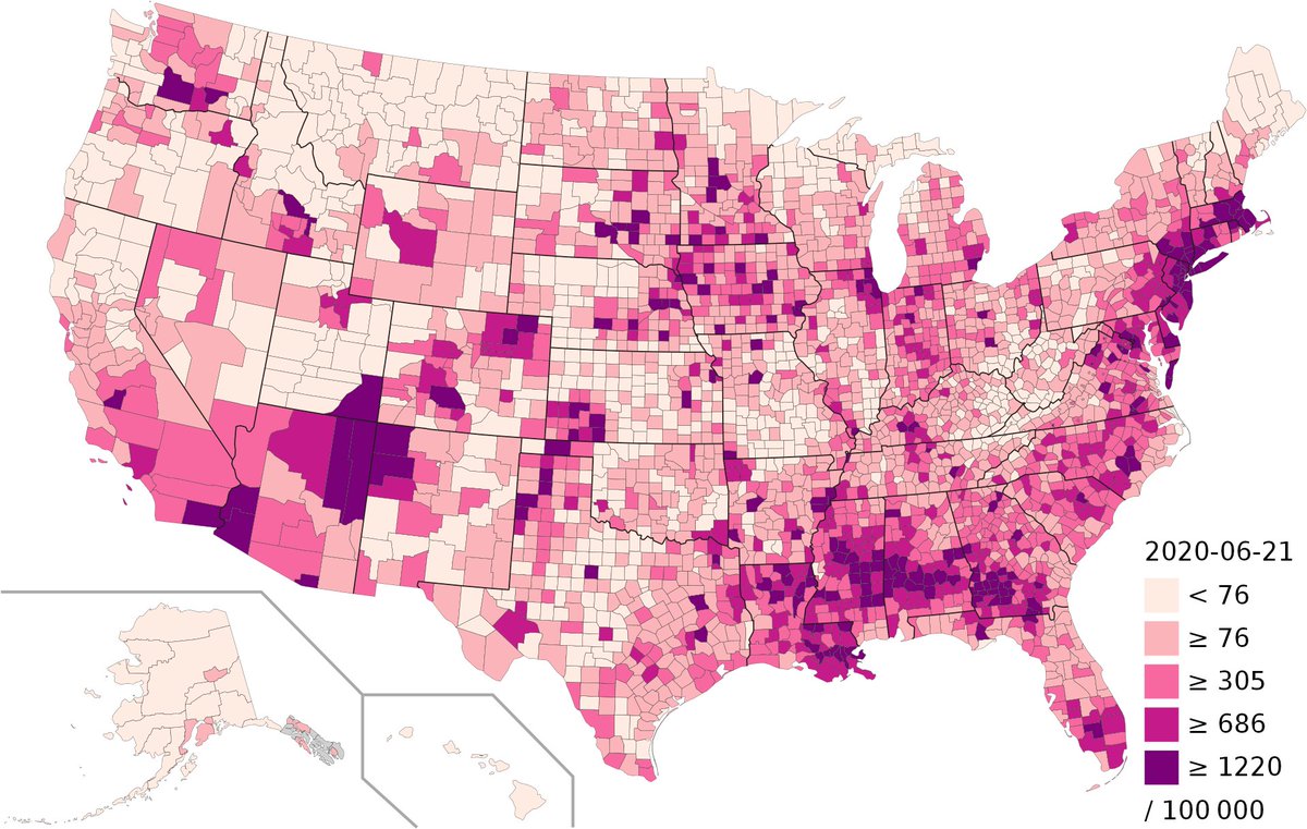
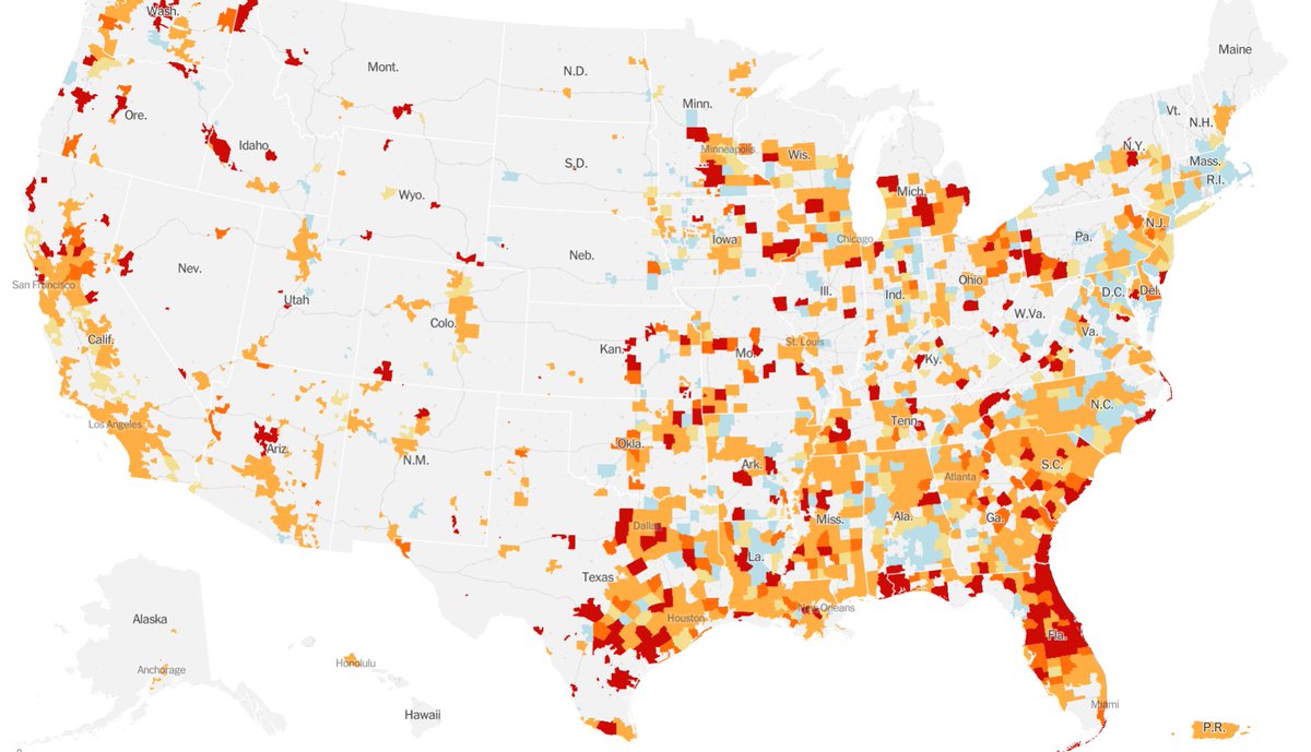 all three are county level maps of the US -- made with county level data.
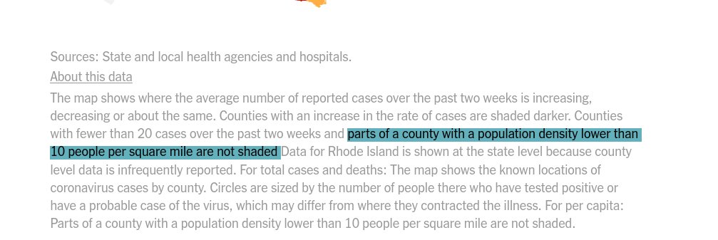
 1/ Decisions about how to reopen the economy depend on extremely local factors such as how and where people from different age groups intermingle—
 The basic motivation for our work is summarized well by this article from @jsumers theatlantic.com/technology/arc… -- Even though we know have the technology, why isnt there a digital library of Alexandria? One place for all knowledge?