
Figuring out smarter ways to use satellite data & AI for environment ┋ PhD student @UCSBgeog @emLabUCSB┋Past: @PEAK_Urban @iihsin
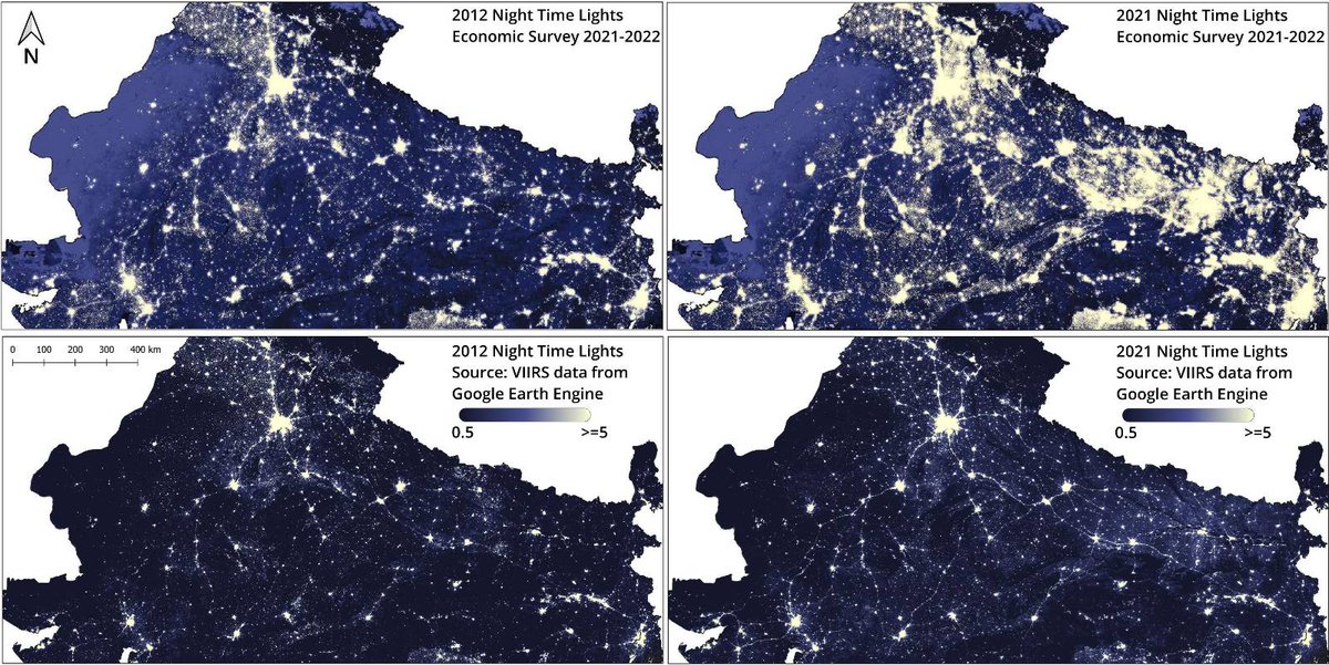 ES states that comparison of night time lights (NTL) between 2012 and 2021 provides “..an interesting representation of the expansion of electricity supply..” apart from distribution of population, economic activity and ribbon developments.