MemphisWeather.net Profile picture
The best in Memphis weather, for 20+ years! Curated by meteorologist EP ( @NWAS Digital Seal) & #TeamMWN. Official weather for @MemphisinMay & @LiveattheGarden.
Jan 11, 2021 4 tweets 2 min read
Sunday evening #sNOw update:
Continuing the trend from this morning, today's model data has not been encouraging for snow lovers. In fact with high-res (3km hourly) model data now within range, the path for snow accumulation seems to now be south of the metro in north/central MS. The main culprit for this southward shift is the further intrusion of dry air into the I-40 corridor, as mentioned could happen in Saturday's blog. Here's the NAM3 model showing moisture anomaly (green is not rain, but above normal moisture where accumulation is most likely).
Jan 10, 2021 5 tweets 3 min read
Sunday AM Snow Update: latest models continue to show minor amounts (1/2" or less) of snow on Monday.

When? Dawn-ish through early afternoon. Temps: 31-36.

NWS impact forecast has lowered from "minor" to "limited" impacts. #memsnow 
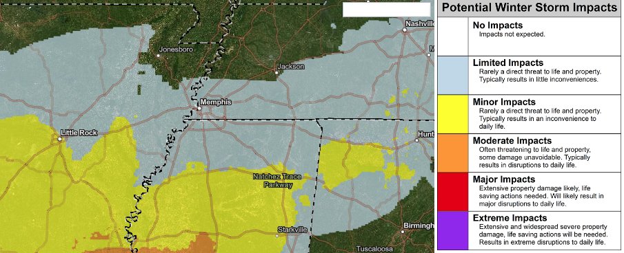
Overnight and early AM models/ensembles range from 0.1"-0.8", almost all < 0.5". Highest chances for more than this are SOUTH of the metro (central MS could get 1-2"). Less to our north. #memsnow