I study and write (via the @RMetS) about snow-patches on UK hills. Self-confessed chionophile and author of 'The Vanishing Ice'.
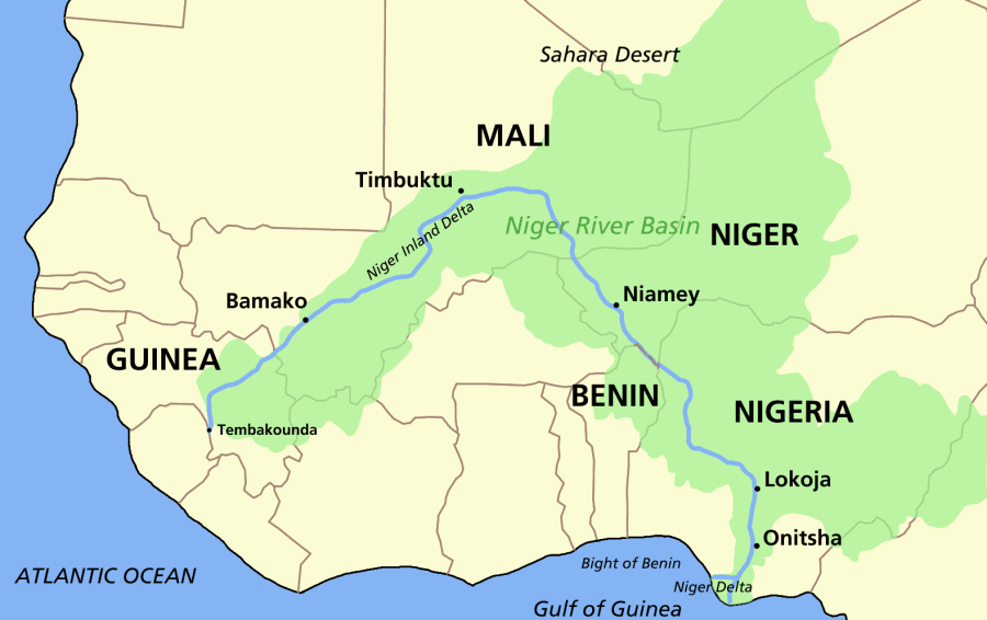 The river flows northeast for more than 1,000 miles (1,600 km) through Mali, passing the ancient city of Timbuktu after forming a massive inland delta, the largest in West Africa. Then, instead of continuing to the desert, it makes a sharp turn southeast.

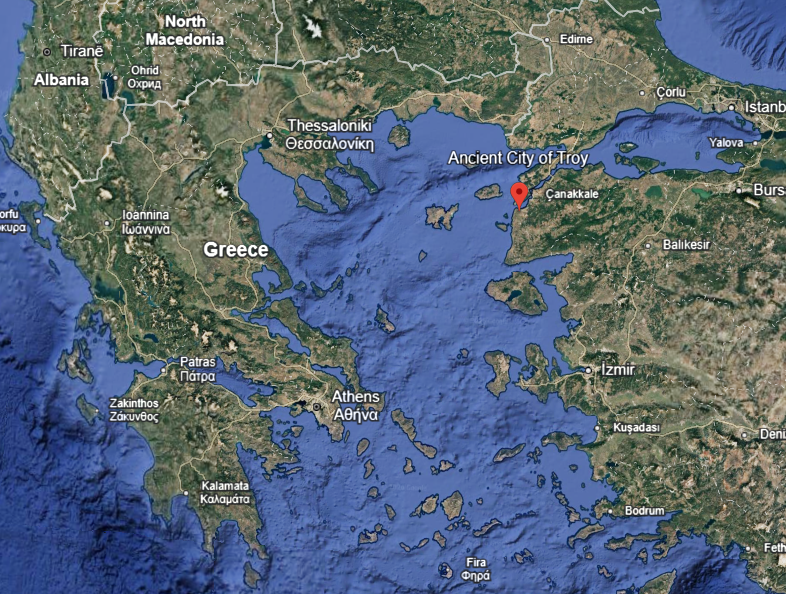
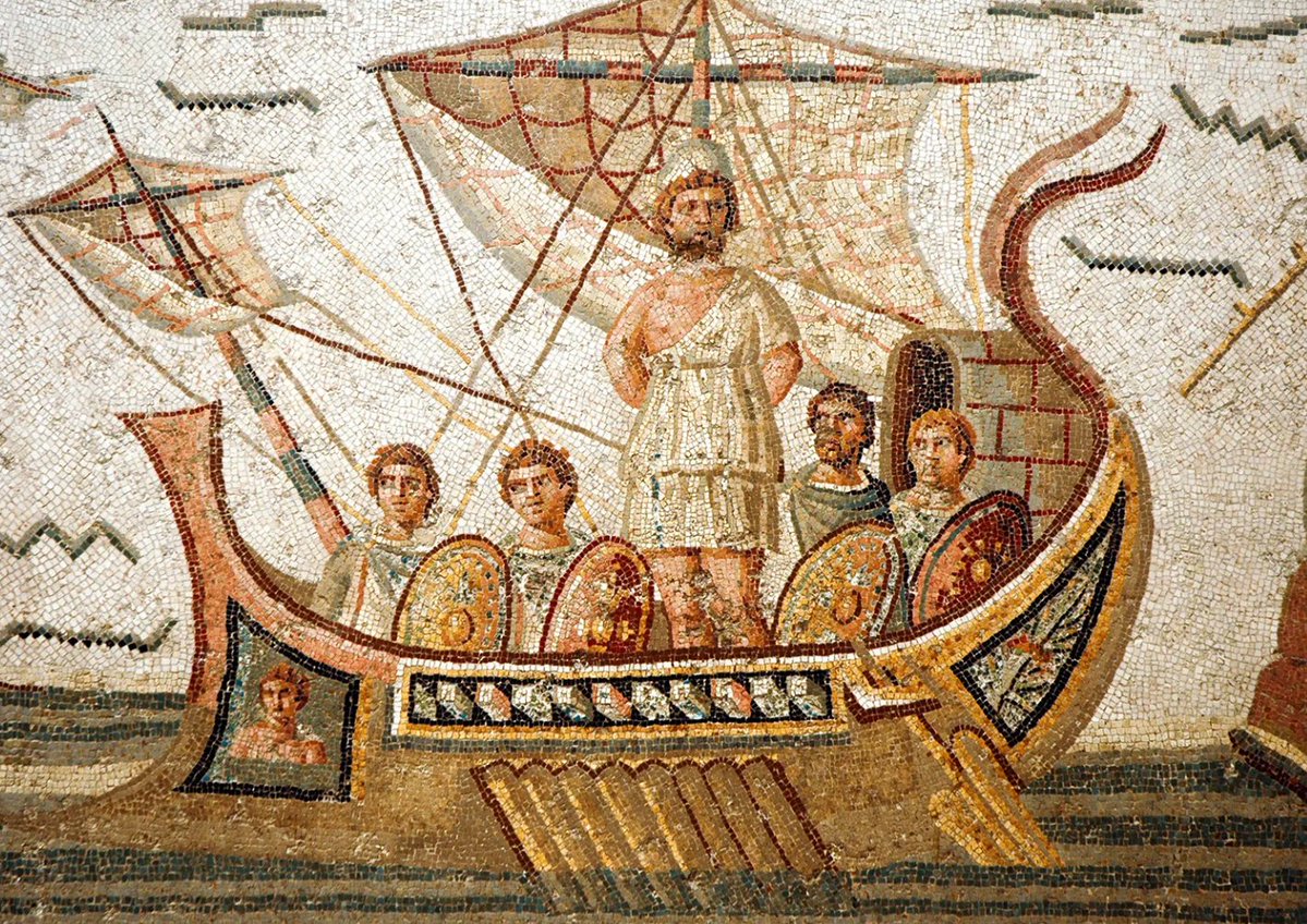 After the Greeks sack Troy, Odysseus sails home for Ithaca. The trip should take weeks. Instead, storms, monsters, and angry gods turn it into a 10-year 'odyssey'.
 For centuries, the accepted source was the Marañón River in northern Peru.
 Yathkyed Lake has a plethora of small islands. The largest, however, is about 9 miles (15 km) long, and itself contains a number of smaller lakes. The largest of these is about a mile (1.6 km) long.

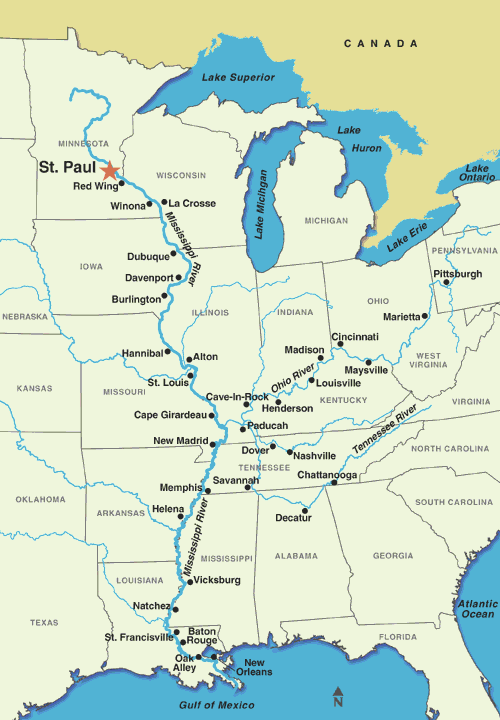 The longest tributary of the Mississippi by far is the Missouri. At the confluence of the two, the Missouri is 2,540 miles (4,090 km) long as opposed to the Mississippi's 1,170 miles (1,880 km). In effect, it is twice as long.
 Skjolden is at the farthest extremity of the mighty Sognefjord, a seawater fjord that extends deeply into the Norwegian west coast.
 The first candidate, Triple Divide Peak in Montana, is claimed to be the true hydrological apex of the North American continent. Water on one side flows to the Pacific in Oregon, to the Atlantic (via the Mississippi), and to the Hudson Bay via the Nelson river.
 The stream in question is called North Two Ocean Creek, and for a short duration it runs right on top of the Continental divide for North America. What makes this creek so unusual is that as it spills out onto Two Ocean Pass it bifurcates.
 ‘Do you know Gordon of Abergeldie?’ continued the prince.
 It is when a name means the same thing in multiple languages.
 The name is in three sections Kir-kin-tilloch. The first part, 'Kir', is from an ancient Brythonic word for 'fort': caer. The fort in question is the old Roman fort of the Antonine wall, situated in what is now Peel Park in the middle of the town.
 The third part of the name, muir, is straightforward enough. It simply means "moor": an area of uncultivated land, usually of questionable agricultural quality. However, it's the first two parts of the name that are so interesting, and whose geneses go back 2,000 years.
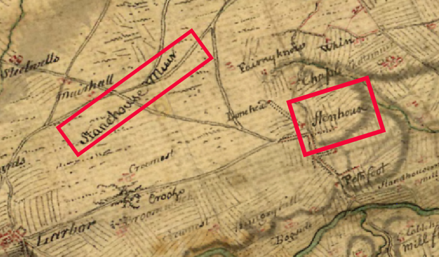
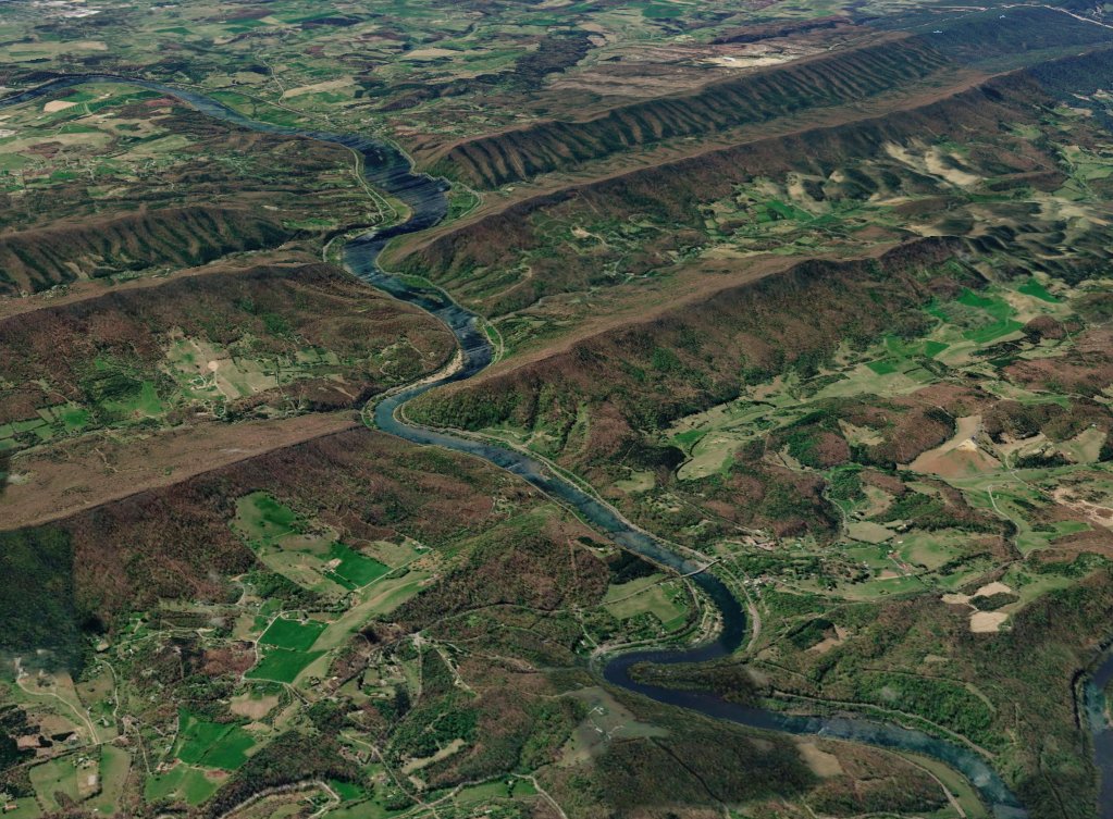 Starting off in North Carolina, the oddly-titled New River runs north into Virginia then onward until it meets the Ohio River and then to the sea via the Mississippi. In southern Virginia, though, it passes through part of the Appalachians.
 The stream in question is called North Two Ocean Creek, and for a short duration it runs right on top of the Continental divide for North America. What makes this creek so unusual is that as it spills out onto Two Ocean Pass it bifurcates.
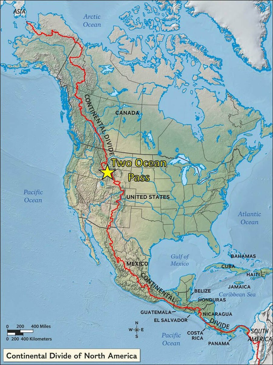
 Skjolden is at the farthest extremity of the mighty Sognefjord, a seawater fjord that extends deeply into the Norwegian west coast.
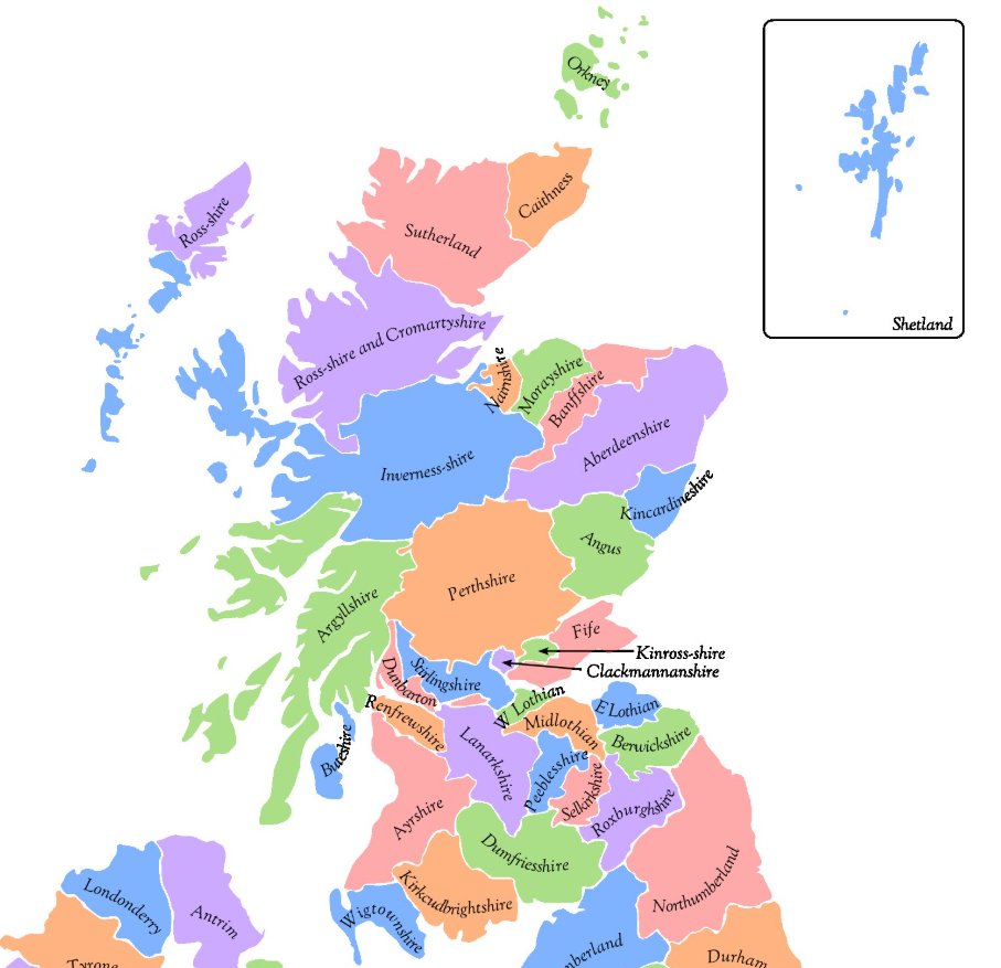
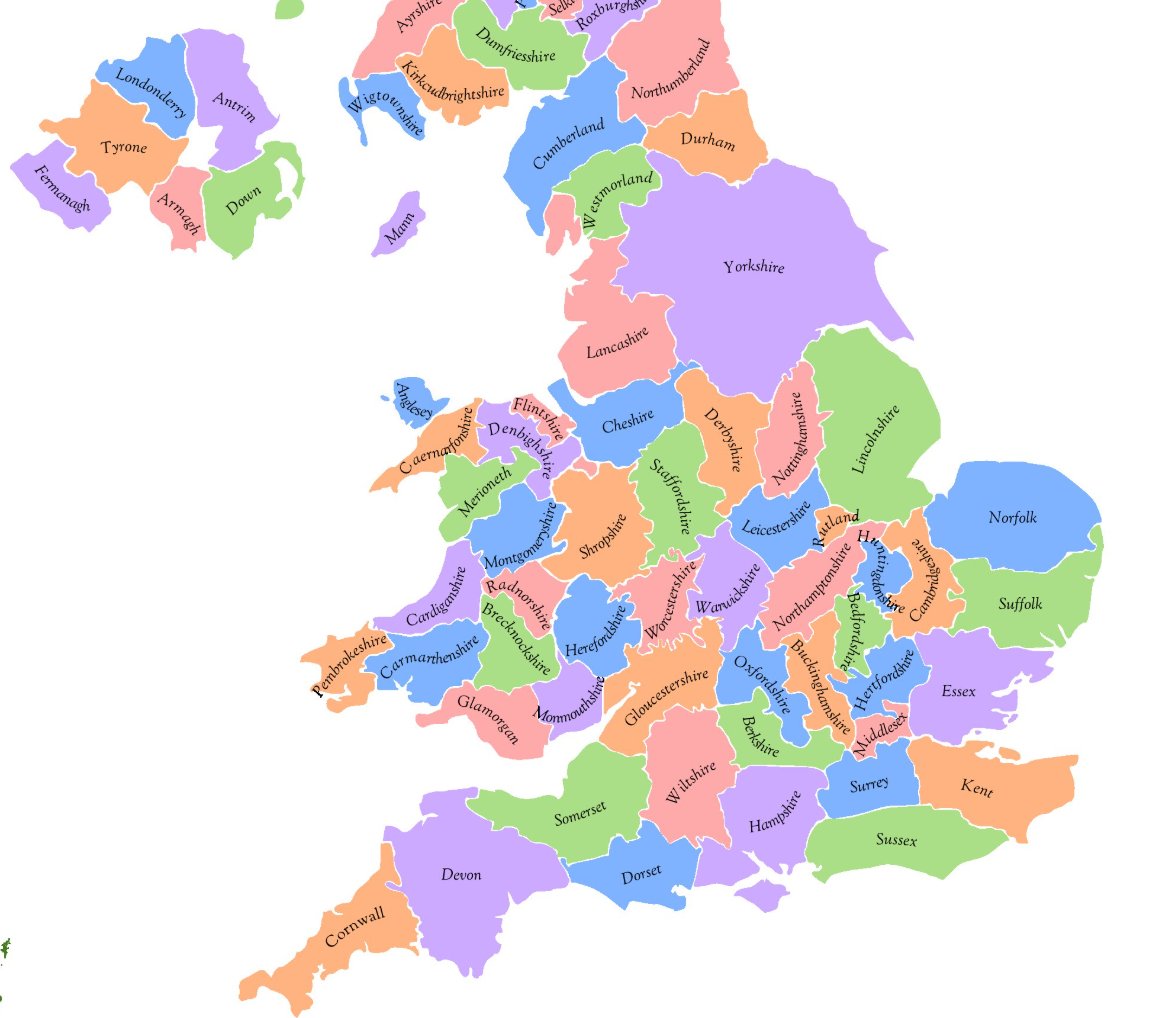 To see proud old counties like 'Huntingdonshire' and 'Westmorland' consumed by larger neighbours is a travesty. Look also how the new Cumbria has annexed the Barrow-in-Furness peninsula of Lancashire. Absolutely criminal.

 The Roman name for what is now London was Londinium. But this is merely a Latin rendition of an existing name.
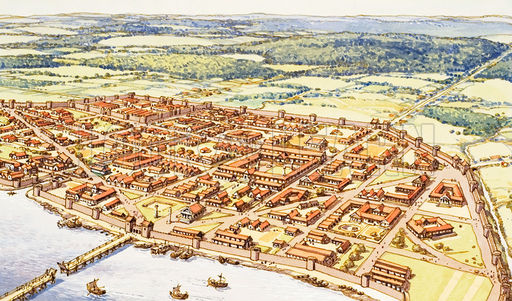
 The loch is divided into two distinctive parts: the broad and shallow Lowland section with many islands, and the narrow and deep Highland section.
 Directly below the rip-off car park (£8.20, thank you. KERCHING) signage, the first misrepresentation/bastardisation of the Scottish Outdoor Access Code is displayed prominently, telling people to walk elsewhere. A clear breach of the code.
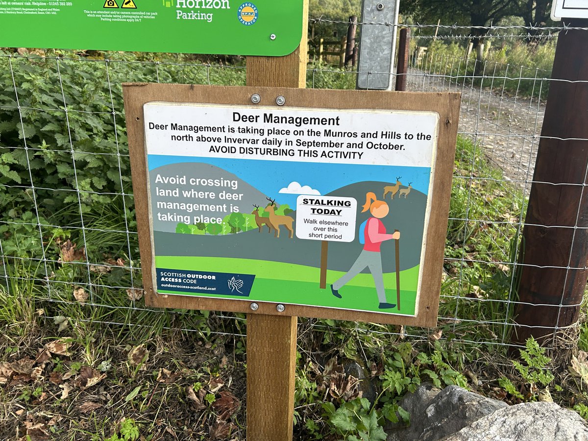

 Tigh nam Bodach is a rare surviving pagan relic. A small stone structure shelters a set of smooth, human-like stones, thought to represent an ancient family: the Bodach (old man), the Cailleach (old woman), and their children.
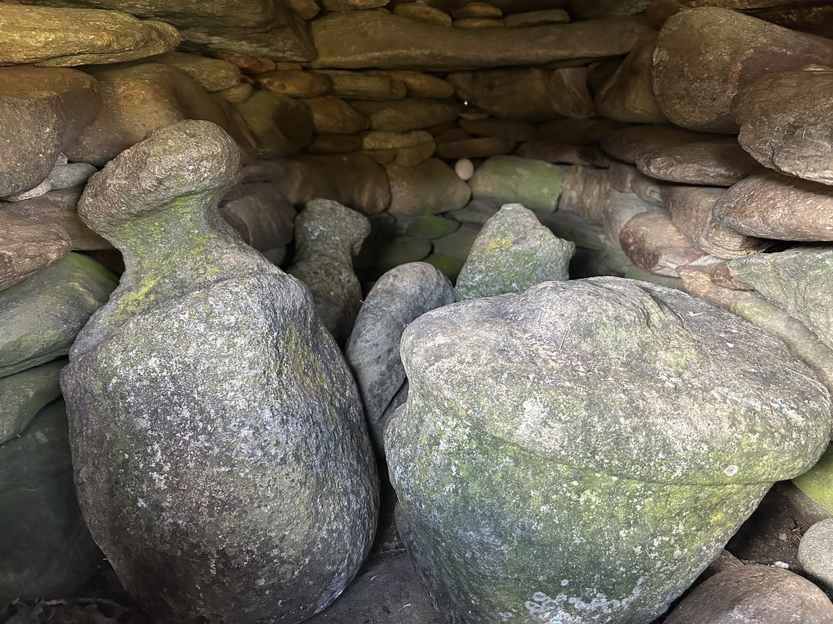
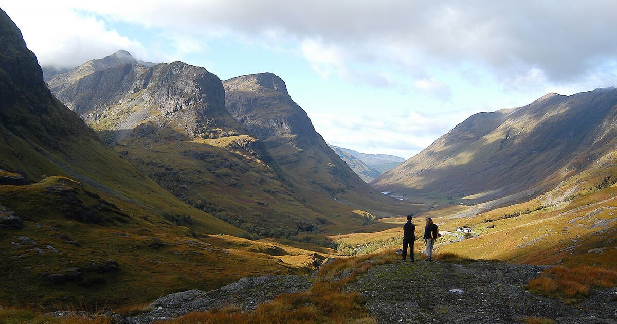 After the 1688 Glorious Revolution, William III required Scottish clans to swear allegiance by 1 January 1692. Alasdair MacDonald of Glen Coe attempted to take the oath but was delayed by bad weather. Despite swearing fealty on 6 January, his clan was marked for punishment.