Footage coming out under 'Geneina Bleeds' (#الجنينة_تنزف) tag after signs of attack emerge from Geneina/Al-Junaynah (الجنينة) in #Darfur Sudan. Refugees moving west through city. Footage filmed from this exact loc: goo.gl/maps/qXqbVUdiV…. H/T to @TramaZoul for the 📹
Transparency of geolocation of footage of refugees moving west through Geneina/Al-Junaynah (الجنينة) in #Darfur, Sudan, along the main road that cuts through the middle of the city. Geolocated to here: goo.gl/maps/qXqbVUdiV… 


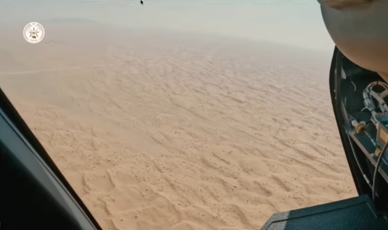
Footage indicates area where attack occurred in Geneina (الجنينة) #Sudan. This video was filmed from here: goo.gl/maps/Um9vbZrRT… & shows smoke rising from the far east side of the city near TAH6 highway. #الجنينة_تنزف #SudanUprising
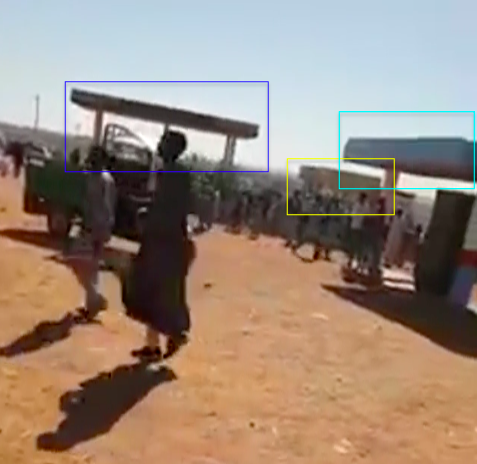
Geolocation of video situates origin of footage at fuel station on east outskirt of #Geneina (#الجنينة). His bearing to the black&white water tower is about 307° from the fuel pumps. Smoke is behind that. He was standing here: goo.gl/maps/1SXx1sutS… #الجنينة_تنزف #SudanUprising


By observing the geolocation of the video above, and the direction the cameraman was standing when he filmed it, I have identified a likely area of east #Geneina (#الجنينة) in Sudan's Darfur, where the burning happened. #الجنينة_تنزف #SudanUprising
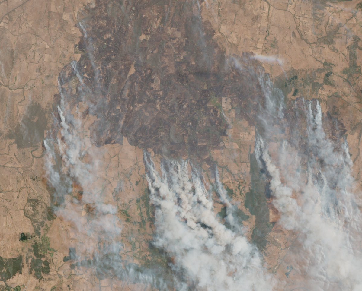
NASA Worldview's @NASAEarthData MODIS fire anomaly detection layer shows multiple fires in east of #Geneina (#الجنينة) #Sudan on Dec 30. Resolution is not too clear, but I have provided @googleearth imagery for reference. #الجنينة_تنزف #SudanUprising
worldview.earthdata.nasa.gov/?v=22.27768043…
worldview.earthdata.nasa.gov/?v=22.27768043…


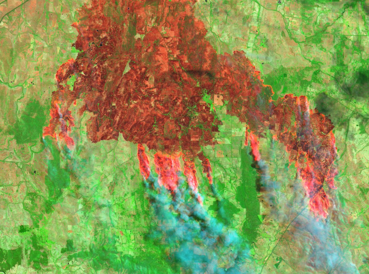
Area of burning more strongly identified using @sentinel_hub false color filter based on bands 8, 4 & 3 to show where burn marks were left by fire. Timelapse created below using EO Browser imagery of #Geneina (#الجنينة) from Dec 26 & Dec 31, 2019. #الجنينة_تنزف #SudanUprising
• • •
Missing some Tweet in this thread? You can try to
force a refresh