A very brief history of Pompeii in plans:
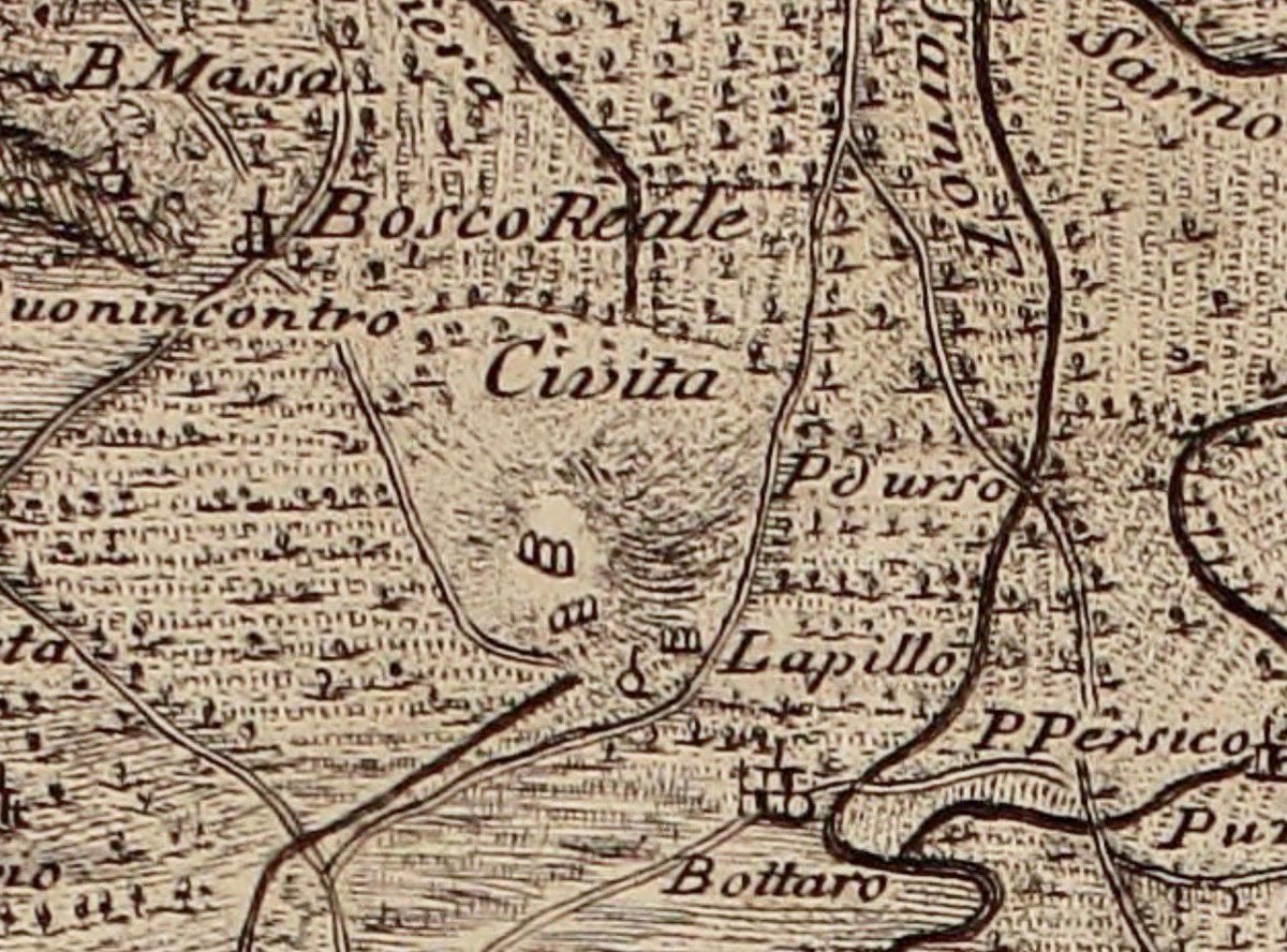
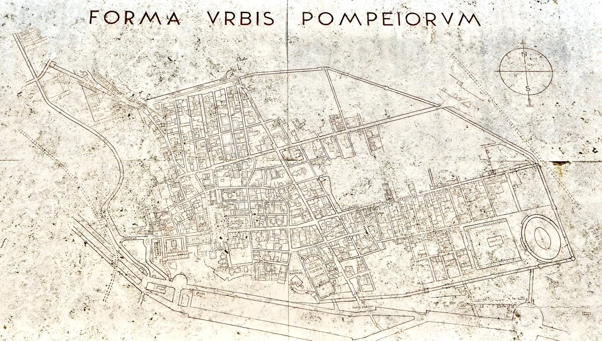
Historically, the hill that covered the ancient city of #Pompeii was known as ‘La Civita’ – the settlement.
Gaultier 1754
raremaps.com/gallery/detail…
#cartography @_MiBACT #viaggioinitalia #ArTyouReady #paesaggioitaliano
Historically, the hill that covered the ancient city of #Pompeii was known as ‘La Civita’ – the settlement.
Gaultier 1754
raremaps.com/gallery/detail…
#cartography @_MiBACT #viaggioinitalia #ArTyouReady #paesaggioitaliano
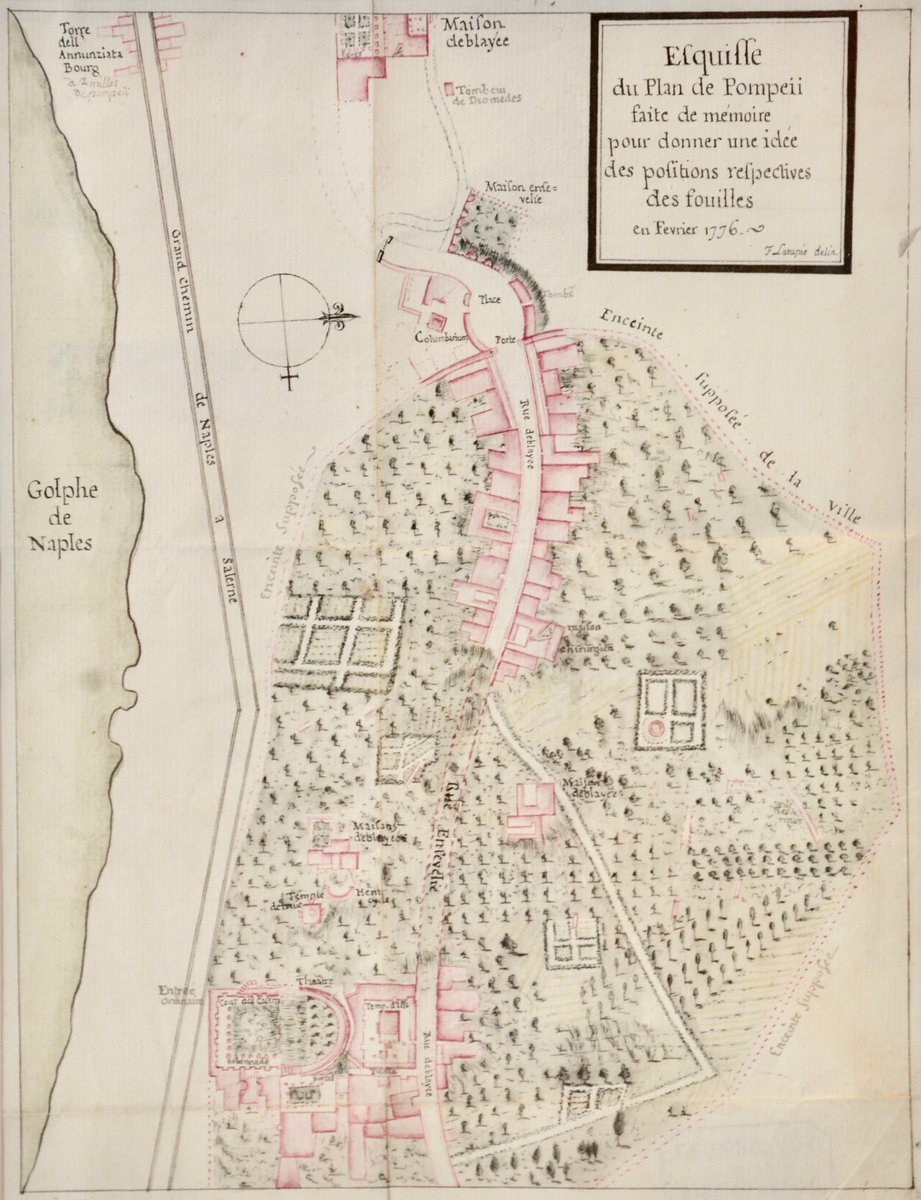
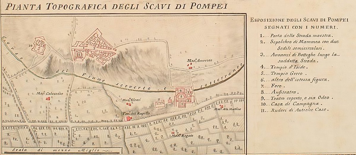
While excavation of #Pompeii was in its infancy plans of the city were being made and I love that they are barely identifiable as being the ancient city we see today.
Lapatie 1776
Piranesi 1792 (detail)
La Vega 1800
#cartography for @_MiBACT #viaggioinitalia
Lapatie 1776
Piranesi 1792 (detail)
La Vega 1800
#cartography for @_MiBACT #viaggioinitalia
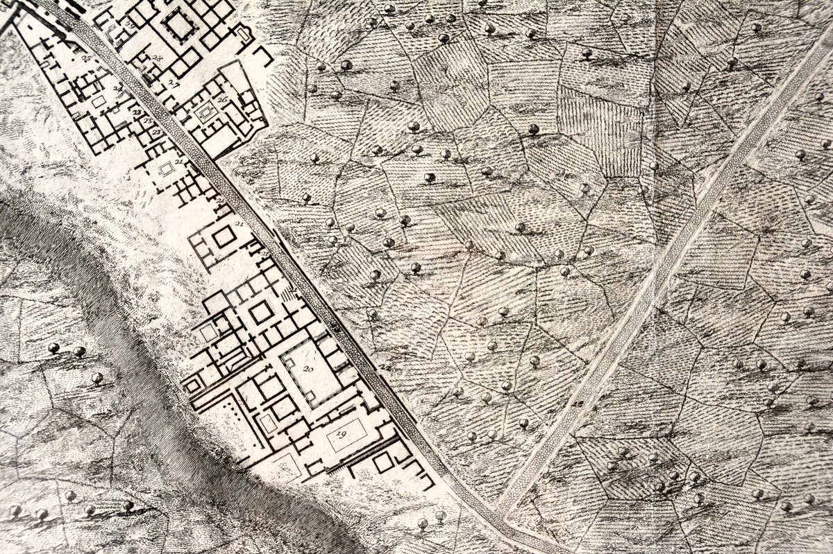
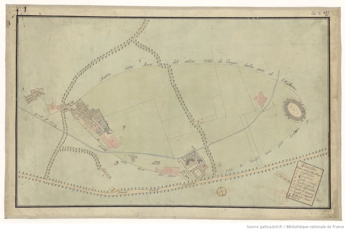
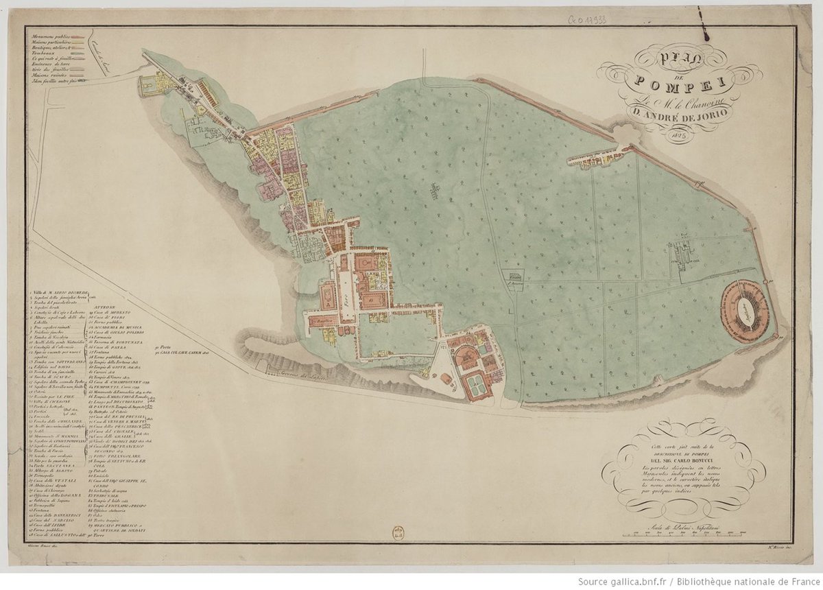
Under the auspices of French rule at the start of the 19th cent, excavations in #Pompeii opened up huge swathes of the ancient site & the city walls were uncovered revealing the extent of the urban area.
Unknown 1800
De Jorio 1825
#cartography for @_MiBACT #viaggioinitalia
Unknown 1800
De Jorio 1825
#cartography for @_MiBACT #viaggioinitalia
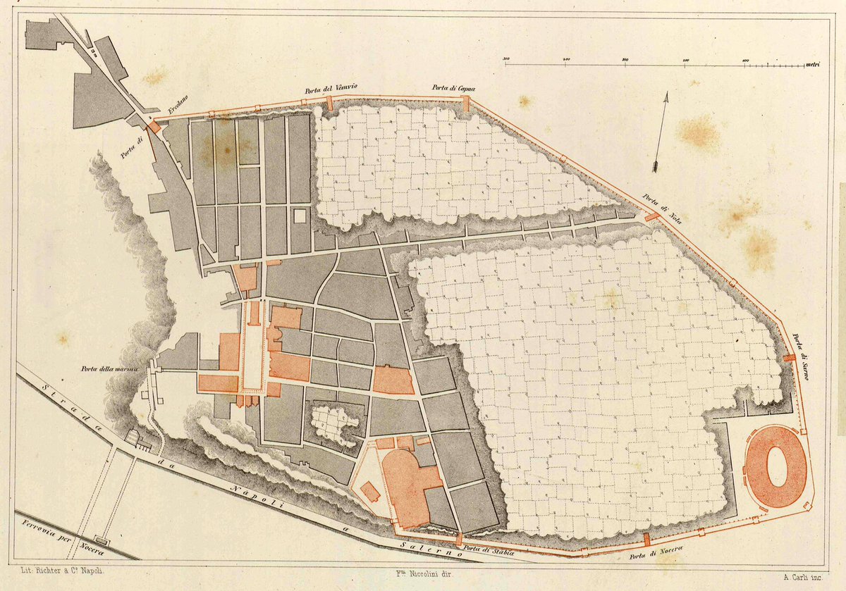
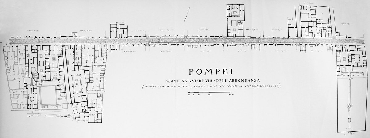
Excavations of houses continued and by late 19th/early 20th cent it became de riguer to expose the main streets and the adjacent façades of buildings.
Niccolini 1890
Spinazzola 1953 (excavated in 1910-20)
#cartography for @_MiBACT #viaggioinitalia
Niccolini 1890
Spinazzola 1953 (excavated in 1910-20)
#cartography for @_MiBACT #viaggioinitalia
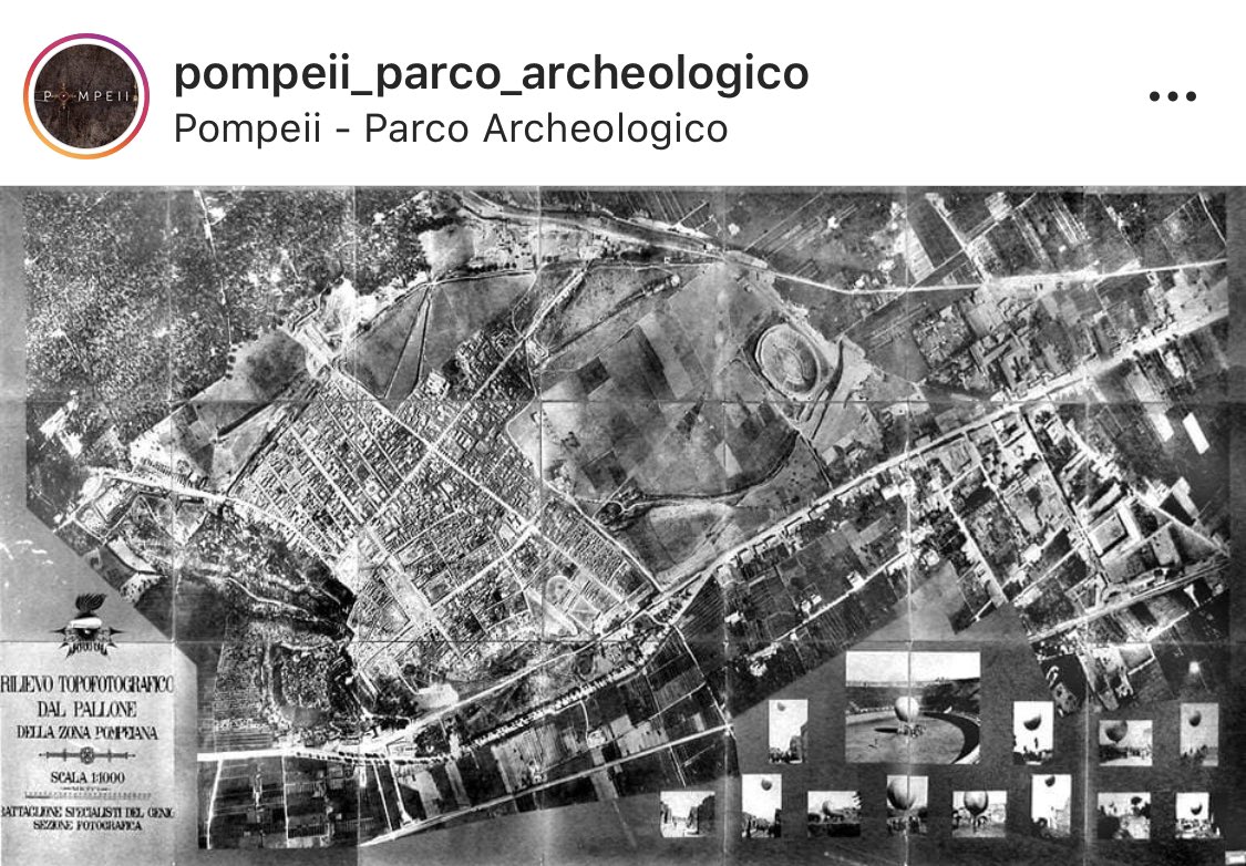
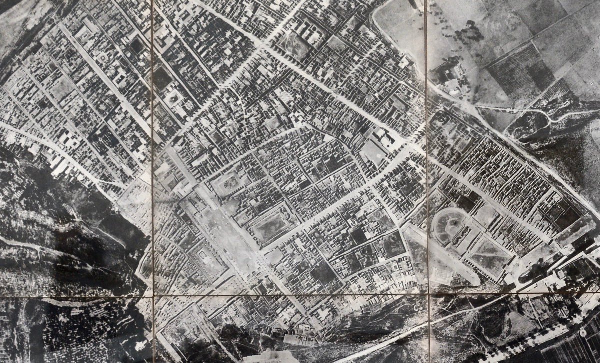
In 1910 this incredible aerial photograph of the entire site was taken from a balloon.
Image 1: 1910 via @pompeii_sites
Image 2: 1910 author’s own (detail)
#cartography for @_MiBACT #viaggioinitalia
Image 1: 1910 via @pompeii_sites
Image 2: 1910 author’s own (detail)
#cartography for @_MiBACT #viaggioinitalia
When Maiuri was director of Pompeii in 1920s houses & their inhabitants became the focus of excavations again. Majority of Region I was excavated at pace after WW2 in order to create work for locals.
Warscher 1955
1947 marble plan
#cartography for @_MiBACT #viaggioinitalia
Warscher 1955
1947 marble plan
#cartography for @_MiBACT #viaggioinitalia
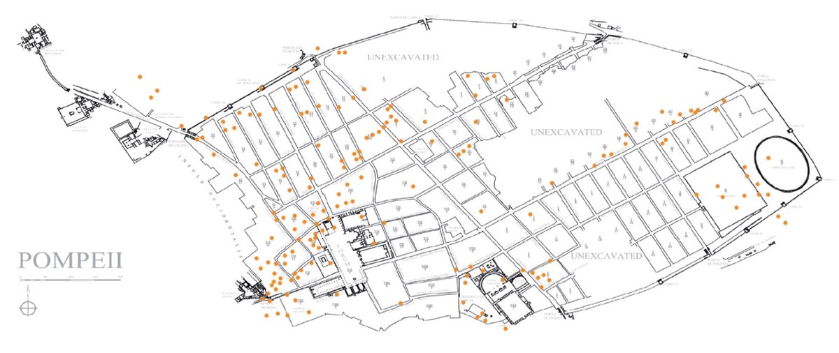
During WW2 Pompeii was, most likely unintentionally, bombed heavily by the Allies during 1943 air raids. Each of the orange stars represents a known bomb.
Author’s own after Garcia y Garcia 2006.
#cartography for @_MiBACT #viaggioinitalia
Author’s own after Garcia y Garcia 2006.
#cartography for @_MiBACT #viaggioinitalia
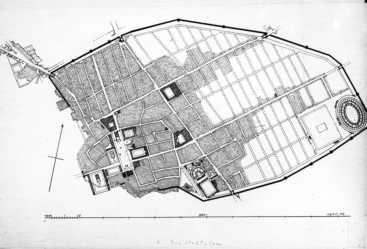
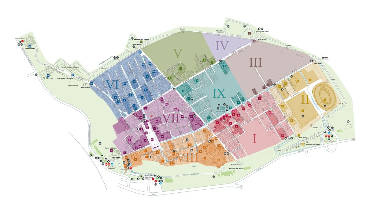
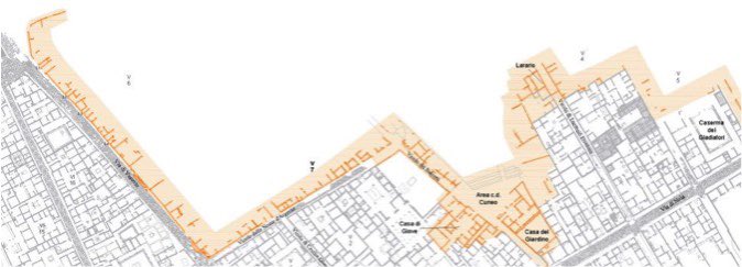
Most recently, the familiar plan of Pompeii has been altered slightly by the excavations in Region V in the north of the city and in the south of the city outside the Stabian Gate.
@pompeii_sites overall plan 2019
Region V 2019
#cartography for @_MiBACT #viaggioinitalia
@pompeii_sites overall plan 2019
Region V 2019
#cartography for @_MiBACT #viaggioinitalia
Most of these maps can be found here: pompeiiinpictures.com/pompeiiinpictu…
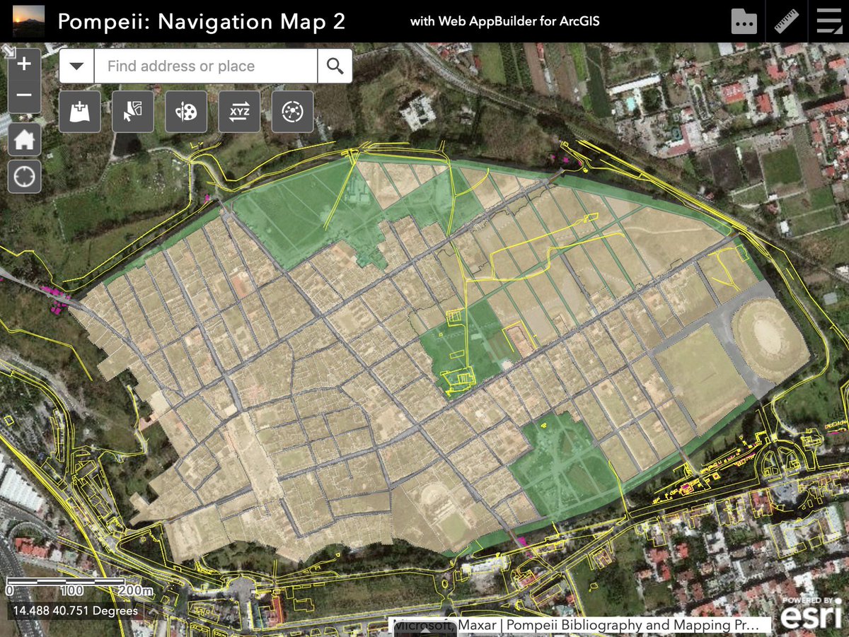
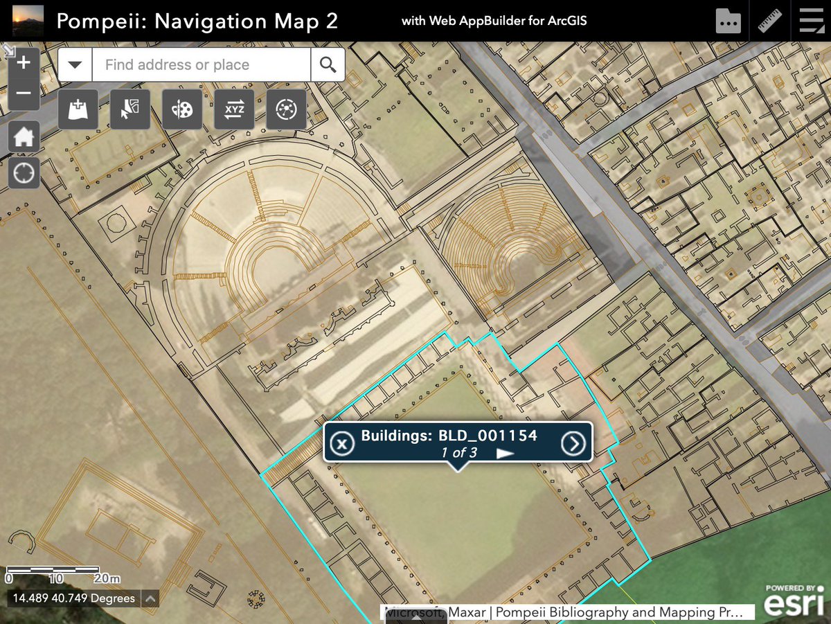
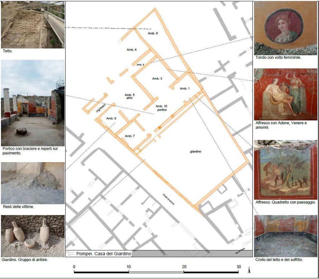
Recent cartography from Pompeii goes well beyond merely mapping the site. Thanks to @Pompeiana79 & team their digital map of Pompeii contains layers of information on the city & its buildings & infrastructure as well as a bibliography.
digitalhumanities.umass.edu/pbmp/?author=1
#viaggioinitalia
digitalhumanities.umass.edu/pbmp/?author=1
#viaggioinitalia