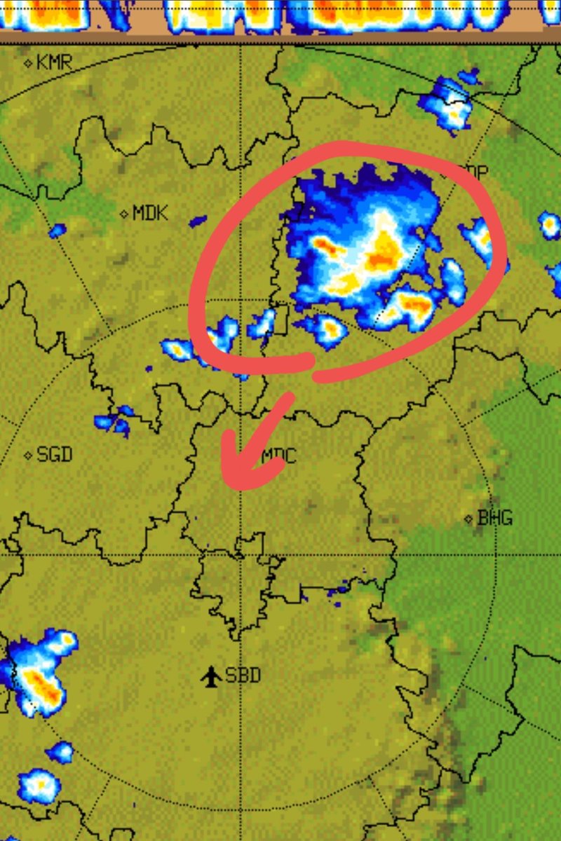
Convergence was unfavorable over Hyd. N & SE parts of Hyd still received light to moderate rain.
However the good news is moisture incursion from the Bay has already started after #Amphan has squeezed it all last wk. Expect showers to increase going forward. @Rajani_Weather
• • •
Missing some Tweet in this thread? You can try to
force a refresh
So how does IMD provide all the forecasts that we see and follow regularly all throughout the year?
IMD runs GFS T1534 model (Global Forecast System) with 12.5km resolution for short to medium range deterministic forecasts upto 10 days @Rajani_Weather @Hyderabadrains @WeathrCast
IMD also runs WRF model (Weather Research and Forecasting) non-hydrostatic model with 3km resolution for 3-day short range forecasts. It is better capable for predicting MCS (Mesoscale Convective Systems) or Thunderstorms.
For Ensemble mean forecasts, IMD uses GEFS for forecasts upto 10 days based on average of 21 ensemble members and provides probabilistic forecasts.
Now that #SWM has officially ended, time for some colorful reports for #Telangana
Except few northern mandals, and one S mandal, rest of State has received normal to above normal rainfall.
13 of 33 districts got excess rains in all mandals, incl Hyderabad.
Contd.. @Rajani_Weather
11 districts got excess rains in more than 50% of mandals, with no mandal in deficit.
Rest of them got Normal to above N rains in more than 50% of mandals with only few mandals in deficit.
Overall State performance was 46% above normal
Best performing weeks for entire state:
1st n 3rd wk of June
3rd n 4th wk of Aug
3rd n 4th wk of Sep
For southeast districts, excepts only 2 weeks, entire season was active.
Warangal got a whopping 850% abv normal rain in 3rd week of Aug.
When i started this page in April 2020, little did i imagine i will reach here. I think i tweeted abt weather almost every single day since then, so "Thank you dear followers" for bearing with my tweets n bad forecasts. I hope to provide you with better n better forecasts.
Contd.
Firstly, i would like to thank @Rajani_Weather, he is my guru, mentor, learnt a lot from him, you r such cool, down-to-earth person, thanks for being there for me.
Some more awsome teachers @WeathrCast@Weather_AP@PIW2020@lovelyweather_ thanks for guiding me wth useful content
As promised, continuing my discussion on #RWH, #rainwaterharvesting. Most queries were on how to get started, so i will start with rooftop rainwater harvesting which can be implemented for any house or apartment.
CONTD..
The mechanism is cheap, and build is fairly complex, but I will make it easy for you. It has 3 parts; collecting rainwater through down pipes, diverting them to the filter chamber and then to a sump or bore.
Water Collection: All rooftops mostly already have gutter/ drain exits and down pipes. You just need to point them towards the filter chamber, so some plumbing work needed here.
Tips: Keep rooftop always clean. First rain should always be flushed out.
Telangana lies in the area which is prone to droughts, but v were very lucky to hav above normal monsoon last 5 yrs. But what lies ahead for upcomng yrs is unknown.
I vl talk abt terrace rainwater harvesting as this is something we hav installed in my apartment 3 yrs ago.
CONTD..
Using the example of last 3 days, we got 13cm rain. 13cm × 3500sqft of terrace area = 42 thousand ltrs of fresh water which is huge.
We divert this water to underground sump and remaining excess into bore.
Considering avg 70cm rainfall for Hyderabad, for 14 families in my aptmt, this is enough additional water for 54 days. But for individual houses with small terrace, it can go to 8 months of excess water, which is surprisingly high.
@PIW2020@Rajani_Weather@pavanpuli1234
So i wanted to know if there is a way to know why the rains skipped major part of Hyd today.
At around 4pm, the 700h winds were northerly, so i assumed the first storm that touched kapra area was controlled by 700h level winds.
Contd...
At the same time, the 500h winds were northwesterly, and the squall of storms from Vikarabad/Sangareddy post 4pm seemed to be guided by these high winds, since they followed this path.
Contd...
Around 5pm, there was divergence of low level winds to NW of city, and convergence of winds to south of city. Was this the reason why the squall died before reaching the city?
Is my analysis any right? What other unknown/ known factors may have to be considered here as well?