
In continuation of our #TheBrahmaputraSeries here’s some tits & bits on the Rs. 6000 Crore ‘Lower Subansiri Hydro Electric Project’ and its effects on the floodplains downstream.
Note: It might be a long thread. A thread roll shall be shared separately.
1/n
#AssamFloods
Note: It might be a long thread. A thread roll shall be shared separately.
1/n
#AssamFloods

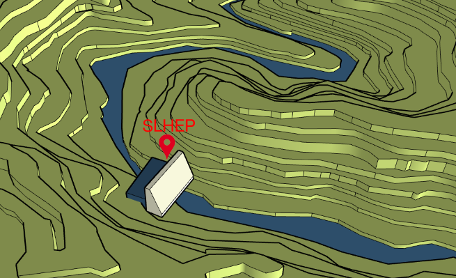
Officially named The Subansiri Lower Hydro Electric Project (SLHEP) is located on the Subansiri river at 2.3 kms upstream of Gerukamukh on the border of Assam and Arunachal Pradesh.
2/n
#TheBrahmaputaSeries
2/n
#TheBrahmaputaSeries

Subansiri is the largest tributary of the Brahmaputra. It discharges around 18,799 cubic metres of water per second and contributes 8-10% of the Brahmaputra's total flow.
3/n
#TheBrahmaputaSeries
3/n
#TheBrahmaputaSeries

The primary objective of the dam is to tame this flow of water and use it for production of electricity. The 2000 MW capacity project is NHPC’s biggest hydroelectric power project in India.
4/n
4/n
Subansiri hydel project’s dam is located within the 5 km diameter circle area of two major active faults and four small faults, which were identified long back by the Assam State’s Geology and Mining Directorate.
5/n
5/n
Earlier, the findings of the Geological Survey of India (GSI) stated that the Subansiri River itself is flowing through a major fault, running in a north-south direction from Tibet to the Brahmaputra Valley, in a zigzag manner.
6/n
6/n
Another important aspect is the drainage basin of the Subansiri river. Originating in Tibet at an altitude of 5340m it drops to 143m at the dam site. One can imagine the steepness of the flow. It is also fed by numerous small & big streams like the Sichi, Situ and Sigen etc.
7/n
7/n
The slope gradient from the dam to Gerukamukh, within a distance of around 2.3 km, is around 38 metres or around 127 feet. Hence, the force of the water being released from the reservoir will be very high and poses serious threat to the downstream areas.
8/n
8/n
On entering the plains of the Brahmaputra valley after flowing down the steep gradient of the Himalayas, the river spreads its enormous discharge and load of sediments.
9/n
9/n
Since the dam is at a point of natural flow, these sediments will get collected at the water reservoir increasing its water level and overall weight. Moreover, due to rapid deforestation in the Subansiri River catchment, the sediment load is increasing at a very fast pace.
10/n
10/n
As per some study reports suggest that the site if the dam is located in Sandstone which is soft and friable in nature and has salt and pepper texture. The rocks along the sides of the river are soft.
11/n
11/n
The dam is located in a highly seismic Zone - Zone V which is itself a great concern for the dam and its safety. A very important point to be noted here is that the epicenter of the Great Assam Earthquake of 1950 (8.6 on Richter Scale) was in the Misimi Hills not very far.
12/n
12/n
The evident impacts of the dam often quoted are:
*Negative Impacts on the aquatic ecosystem and overall biosphere
*Conversion of a free-flowing river ecosystem to an artificial slack-water
*Alteration of a river's flow and sediment replenishing cycle dowmstream
13/n
*Negative Impacts on the aquatic ecosystem and overall biosphere
*Conversion of a free-flowing river ecosystem to an artificial slack-water
*Alteration of a river's flow and sediment replenishing cycle dowmstream
13/n
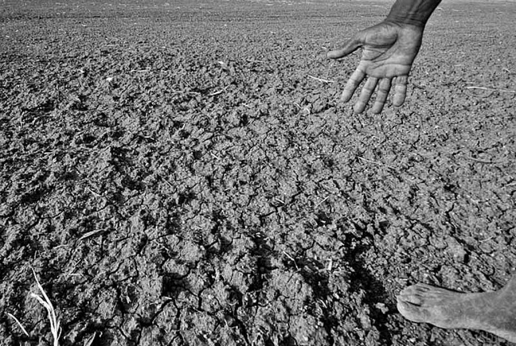
However the most important impact is the direct threat to the Brahmaputra plains. Regulated flow of water in winters will cause a drought like situation. While in the monsoons, opening of the dam gates will pump huge amounts of water in an already sustainable flood scene.
14/n
14/n
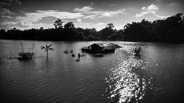
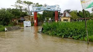
The flooding of areas in and around #Gohpur and #Narayanpur areas in Assam from the last couple of years can be directly connected to the water controlling systems of the dam. Also concentrated sediment flow has caused farm lands to be covered by sand.
15/n
15/n
To understand the size of damage in a worst case scenario, we can consider the following dam failures in modern history. They were not only deadly to human life but also caused irreversible damage to the eco system.
16/n
16/n
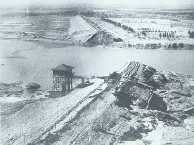
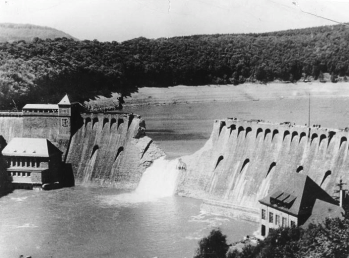
The Banqiao Dam collapse of 1975 in Henan, China created the 3rd-deadliest flood in history & affected a total population of 10.15 million and inundated around 30 cities and counties of 12k sq. km (or 3 million acres), with an estimated death toll ranging from 85k to 240k
17/n
17/n
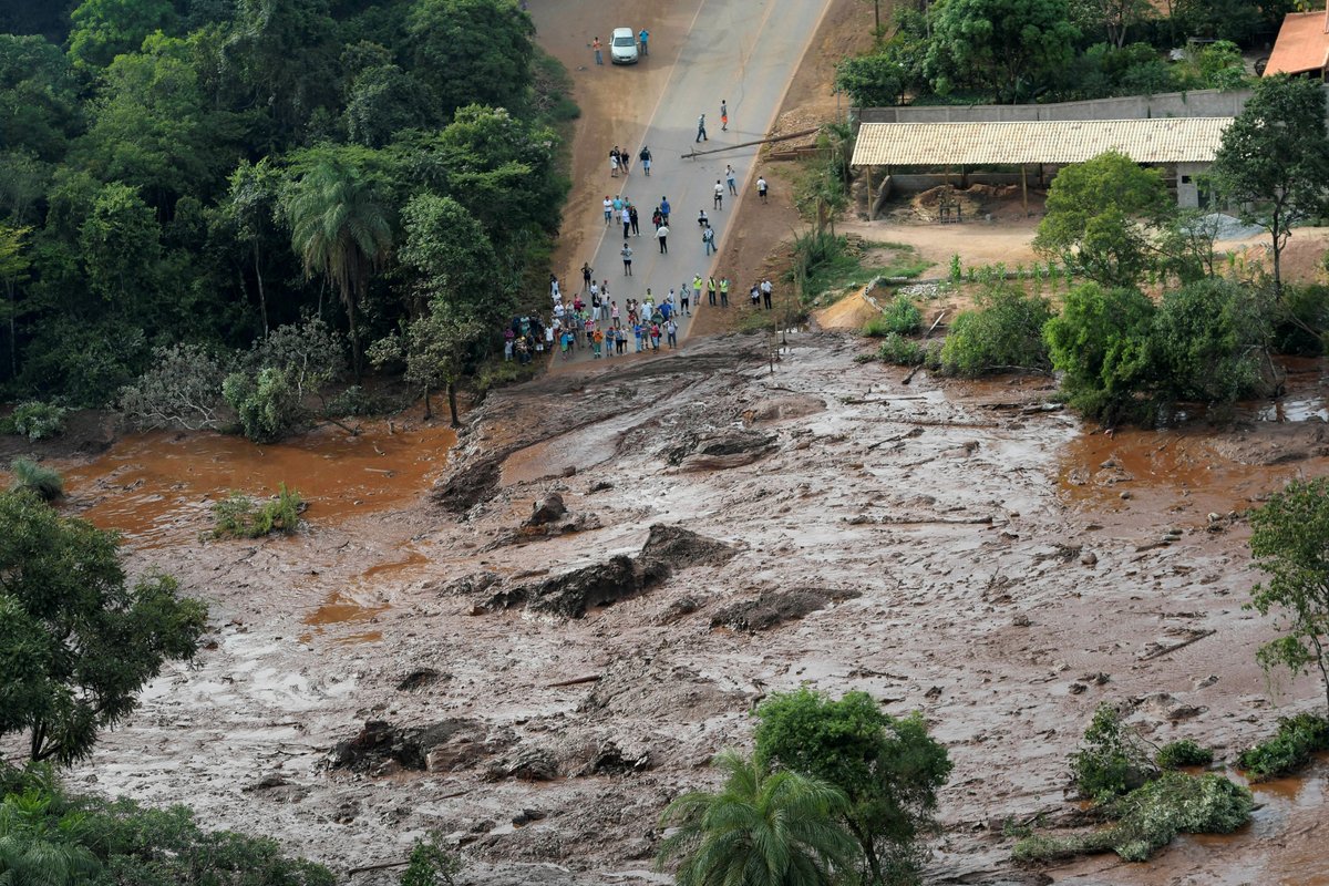
The Brumadinho dam disaster of 2019 in Minas Gerais, Brazil, released a mudflow that advanced through the mine's offices, along with houses, farms, inns and roads downstream. 270 people died, of whom 259 were officially confirmed dead, others were never found.
18/n
18/n
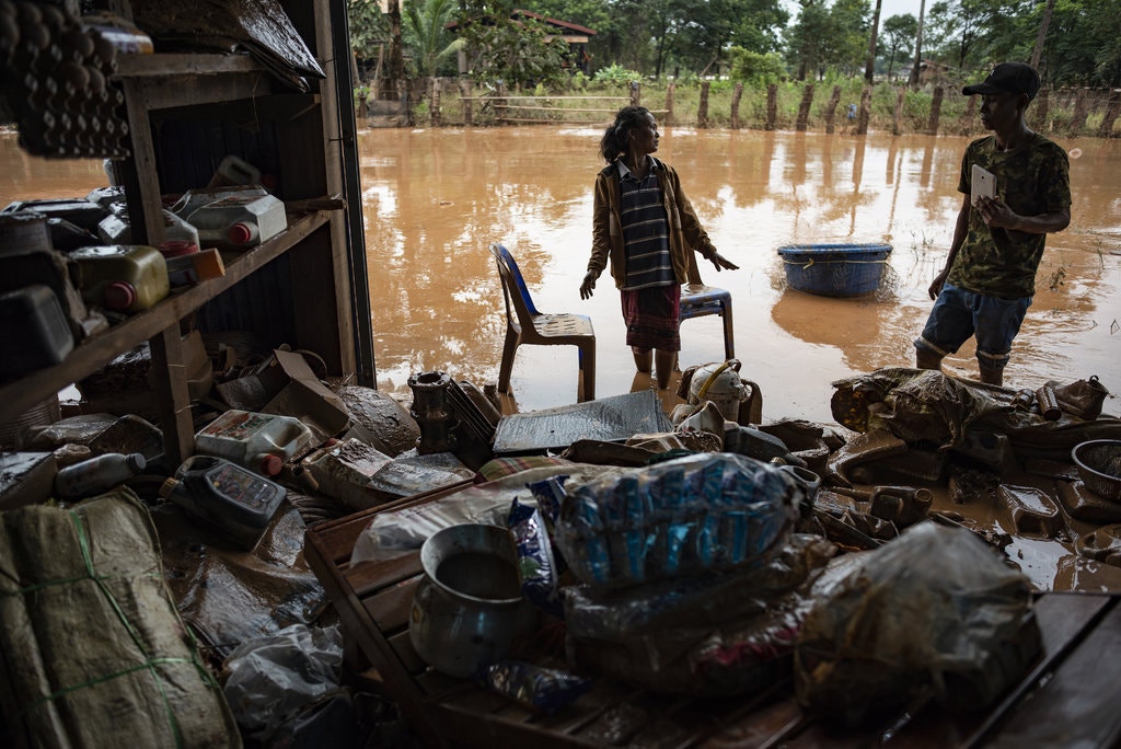
The 2018 Laos dam collapse was the collapse of Saddle Dam D, part of a larger hydroelectric dam system under construction in southeast Laos's Champasak Province. The dam collapse lead to widespread destruction and homelessness among the local population.
19/n
19/n
@threadreaderapp Unroll
EOT
EOT
@threadreaderapp @threader
@threadreaderapp unroll
• • •
Missing some Tweet in this thread? You can try to
force a refresh


