OK, here's the view for the Sandhills and points east. There are two caveats before we start micro-managing, however: The strength of #Isaias at landfall and where exactly the landfall takes place. With a storm this small, both are subject to change in the next 36 hours. 1/x
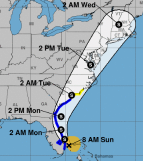
First the official word from the NHC: They anticipate #Isaias to remain below hurricane strength as it turns and races up the East coast beginning tomorrow. Included in that track is a run through the southern Sandhills Tuesday morning. 2/x 
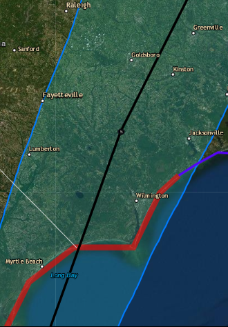
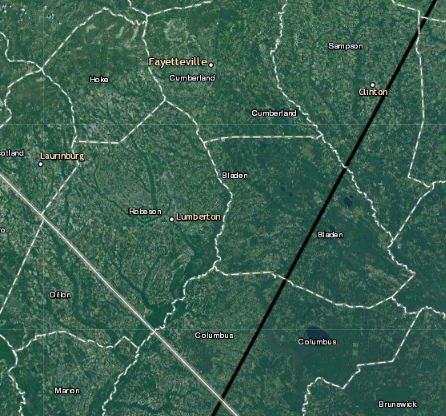
A closer look at the current NHC track shows a coninuted westward crawl. Yesterday morning the cone center came ashore near Wilmington. Today, it's more like Georgetown, SC, running inland near Whiteville, E'town and Clinton. That's abt. 30 miles SE of FAY. 3/x
#Isaias is an elongated mess, with strongest wind and rain to the north and east. If timing stays on track, that would mean things start going downhill in the Sandhills Monday night into Tuesday morning. 4/x
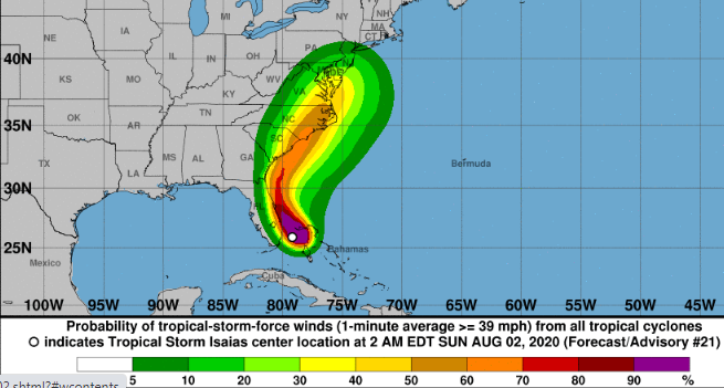
This is the 6Z ICON model, not an official NHC product. However, it shows the current NHC thinking on strength and general track of #Isaias this morning, offered as a visual guide. Has sort of an I-95 look to it.
The storm has maintained a healthy core, despite constant decapitation by shear at the mid-levels. That lower-level organization will continue as #Isaias heads north as a decent tropical storm. Once off the Georgia coast ... 5/x
... #isaias should begin to encounter a more benign air flow, thanks to an approaching trough from the west. That's why the storm's intensity as it reaches the Carolinas is a bit suspect. It won't have much time to recharge, but conditions could be conducive. 6/x
The other steering pattern is offshore high pressure, which hasn't budged overnight. As the trough approaches from the west, it should erode the ridge a bit, effectively pinning #Isaias between the two. That's why the storm picks up speed on Tuesday. 8/x
That increased forward speed will translate into some additional wind. Folks in the Sandhills, especially east of I-95, could see gusts in the 50 mph range ... high if #Isaias manages to get a boost as the NAM implies.
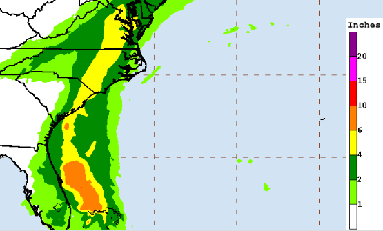
The faster #Isaias rolls through, the less we'll need to worry about rainfall. That said, it's a tropical system and we're already a muggy mess, with air just waiting for an excuse to rain. The NHC is looking for 3-5 inches along the storm path, with higher totals possible. x/10
We'll update the outlook for our neck of the woods as the time approaches. For now, though, this looks like a reasonable expectation. Take some time to secure outside equipment and check the flashlight batteries ... just in case.