🌞GOOD MORNING🌞
HERE IS YOUR MORNING FIRE UPDATE FOR #SONOMACOUNTY 8/20
I have TWO fires to tell you about: #WalbridgeFire & #MeyersFire. #LNULightningComplex
Napa County update is available here:
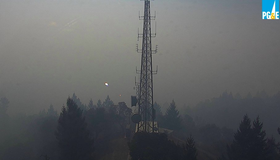
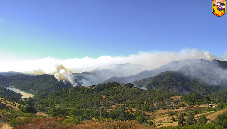
📸: Walbridge Fire as seen from Rockpile.
1/25
HERE IS YOUR MORNING FIRE UPDATE FOR #SONOMACOUNTY 8/20
I have TWO fires to tell you about: #WalbridgeFire & #MeyersFire. #LNULightningComplex
Napa County update is available here:
📸: Walbridge Fire as seen from Rockpile.
1/25
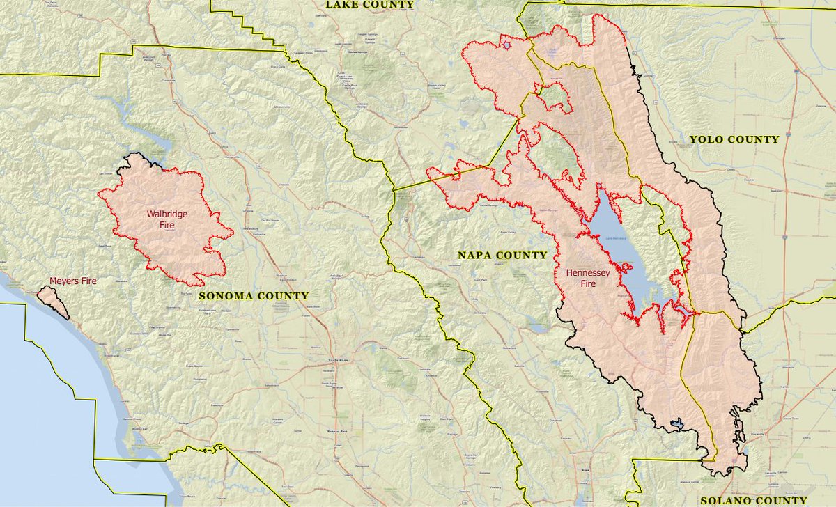
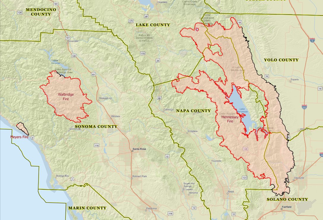
These are all part of the #LNULightningComplex in Napa, Sonoma, Lake, Yolo & Solano Counties
✅Total size Complex (5 fires) is 131,000 acres (up from 124,100)
✅1 death (PG&E employee)
✅4 civilian injuries
2/25
✅Total size Complex (5 fires) is 131,000 acres (up from 124,100)
✅1 death (PG&E employee)
✅4 civilian injuries
2/25
✅30,500 structures are threatened (probably more than that now)
✅105 have been destroyed
✅70 have been damaged
3
✅105 have been destroyed
✅70 have been damaged
3
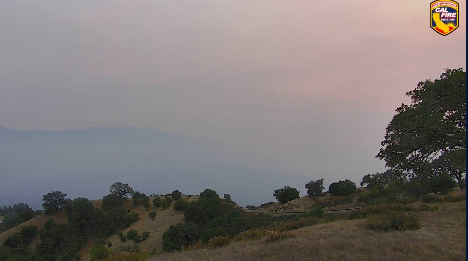
CAL FIRE WEATHER REPORT FOR THURSDAY
🌥Hot and dry
🌥Breezy N-NW winds will lead to critical fire conditions
🌥Gusts up to 30 MPH expected
4/25
🌥Hot and dry
🌥Breezy N-NW winds will lead to critical fire conditions
🌥Gusts up to 30 MPH expected
4/25
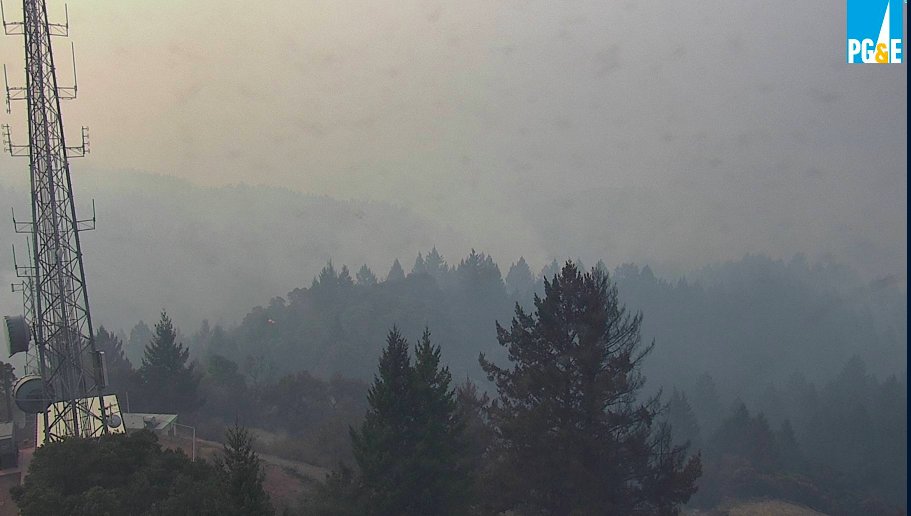
THE SITUATION
📌Critically dry fuels due to drought. These fuels ignite easily from embers and heat spots from old lightning strikes
📌Possible we will see large plumes and smoke again today
5/25
📌Critically dry fuels due to drought. These fuels ignite easily from embers and heat spots from old lightning strikes
📌Possible we will see large plumes and smoke again today
5/25
THE SITUATION
📌Steep and rugged terrain in most areas where the fires are burning
📌Fires fueled by pine, redwood timber and understory w/grass
6/25
📌Steep and rugged terrain in most areas where the fires are burning
📌Fires fueled by pine, redwood timber and understory w/grass
6/25
#WALBRIDGEFIRE
Started 8/17 west of Healdsburg and north of Guerneville. Formally known as 13-4. Threatening Guerneville, Healdsburg, Windsor, and Dry Creek Valley. Burning towards Rio Nido, Hacienda and Hwy 101
✅14,500 acres up from 14,000
✅0% contained
7/25
Started 8/17 west of Healdsburg and north of Guerneville. Formally known as 13-4. Threatening Guerneville, Healdsburg, Windsor, and Dry Creek Valley. Burning towards Rio Nido, Hacienda and Hwy 101
✅14,500 acres up from 14,000
✅0% contained
7/25
#MEYERSFIRE
Started 8/17 north of Jenner. It’s crossed Hwy 1 and is burning along ocean. Formally known as 11-16. Threatening Fort Ross, Seaview, Cazadero, and Jenner. Burning SE along coastal ridges.
✅3,000 acres up from 2,500
✅0% contained
8/25
Started 8/17 north of Jenner. It’s crossed Hwy 1 and is burning along ocean. Formally known as 11-16. Threatening Fort Ross, Seaview, Cazadero, and Jenner. Burning SE along coastal ridges.
✅3,000 acres up from 2,500
✅0% contained
8/25
MANDATORY EVACUATIONS FOR SONOMA COUNTY
NOTHING HAS CHANGED. ALL REMAIN IN PLACE.
SEE YOUR ZONE HERE: experience.arcgis.com/experience/8ca…
9/25
NOTHING HAS CHANGED. ALL REMAIN IN PLACE.
SEE YOUR ZONE HERE: experience.arcgis.com/experience/8ca…
9/25
MANDATORY EVACUATIONS FOR SONOMA COUNTY
🔴Includes 1D1, 1D2, 1D3, 1D4 & 1D5🔴
🚨East of Sonoma Coast from Fort Ross Rd to Russian River
🚨North and East of Russian River
🚨South of Sweetwater Springs Rd & south of Fort Ross Rd
10/25
🔴Includes 1D1, 1D2, 1D3, 1D4 & 1D5🔴
🚨East of Sonoma Coast from Fort Ross Rd to Russian River
🚨North and East of Russian River
🚨South of Sweetwater Springs Rd & south of Fort Ross Rd
10/25
MANDATORY EVACUATIONS FOR SONOMA COUNTY
🔴ZONE 1B3🔴
🚨East of Sewell Rd & King Ridge Rd
🚨N of Old Cazadero Rd & Austin Creek (actual creek) & East Austin Creek through recreation area
🚨West of E Austin Creek and Walbridge Ridge
🚨South of Stewarts Point Skaggs Springs Rd
11/25
🔴ZONE 1B3🔴
🚨East of Sewell Rd & King Ridge Rd
🚨N of Old Cazadero Rd & Austin Creek (actual creek) & East Austin Creek through recreation area
🚨West of E Austin Creek and Walbridge Ridge
🚨South of Stewarts Point Skaggs Springs Rd
11/25
MANDATORY EVACUATIONS FOR SONOMA COUNTY
🔴ZONES 2E1, 2E2, 2E3 & 2E4🔴
🚨South of Stewarts Point Skaggs Springs Rd
🚨West of West Dry Creek Road & Westside Rd
🚨North of Sweetwater Springs Road & McCray Ridge Rd
🚨East of the E Austin Creek (actual creek)
12/25
🔴ZONES 2E1, 2E2, 2E3 & 2E4🔴
🚨South of Stewarts Point Skaggs Springs Rd
🚨West of West Dry Creek Road & Westside Rd
🚨North of Sweetwater Springs Road & McCray Ridge Rd
🚨East of the E Austin Creek (actual creek)
12/25
EVACUATION WARNINGS FOR SONOMA COUNTY
Be prepared to leave if changes to mandatory
Zone map - experience.arcgis.com/experience/8ca…
13/25
Be prepared to leave if changes to mandatory
Zone map - experience.arcgis.com/experience/8ca…
13/25
EVACUATION WARNINGS FOR SONOMA COUNTY
🔴ZONE 1C1🔴
➡️All areas east of the Sonoma Coast to south fork of the Gualala River
➡️South of Kruse Ranch Rd & Howser Bridge Rd to Fort Ross Rd
14/25
🔴ZONE 1C1🔴
➡️All areas east of the Sonoma Coast to south fork of the Gualala River
➡️South of Kruse Ranch Rd & Howser Bridge Rd to Fort Ross Rd
14/25
EVACUATION WARNINGS FOR SONOMA COUNTY
🔴ZONE 1C2🔴
➡️West of South Fork Gualala River
➡️North of Fort Ross Rd
➡️South & East of King Ridge Rd
15/25
🔴ZONE 1C2🔴
➡️West of South Fork Gualala River
➡️North of Fort Ross Rd
➡️South & East of King Ridge Rd
15/25
EVACUATION WARNINGS FOR SONOMA COUNTY
🔴ZONE 1E1🔴
➡️All areas south and west of Willow Creek Rd
➡️North of Coleman Valley Rd and Wright Hill Rd
➡️East of California Coastal National Monument (BLM)
16/25
🔴ZONE 1E1🔴
➡️All areas south and west of Willow Creek Rd
➡️North of Coleman Valley Rd and Wright Hill Rd
➡️East of California Coastal National Monument (BLM)
16/25
EVACUATION WARNINGS FOR SONOMA COUNTY
🔴ZONE 1E3🔴
➡️All areas south of the Russian River
➡️West of Bohemian Hwy
➡️North and East of Coleman Valley Rd and Willow Creek Rd
17/25
🔴ZONE 1E3🔴
➡️All areas south of the Russian River
➡️West of Bohemian Hwy
➡️North and East of Coleman Valley Rd and Willow Creek Rd
17/25
EVACUATION WARNINGS FOR SONOMA COUNTY
🔴ZONE 1F1🔴
➡️All areas east of Bohemian Hwy
➡️North of Graton Rd & Harrison Grade Rd
➡️West of Harrison Grade Rd, Green Valley Rd, & Hwy 116
➡️South of the Russian River
18/25
🔴ZONE 1F1🔴
➡️All areas east of Bohemian Hwy
➡️North of Graton Rd & Harrison Grade Rd
➡️West of Harrison Grade Rd, Green Valley Rd, & Hwy 116
➡️South of the Russian River
18/25
EVACUATION WARNINGS FOR SONOMA COUNTY
🔴ZONE 1F2🔴
➡️All areas south of the Russian River
➡️East & North of Hwy 116 (Pocket Canyon)
➡️West of Martinelli Rd
19/25
🔴ZONE 1F2🔴
➡️All areas south of the Russian River
➡️East & North of Hwy 116 (Pocket Canyon)
➡️West of Martinelli Rd
19/25
EVACUATION WARNINGS FOR SONOMA COUNTY
🔴ZONE 2K1🔴
➡️All areas N & E of Westside Rd
➡️South of Hwy 101
➡️W of Russian River
20/25
🔴ZONE 2K1🔴
➡️All areas N & E of Westside Rd
➡️South of Hwy 101
➡️W of Russian River
20/25
EVACUATION WARNINGS FOR SONOMA COUNTY
🔴ZONE 2K2🔴
➡️All areas south of Hwy 101
➡️East of Russian River to Windsor town limits
➡️North of where Windsor River Rd dead ends extending west to Russian River
21/25
🔴ZONE 2K2🔴
➡️All areas south of Hwy 101
➡️East of Russian River to Windsor town limits
➡️North of where Windsor River Rd dead ends extending west to Russian River
21/25
EVACUATION WARNINGS FOR SONOMA COUNTY
🔴ZONE 4A1🔴
➡️All areas East of the Russian River
➡️North of River Rd.
➡️West of Trenton Healdsburg Rd. and Eastside Rd.
➡️South of the area between the western dead end of Windsor River Rd. and the Russian River
22/25
🔴ZONE 4A1🔴
➡️All areas East of the Russian River
➡️North of River Rd.
➡️West of Trenton Healdsburg Rd. and Eastside Rd.
➡️South of the area between the western dead end of Windsor River Rd. and the Russian River
22/25
EVACUATION WARNINGS FOR SONOMA COUNTY
🔴ZONE 4B1🔴
➡️All areas south of River Rd. from Martinelli Rd to Trenton Rd
➡️West of Covey Rd
➡️North of Front St/Hwy 116
➡️East of Martinelli St
23/25
🔴ZONE 4B1🔴
➡️All areas south of River Rd. from Martinelli Rd to Trenton Rd
➡️West of Covey Rd
➡️North of Front St/Hwy 116
➡️East of Martinelli St
23/25
ROAD CLOSURES IN SONOMA COUNTY
Go here: …dclosures-sonomacounty.hub.arcgis.com
EVACUATION POINT - All have been condensed to one location
⭕ Santa Rosa - Fairgrounds
24/25
Go here: …dclosures-sonomacounty.hub.arcgis.com
EVACUATION POINT - All have been condensed to one location
⭕ Santa Rosa - Fairgrounds
24/25
STAY SAFE, STAY VIGILANT
I believe passionately in fast access to trusted information presented in an honest, easy to digest way. When disaster strikes, I do my best to present to you just that. Please consider supporting my work via venmo.com/SarahStierch. Thank you.
25/25
I believe passionately in fast access to trusted information presented in an honest, easy to digest way. When disaster strikes, I do my best to present to you just that. Please consider supporting my work via venmo.com/SarahStierch. Thank you.
25/25