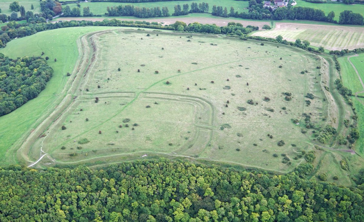
Figsbury Ring comprises a fine set of prehistoric enclosure systems on the chalk above Salisbury in #Wiltshire looked after by @nationaltrust @NatTrustArch
A short thread for #HillfortsWednesday
A short thread for #HillfortsWednesday


Figsbury Ring, once known as Chlorus Camp, #Wiltshire @NatTrustArch - The outer circuit encloses 6.2ha with entrances on the E and W
📷 Dae Sasitorn + Adrian Warren © Sasitorn Images
For more amazing images see: sasitornimages.com
#HillfortsWednesday
📷 Dae Sasitorn + Adrian Warren © Sasitorn Images
For more amazing images see: sasitornimages.com
#HillfortsWednesday

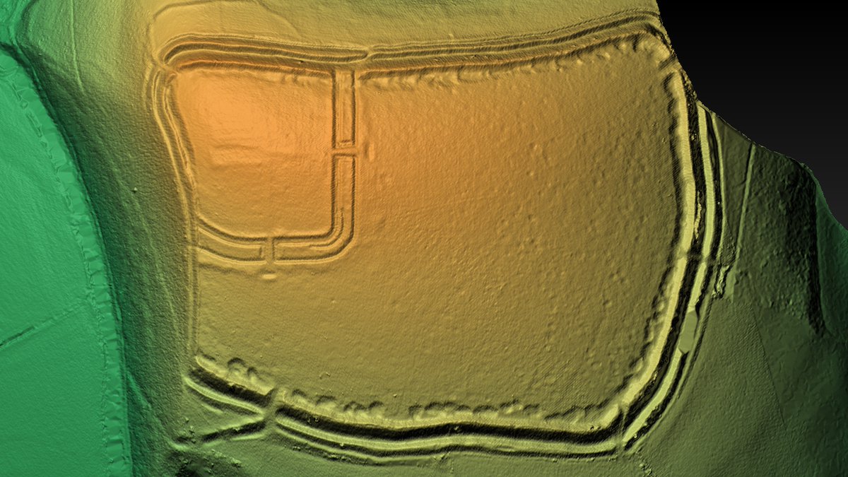
For many years, Figsbury Ring, depicted here in the Ordnance Survey for 1927 with the Roman road from Old Sarum to Winchester to the south, was thought to be a bivallate Iron Age hillfort...
...but there was something strange about the innermost circuit
#HillfortsWednesday
...but there was something strange about the innermost circuit
#HillfortsWednesday

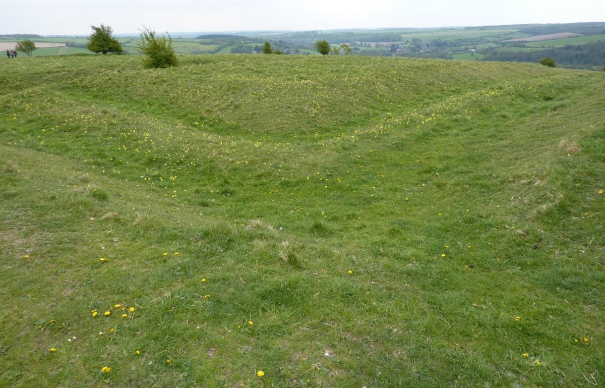
Maud Cunnington dug Figsbury Ring inner circuit in 1924 finding bone with Grooved Ware and Beaker pottery. It may have been a causewayed enclosure or even a henge – as old to the hillfort builders as the hillfort is to us
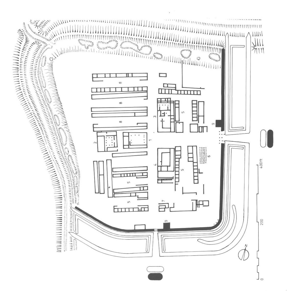
📷© Tony Gonçalves 2008 CC-By-SA-2.5
#HillfortsWednesday
📷© Tony Gonçalves 2008 CC-By-SA-2.5
#HillfortsWednesday
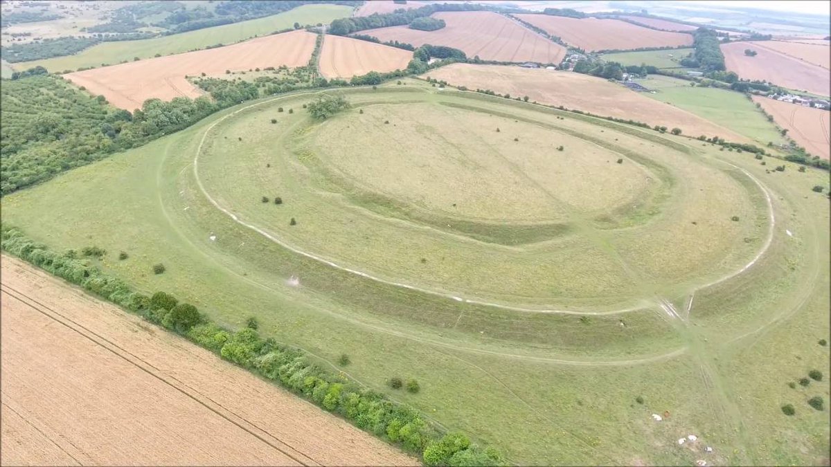


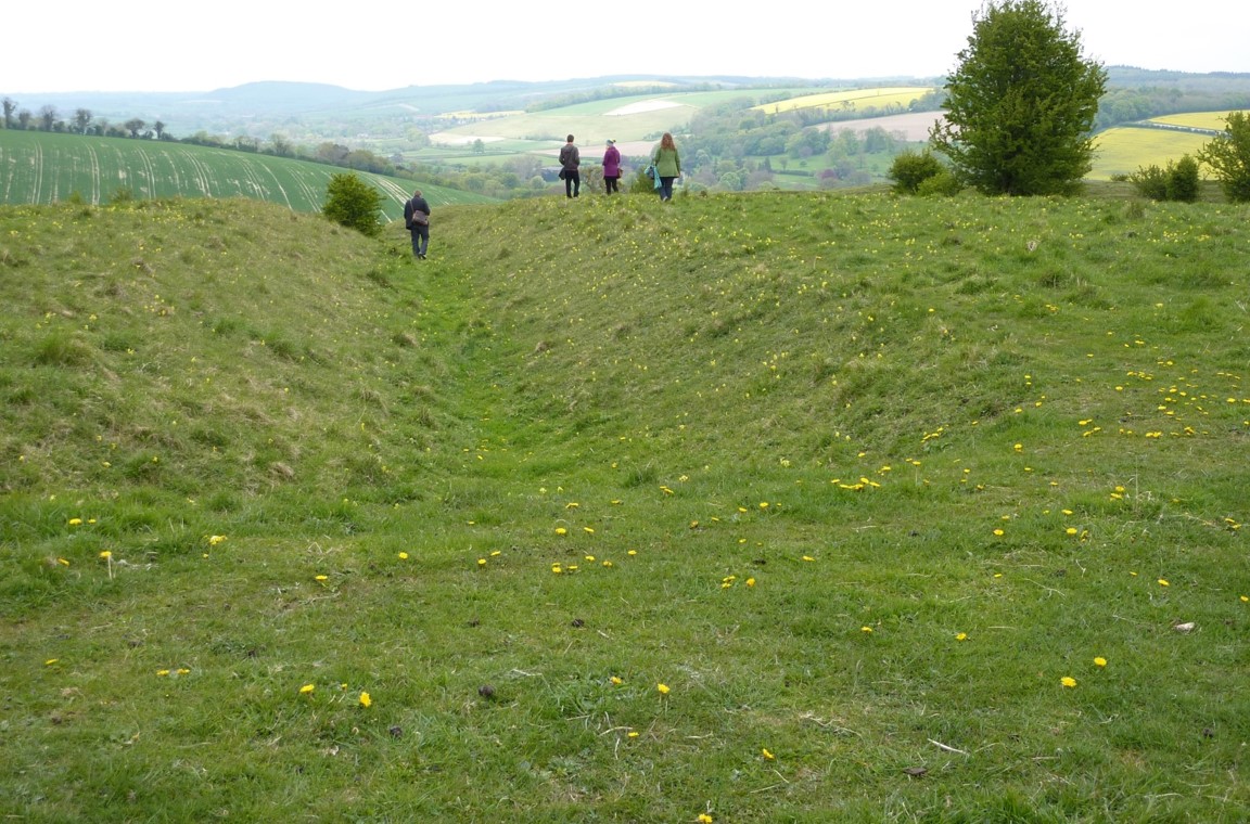
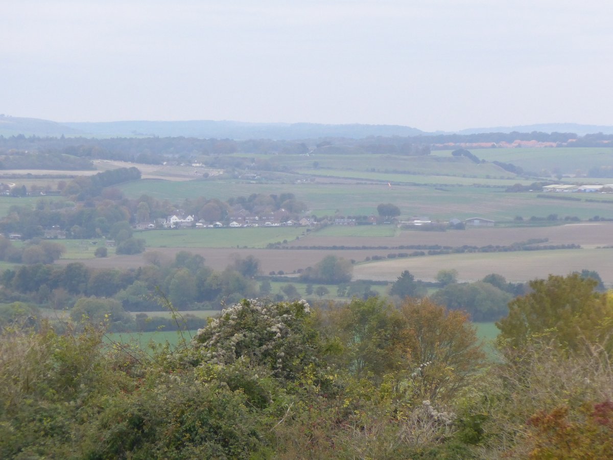
The outer circuit of Figsbury Ring #Wiltshire forms a quietly impressive univallate hillfort dominating the chalkscape, the wide valley of the River Bourne and the views to #Salisbury and @EHOldSarum
#HillfortsWednesday
#HillfortsWednesday


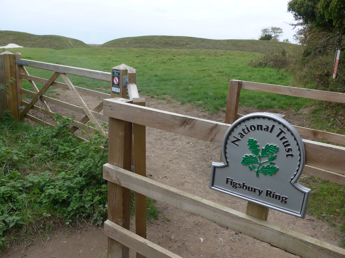
Figsbury Rings #Wiltshire is owned and cared for by the @nationaltrust @NatTrustArch
There’s an, ahem, *interesting* road to the top but once there, the views alone make it worthwhile. The Iron Age ramparts are popular with humans and animals alike 🤩😍
#HillfortsWednesday
There’s an, ahem, *interesting* road to the top but once there, the views alone make it worthwhile. The Iron Age ramparts are popular with humans and animals alike 🤩😍
#HillfortsWednesday


Figsbury Ring #Wiltshire - a 360 pan of hillfort and view from the Eastern ramparts 🤩🤩
#HillfortsWednesday
#HillfortsWednesday
The interior of Figsbury hillfort #Wiltshire with the earlier internal henge / causewayed enclosure (would prefer it to be a causewayed enclosure if I'm honest)
Another example of prehistory brightening up the gloomiest of days 😍
#HillfortsWednesday
Another example of prehistory brightening up the gloomiest of days 😍
#HillfortsWednesday
• • •
Missing some Tweet in this thread? You can try to
force a refresh