Barely a year ago, Ethiopia's PM Abiy was acclaimed as a peacemaker, a youthful African leader awarded the Nobel Prize after signing a peace deal with Eritrea. But this week, he started a sweeping military operation against Tigray, one of his own regions. nytimes.com/2020/11/04/wor…
“Mr. Abiy announced the operation on Facebook just before 2 a.m. on Wednesday, an hour after internet and phone links to the region went down, according to NetBlocks, an organization that tracks internet services.”
https://twitter.com/netblocks/status/1323799930947964928
“Without any substantive foreign backing and Sudan and Eritrea cooperating with the Ethiopian military, it remains unlikely that the TPLF will be able to resist the Ethiopian military’s incursions for long.” mailchi.mp/thesoufancente…
Re: geolocated video above, Amnesty believes likely hundreds of people not involved in the ongoing military offensive were stabbed or hacked to death in May Cadera. Witnesses say forces loyal to TPLF were responsible for the mass killings. amnesty.org/en/latest/news…
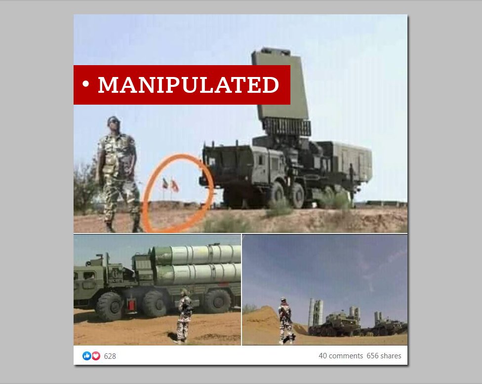
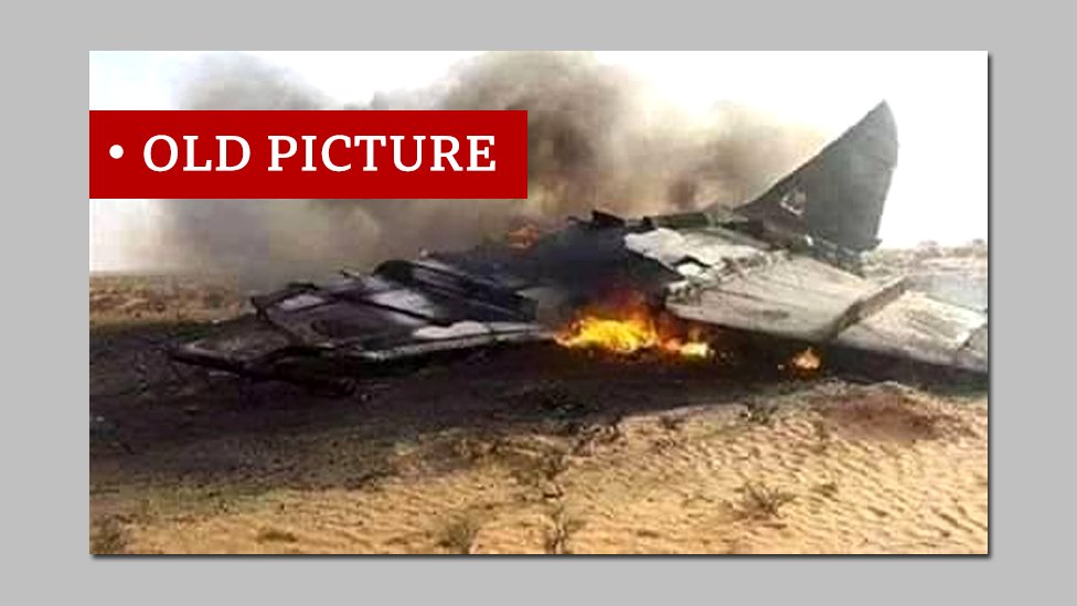
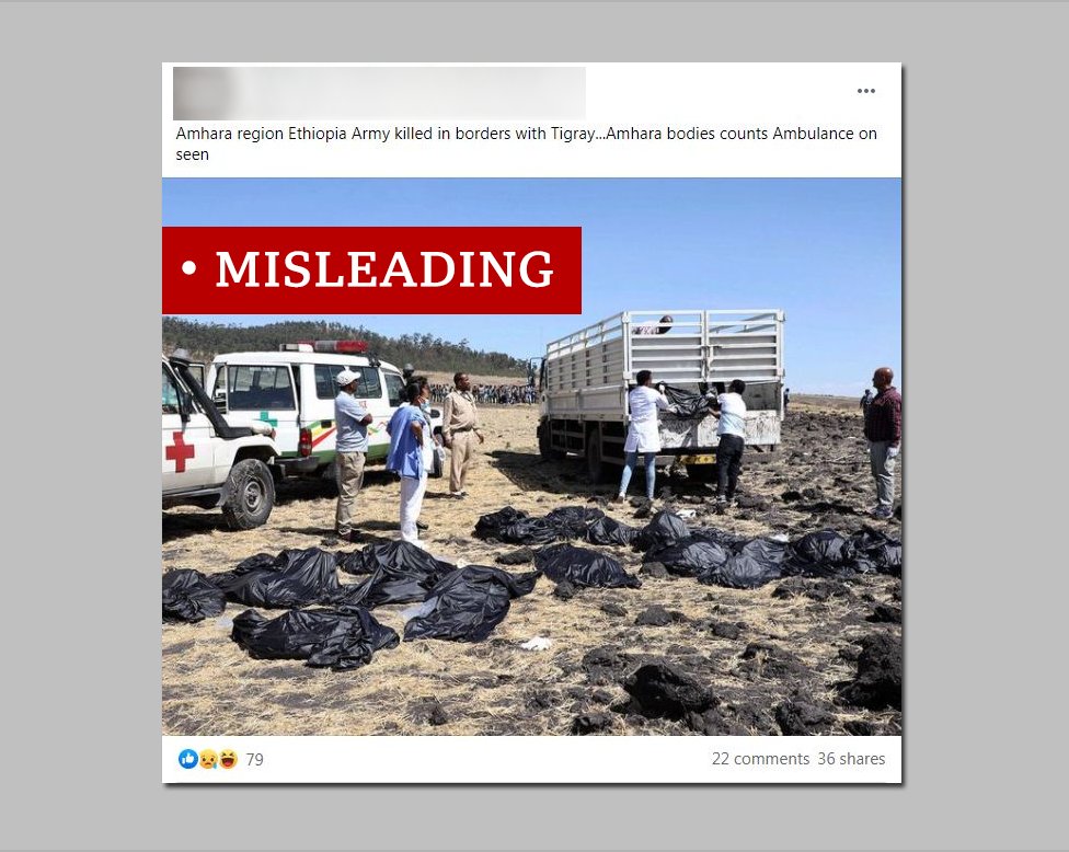
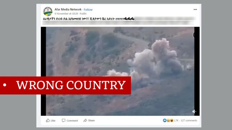
There's also lots of online disinformation regarding the ongoing military offensive by Ethiopia. Good fact-check overview here by the BBC's @MwaiPetrov. bbc.com/news/world-afr… 


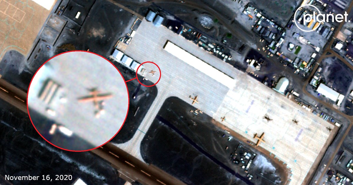
A Chinese-made Wing Loon II was spotted by @wammezz at Assab, the Emirati military base in Eritrea. While TPLF has claimed to be under attack on several fronts, this is no evidence that the UAE is actively supporting the Ethiopian Air Force above Tigray. bellingcat.com/news/rest-of-w… 
Started a specific thread monitoring airstrikes here.
https://twitter.com/trbrtc/status/1329652042185531395
Over 30,000 people have fled to Sudan already, according to the UN. And with the federal government stating its troop are marching on the capital Mekele, it's expected that number will continue to rise in the coming days.
“From fleeing refugees to missile attacks — the fallout from the conflict in Ethiopia's Tigray Region is spilling into other countries and threatens to destabilize an already fragile region,” says @ReutersAfrica's @Katchysangel.
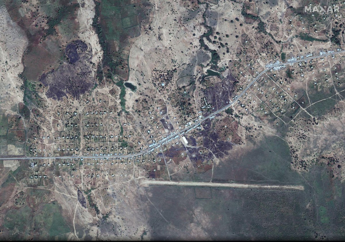
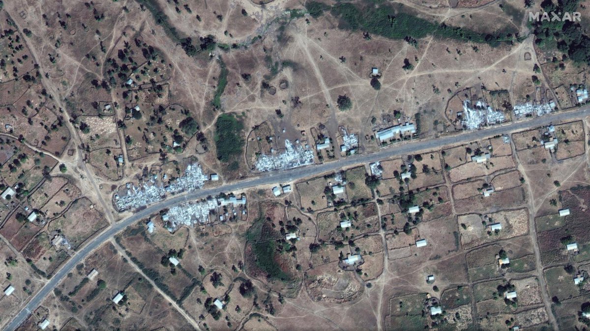
At least 30 destroyed buildings lining the main road near Dansha airport, where the Ethiopian government says there was a Nov. 4 surprise attack by the TPLF on federal troops, are visible on this Nov. 18 @Maxar satellite image. reuters.com/article/us-eth… 

Shire (ሽረ) was reportedly captured by ENDF forces on Nov. 17. Satellite imagery of @planetlabs shows smoke rising from this warehouse google.com/maps/place/14%… that day. It appears to have been reduced to rubble judging from the image a day later, as was also noted by @Obs_IL.
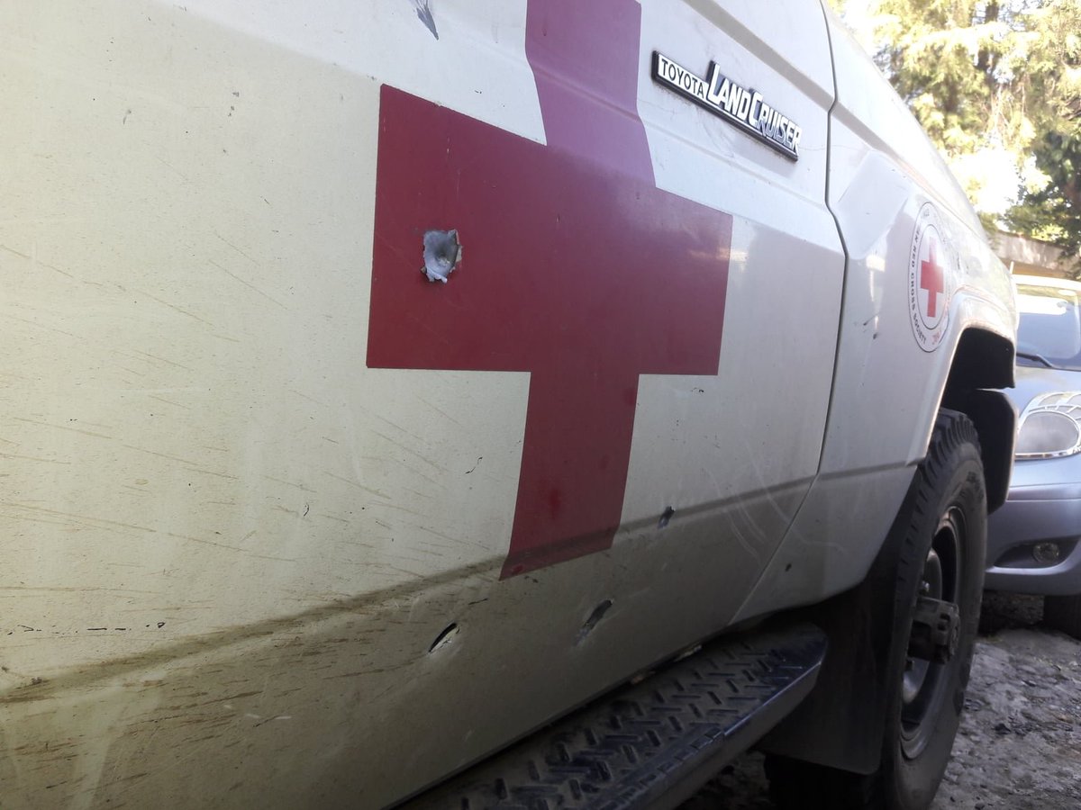
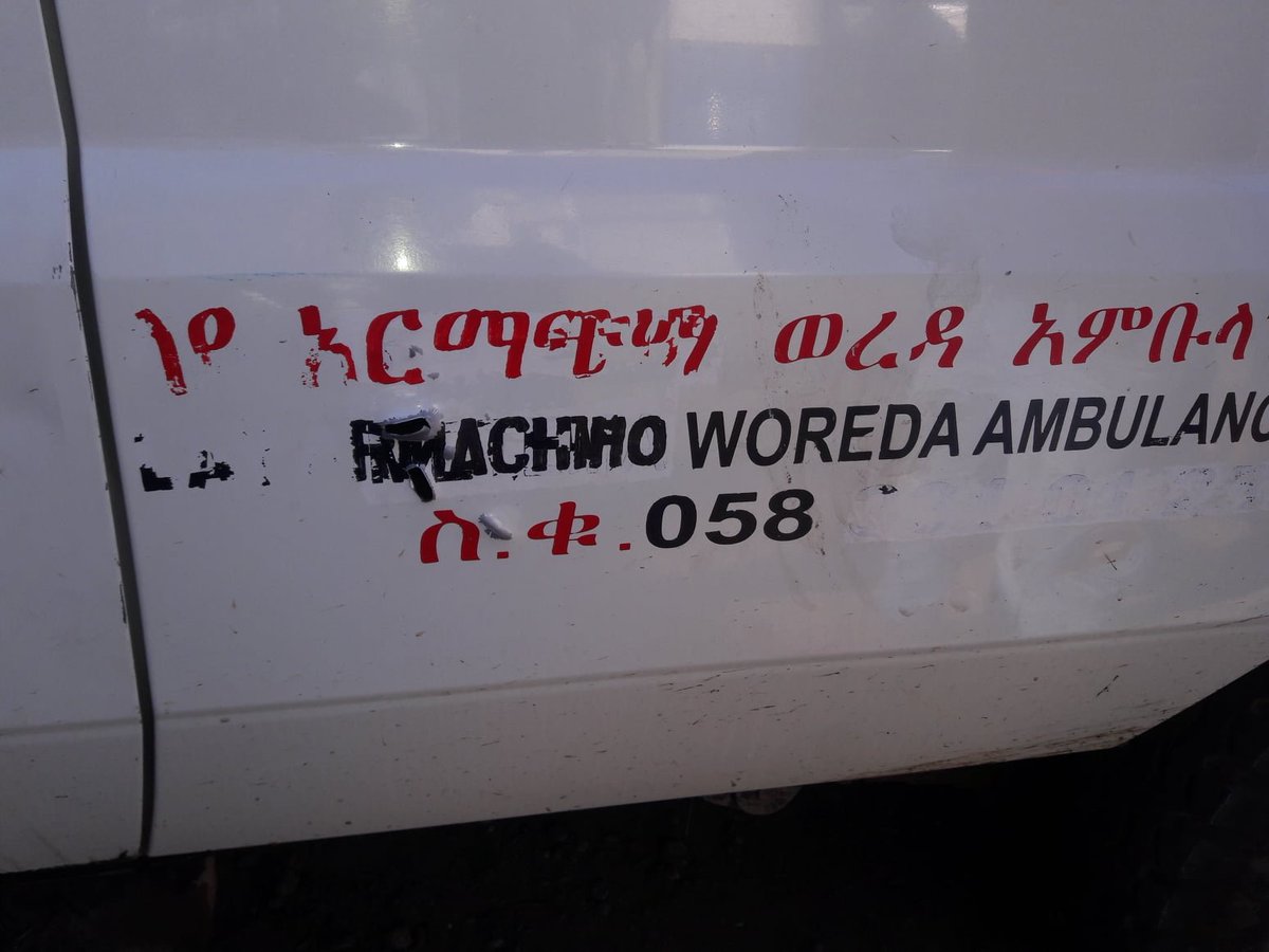
Last week, three ambulances were attacked, according to the Ethiopian Red Cross Society. Details of the incidents remain unclear, ICRC stated, but it's “a worrying sign that medical workers and first responders are not being respected and protected”. facebook.com/EthiopianRedCr… 

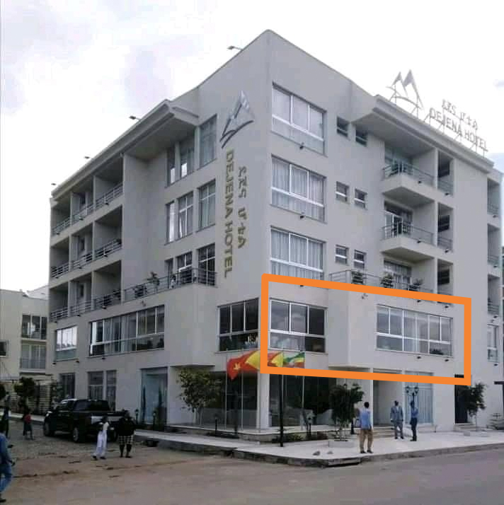
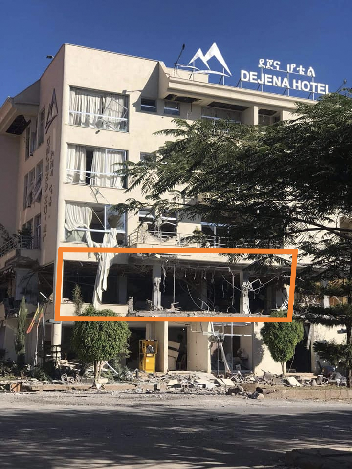
The Dejena Hotel in Shire (google.com/maps/place/Dej…) appears to have been damaged as well, especially the firs floor, as seen in before and after images. It's unclear exactly when, why, and by whom the hotel was damaged. 

Follow this thread by @ryanmofarrell for, as far as I've seen, the most accurate territorial control situation in Ethiopia's Tigray Region. It's striking how little we know of what's going on in TPLF-held territory, given the communications blackout.
https://twitter.com/ryanmofarrell/status/1330962355526758406
AFP journalist @rcoreyb and photographer @edusoteras were the first independent journalists to report from inside Humera, after Ethiopian federal forces took the town on Nov. 12 from forces loyal to the TPLF, and found the scars of the conflict everywhere. uk.news.yahoo.com/inside-tigray-…
Multiple people told @rcoreyb that, during the battle, they heard mortars coming in “from the north”, referring to Eritrea. While Ethiopian federal forces make use of Eritrean soil, AFP writes, Ethiopia denies that Eritrea takes part in the fighting.
Axum's runway was obstructed with dirt barriers and other objects, @fanatelevision footage shows. The state-affiliated broadcaster blames TPLF, which lost the popular tourist location home to a UNESCO World Heritage site to federal forces in the past days. fanabc.com/english/desper… 


The dirt barriers (probably trenches) can faintly be seen on this @sentinel_hub satellite image too. I counted over 20 of the barriers, aimed to obstruct aircraft from using Axum Airport.
https://twitter.com/Obs_IL/status/1330910660541227011
From yesterday: “The leader of Ethiopia's dissident Tigray region has said that his people are "ready to die" defending their homeland, rejecting Prime Minister Abiy Ahmed's ultimatum that they surrender within 72 hours.” news.yahoo.com/tigray-leader-…
At least 9 out of 27 apparent warehouses/storage sites northwest of Wikro (ውቕሮ), #Ethiopia, were heavily damaged if not entirely destroyed, @sentinel_hub satellite imagery shows. Fire data suggests this happened on Nov. 27. 

https://twitter.com/ryanmofarrell/status/1333135570588078081


Here's a higher resolution satellite image look at that location northwest of Wikro, #Ethiopia.
https://twitter.com/Obs_IL/status/1333379788157939715
An Ethiopian Air Force MiG-23 crashed in the TPLF-controlled Kola Tembien district yesterday, per Tigray TV. @projectowlosint and @NotWoofers identified suspected wreckage parts of fighter jet, such as the canopy, variable wing assembly, and the helmet.
https://twitter.com/MapEthiopia/status/1333113816276676612
In mid-November, the Ethiopian Air Force said the TPLF had targeted Bahir Dar with rockets (amharic.voanews.com/a/Ethiopia-con…). This satellite image strongly suggests at least one rocket hit the airbase, which is home to several MiG-23s.
https://twitter.com/wammezz/status/1339370865096572930
A satellite image of a storage site southwest of Asmara is making the rounds, alongside the claim that looted goods from Tigray are being sold in Eritrea. Please note that this satellite image is outdated; it's from April 2019.
https://twitter.com/trbrtc/status/1338919280193253376
As the first foreign media, @vrtnews went as deep as Shire into Ethiopia's Tigray Region, spotting desolated villages, burned houses, destroyed armoured vehicles, and a dire situation in a hospital, ran by volunteers. See @vercrus' timeline for more.
vrt.be/vrtnws/nl/2020…
vrt.be/vrtnws/nl/2020…
This video, obtained by @vrtnews, is making the rounds as evidence of Eritrean soldiers transporting looted goods in Tigray. While it's possible to identify the tank as a T-55(A)MV, it's important to note that it's unclear who's operating it here. H/t @Rebel44CZ @oryxspioenkop.
Thread on the Hitsats camp for Eritrean refugees in Ethiopia. /28
https://twitter.com/trbrtc/status/1343646364375412736
The tomb of Nejashi, the Abyssinian king who sheltered Muslims seeking refuge in the 7th century, was damaged during, photos and videos show. The first reports of looting and damage emerged on Dec. 16, but there was no visual confirmation of damage until now. H/t @MarksSimon. 


The northern corner of the Najashi tomb [orange] suffered most damage, footage suggests. Unclear whether the nearby 7th-century mosque [yellow], believed to be one of the oldest on the African continent, was damaged. Both were restored by Turkey in 2018: tika.gov.tr/en/news/the_ab…. 

Update on apparent aerial weapon remnants. /31
https://twitter.com/trbrtc/status/1365054454861594633
Fires —that appear to have been deliberately set— destroyed +500 structures this week in and around the town of Gijet, @Reuters reports based on @planetlabs satellite imagery. May be related to fighting between federal forces and local militias. /32 mobile.reuters.com/article/amp/id… 

Based on 41 survivor and witness testimonies, @amnesty claims that Eritrean forces “systematically killed hundreds of unarmed civilians” on Nov. 28-29 in Axum, a city in Ethiopia's Tigray region. “All we could see were dead bodies and people crying.” /33 amnesty.org/en/latest/news… 


If you're looking for a primer on the war in Ethiopia's Tigray region, make sure to watch this video by @Salem_Solomon and her team which traces the beginnings of the conflict that grew into a humanitarian crisis: voanews.com/episode/tigray…
The exact location of the “Mahbere Dego massacre,” shown in multiple videos that appeared online last month, has been found. Important work by @bellingcat @Newsy #BBCAfricaEye for potential accountability and to counter disinfo narratives on Tigray Region.
Read more about the geolocation process of these videos on the @bellingcat website. Specifically the value of using a website like PeakVisor is worth mentioning. bellingcat.com/news/2021/04/0… 


The identities of both the perpetrators nor the victims were found. But #BBCAfricaEye suggets that the details of the uniforms, including the camouflage pattern and flag patch, appear to match those worn by the Ethiopian National Defence Force (ENDF). bbc.com/news/world-afr… 

CNN and Amnesty International independently reached the same geolocation conclusion — but on top of that we're also able to find out more about the victims, speak to a family member, and where one of the videos came from: a soldier-turned-whistleblower.
https://twitter.com/elizamackintosh/status/1377766546131578884
*('were' not 'we're') — anyway, great work by all of those involved at Amnesty International, BBC Africa Eye, Bellingcat, CNN, Newsy and others.
And here's the link to the joint CNN and Amnesty video investigation. edition.cnn.com/videos/world/2…
• • •
Missing some Tweet in this thread? You can try to
force a refresh


