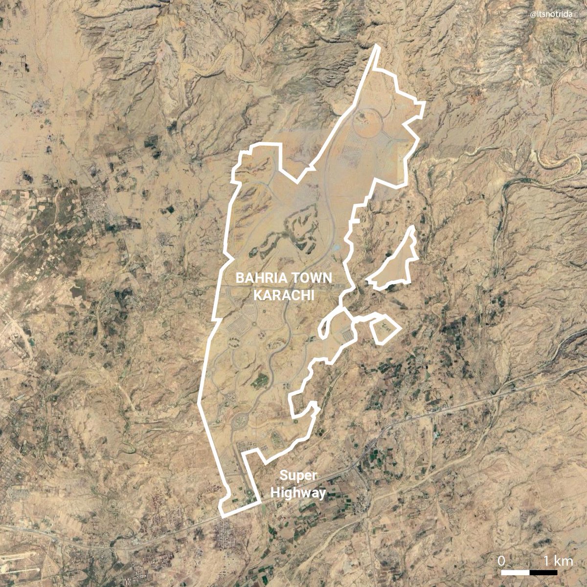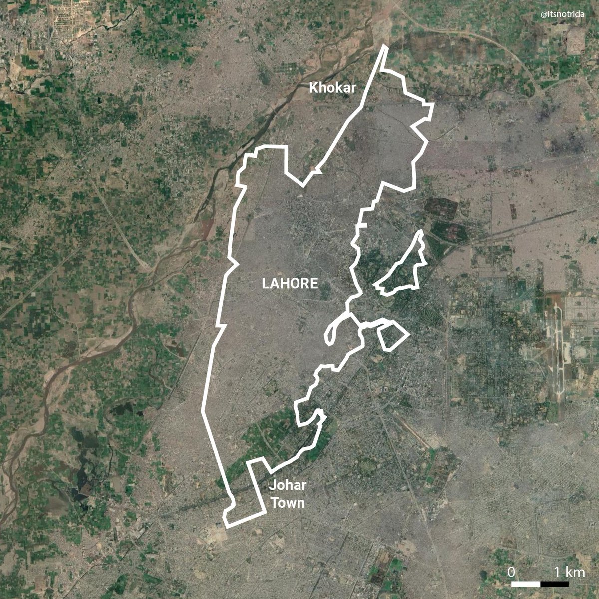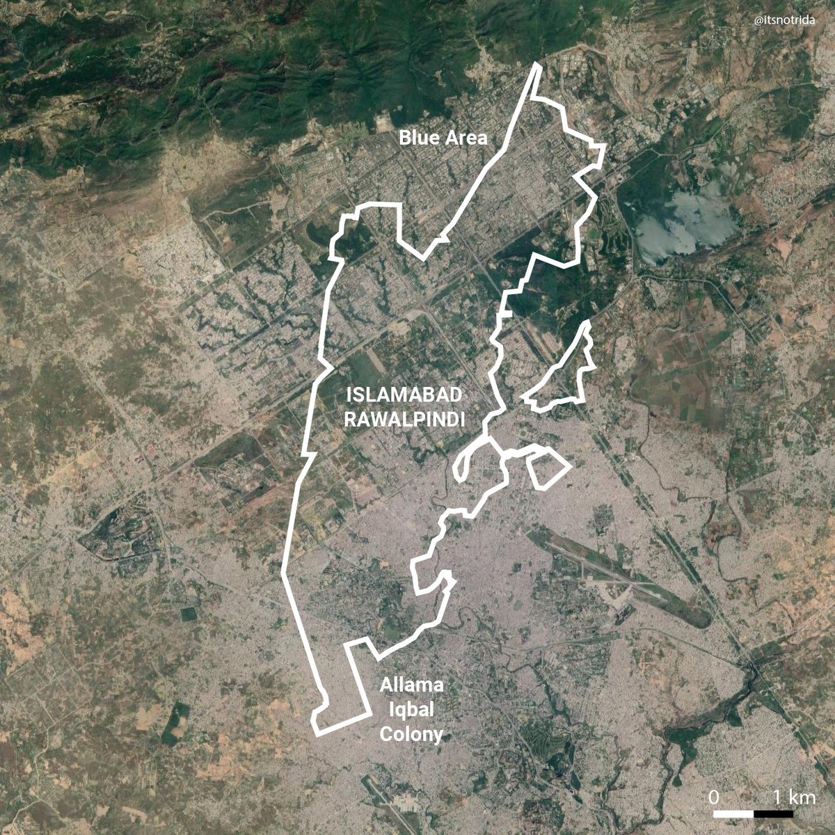
In this thread I compare Bahria Town (Karachi) to other cities, local and international, to relay the spatial scale of 'legalized' fraud involved. Try to also grasp that all of the areas in these cities fall under one developer. 


On one hand, top authorities are adamant on removing encroachments along Karachi Circular Railway, not resettling the most marginalized, rendering several homeless. On the other, they've essentially 'fined' fraud of this scale.
"No one man should have all that power". As a millennial i'll conclude this with a meme.
(Bahria Town outline based on satellite image showing current expansion, not fully realized master plan)
(Bahria Town outline based on satellite image showing current expansion, not fully realized master plan)
Sincerely regret a text typo in the scale bars: it is 2 km not 1 km. The displayed maps are still accurate.
Basic methodology
- "QGIS" software, load satellite
- Trace dev bounds using satellite tiles, export as vector
- Export images of cities at same scale as bounds
- Overlay vector bounds with city images on "Illustrator"
Ensure scale is uniform because that's the point.
- "QGIS" software, load satellite
- Trace dev bounds using satellite tiles, export as vector
- Export images of cities at same scale as bounds
- Overlay vector bounds with city images on "Illustrator"
Ensure scale is uniform because that's the point.

If too technical, i'll do a tutorial, let me know. Thanks for wanting to learn about mapping your cities. Technically empowered citizens are what the admin would hate :)
• • •
Missing some Tweet in this thread? You can try to
force a refresh


