A Look at Taipei Zoning & City Planning - a thread! A close look (complete with technical details!) at one of Asia's newest yet interesting cities. 1/ 

As cities in Asia go, Taipei is a very young city - comparable to San Francisco in age. Until 1949, it was just a province capital. en.wikipedia.org/wiki/History_o… 2/
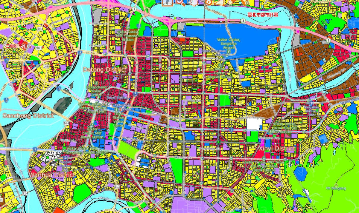
The core of Taipei city is a roughly a 4 mile x 4 mile square, boxed in by mountains and rivers. The oldest parts are by the river and train station. 

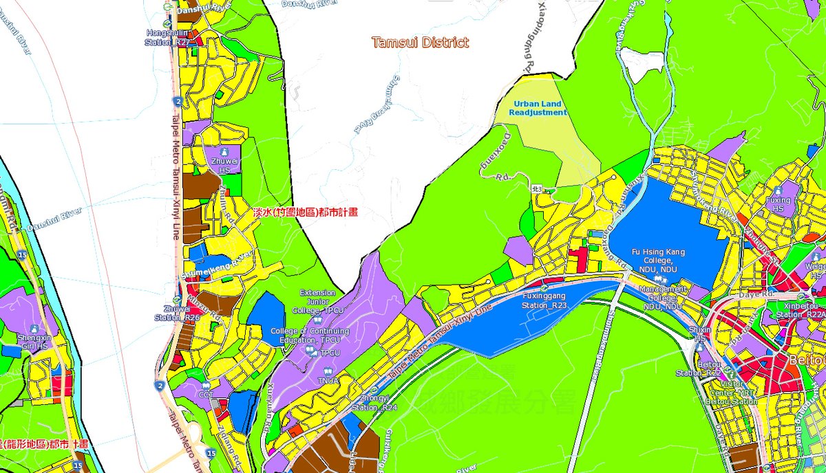
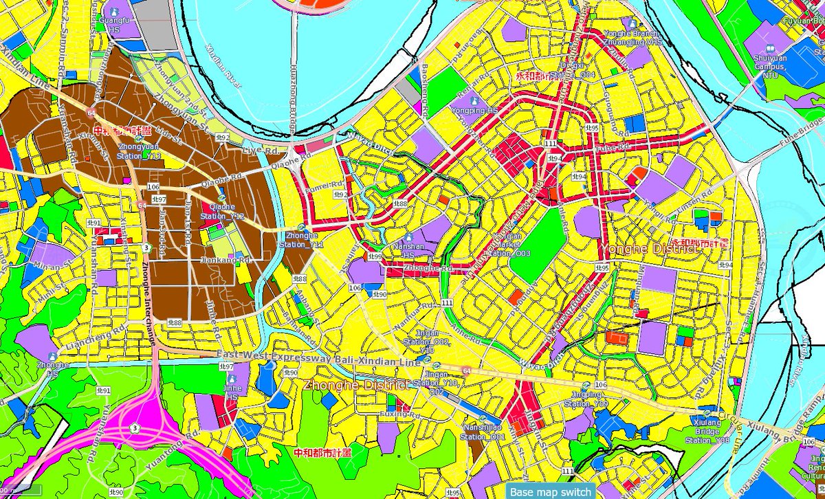
Taipei has wide avenues spaced about a quarter mile apart and lined with commercial buildings (red). Residential buildings (yellow) fill the areas in between, while industrial areas are at the edges (brown).
Zoning map of all of Taiwan at maps.nlsc.gov.tw
Zoning map of all of Taiwan at maps.nlsc.gov.tw
This is what it looks like as built - tall office buildings and apartments on the main avenues, 5-7 story apartments in between. 

Taipei and Los Angeles (another city with a grid of commercial avenues and smaller residential streets in between). Both views are at the same scale. 

Between the commercial avenues are narrow streets and alleys, with 130'x300' blocks of 5-7 story buildings from the mid-20th century. The orange square is a open-air farmers market, purple is a school. Schools in Taiwan are big, with thousands of students. 

this is from the interactive map at maps.nlsc.gov.tw Go to Layers --> Land Layer --> Land Use Zoning Map of Urban Planning.
Most Taipei residential zones are Type 3 or Type 4 residential zones, which allow a floor area ratio of 2.25 to 4, and heights of up to 1.5 times the street width. 5-story walkups with unauthorized rooftop additions are common.
laws.taipei.gov.tw/lawsystem/wfLa…

laws.taipei.gov.tw/lawsystem/wfLa…


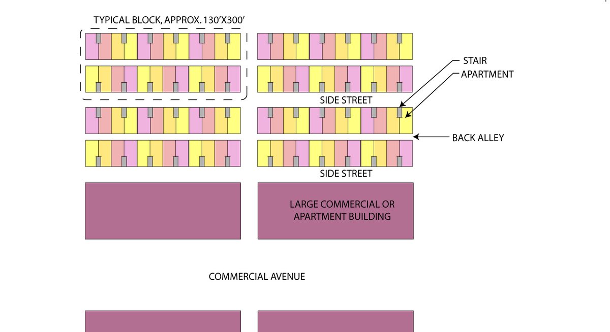
this is what a typical Taipei apartment floor plan looks like: living room facing the street, bedrooms facing a back alley or a light court. Roughly 20 feet wide x 40 feet deep. 

How a bunch of standard Taipei apartments fit together into a typical residential block. One interesting thing about the side streets: they are given a street number as if they were a building! Makes it easy to find your way around. 
speaking of street numbers, every building in Taipei gets a standardized building number sign, which has the street number and the name of the street on it. No need to guess which street a building on a corner is on, or complaining about a "gentrification font" 

Commercial zones in Taipei range from floor area ratios of 3.6 to 8, and heights up to 2 times street width. Since most commercial zones are on the big avenues, heights can easily go up to 30 floors. The handful of buildings that are taller are mostly in special zones. 

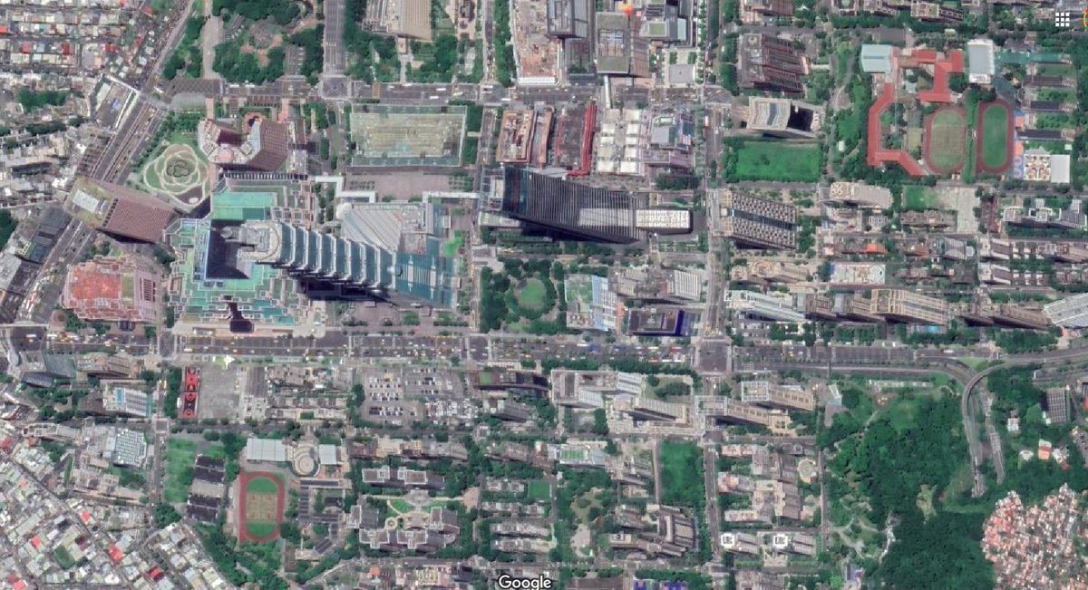
One of the special zones is where the Taipei 101 office tower is located. This was an industrial area that was redeveloped into a new city hall, offices, and shopping malls. Unlike the rest of the city, it's all wide roads and big setbacks, and is best experienced indoors. 


a more typical Taipei commercial area. Note the partially covered sidewalks on the first floor. This provides a covered place to walk during rainy or hot days, as well as extra retail space or a place to park motorcycles (not sure if that last one is legal) 

In Taipei's downtown and other busy areas, side streets also have businesses on them. Some are fully pedestrian-only, while others are closed to cars during farmers markets and night markets. 

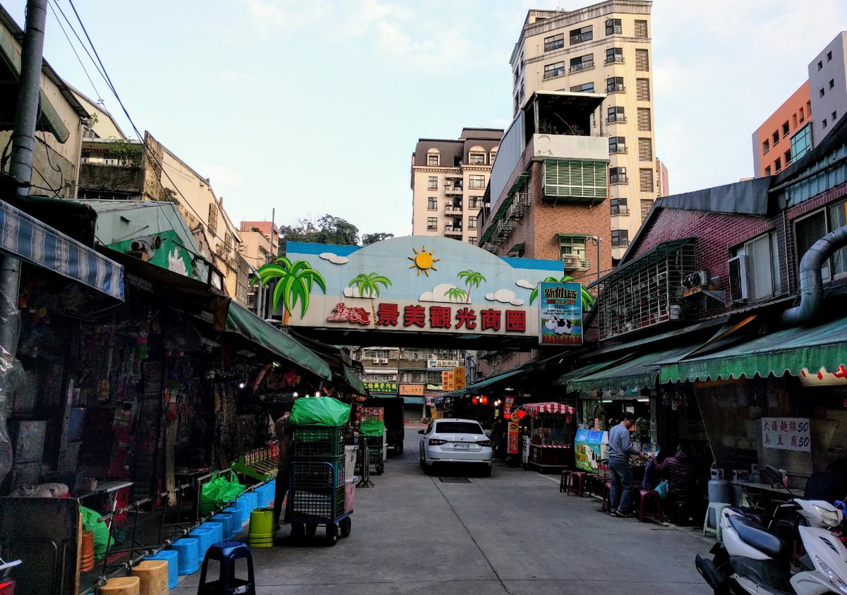

every bit of space is used in the city, even the area under elevated rail tracks is landscaped into a park. 

a rare sight in Taipei - an empty lot. the founder of the country - Sun Yat-sen - was a fan of Georgism and the way taxes work discourage leaving land unused. "everyone works but the empty lot" 🔰 

Another example of Georgist thinking: the Taipei 101 office tower is a build-operate-transfer project. Developer bought a 70-year land lease from the city. In 2067, the city gets both the land and the building back at no cost. taiwanratings.com/portal/front/v… 


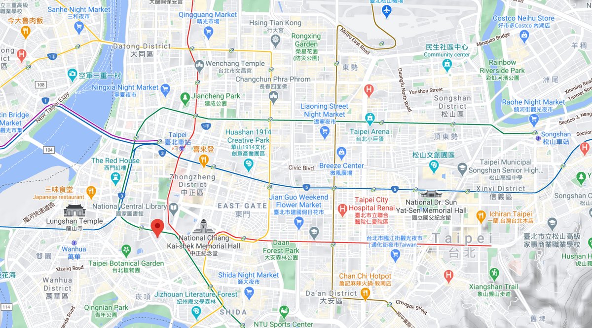
The main downtown is on the west side of Taipei near the train station & government bldgs. Presidential office building & legislature are just a couple blocks from the station, residential areas, & an entertainment district. In 2014, students occupied the legislature for weeks. 
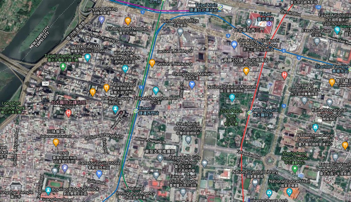
Taipei's metro system opened in the late 1990s, new lines have been added continuously since then. Stations are about 1/2 mile apart. Some have underground shopping malls between them. It was built using cut-and-cover, and the construction era was known as "the traffic dark ages" 
In 2015, someone made a map showing the median family income near each rapid transit station in Taipei. Notice how small the range of differences is compared to the Bay Area.
(Taipei map from thenewslens.com/article/30021)

(Taipei map from thenewslens.com/article/30021)


For comparison, here is a similar 2015 map of Hong Kong showing average income by subway/metro station, made by the same people that made the Taipei map
thenewslens.com/article/18735
thenewslens.com/article/18735

Taipei's outer districts and adjacent suburban areas are typically narrow strips of highrises built into the steep valleys. In 2010, the surrounding suburbs were merged into New Taipei City, which has a larger population than the city of Taipei itself. 

While these suburban areas aren't on a grid, they have similar patterns of commercial zones near metro stations and on major streets, and 5-story apartments in between. 

I love how this city doesn't take itself too seriously. A giant memorial to a president from the martial law era now hosts contemporary art exhibits including a replica of a lab from the Spongebob cartoons. ![Zhongzheng District (also Jhongjheng District[1]) is a distr](/images/1px.png)
![Zhongzheng District (also Jhongjheng District[1]) is a distr](https://pbs.twimg.com/media/Er7LjcTUcAEUunf.jpg)
as one might expect, Taipei also has one of the highest densities of bubble tea shops, second only to Berkeley, California. 

there are 9 bubble tea shops within 1 block of Durant and Telegraph in Berkeley. I guess that's what happens when you have college students but the drinking age is 21. In Taipei the drinking age is 18 and it is legal (though uncommon) to drink outside in public. 🙃 

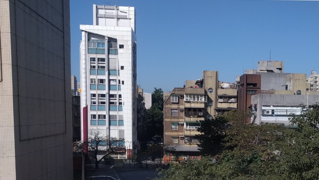
Remember the part about how building density is based on Floor Area Ratio? Some buildings (like the one on the left) are built with extra-high ceilings so that residents can install lofts inside for extra space. 
Like most other big cities, high housing costs are a problem in Taipei. However, the homeownership rate is still very high - around 84% - made possible by very low mortgage interest rates around 1.6%. taipeitimes.com/News/biz/archi…
There's a very small amount of public / social housing. Recently the government has started a program of building more, though there are familiar challenges - who gets the units, NIMBYs, etc. slideshare.net/OURsOURs/socia… 

With most people homeonwers, and limited public housing, the rental market is mostly informal, with individuals renting out condos, as well as unauthorized conversions & additions. American-style apartment buildings owned by a single landlord are rare.
topics.amcham.com.tw/2018/10/taipei…
topics.amcham.com.tw/2018/10/taipei…
Another option for people looking for cheaper housing is to commute. In the last 20 years, high speed rail, subway, and highway tunnel projects have brought a lot of rural areas into commuting range. 

Two examples of high speed rail stations in Taiwan. Outside of Taipei, the stations are in rural areas at the edge of existing cities. Hsinchu (on the left) opened in 2006 and is now partly built up with highrises, Miaoli opened in 2015 and buildout is just starting. 


Similar thing going on with the new metro lines. Places are going straight from fields to towers.
I have a relative who once thought Americans lived in skyscrapers or on farms, based on movies they saw. Turns out they're the ones who live that way. 🤣
I have a relative who once thought Americans lived in skyscrapers or on farms, based on movies they saw. Turns out they're the ones who live that way. 🤣

Further south, stations about 70 minutes from Taipei in rural areas have about townhouses built around them. 

for more photos, commentary, and the occassional anime-style official light rail advertisement with cyborg dolphins, I recommend following @TaipeiUrbanism
https://twitter.com/TaipeiUrbanism/status/1348181203342397443
• • •
Missing some Tweet in this thread? You can try to
force a refresh

