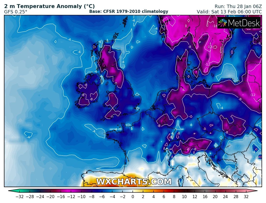
Not very often you run a model for 384hrs and see 85% hemisphere below mean of 1979-2010. Highest hour was 0.4 midnight 26th.lowest minus 0.6 29th 06.00.
Extraordinary.
Extraordinary.

Simply Amazing amount of Cold from West to East.
Time to start preparing I think.
Cars.. Top up fluids and Antifreeze.
Aviaries... Check water every morning.
Local councils.. Gritters ready.
Time to start preparing I think.
Cars.. Top up fluids and Antifreeze.
Aviaries... Check water every morning.
Local councils.. Gritters ready.

So the Trend continues and the event is getting closer, this is an incredible set up for cold to strike Europe and America/Canada.
Any precipitation would fall as #Snow. DP"s in minus double figures.


Any precipitation would fall as #Snow. DP"s in minus double figures.


High pressure blocking any beast from the East, but this has potential to be a very cold few weeks for much of N/NW/NE Europe. 


Huge temperature anomalies in the NH, check out US CONUS. 6-10th Feb.
Again evident in every update.

Again evident in every update.


Or concrete but the Low to our SE shifted north slightly on the 18z.
Snow in London and the SE.
Pretty brisk Easterlies too.

Snow in London and the SE.
Pretty brisk Easterlies too.


As per previous tweets, our focus was on 2 areas. the low to our SE and the High to our NE.
The low has shifted north over the last few runs making a snow event for the SE.
Can change however, i think any changes will be for and not against.

The low has shifted north over the last few runs making a snow event for the SE.
Can change however, i think any changes will be for and not against.


06z GFS looking to bring the low in the SE further north, little changes big outcome.
This would now be snow less for the SE.
Would be Blizzard conditions running odd the North Sea for NE and Scotland.

This would now be snow less for the SE.
Would be Blizzard conditions running odd the North Sea for NE and Scotland.


Euro and the GFS 12z holding on to the cold.
Euro and other models want to bring cold west, GFS holding off for now.
Low to SE still bone of contention. 👇

Euro and other models want to bring cold west, GFS holding off for now.
Low to SE still bone of contention. 👇


Forming up now and 3-4 days out, good model agreement on the Low to our SE stalling, this will bring significant disruption to travel, warnings will be issued in due course, Gusty winds could see drifting in Rural areas.
Could see 20cm in far east, over half a foot in Old money!

Could see 20cm in far east, over half a foot in Old money!


• • •
Missing some Tweet in this thread? You can try to
force a refresh


