
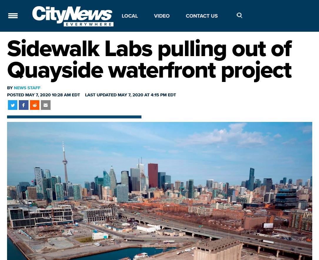
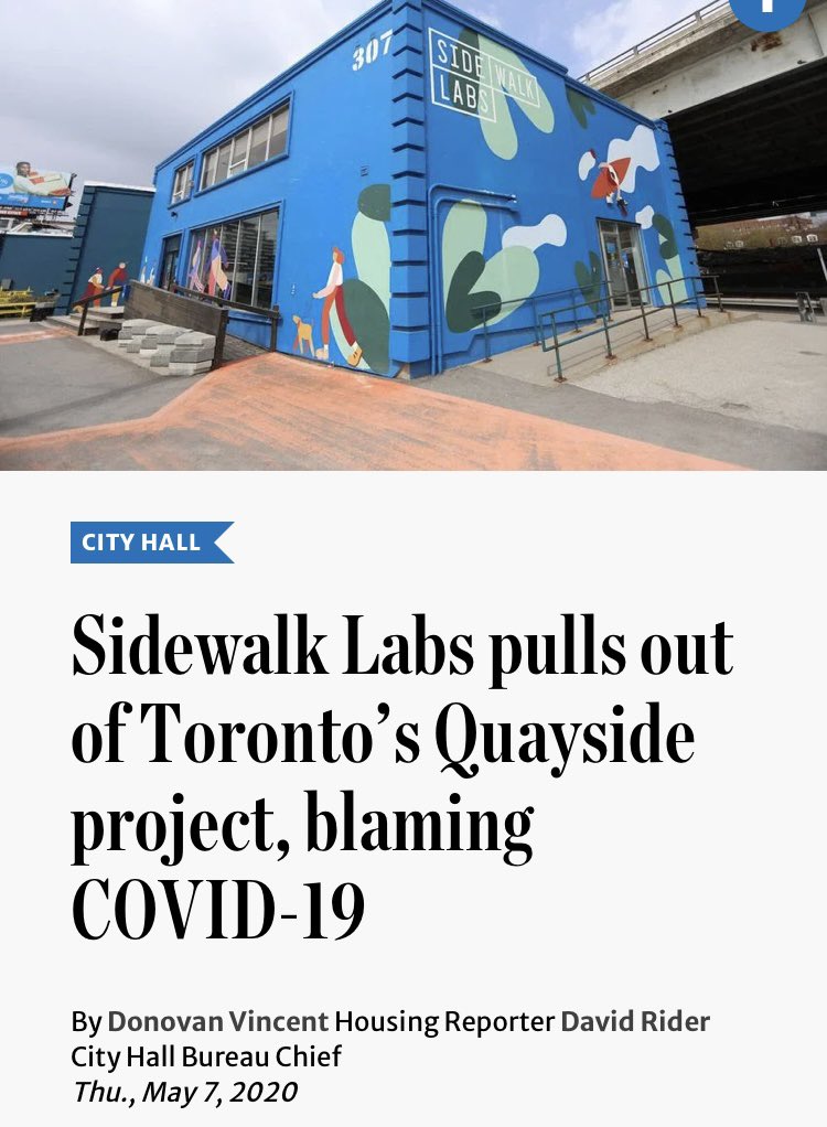
1. Last Friday was the 7th of May.
That was the one-year anniversary of Sidewalk Labs confirming, in a post from CEO Dan Doctoroff, that they would no longer be pursuing the Quayside Project.

That was the one-year anniversary of Sidewalk Labs confirming, in a post from CEO Dan Doctoroff, that they would no longer be pursuing the Quayside Project.
2. Others, more knowledgeable than I on the subjects, wrote and spoke at length on concerns related to process, scope, financing, data governance, and privacy. I myself wrote about the need to achieve greater public return from such a unique public asset as the Port Lands.
3. I don’t want to relitigate any of those issues. I want to talk about another aspect of Sidewalk’s pitch that got under my skin from the outset.
I want to talk about ‘lands that for 100 years have been lying fallow’.
I want to talk about ‘lands that for 100 years have been lying fallow’.
4. As Sidewalk tried to expand its scope, Dan Doctoroff went on a media roadshow – a full court press to establish his key messages.
Here, on Breakfast Television…..people have been trying to solve these problems (development of the Port Lands) for a long time…
Here, on Breakfast Television…..people have been trying to solve these problems (development of the Port Lands) for a long time…
5. But how long have we been trying to solve these problems, Dan Doctoroff?
DD: ‘It’s been 107 years since they first started to fill it in, and it has frustrated planners and builders for a long time…’
DD: ‘It’s been 107 years since they first started to fill it in, and it has frustrated planners and builders for a long time…’
6. Again, on The Agenda: ‘Literally it’s been 107 years since they first started filling it in…’
7. And speaking to Matt Galloway: ‘what do you need to do, in order to transform this area, that for 100 years has been lying fallow?’
8. It’s the mark of a practiced political operator – stay on message, repeat and repeat and repeat the premise upon which you are making your case. Build it into every statement.
A long time.
Frustrated planners and builders.
107 years.
Lying fallow.
A long time.
Frustrated planners and builders.
107 years.
Lying fallow.
9. The premise here is that the Port Lands should have been developed long ago, that the city has had its chance, and that it should step aside to let Sidewalk get things done. Forget Quayside, let us at the Port Lands. You had your turn.
10. But let’s look at that premise.
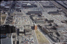
Here are the Port Lands around 50 years ago. Perhaps not attractive, but fallow? There is a generating station, a ship unloading coal, an incinerator, oil storage containers, marine terminals, container facilities….it’s an industrial port.
Here are the Port Lands around 50 years ago. Perhaps not attractive, but fallow? There is a generating station, a ship unloading coal, an incinerator, oil storage containers, marine terminals, container facilities….it’s an industrial port.

11. And what about the notion that the Port Lands have defied development? That it could have happened by now. Should have.
Forget 107 years.
Forget 100 years.
I just want to look at how the area below has changed in the 40+ years of my life.
Forget 107 years.
Forget 100 years.
I just want to look at how the area below has changed in the 40+ years of my life.
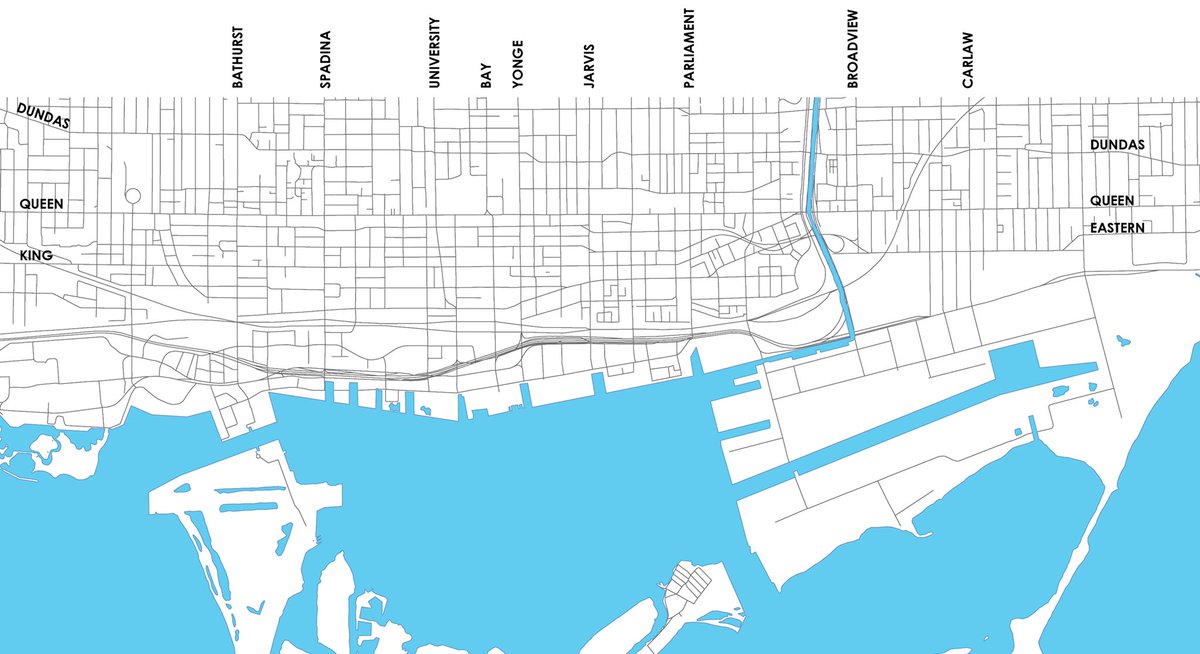
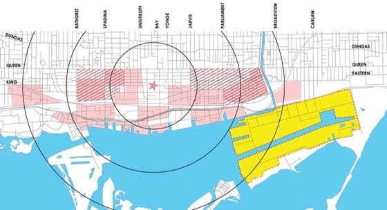
12. Let’s put a star down, indicating the heart of the financial district. Jobs. Transit. The centre of gravity for development downtown. Let’s also add some concentric circles, indicating radii 1km, 2km, and 3km from that centre. 
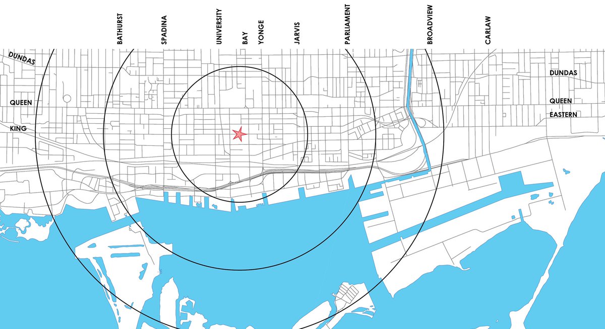
13. Let’s also indicate the Port Lands. 880 acres on the waterfront, much of it publicly-owned. (Sidewalk had been angling to expand their scope from the 12-acre Quayside to include 190 acres of the Port Lands – an area it referred to as the IDEA district) 
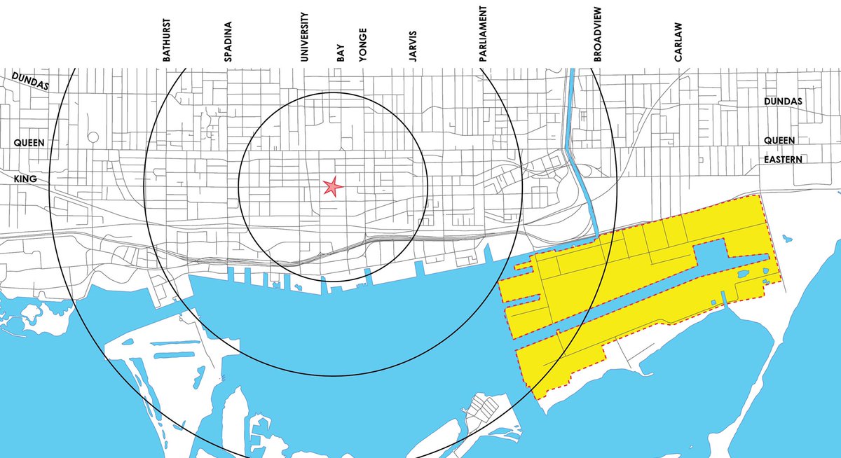
14. So I’d like to walk through a rough* chronology of some of the big moves that have happened in this area within my lifetime, and map them out.
(*the list isn’t comprehensive, and dates/geographies may not be precise)
(*the list isn’t comprehensive, and dates/geographies may not be precise)
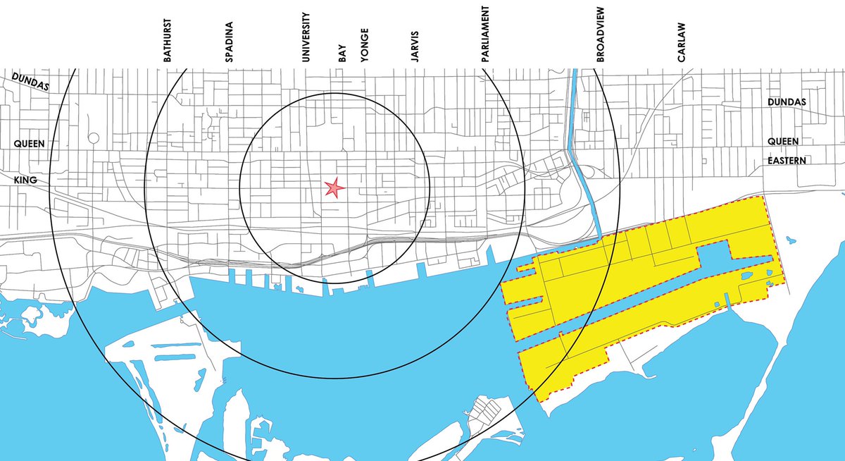
15. mid-1970s: planning and land assembly for the St. Lawrence Neighbourhood took place.
1982: the first phase (of three) was completed.
1992: the community centre & public school were completed.
Infill development of condominiums continues to this day.
1982: the first phase (of three) was completed.
1992: the community centre & public school were completed.
Infill development of condominiums continues to this day.
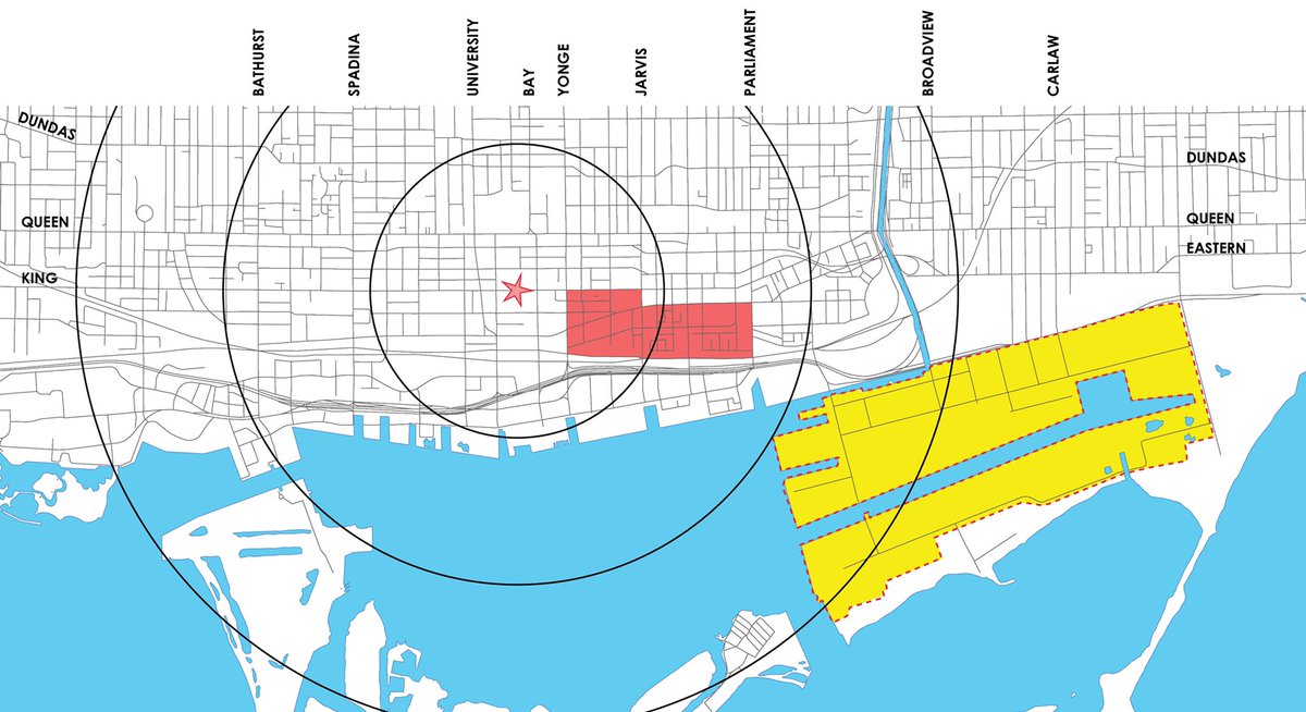
16. mid-70s to the mid-80s: the central waterfront started to take form - Harbourfront Westin, Harbour Square, a new ferry terminal, Queen’s Quay Terminal, and Harbourfront Centre. 
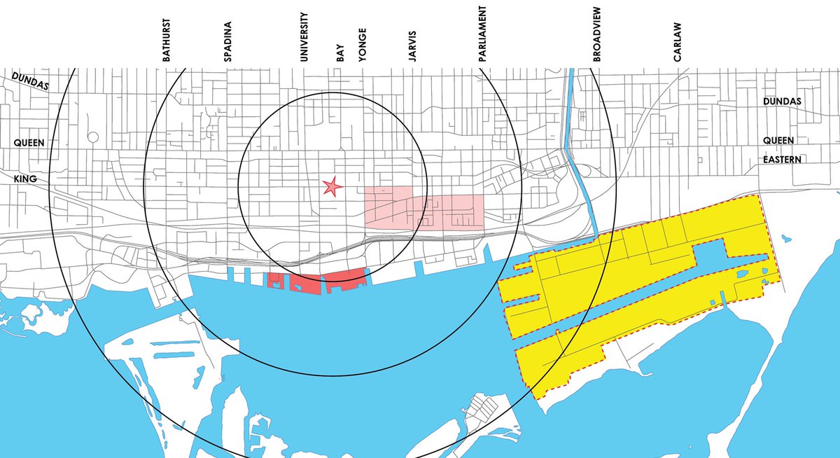
17. The 1980s to early ‘90s saw the development of former rail yards and railway lands west of Simcoe – Roy Thomson Hall (1982), Metro Toronto Convention Centre (1984), Metro Hall (1992), and the Canadian Broadcasting Centre (1992). 
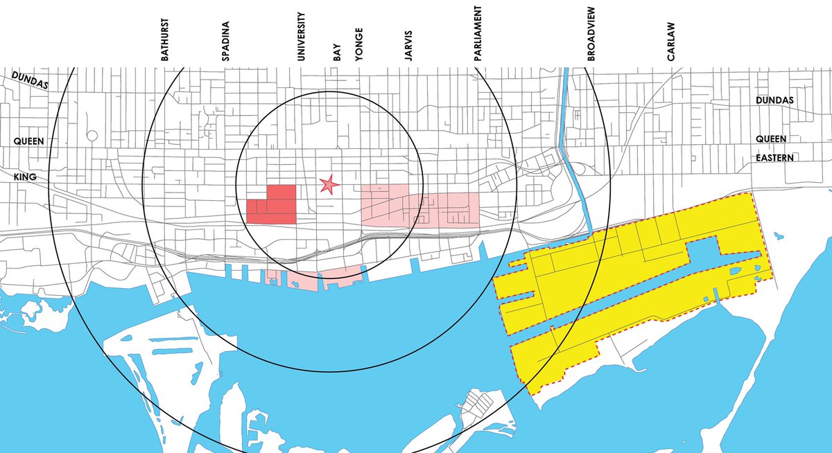
18. Mid-1980s to about 2001: the transformation of Queens Quay West, from Spadina to Bathurst – including King’s Landing Condos, 500 Queens Quay West, the Waterfront School, and the Toronto Music Garden (a gem of a park). 
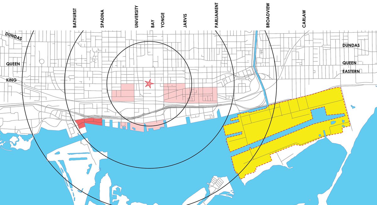
19. Mid-80s to early 2000s: also saw the development of the north side of Queens Quay West, across from Harbourfront Centre – Maple Leaf Quay (The Quay), HarbourPoint Condominiums, Waterpark Condos, The Riviera. 
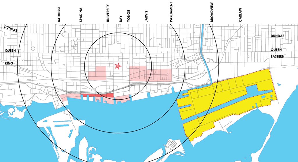
20. 1996: Barbara Hall and Paul Bedford implemented ‘the Two Kings’ - a relaxation of zoning requirements in former industrial areas near downtown. I’ll leave those areas hatched on the map. 
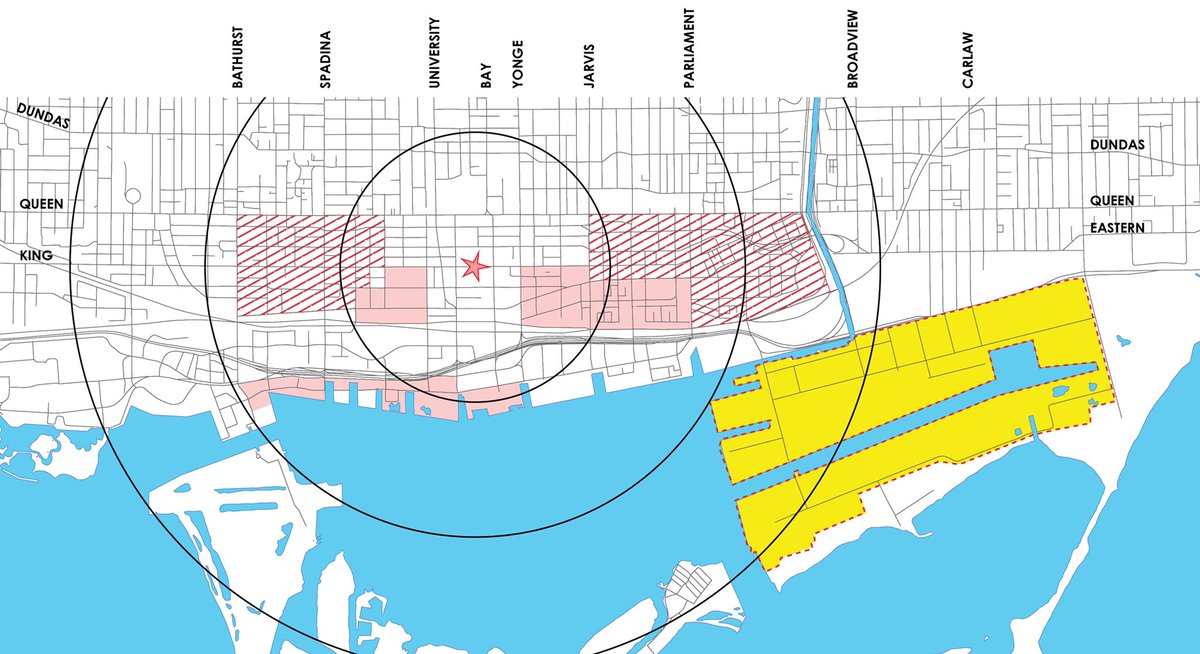
21. 1990s – 2000s: Disused fashion industry warehouses between Queen, King, Spadina, & University became a massive club scene.
Mid-2000s – now: condos replaced parking lots and warehouses/clubs over the last 15 years. Now the Entertainment District.
Mid-2000s – now: condos replaced parking lots and warehouses/clubs over the last 15 years. Now the Entertainment District.
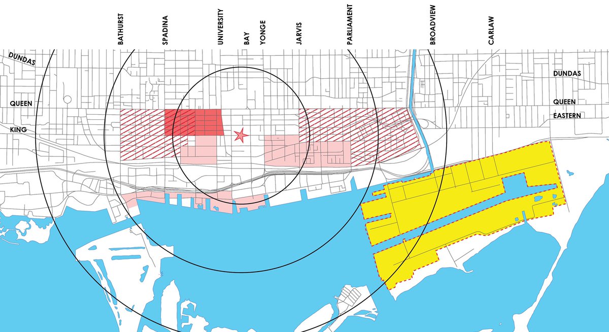
22. Late 1990s – today: King West feels well-established, but has been completely transformed over just the last two decades. From early, small condos near Victoria Memorial Square, to larger projects along King, to The Well, a massive mixed-use project now underway. 
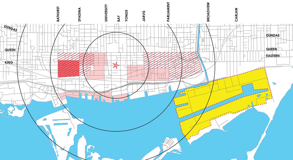
23. 2001: Cityscape acquires the long-disused Gooderham & Worts Distillery, reopening to the public a couple years later (2003) as the Distillery District. Development of the area continuing in the years that followed. 
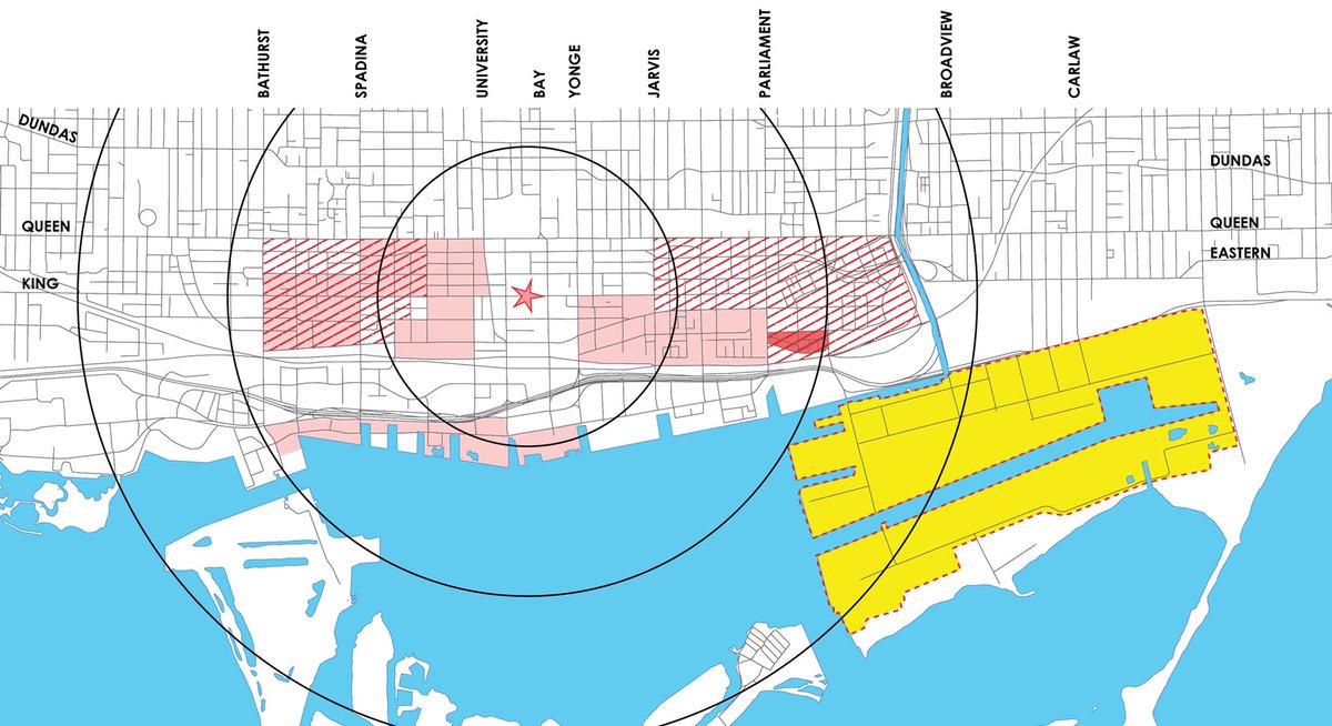
24. 2002: CityPlace west of Spadina was still a 9-hole golf course, and had broken ground east of Spadina.
2005: First towers begin to rise west of Spadina.
Today: CityPlace has recently opened new schools and community centre, and is still building out its last sites.
2005: First towers begin to rise west of Spadina.
Today: CityPlace has recently opened new schools and community centre, and is still building out its last sites.
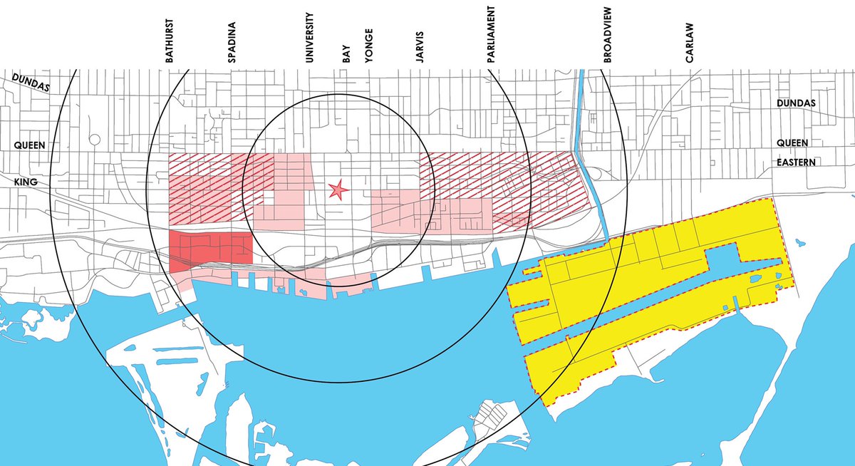
25. Early 2000s – today: Now a community of thousands, Liberty Village, between Strachan and Hanna, was little but cleared land as recently as 2002. By 2007, townhomes and a single condo tower. Since then, a huge build-out of residential towers. 
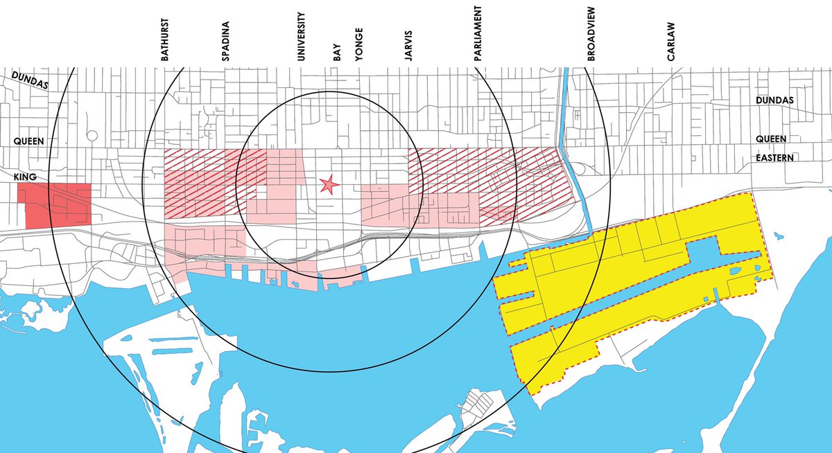
26. 2005-today: South Core – steps from Union Station - offices, hotels, shops, and condos. Most of what’s there opened in the past decade, and if you go back to 2003 aerials, there is little other than surface parking and empty lots. 
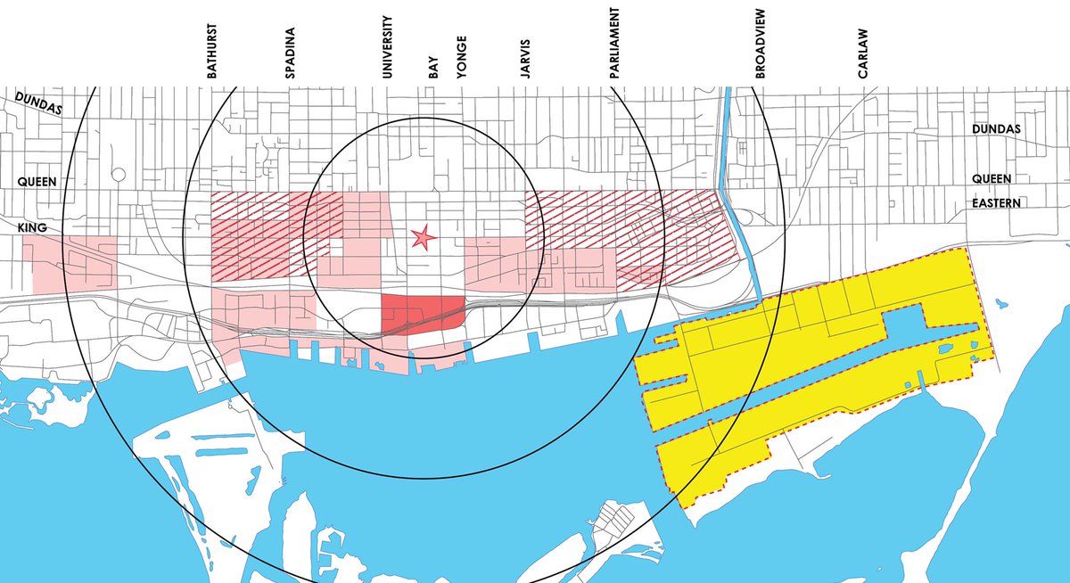
27. Mid-2000s – today: Fort York/Garrison Neighbourhood – on a former industrial site (brewery / concrete plant) between the Gardiner and Fleet, much of the build-out happened between 2005 to 2015, with the last sites recently wrapping up. 6,000 homes here now. 
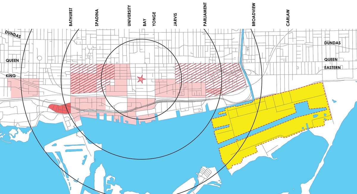
28. 2006 – today: West Don Lands/Canary District – development catalyzed by Pan Am Games, the site was industrial as recently as 2005, the first new buildings not appearing until after 2010. Now, thousands of residences, YMCA, Corktown Common, Underpass Park, and more to come. 
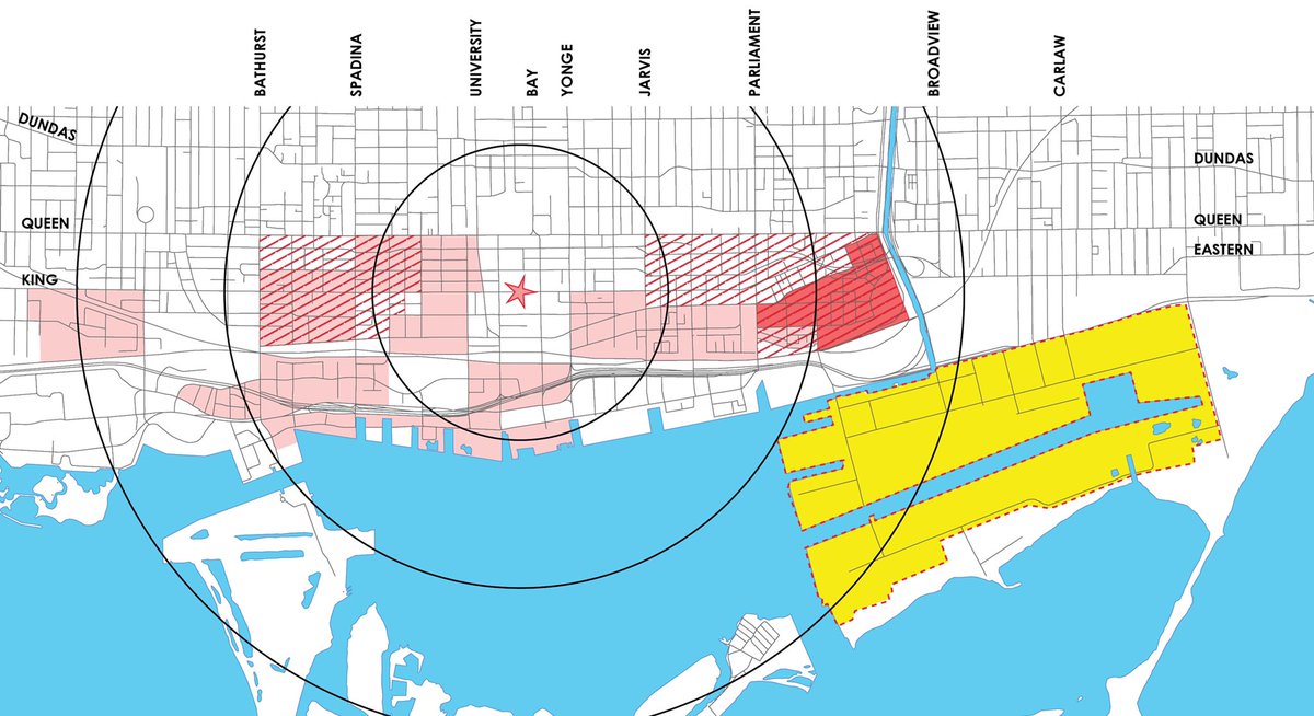
29. 2010 – today: East Bayfront is rapidly developing. Corus Quay, Sugar Beach, and Sherbourne Common South opened in 2010. Since then, George Brown, Monde, Aqualina, Daniels City of the Arts, and much more currently underway. Many homes. Many jobs. 
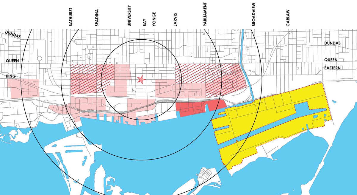
30. 2017 – today: Ordnance Triangle – a six acre CreateTO site. New park. New pedestrian and bicycle connections. New condos. 
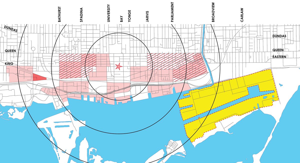
31. Coming soon: East Harbour, the former Unilever site. 38 acres, planned to become a new employment centre, built around a major transit hub. 10,000,000 square feet of new office. 50,000 jobs. 
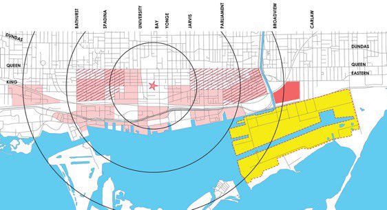
32. When I watch this, I see a city whose development has worked through lower hanging fruit and is now progressing, logically, toward the Port Lands. A city whose growth, and changing market, now put more challenging sites in play.
33. The point is this: that Toronto’s downtown core was adjacent to massive rail yards as recently as the ‘60s. That it was surrounded by surface parking, empty lots, and disused industrial buildings – soft sites – through the ‘70s, ‘80s, ‘90s, and into the 2000s. 


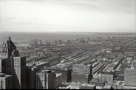
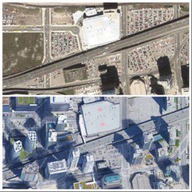
34. The point is this: almost all of these sites below are closer to downtown and Union Station than the Port Lands. They are not separated by river and lake. The are on or closer to transit. They are less contaminated and less flood-prone. 
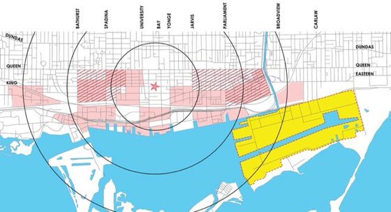
35. The point is this. If you think the Port Lands could have been developed much before today – given other sites available; given the maturity of the market; given the burden of remediation/flood mitigation - you’re dreaming. Or building a narrative to suit your agenda. 
36. Apart from being deceptive/misleading, there are two additional reasons that the ‘lying fallow/has been resistant to development’ narrative bothered me.
First, it diminishes all that Waterfront Toronto has achieved, and has been advancing.
First, it diminishes all that Waterfront Toronto has achieved, and has been advancing.
37. Slips and Wavedecks
HTO Park
Queens Quay redesign
Sugar Beach
Sherbourne Common North/South
East Bayfront
West Don Lands
Corktown Common
Much more…
Honestly, in some ways they have been one of the most effective public entities that I can think of.


HTO Park
Queens Quay redesign
Sugar Beach
Sherbourne Common North/South
East Bayfront
West Don Lands
Corktown Common
Much more…
Honestly, in some ways they have been one of the most effective public entities that I can think of.
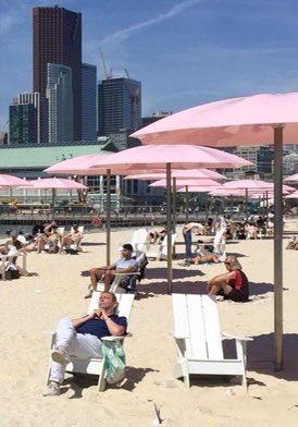
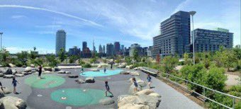
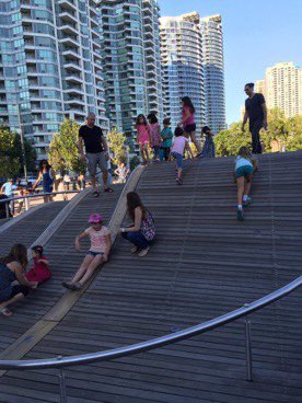
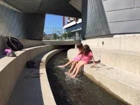
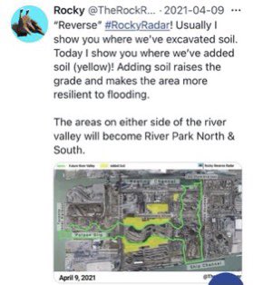
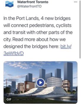
38. And second, it’s a narrative that’s dismissive of the billions of dollars of public investment that are currently underway – Don Mouth Naturalization, flood protection, bridges – to make the site viable, and to create parks and green space that will uplift the remaining land. 

39. Anyhow, I grew up with the Simpsons. I think I knew what I was seeing when Doctoroff’s Smart City roadshow came to town. 


40. So May 7, 2020.
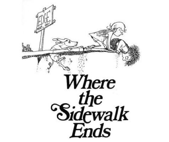
Where the Sidewalk ended.
Also, I suspect, where a better future for the Port Lands began.
Where the Sidewalk ended.
Also, I suspect, where a better future for the Port Lands began.
- END -
(I hope the thread works now)
(I hope the thread works now)
• • •
Missing some Tweet in this thread? You can try to
force a refresh


