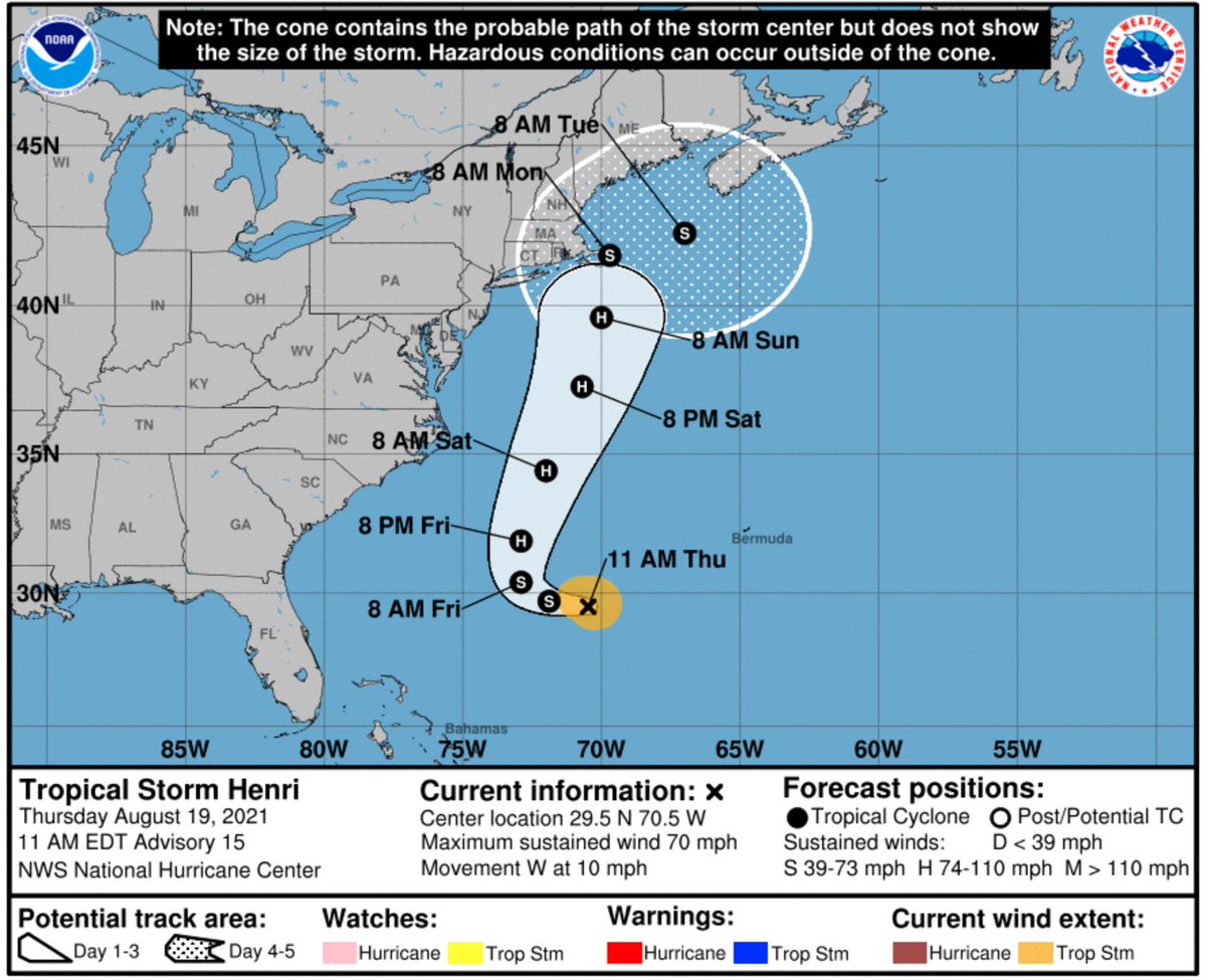
Tropical Storm #Henri struggled to strengthen overnight, which is great news because a weaker storm will be more likely to stay out to sea.
Sure enough, the latest forecast track from @NHC_Atlantic has shifted a bit further offshore of New England:
Sure enough, the latest forecast track from @NHC_Atlantic has shifted a bit further offshore of New England:

TS #Henri update:
No major changes this morning from @NHC_Atlantic, other than the fact that the NYC metro area is now outside the cone again — good news.
No major changes this morning from @NHC_Atlantic, other than the fact that the NYC metro area is now outside the cone again — good news.

TS #Henri update, 5pm:
Another nudge back towards land. Of note is that @NHC_Atlantic is now expecting Henri to be near hurricane force for a full 24 hours on its closest approach to Cape Cod and the islands off of Massachusetts. That's a recipe for severe coastal flooding.
Another nudge back towards land. Of note is that @NHC_Atlantic is now expecting Henri to be near hurricane force for a full 24 hours on its closest approach to Cape Cod and the islands off of Massachusetts. That's a recipe for severe coastal flooding.

TS #Henri update, 11pm:
It's now more likely that #Henri will make landfall, possibly at hurricane strength — it would be the first New England hurricane landfall in 30 years.
@NHC_Atlantic predicts a landfall in mainland Massachusetts for the first time.
It's now more likely that #Henri will make landfall, possibly at hurricane strength — it would be the first New England hurricane landfall in 30 years.
@NHC_Atlantic predicts a landfall in mainland Massachusetts for the first time.
https://twitter.com/NHC_Atlantic/status/1428557210230132738
• • •
Missing some Tweet in this thread? You can try to
force a refresh


