Raj Bhagat P #Mapper4Life Profile picture
Jan 7, 2022 12 tweets 7 min read Read on X
#Thread of maps on Palayamkottai, now part of #Tirunelveli

As a city,Palayamkottai has a recorded history for more than a thousand years. It reached its zenith during the British era & was called as "Oxford of South India"

My first thread in 2022 is a tribute to #ThoPa
Palaymkottai was located in KeelKalaKootram, a revenue division in the east side of Porunai river (now called Thamirabarani). The fort itself was positioned to protect the lush farmlands & was at the intersection of the farmlands & pastures which designed its socio-cultural setup
Before the 1700s, the city was largely confined within the fort walls. But it had began expanding outside afterwards. The fort was a largely rectangular shaped structure with a number of bastions and four gates in four directions.
Yes. You read it right.. The stream is named so because a lady dropped her child while taking bath after trying to take a jackfruit that was floating in the stream when it had flooded once.
The city's head/mother goddess is Aayirathamman (Goddess of one thousand) whose temple is at the intersection of the arterial roads. The earliest inscriptions about the city are in Gopalaswamy temple and are more than a 1000 years old
The city has sprawled well outside the fort and now palayamkottai is part of Tirunelveli which has a population of ~0.5 million.. Only parts of the once majestic fort - east gate and west gate are left over.
Efforts are taken by @Vish_speaks to renovate
thehindu.com/news/cities/Ma…
This is my attempt to spatialize and record the history of this city based on the book by Tho Paramasivan and Navaneetha Krishnan.

In the early 2000s, I thought of giving a proposal to ThoPa to bring my skills and the geographical dimension to his anthropology works.
I was supposed to meet him as he lived a few streets away. I postponed it every time & I never met! Few years ago, when I heard that he was not well, I began regretting my procrastination 😏
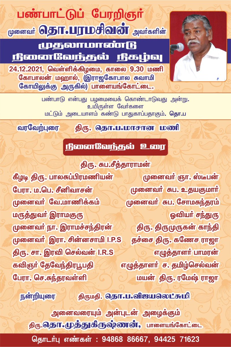
His first year death anniversary was conducted right next to my house attendedby @thiruja
Collaborations may or may not work out as they depend on lots of factors. But a conversation would have been fruitful for both the parties.

This year my resolution is that - "Never postpone/ignore a conversation". We will never know what kind of idea that would spark.
Additional info: In 1940, Kirubantha Variyar influenced the then Tirunelveli collector to ban the tradition of bull sacrifice that was done for Aayirathamman. My grandfather (Mother's uncle) who was incharge of the temple then wanted the tradition to continue.
Fearing a social unrest, the tradition was continued. And when my grandfather who was an influential man died in 1942, the tradition came to a halt. This (without names) has been recorded by Tho Pa..
Legacy of ThoPa is about documentation. The wholesome recording of rituals around Aayirathamman makes me realize now that it was no random festival but people (unknowingly) are commemorating & reenacting events where the city rallied against external foes (but in altered manner)

• • •

Missing some Tweet in this thread? You can try to force a refresh
 

Keep Current with Raj Bhagat P #Mapper4Life

Raj Bhagat P #Mapper4Life Profile picture

Stay in touch and get notified when new unrolls are available from this author!

Read all threads

This Thread may be Removed Anytime!

PDF

Twitter may remove this content at anytime! Save it as PDF for later use!

Try unrolling a thread yourself!

how to unroll video
  1. Follow @ThreadReaderApp to mention us!

  2. From a Twitter thread mention us with a keyword "unroll"
@threadreaderapp unroll

Practice here first or read more on our help page!

More from @rajbhagatt

Jun 1
#Thread
A collection of geographical myths & unknown facts about #Kanyakumari

1. Kanniyakumari is NOT the southern most point of mainland India, the southern most point is near star of the sea rock in nearby #Kovalam. In the last 20 years,it has been popularized as sunset point Image
2. Contrary to popular opinion, the three seas (Arabic Sea, Bay of Bengal, Indian Ocean) don't meet in Kanniyakumari.

Officially, the sea around Kanniyakumari district is Laccadive sea. Check map below for official extents of the seas and their names Image
3. Before 1956, Kanniyakumari was part of Travancore which pre-independence was a separate princely state. The South Travancore lines (a series of fortifications) were built to protect #Travancore. Currently, a small amount of this fortification is visible near Kanniyakumari
Image
Image
Read 7 tweets
Feb 25
Here's a compilation of my #maps which can help you in understanding the #Bengaluru #Water situation a bit better.

Bengaluru is unofficially a hill station which is located nearly a kilometre above sea level. Image
Being in the top of a ridge line, the city is partly within Kaveri watershed and partly in Ponnaiyar (Dakshina Pinakini watershed).
Being on top, water from elsewhere dont flow through Bengaluru but flow outward from the city
Image
Image
Bengaluru right now depends on Kaveri river for water supply. Because of its height, Water is pumped for a height of 1000 feet from the river 100km away from the city Image
Read 15 tweets
Feb 4
Here is the story of how @googlemaps helped me recover items stolen in a moving train from my father.

My father was travelling from Nagercoil to Trichy in sleper class in Nagercoil - Kacheguda express. He had boarded at 1:43 AM from NCJ. The train was relatively empty & another person who boarded along with my dad stole my dad's bag and mobile phone from him, and deboarded the train in Tirunelveli Junction.Image
When my dad realized it, he searched in the train and rang me from his friend's phone at 3:51 AM to inform that his phone was stolen. Luckily, among immediate family members we have location sharing "on" which meant I could track the location of mobile. When I checked it, I realized that the mobile was moving along the track near Melapalayam in Tirunelveli so I deduced that the thief was returning back to Nagercoil in another train.Image
I called my close friend Babin who is also a local DMK (@arivalayam) functionary to help me recover this. And we both went to Nagercoil station to catch the theif. The railway police listened to us and one of them came along. This is a snapshot of Google maps at the time when I was waiting railway station and the theif was still having my dad's phone.Image
Read 8 tweets
Dec 10, 2023
Thread:
I'll summarise the #Chennai cyclone event and the flooding issue once again as I feel that there is a lot of misinformation floating around which could guide people and government in wrong way w.r.t future actions
#ChennaiFloods2023
1/n Image
1. The cyclone path had been more or less accurately predicted by IMD, private forecasters

2. The intensity of rainfall however was not clear as per official forecast though it was expected to be heavy, it was not indicated that it would be near record rainfall
3. Though private forecasters including myself had warned about the possibility of extreme nature of rainfall, there was always a doubt and it is difficult for the government to take decisions based on non-official arms like mine and it would be too much of a risk for them Image
Read 23 tweets
Dec 4, 2023
Short thread:
#Chennai, lakes, and floods

I have written some threads about the flooding in Chennai, this one would focus specifically on the lake aspect.

#Map below shows the flood forecasted areas in Chennai for an extreme amount of rainfall. If we carefully look into this forecast map, we can see that apart from the major rivers, there are many other paths for the water to run which appear like a tree branching out.

This forecast based on coarser DEM with extreme rainfall & was prepared by my team mates @smkirthiga & pavithra

Pardon the visual quality of maps since I dont have much time to prepare this
Image
If we look at the topography map, the flow paths become clearer as in the map below. When water falls in these places, they are supposed to drain along these streams which appear only during monsoons Image
Let us zoom in further, these "conduits" are the ones that are supposed to carry water. I have added some water flow lines on top of the topography map here near Pallkaranai wetlands Image
Read 15 tweets
Oct 13, 2023
Thread:
A recent #satellite image of the sea near #Chennai's Marina beach. There are 3 dots in the image (red, green, blue). What causes it? Image
Satellites have cameras that observe reflection in different spectral bands (including red, green, blue). But they don't observe the same place at the same time and there is a very small lag between them. Meaning between red colour and green colour there is a time difference Image
Most of the objects (like buildings, lakes etc.) that satellites observe don't move that fast in microseconds and hence when image collages are created, it won't show any major difference. But what if objects like Aeroplane which move at say 800kmph is observed? Image
Read 6 tweets

Did Thread Reader help you today?

Support us! We are indie developers!


This site is made by just two indie developers on a laptop doing marketing, support and development! Read more about the story.

Become a Premium Member ($3/month or $30/year) and get exclusive features!

Become Premium

Don't want to be a Premium member but still want to support us?

Make a small donation by buying us coffee ($5) or help with server cost ($10)

Donate via Paypal

Or Donate anonymously using crypto!

Ethereum

0xfe58350B80634f60Fa6Dc149a72b4DFbc17D341E copy

Bitcoin

3ATGMxNzCUFzxpMCHL5sWSt4DVtS8UqXpi copy

Thank you for your support!

Follow Us!

:(