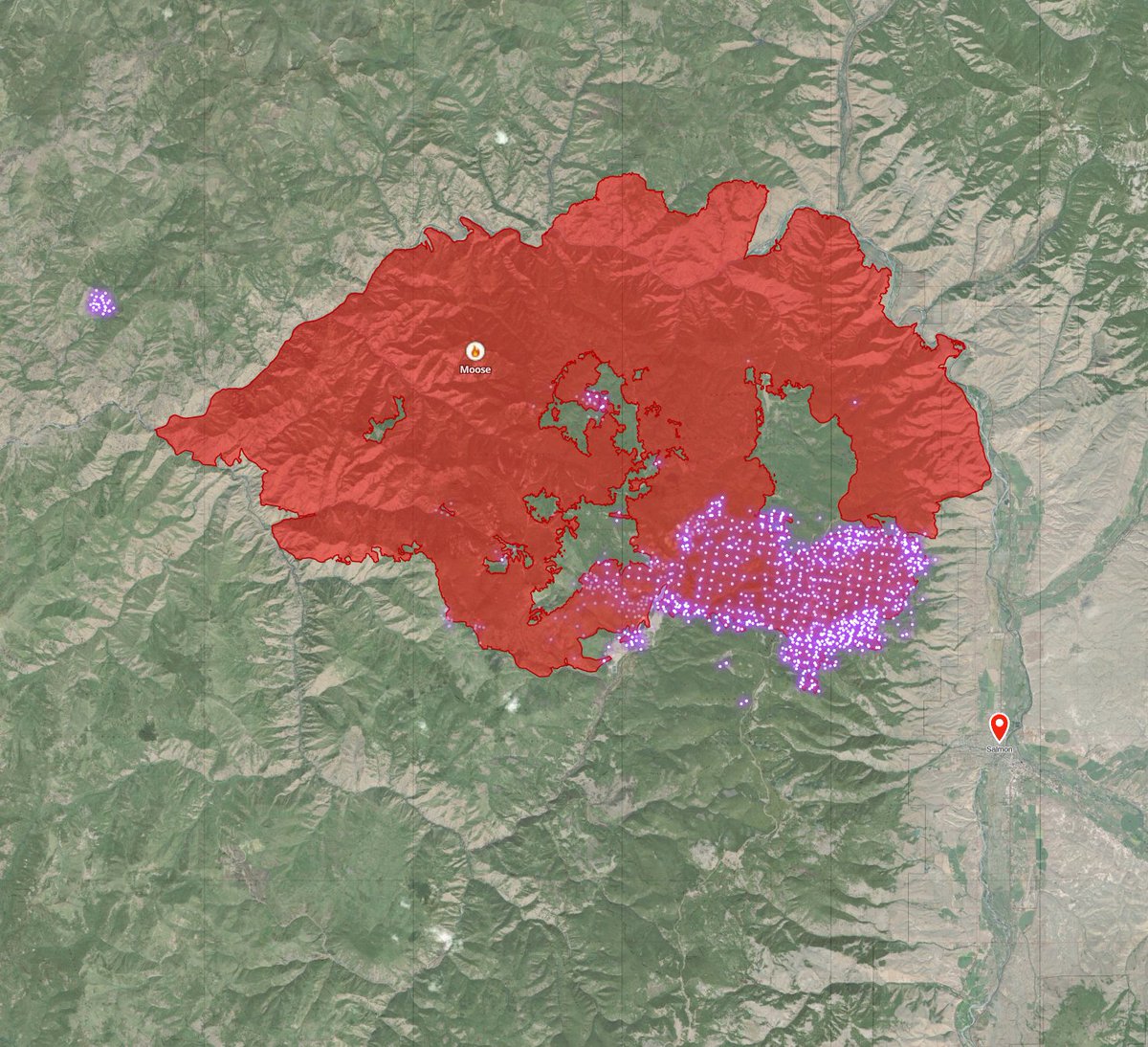
Ok, let me put on my optimistic hat for a moment for #MooseFire and then, I'm going to do something I try not to do. Speculate. a🧵
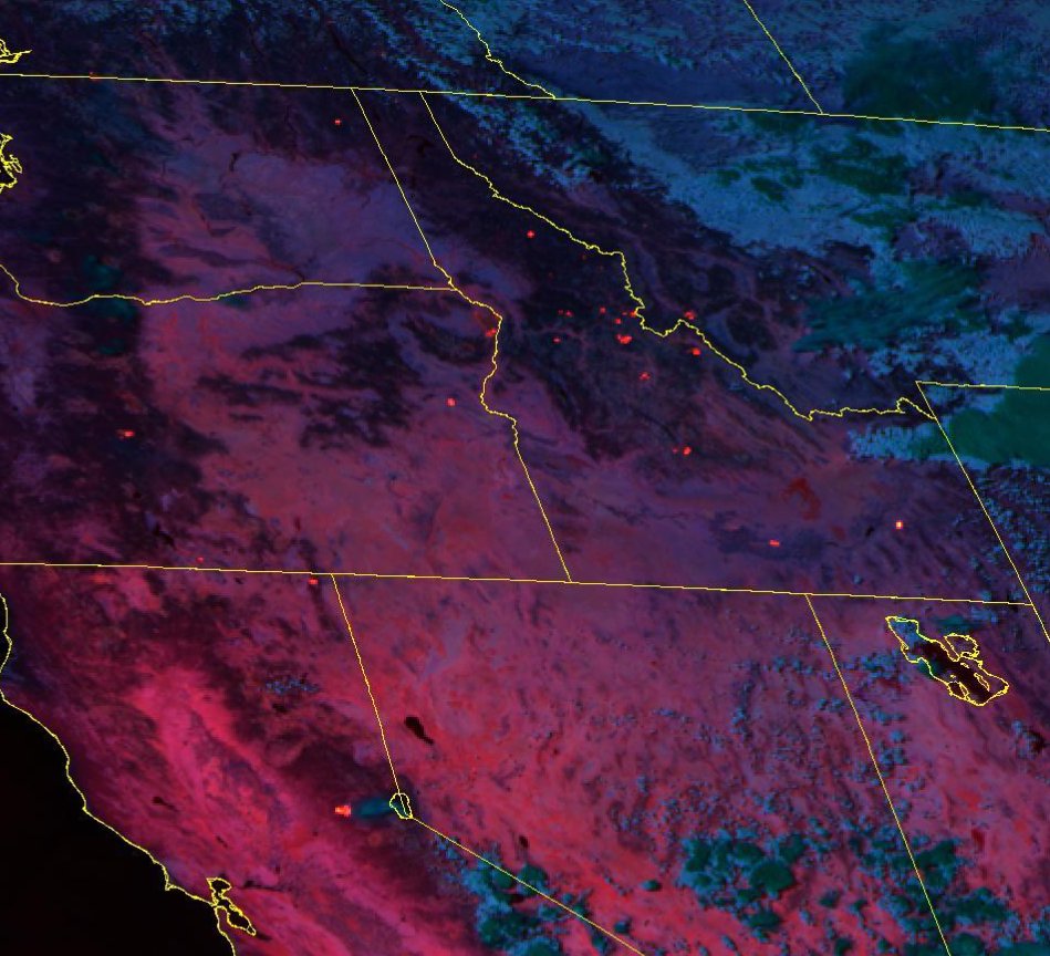
First, here's the most recent 🛰️ pass of Tera (MODIS) as of 20 minutes ago.
First, here's the most recent 🛰️ pass of Tera (MODIS) as of 20 minutes ago.

It shows fire well-established E of contingency line. But (optimistic hat) not well established in Jesse Creek drainage. Jesse creek is the town's municipal water supply.
We're seeing a significant change in fire behavior.
it's still *VERY* active, crowning, touching etc.
BUT! (optimistic hat)
it's not a wall of 300' flames like we saw when it crossed the contingency line.
(gonna be a slow thread, juggling a lot, lets look at a map)
it's still *VERY* active, crowning, touching etc.
BUT! (optimistic hat)
it's not a wall of 300' flames like we saw when it crossed the contingency line.
(gonna be a slow thread, juggling a lot, lets look at a map)
Forgive the quick and crappy map...
Red was perimeter 9/7 am.
Pink-ish line is (was) the Ridge Road contingency line
orange line is the power line (also a fire break)
the yellow area is the *ROUGH* estimate of the perimeter of this blowup based on 🛰️ pass at 11:20p #mooseFire
Red was perimeter 9/7 am.
Pink-ish line is (was) the Ridge Road contingency line
orange line is the power line (also a fire break)
the yellow area is the *ROUGH* estimate of the perimeter of this blowup based on 🛰️ pass at 11:20p #mooseFire

(Optimistic hat)
again, the fire is *mostly* north of Jesse Creek. and the wind is blowing it northeast.
It'd be very excellent if the town's municipal water supply didn't burn.
again, the fire is *mostly* north of Jesse Creek. and the wind is blowing it northeast.
It'd be very excellent if the town's municipal water supply didn't burn.
Based on what I see, hear and can get from data.
(speculation warning)
This is very, very bad. BUT!
(optimistic hat)
not near as bad as it looked two hours ago.
why?
(speculation warning)
This is very, very bad. BUT!
(optimistic hat)
not near as bad as it looked two hours ago.
why?
we've gone from a 300' tall wall of flames over four miles long to... a less extreme version of that.
Basically, the fire is moving **MUCH** slower.
given it's midnight, its going to cool off and the winds have died.
Basically, the fire is moving **MUCH** slower.
given it's midnight, its going to cool off and the winds have died.
there's a very possible chance that this fire backs down the ridge towards down all night. when it exits the trees and hits sage brush just before town, I'm (Optimistic) fairly hopeful that a massive burnout & some VLAT tanker operations can curtail it from reaching homes.
TLDR: Fighting this fire at the bottom of the hill in a few hours is way more plausible than it looked like it was going to be a couple hours ago.
* towards town, not towards down, I have no clue where down is, or apparently how to spell & proofread. Holy hell what a couple of days....
if you landed on this tweet above, twitter broke my thread. it continues here
https://twitter.com/zebpalmer/status/1567755273254879233?s=20&t=4Mt9jt1sR9_JsrahscTfng
• • •
Missing some Tweet in this thread? You can try to
force a refresh


