#HurricaneKay weakening into a tropical storm will bring widespread showers with potential for inland flooding to the Southern California region, says @jaycordeira of @CW3E_Scripps. View the water vapor transport forecast showing the storm’s movement: cw3e.ucsd.edu/ivt_iwv_uswc/
“The storm's circulation will drag water vapor up the Mexican coastline & into SoCal, but will be drastically different than the hurricane making landfall here. The latest forecasts bring the storm's circulation (tropical storm) to SD.” - @jaycordeira of @CW3E_Scripps
It's been a while since a large tropical storm has come close to SoCal & #HurricaneKay is showing up in @CW3E_Scripps’ #AtmosphericRiver (AR) forecast tools. ARs move water vapor in long narrow corridors, producing rain when making landfall. More on ARs⬇️
.@jaycordeira said while different from ARs, hurricane winds move water vapor in a circular pattern rather than long narrow bands. “As Kay moves up the coast, its counterclockwise circulation transports water vapor into SoCal’s inland deserts where flash flooding is likely.”
James Behrens, manager for @CDIPBuoys, notes that when the storm passes offshore, expect to see large surf. "When the storm turns west and heads out to sea Friday night, we will see some stronger waves similar to what we see during winter storms."
• • •
Missing some Tweet in this thread? You can try to
force a refresh
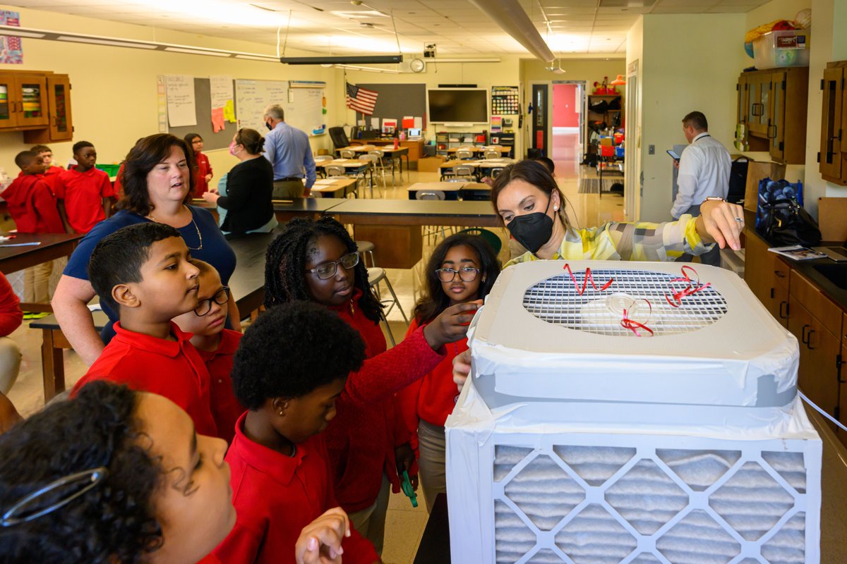
Today Kim Prather (@kprather88) gifted a #CorsiRosenthalBox to the @WhiteHouse, as part of her outreach on the importance of cleaning the air to prevent transmission of SARS-CoV2. Nicknamed “Air Force One,” it was presented to @WHOSTP by Prather and @MarinaC_Dyb of @UConn.
C-R air filtration boxes are made from a box fan, MERV-13 filters & duct tape. The low-cost, DIY boxes can filter the air for up to six months. Prather also led the effort to build 250 for @UCSanDiego as part of the university’s #ReturnToLearn initiative: go.ucsd.edu/3U2wVEy
The “Air Force One” C-R box given to the @WhiteHouse was built by 5th graders from Noah Webster MicroSociety Magnet School in Hartford, CT.
A new @CDIPBuoys (Coastal Data Information Program) monitoring station (CDIP 262 Leucadia Nearshore) was established at Beacon’s Beach to provide continuous wave observations offshore from this #CoastalErosion study site. 🌊
The new buoy station will monitor waves in the context of coastal erosion. The high-precision wave buoy data provided will allow researchers to understand wave effects independent of other environmental factors. 🌊
In addition, wave models for the local coastline will be validated and improved with these data. Sea surface and air temperature data will also be available. 🌡️ Data from CDIP 262 Leucadia can be found here: cdip.ucsd.edu/m/products/?st…
A team of marine biologists led by Scripps Oceanography's Amro Hamdoun (@Hamdounlab) has created lines of sea urchins — the marine equivalent of lab rats — that can be used as genetic models using the gene editing technology known as #CRISPR.
Described in a new paper out today in @Dev_journal, the genetic makeup of the #SeaUrchins is fully mapped and can be edited to study human disease genes. The creation of these new research model organisms will accelerate the pace of marine #biomedical research.
Having this new “genetically enabled” sea urchin could dramatically enhance the efficiency, reproducibility, and utility of studies of the developmental origins of diseases.
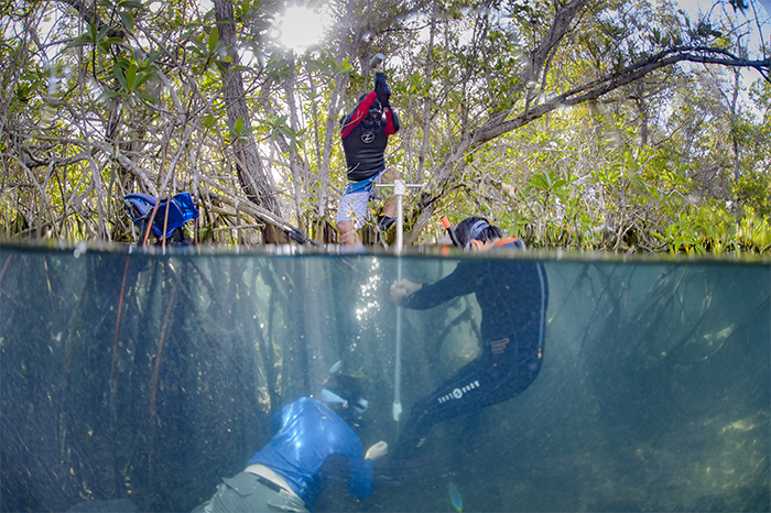
Today on #WorldMangroveDay, we're appreciating these salt-tolerant trees that live where the ocean meets the coast. 🌊🌳 Mangroves provide essential habitat for thousands of species. They also stabilize shorelines, and play an essential role as carbon sinks. 📷@octavioaburto
Researchers @octavioaburto, @MangroveMatt, @_hsumar, and others at Scripps have studied #mangroves in places like Mexico and the Galápagos Islands. They've been sampling mangrove sediments to understand understand carbon storage in these coastal ecosystems. #WorldMangroveDay
In this video by @NatGeoEducation, Scripps marine biologist Astrid Hsu (@_hsumar) describes how she and other researchers use remote sensing, including satellites and drones, to study mangroves and inform conservation efforts: #WorldMangroveDay