#HurricaneIAN update.
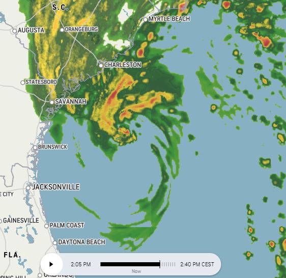
Four radar images over an hour 1-2pm UST.
#HurricaneIAN's motion is not as expected/forecast.
With sunrise approaching energy from the sun increases visibility of the circulation with the development of rain bands in the South Eastern quadrant.
Four radar images over an hour 1-2pm UST.
#HurricaneIAN's motion is not as expected/forecast.
With sunrise approaching energy from the sun increases visibility of the circulation with the development of rain bands in the South Eastern quadrant.
https://twitter.com/althecat/status/1575799231960358912


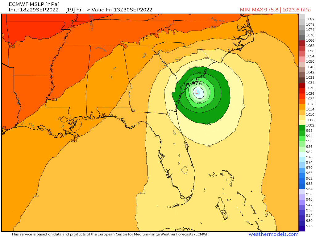
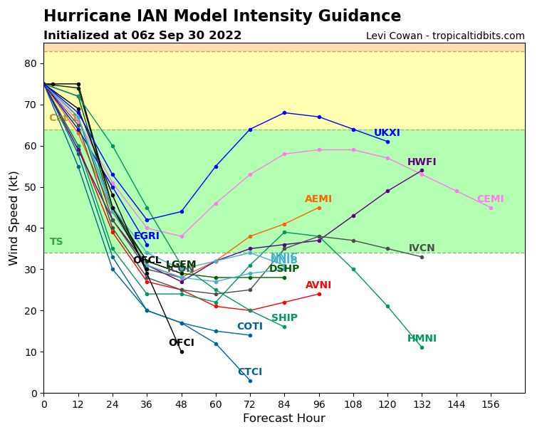
Spaghetti guidance is tightly clustered on Charleston landfall. After moving inland a very sharp turn W/SW is expected with some models even predicting a return back to the Carolina coast.
Tropical rain all the way to the Great Lakes is possible/likely given the size of Ian.
Tropical rain all the way to the Great Lakes is possible/likely given the size of Ian.


Intensity guidance is very clear that the storm is expected to weaken - based on landfall today. This will change rapidly if Ian does not weaken or landfall quickly.
Two hour Satellite loop via @TropicalTidbits showing a burst of convection over the South Carolina coast. Note however that landfall of the center of #Hurricane Ian is still 4-11 hours away. Its going to be a long day.
Back to the issue of forecast uncertainty. This data is from Windy which gets data feeds directly from the models. The issue here is that these three models completely disagree about the current center of circulation.
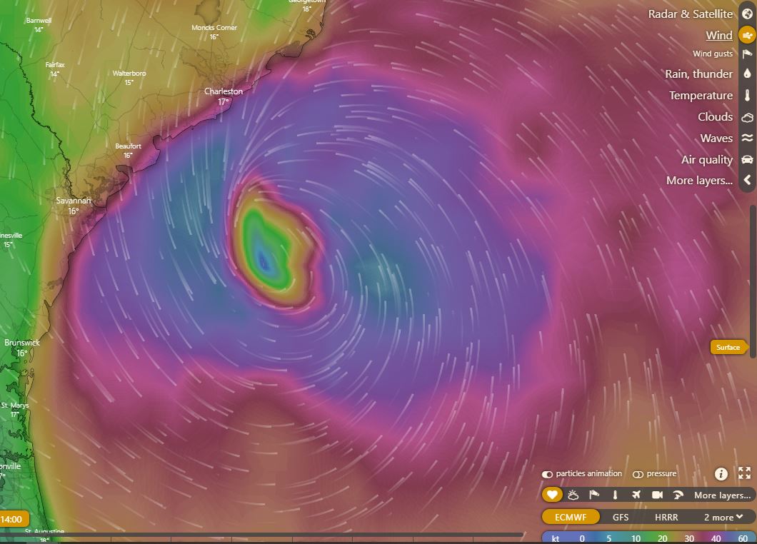

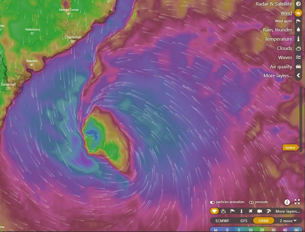
Only the HRRR model runs hourly (i.e. its initialisation data is the most up to date. The torm looks ragged. But this definitely suggests it is strengthening. But on this trajectory, it seems unlikely that it will make landfall at Charleston.
With that in mind, here's the latest HRRR model run. But bear in mind. Its initialisation data is only as good as NOAA/NHC's weather data, and it is probably not realtime. The model appears to be tuned to learn on each run from error.

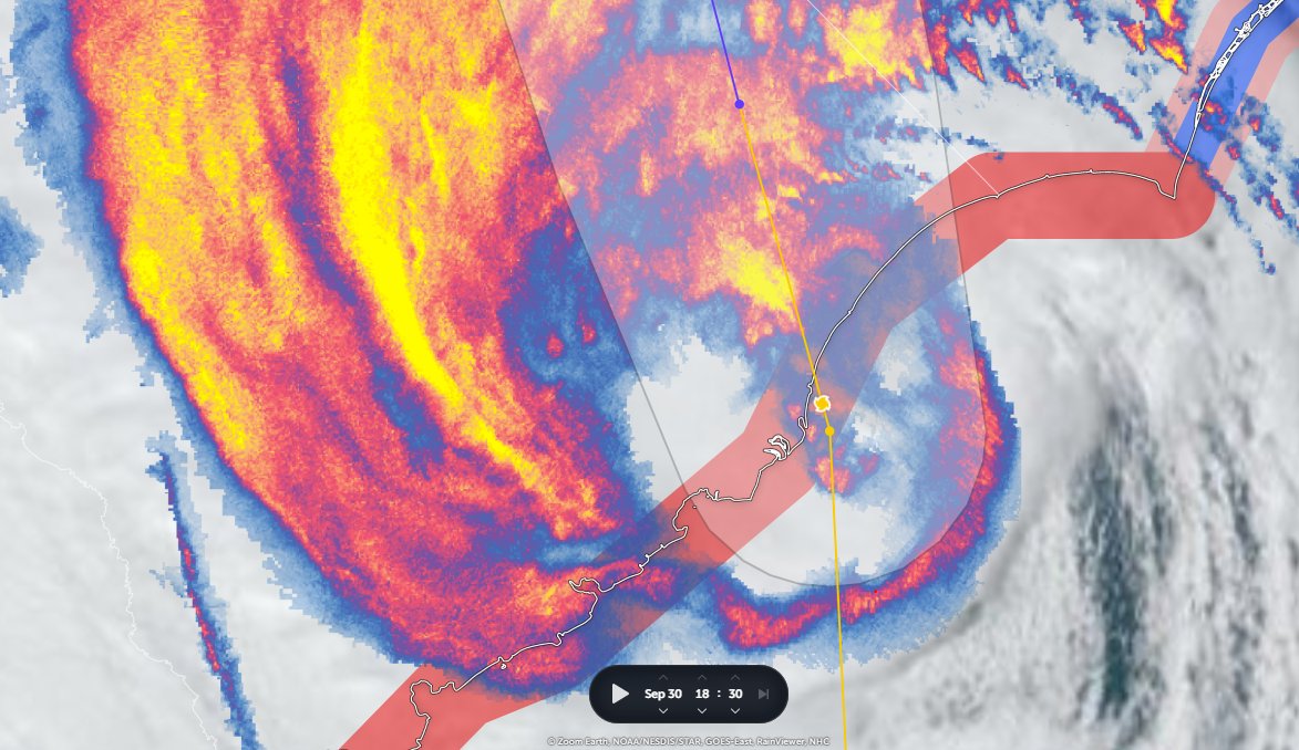
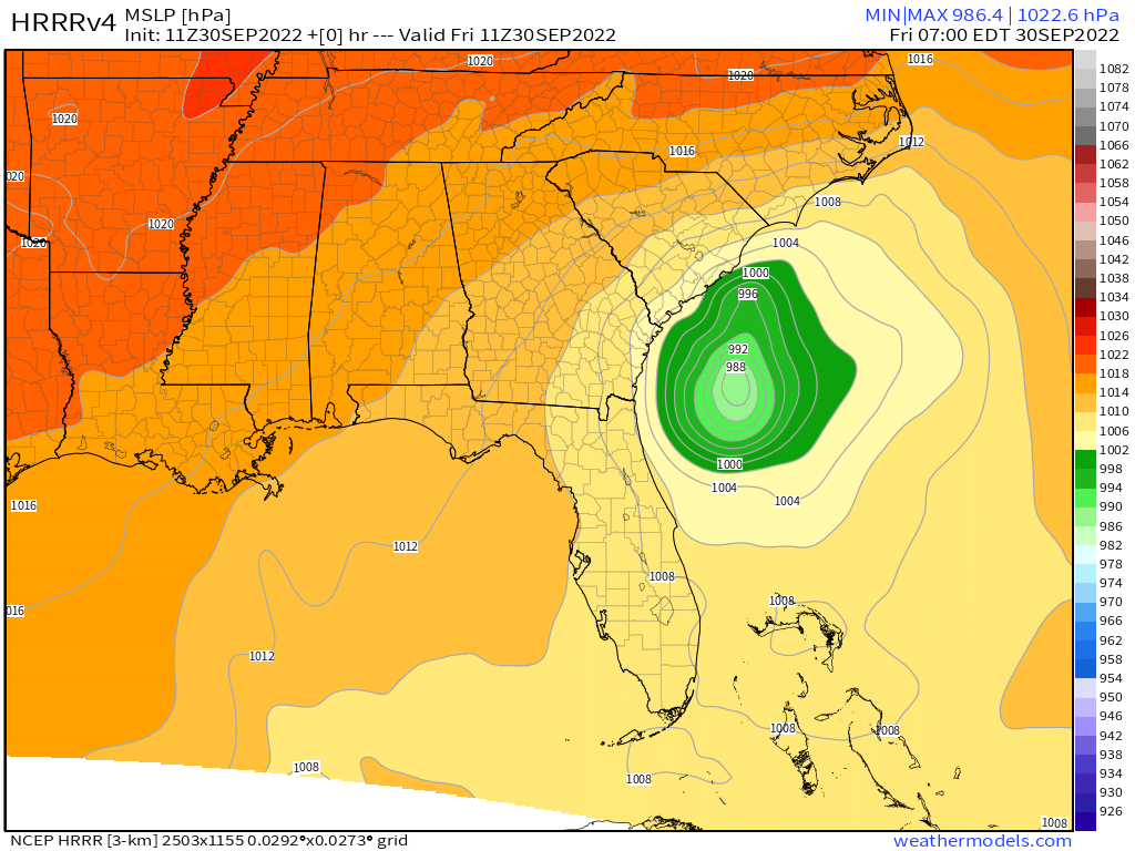
With the sun coming up we should finally able to fix an accurate center of rotation for the circulation. On the left is a guess (improvements welcome). On the right are:
1. The HRRR's forecast 0 hour, 7am EDT]
2. HRRR's #HurricaneIANlandfall location at 5pm EDT - Myrtle Beach.
1. The HRRR's forecast 0 hour, 7am EDT]
2. HRRR's #HurricaneIANlandfall location at 5pm EDT - Myrtle Beach.


Ok so nature is terrifying
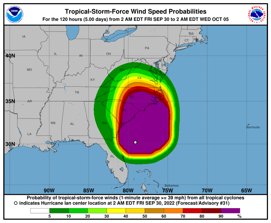
Right: Latest Hurricane Wind Probabilities
Left: Satellite Presentation on sunrise (Note: this is 30 minutes delayed).
It looks like #HurricaneIAN has strengthened a lot - and is in the process of trying to form an eyewall.
Right: Latest Hurricane Wind Probabilities
Left: Satellite Presentation on sunrise (Note: this is 30 minutes delayed).
It looks like #HurricaneIAN has strengthened a lot - and is in the process of trying to form an eyewall.

#HurricaneIAN's astonishing expanding rain impacts.
This is a three hour radar animation.
While this is driven by the hurricane, the stream of water and storms coming in across the North Carolina coast near Jacksonville is due to an atmospheric river.
This is a three hour radar animation.
While this is driven by the hurricane, the stream of water and storms coming in across the North Carolina coast near Jacksonville is due to an atmospheric river.
96 hour anumation which provides a view of how long this East Coast US #HurricaneIAN rain event will persist. The strength of the hurricane at landfall (which is hard to predict) may affect this model forecast.
The Nam-Conus model is currently forecasting 2 unches of rain all the way up the coast to New England and as far west as Eastern Ohio.
As you can see in the previous tweets ^^ rain from #HurricaneIan is arriving now in Washington DC.
As you can see in the previous tweets ^^ rain from #HurricaneIan is arriving now in Washington DC.

A 60 hour accumulating rainfall forecast for the Carolinas.
#HurricaneIAN The next 30 hours look seriously intense Carolinas. Stay Safe.
• • •
Missing some Tweet in this thread? You can try to
force a refresh