(1/8) We have quite the storm this week. We will lay out the impacts in this order:
1. Rain and Flooding
2. Wind
3. Snow
4. Hazardous Marine Conditions
Please read through the full thread & know that we are always looking at/updating the forecast as we get new information.
#CAwx
1. Rain and Flooding
2. Wind
3. Snow
4. Hazardous Marine Conditions
Please read through the full thread & know that we are always looking at/updating the forecast as we get new information.
#CAwx

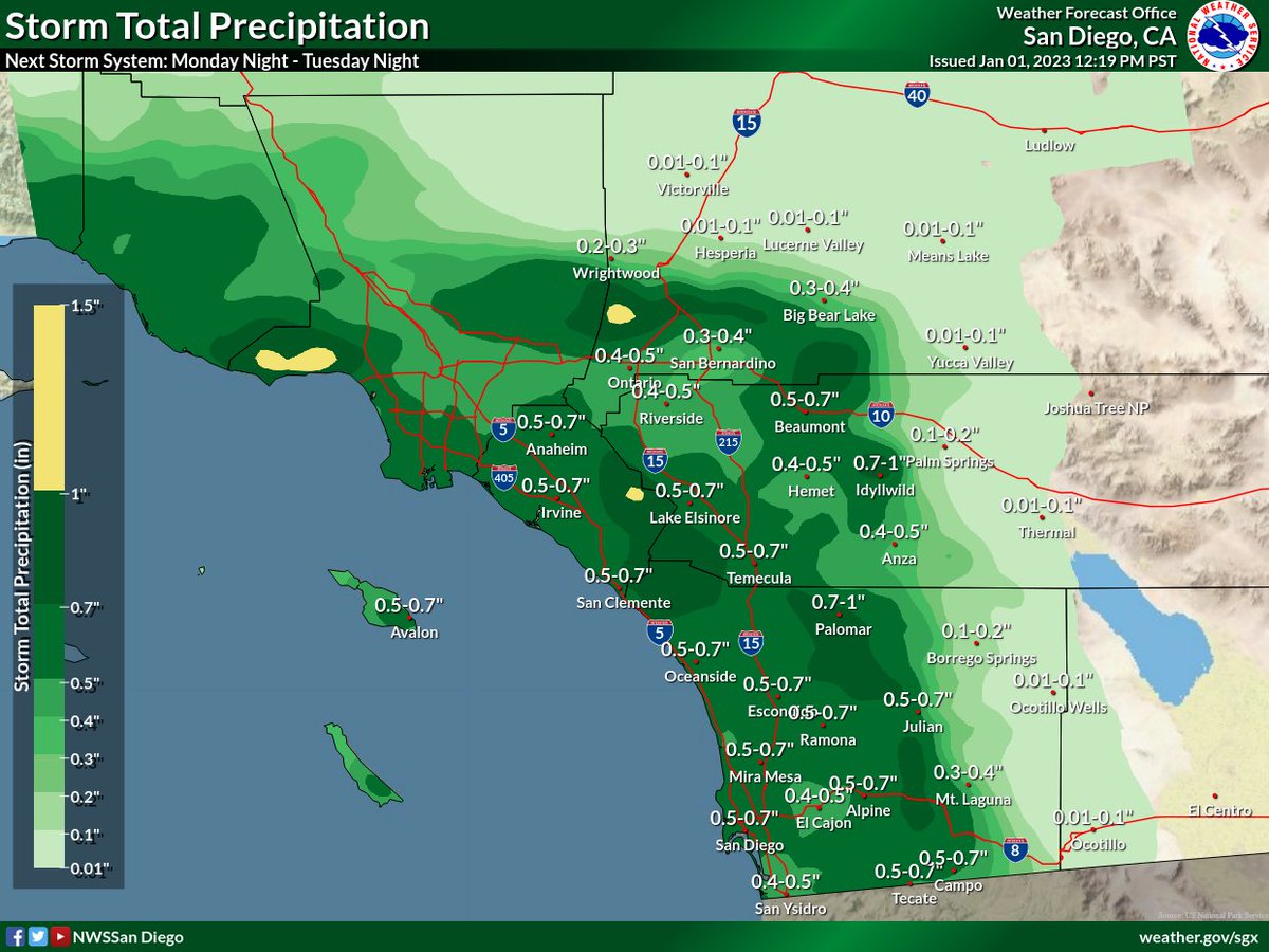
(2/8) Scattered showers will be possible as early as Mon morning across northern areas & will spread to the southeast by Mon night. The heaviest/most widespread rain will occur Tue morning/afternoon, and flooding will be possible. T-storms will also be possible during this time. 

A ⚠️ FLOOD WATCH ⚠️ has been issued for our northern areas, where the heaviest rain/highest rain rates are expected. Thunderstorms will be possible on Tuesday; rain rates may exceed 1"/hr with the heaviest cells. There will be a HIGH risk for flooding near recent burn scars. 

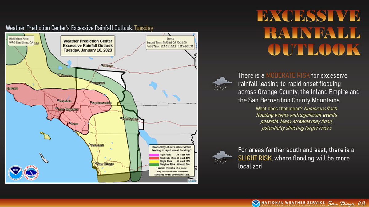
The @NWSWPC has expanded their MODERATE RISK for excessive rain leading to flooding into Orange County and portions of Riverside/San Bernardino Counties. This means there will be the potential for numerous flash flooding events, with significant flooding possible. 

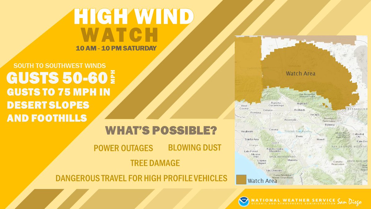
Next up: Wind. A High Wind Warning has been issued for the San Bernardino County Mountains into the High Desert from Mon morning through Tue evening. Winds will increase tomorrow for these areas, spreading to the remainder of SoCal on Tuesday. 

Snow: this system is looking quite warm, with snow levels starting above 8000 feet on Mon, eventually falling as low as 5500 feet later in the day on Tuesday. Very heavy snow will be possible above 7000 feet. 

Finally, strong southerly winds and steep combined seas are likely for much of Monday and Tuesday. A Small Craft Advisory is in effect for the coastal waters for very hazardous boating conditions. 

That's it! PLEASE remain weather aware the next several days. This could be a highly impactful system, and you don't want to be caught off guard with rapidly changing conditions. Use caution when traveling and allow for extra time to reach your destination.
#CAwx
#CAwx
• • •
Missing some Tweet in this thread? You can try to
force a refresh


