National Weather Service | San Diego
24/7 Warnings, forecasts, and support. Serving San Diego, Orange, Riverside and San Bernardino Counties.
 (2/5) Snow levels are expected to be 7000-8000 ft during the bulk of the precipitation Sun and Mon before falling to around 5500 ft Tue. That means below 7000 ft, rain will be the main hazard. Most of the precipitation will accumulate on the western San Bernardino mtns.

 Is it confusing/tricky to associate a "weakening storm" with a consistent catastrophic flooding threat? Absolutely! But these categories are based on wind alone, and while there will still be wind impacts, heavy rain and flooding remain by far and away the biggest threat. #CAwx

 (2/4) For Thursday through Saturday, an atmospheric river takes aim at Southern California, leading to widespread moderate to heavy rain, with the heaviest expected to occur on Friday. Heavy mountain snow will also be possible Thu-Sat, generally above 5000 feet.
 (2/4) PLEASE NOTE: The snow accumulation graphic is only for snow accumulations through Thursday morning. ADDITIONAL HEAVY SNOW, ON THE ORDER OF SEVERAL FEET OF SNOW, WILL BE POSSIBLE THURSDAY NIGHT THROUGH SATURDAY.
 (2/3) There is a Winter Storm Warning in effect from tonight through Saturday for the San Bernardino/ Riverside/ San Diego County Mountains, Santa Ana Mountains. Expect damaging winds and extremely heavy snowfall.
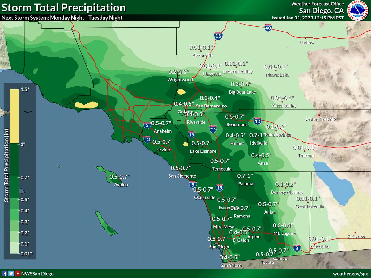
 (2/8) Scattered showers will be possible as early as Mon morning across northern areas & will spread to the southeast by Mon night. The heaviest/most widespread rain will occur Tue morning/afternoon, and flooding will be possible. T-storms will also be possible during this time.
 (2/5) Rain may develop as early as Mon morning across Orange/San Bernardino Counties, with light rain spreading southeastward through the day. However, an increase in activity is expected through Monday night, with with heaviest and most widespread rain occurring on Tuesday.
 (2/4) Rain will increase from northwest to southeast Monday night. Preliminary rain totals are as follows: