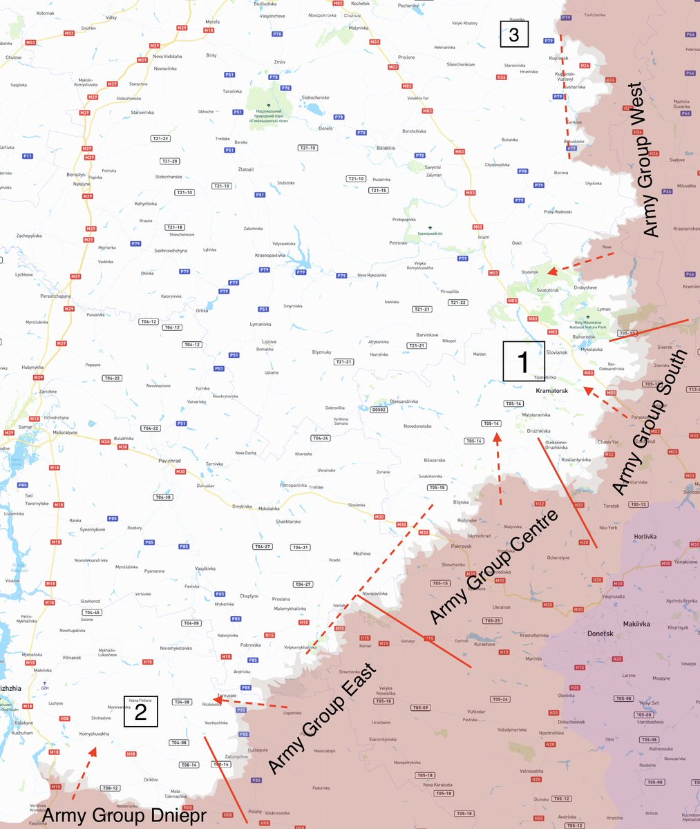
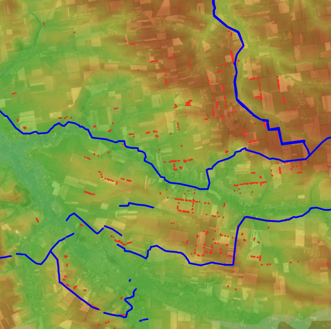
#Map Bakhmut madness
The topography at the west of Bakhmutka river provides some advantage for SE offense but at the end it favors those who is uphill.
The whole battlefield is 30km wide and 9 km deep so no deployment will hide.
*It’s made for entertainment.
The topography at the west of Bakhmutka river provides some advantage for SE offense but at the end it favors those who is uphill.
The whole battlefield is 30km wide and 9 km deep so no deployment will hide.
*It’s made for entertainment.

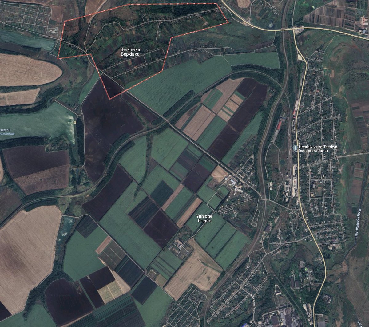
1. Berkhivka hill.
It could be a good place for defense but fully exposed to the downhill attacks from the West and there are no positions to cover the area without exposure to the counter artillery. Can be used to launch an attack to a low ground.
It could be a good place for defense but fully exposed to the downhill attacks from the West and there are no positions to cover the area without exposure to the counter artillery. Can be used to launch an attack to a low ground.
https://twitter.com/M0nstas/status/1657009333316534275
2. Railroad between Berkhivka and Yahidne.
Position to control M03 and all the supply west of the river. The fields are smaller a assault tactics that was used by the russians may be used on the climb agains them on the fall.
Position to control M03 and all the supply west of the river. The fields are smaller a assault tactics that was used by the russians may be used on the climb agains them on the fall.
3. M03 controll.
T0513 congestion would be a challenge, Paraskoviivka mine dominates the area and should be suppressed where UAV magic may come in handy.
Movement from the NW may help, large fields needs to be crossed in a single move, but they are probably mined.
T0513 congestion would be a challenge, Paraskoviivka mine dominates the area and should be suppressed where UAV magic may come in handy.
Movement from the NW may help, large fields needs to be crossed in a single move, but they are probably mined.

4. T0513 and the vast valley around - there is no place to hide and would be abandoned once there would be a real push.

6, 7 Choke points.
There are 3 incoming roads from 🇷🇺, T0513 from Horlivka, T1302 - Lisychansk, T0504 - Popasna.
They all are comparably worst to defend than T0504 and O0506 on 🇺🇦 side but still deep behind the city, so 🇷🇺 should not wait when they would be cut off.
There are 3 incoming roads from 🇷🇺, T0513 from Horlivka, T1302 - Lisychansk, T0504 - Popasna.
They all are comparably worst to defend than T0504 and O0506 on 🇺🇦 side but still deep behind the city, so 🇷🇺 should not wait when they would be cut off.


🇺🇦 don't really need to push that far away, securing the routes would be more than enough, but if the enemy allows all the possibilities needs to be used.
Outskirts of Berkhivka and Klishchiivka would be well above the expectations.
Outskirts of Berkhivka and Klishchiivka would be well above the expectations.
https://twitter.com/M0nstas/status/1657000735605751810
Power balance may change as well as the momentum, but the terrain will wait for the right conditions to come.
• • •
Missing some Tweet in this thread? You can try to
force a refresh