In honour of #FathersDay, here is a thread about the fathers of our Canadian Prime Ministers!
23. Pierre Trudeau (Justin Trudeau)
Pierre was Canada's 13th prime minister from 1968-1979 & 1980-1984.
Pierre & Justin are the only father and son to serve as PM of Canada.
23. Pierre Trudeau (Justin Trudeau)
Pierre was Canada's 13th prime minister from 1968-1979 & 1980-1984.
Pierre & Justin are the only father and son to serve as PM of Canada.

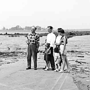
22. Joseph Harris Harper (Stephen Harper)
Joseph Harper was an accountant for Imperial Oil. He had an avid interest in military history & meticulously researched military insignia for his 1992 book Old Colours Never Die.
Joseph Harper was an accountant for Imperial Oil. He had an avid interest in military history & meticulously researched military insignia for his 1992 book Old Colours Never Die.

21. Paul Martin Sr (Paul Martin Jr.)
One of Canada's most influential politicians, Paul Martin Sr. was a member of Parliament from 1935 to 1968. He served as a cabinet minister for three prime ministers & was heavily influential in the creation of Universal Healthcare.
One of Canada's most influential politicians, Paul Martin Sr. was a member of Parliament from 1935 to 1968. He served as a cabinet minister for three prime ministers & was heavily influential in the creation of Universal Healthcare.

20. Wellie Chretien (Jean Chretien)
Jean's father was a major influence on him. While the family grew up poor, he wanted his children to escape the working-class life. He made Jean read the dictionary as a young boy. He was also a lifelong Liberal.
No picture found.
Jean's father was a major influence on him. While the family grew up poor, he wanted his children to escape the working-class life. He made Jean read the dictionary as a young boy. He was also a lifelong Liberal.
No picture found.
19. George Thomas Campbell (Kim Campbell)
Kim's father was born in Scotland and worked as a barrister. He had served with the Seaforth Highlanders of Canada during the Second World War.
After Kim's mother left when Kim was 12, George raised Kim & her sister.
No picture found.
Kim's father was born in Scotland and worked as a barrister. He had served with the Seaforth Highlanders of Canada during the Second World War.
After Kim's mother left when Kim was 12, George raised Kim & her sister.
No picture found.
18. Benedict Martin Mulroney (Brian Mulroney)
Benedict Mulroney worked as a paper mill electrician in Baie-Comeau, Quebec. He often worked overtime & also ran a repair business to earn extra money for his children to attend university.
Benedict Mulroney worked as a paper mill electrician in Baie-Comeau, Quebec. He often worked overtime & also ran a repair business to earn extra money for his children to attend university.

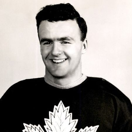
17. Leonard Hugh Turner (John Turner)
Leonard, an English journalist, unfortunately died of a botched operation when John was still a toddler. Frank Ross, the future Lt. Governor of British Columbia, became John's stepfather in 1945 when John was 16.
Leonard, an English journalist, unfortunately died of a botched operation when John was still a toddler. Frank Ross, the future Lt. Governor of British Columbia, became John's stepfather in 1945 when John was 16.


16. Charles Clark (Joe Clark)
Charles was a newspaper publisher in High River, Alberta, where he established the High River Times. The newspaper still exists. Joe (pictured here as a baby) worked at his dad's newspaper in several capacities.
Charles was a newspaper publisher in High River, Alberta, where he established the High River Times. The newspaper still exists. Joe (pictured here as a baby) worked at his dad's newspaper in several capacities.

15. Charles-Emile Trudeau (Pierre Trudeau)
Charles-Emile worked as a lawyer and then grew a fortune by building gas stations around the Montreal area & starting the Automobile Owners' Association.
He died suddenly of pneumonia in 1935 when he was 47.
Charles-Emile worked as a lawyer and then grew a fortune by building gas stations around the Montreal area & starting the Automobile Owners' Association.
He died suddenly of pneumonia in 1935 when he was 47.

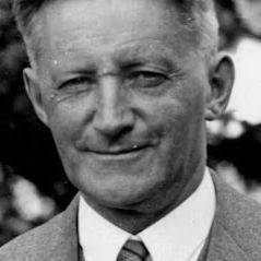
14. Edwin Pearson (Lester B. Pearson)
Edwin was a Methodist, and later United Church, minister. He later became the minister at the Aurora Methodist Church. Edwin is standing to the right. Lester's grandfather Marmaduke, also a minister, is seated.
Edwin was a Methodist, and later United Church, minister. He later became the minister at the Aurora Methodist Church. Edwin is standing to the right. Lester's grandfather Marmaduke, also a minister, is seated.

13. William Thomas Diefenbaker (John Diefenbaker)
The son of German immigrants, William Diefenbaker worked as a teacher and had a deep interest in history and politics. Out of the 28 students in his 1903 class, four, including his son, served in Parliament.
The son of German immigrants, William Diefenbaker worked as a teacher and had a deep interest in history and politics. Out of the 28 students in his 1903 class, four, including his son, served in Parliament.
12. Jean-Baptiste-Moise Saint-Laurent (Louis St. Laurent)
Jean was a prominent person in the village of Compton, Quebec and his home was a social centre. He owned a store in the community, ran for the Quebec Legislature in 1894 & was a staunch Liberal.
Jean was a prominent person in the village of Compton, Quebec and his home was a social centre. He owned a store in the community, ran for the Quebec Legislature in 1894 & was a staunch Liberal.

11. Henry John Bennett (R.B. Bennett)
Henry was a shipbuilder in New Brunswick, but his business did not do well and the family was often short on money. He also attempted to work as a blacksmith, merchant and farmer. He also tried to develop a gypsum mine.
Henry was a shipbuilder in New Brunswick, but his business did not do well and the family was often short on money. He also attempted to work as a blacksmith, merchant and farmer. He also tried to develop a gypsum mine.

10. John King (William Lyon Mackenzie King)
John was a lawyer who had a struggling practice in Berlin (now Kitchener), Ontario. Despite barely making ends meet, he employed servants and tutors in the home. King described his father as providing a happy home.
John was a lawyer who had a struggling practice in Berlin (now Kitchener), Ontario. Despite barely making ends meet, he employed servants and tutors in the home. King described his father as providing a happy home.

9. Joseph Meighen (Arthur Meighen)
Joseph owned a dairy farm near St. Mary's, Ontario and Arthur said his father instilled in him the value of an education & the importance of habits of industry and thrift.
No picture found.
Joseph owned a dairy farm near St. Mary's, Ontario and Arthur said his father instilled in him the value of an education & the importance of habits of industry and thrift.
No picture found.
8. Andrew Borden (Sir Robert Borden)
Andrew was a farmer. He was called by his son, a man of good ability and excellent judgement, who was calm and philosophical. He added he lacked energy & had no aptitude for affairs.
No picture found.
Andrew was a farmer. He was called by his son, a man of good ability and excellent judgement, who was calm and philosophical. He added he lacked energy & had no aptitude for affairs.
No picture found.
7. Carolus Laurier (Sir Wilfrid Laurier)
Carolus was bilingual and dynamic. He instilled in Wilfrid an interest in politics from an early age. He had several hobbies including astronomy & mathematics. He also served as mayor of the community and a local inventor.
Carolus was bilingual and dynamic. He instilled in Wilfrid an interest in politics from an early age. He had several hobbies including astronomy & mathematics. He also served as mayor of the community and a local inventor.

6. Charles Tupper Sr. (Sir Charles Tupper)
Charles was the co-pastor of a Baptist Church in Amherst, Nova Scotia. He was also an accomplished Biblical scholar and wrote two books on Biblical Scriptures.
No picture found.
Charles was the co-pastor of a Baptist Church in Amherst, Nova Scotia. He was also an accomplished Biblical scholar and wrote two books on Biblical Scriptures.
No picture found.
5. John Bowell (Sir Mackenzie Bowell)
John emigrated to Canada with his family when Mackenzie was 10. He worked as a cabinet maker and taught that trade to his son.
No picture found.
John emigrated to Canada with his family when Mackenzie was 10. He worked as a cabinet maker and taught that trade to his son.
No picture found.
4. John Sparrow Thompson (Sir John Sparrow David Thompson)
John made his son recite poetry at school ceremonies and meetings of the Halifax Mechanics' Institute in order to overcome his shyness. He also taught his son shorthand.
No picture found.
John made his son recite poetry at school ceremonies and meetings of the Halifax Mechanics' Institute in order to overcome his shyness. He also taught his son shorthand.
No picture found.
3. Joseph Abbott (Sir John Abbott)
Joseph was a prominent Anglican missionary and he wrote two books, one about emigrating to Canada and another that was his memoirs.
His great-great grandson was Christopher Plummer.
Joseph was a prominent Anglican missionary and he wrote two books, one about emigrating to Canada and another that was his memoirs.
His great-great grandson was Christopher Plummer.

2. Alexander Mackenzie Sr. (Alexander Mackenzie)
Alexander was a carpenter and ship's joiner who moved frequently for work during the Napoleonic Wars. He died suddenly when his son was only 13, forcing Alexander to end his education to support the family.
No picture found.
Alexander was a carpenter and ship's joiner who moved frequently for work during the Napoleonic Wars. He died suddenly when his son was only 13, forcing Alexander to end his education to support the family.
No picture found.
1. Hugh Macdonald (Sir John A. Macdonald)
Hugh was an unsuccessful merchant in Glasgow, forcing a move to Upper Canada when John was a child. Hugh then operated a series of businesses in Upper Canada & became the magistrate for Midland District.
No picture found.
Hugh was an unsuccessful merchant in Glasgow, forcing a move to Upper Canada when John was a child. Hugh then operated a series of businesses in Upper Canada & became the magistrate for Midland District.
No picture found.
• • •
Missing some Tweet in this thread? You can try to
force a refresh