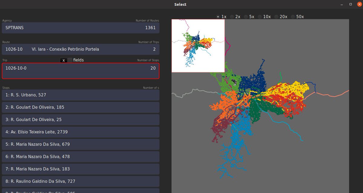
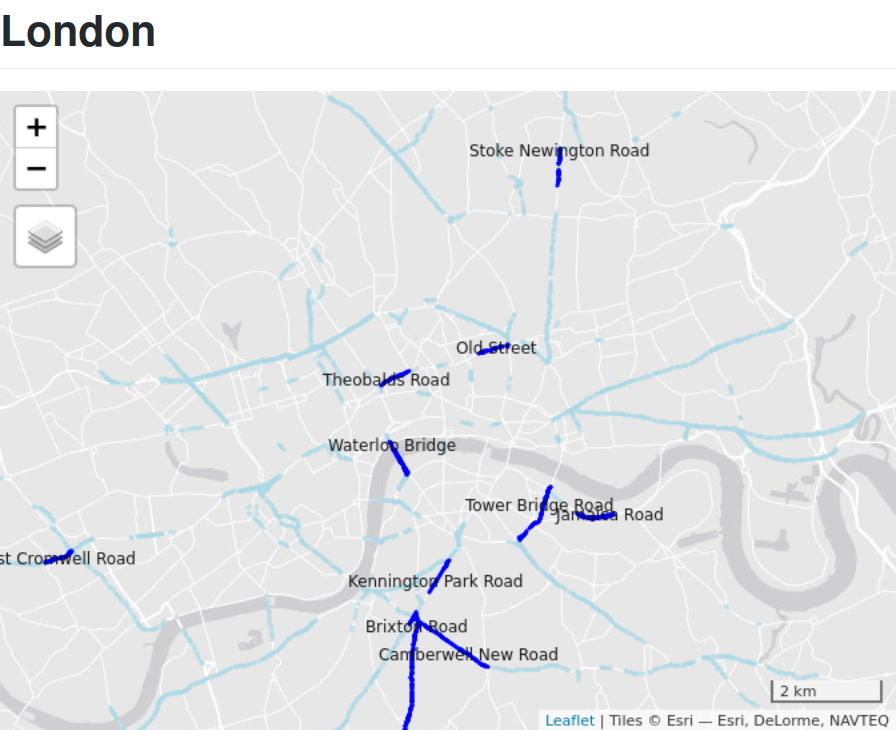
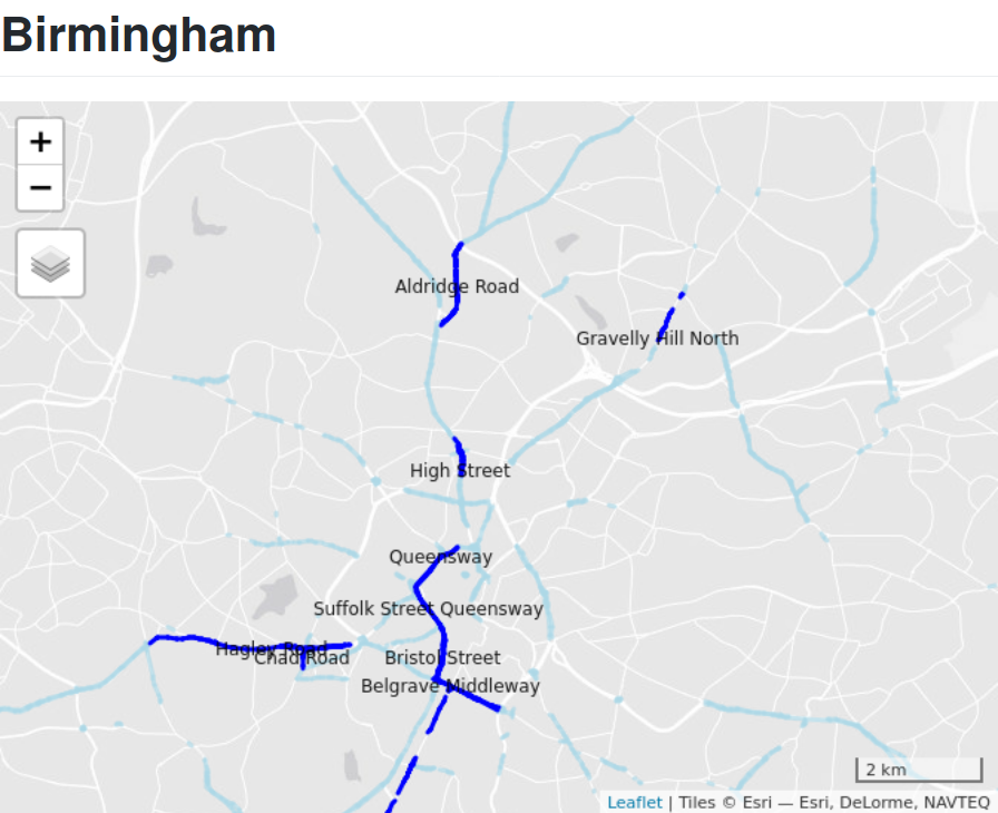
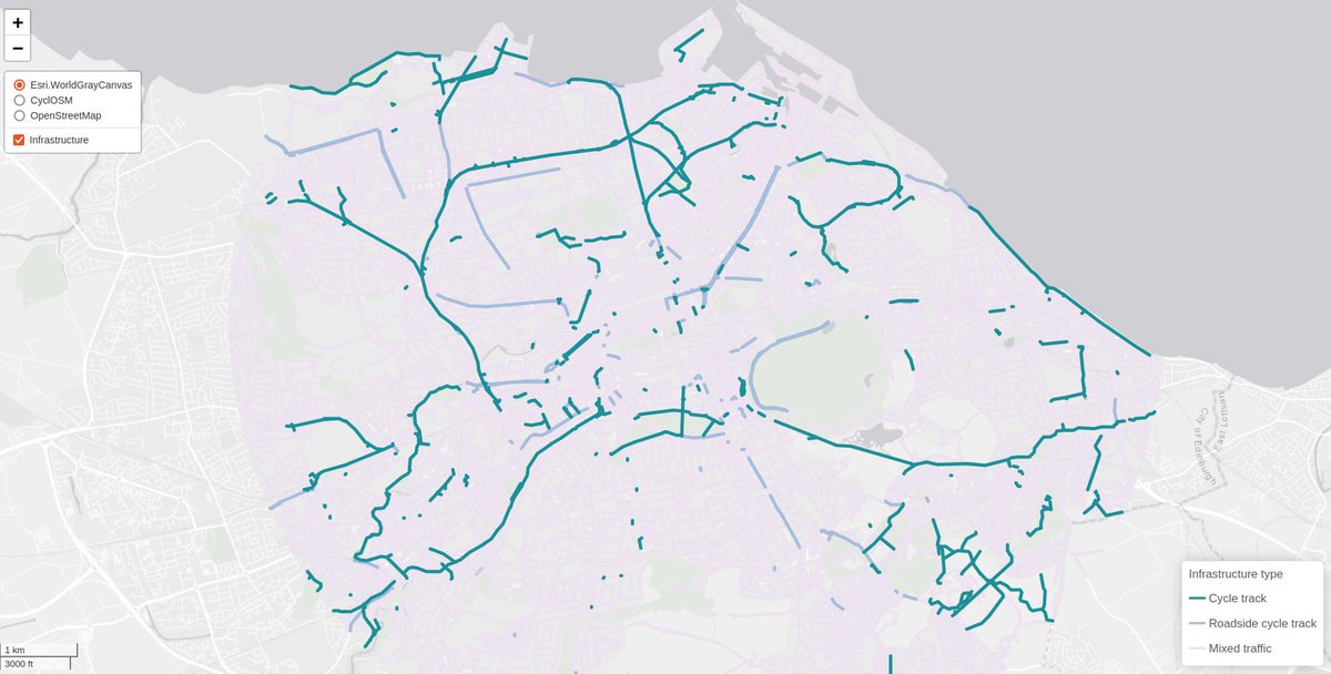
Experimenting 3-way classification of cycleways w. Sustrans Scotland. Simpler than many classifications, but effective? Feedback on this welcome (especially from people with local knowledge in Edinburgh)! Interactive version: buff.ly/3xzoLfX
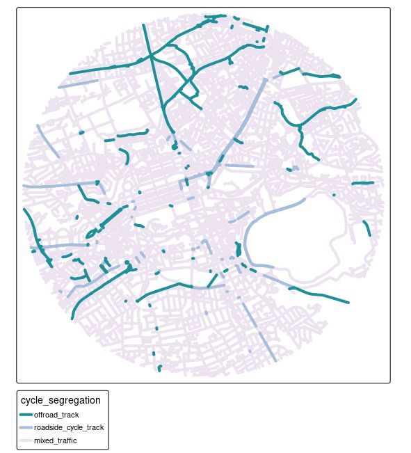
Updated version of this below and now as interactive map at if anyone wants to play, feedback very welcome 🏗 github.com/nptscot/osmact…
Updated version for Edinburgh just uploaded for testing/feedback, more comments welcome. One thing to note: we didn't choose the categories, it's Cycling By Design spec. Interactive version: feedback v. welcome 🙏 github.com/nptscot/osmact…
• • •
Missing some Tweet in this thread? You can try to
force a refresh
Interested in public transit 🚌🚅⛴️ data and software development? Check out the gtfs_manager project, a prototype desktop application written in #rustlang by @maxunsted, to explore and even edit your GTFS files 🎉 A short thread...
The project is now at MVP prototype stage and is looking for people to test it out, provide feedback, and get involved. See post on @rustlang Reddit here: reddit.com/r/rust/comment… for details.
The code underlying the project is #OpenSource and can be found on @github. It's in many ways a @foss4g + #gischat project but focus is on user experience. Check the video there + install with:
cargo install --git github.com/spstreets/gtfs…
It discusses the landscape of free and open tools/software for working with geographic transport datasets (thanks everyone who helped crowd-source this list). link.springer.com/article/10.100…
It shows that the 'ecosystem' of free and open source software for transport planning is maturing, with tools that can support every stage in the transport planning process.
Where should 'pop-up' cycleways go? We analysed data for 10 cities, 4 of which are shown below, finding that there are 'spare lanes' near city centres in all of them.