MPR Weather Profile picture
MPR chief meteorologist Paul Huttner. MPR Climate Cast host. Exploring climate science, news, and solutions. I predict the future.
Feb 19, 2023 9 tweets 3 min read
I normally don't do 🧵on snow events this far in advance. But the magnitude of this week's looming snow event still looks anywhere from seriously impactful, to potentially epic. Here's an early look at the most likely storm outcomes for Tuesday night through Thursday. ❄️❄️
#mnwx First the system: This looks like a 2-part system. Two low-pressure waves will ride over the Rockies. Low #1 is likely to trigger a lead wave of snow across southern 1/2 of Minnesota Tuesday PM into Wednesday. Canadian model loop below between noon Tuesday and noon Wednesday.
Dec 22, 2022 4 tweets 1 min read
Some Minnesotans reacting to a snowstorm.
1) They said a big storm is coming! ❄️❄️❄️
2) It'll probably miss us...
3) Weather enthusiasts post raw model data...
4) So when is the snow gonna get here??
5) It's snowing!
6) Snow stopped. Is this all we're gonna get???
1/4
7) Looks like a bust!!
8) Whoa, the snow is really coming down now...
9) That's a lot of snow!
10) The wind won't be THAT bad.
11) I can drive in anything!
2/4
Mar 17, 2020 15 tweets 4 min read
1/ THREAD: The #COVID19 crisis is heartbreaking on many levels. My first thoughts are always with those whose health livelihoods are impacted. I'm also thinking about the economic impacts all of us are feeling. 2/ I'm also in awe all of you heroes working on the front lines. Health care workers. Grocery supply chain workers. Scientists working on fighting this disease and developing a vaccine. Anyone still working in a higher risk environment. You are amazing.
Sep 10, 2018 6 tweets 4 min read
Dire predictions with Hurricane #Florence look increasingly likely for the Carolinas/Virginia. Several points need to be made as Monday dawns.
1) This will be a LARGE storm. HWRF model Simulated IR satellite is an esitmate, but shows a storm as large as North Carolina. 
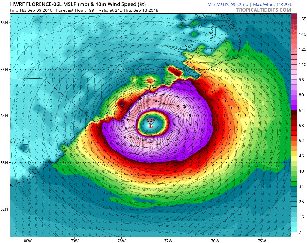
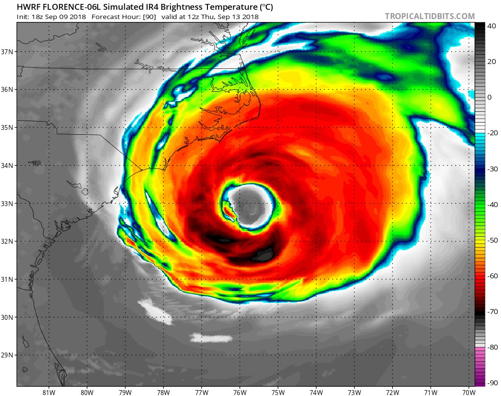
2) @NHC_Atlantic official forecast is 150 mph winds (near Category 5) offshore. #Florence will likely be Category 4 near landfall with 140 mph winds. Landfall zone may still shift, but most models show a devastating wind field near Wilmington/Topsail/Jacksonville, NC Thursday.