
D.C.-area and worldwide weather news from the Washington Post | contact: info@capitalweather.com
 The main reason most winter outlooks are calling for below normal snow for the DC area is because of La Nina, which -- on average -- brings below normal amounts. But this La Nina will probably be weak, if it develops at all. We think its influence may be limited. 2/x
 Here all the places that highs of 100+ and the number of times. Some places in the Southwest like Phoenix and Yuma were 100+ pretty much every day.
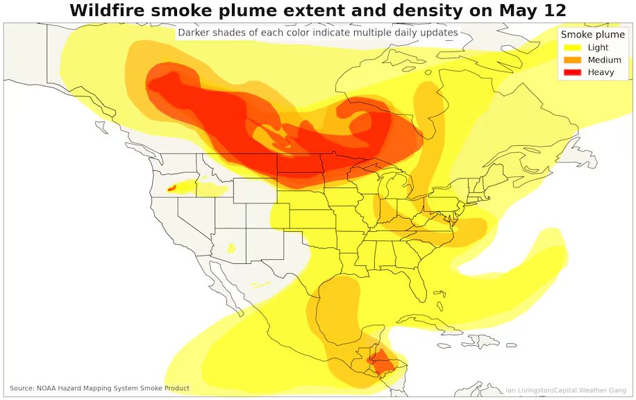 Code red air quality -- signifying unhealthy levels of smoke pollution -- in Minnesota and Wisconsin this morning. Parts of southwest Canada have seen Code Purple air quality-- the worst level. 2/4
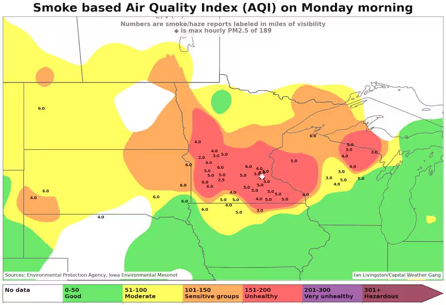


 The land area burned so far in Canada has exceeded 5,000 percent of normal in some provinces. (2/5)
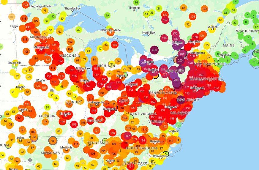 New York City, Detroit and Toronto rank among top 12 cities in the world for bad air quality currently. 2/
 🛰️Bering Sea, from a satellite 440 miles above Earth
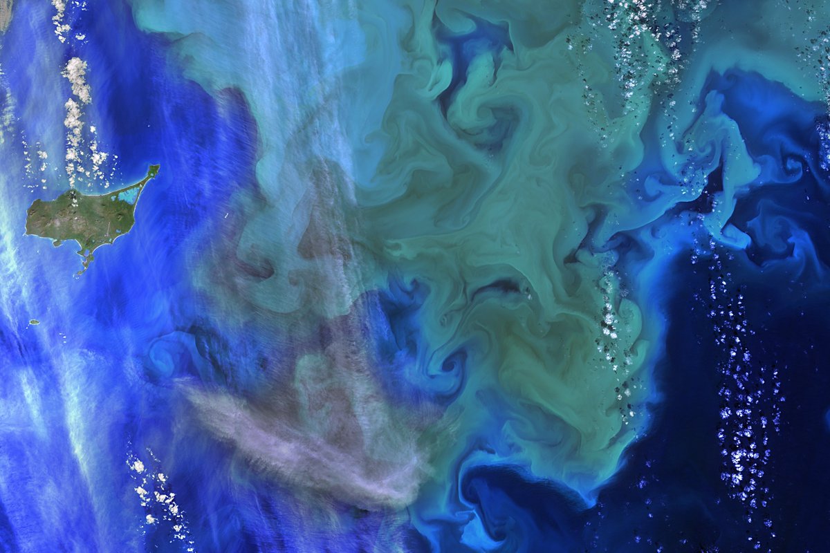

 NOAA Hysplit tool, which can simulate atmospheric steering currents, showed a balloon launched from Hainan Island around Jan. 20 would have reached Aleutians around Jan. 28. (2/x)

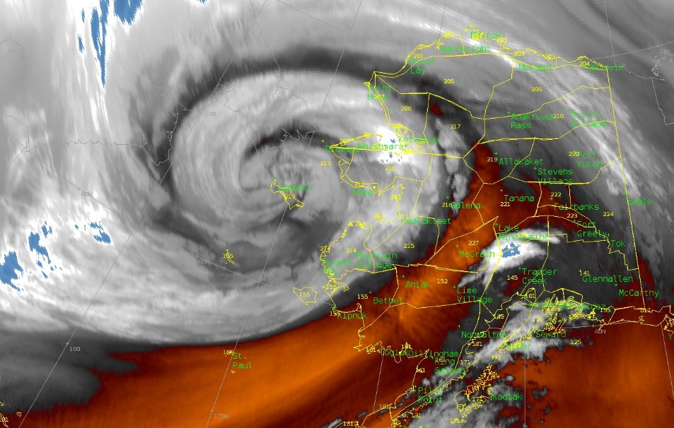 Map of peak wind gusts in western Alaska so far...


