
Bicyclist, Citizen Ped and Bike Advocate. Retired NOAA and USAF/AFWA (and AWS) meteorologist
 2/ Most recent visible imagery: Sentinel-2 (9 JAN) shows dark water indicating unfrozen water w/ no snow cover. LANDSAT8 (11 JAN) shows ice formation in the larger lakes between the Antonovsky Bridges. Ice is definitely forming on the Konka River but not yet on the Dnipro River.


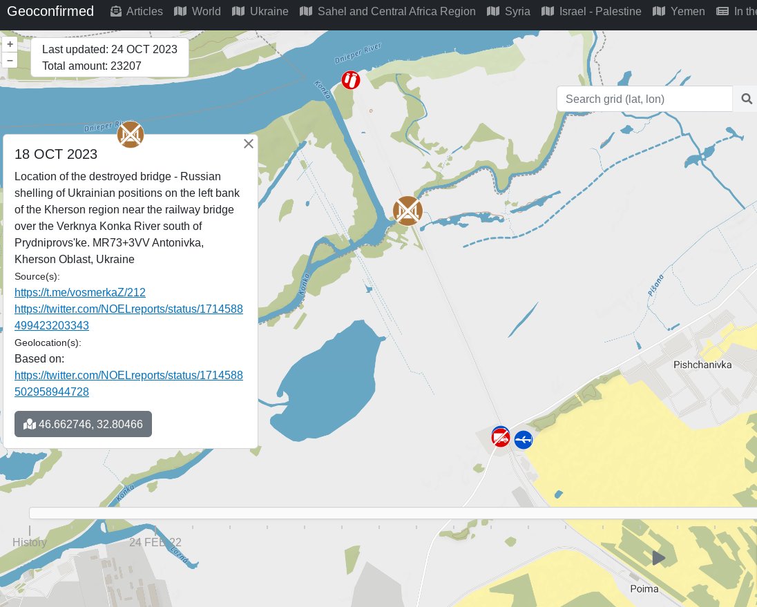 2/ First, key dates in this region: Important to note that RF used this location to ferry troops and vehicles in the fall 2022 and UAF has been been attacking RF obn the left bank near the Antonovsky Bridge 6 km downstream of this location in late June 2023.


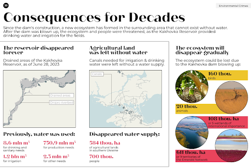
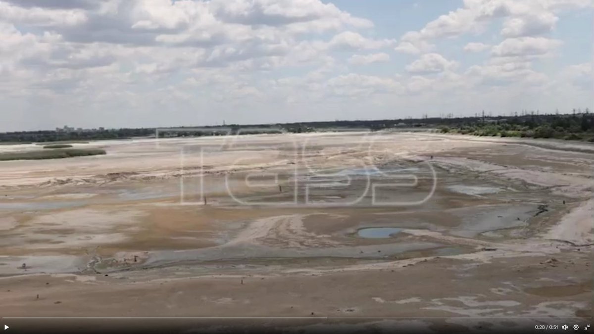
 2/ K-HPP Destruction Impacts:
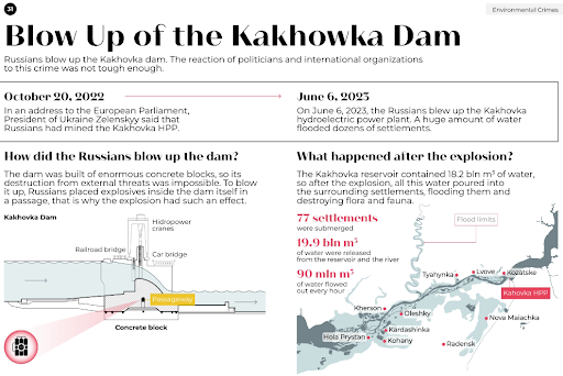

 2/ Sentinel 1 SAR shows #USV barrier getting installed between 19 August and 26 August

 2/ What was going on?


 2/ Sentinel 2 True Color


 Upper Left: Surface Current Direction and Velocity


 2/ Rainfall from thunderstorms was not uniform with some locations close to the LoC receiving weekly peak total rainfall 80-105 mm including Oleshky, Vuhledar, Bakhmut and Raihorodka.