
Educator | Founder @ Spatial Thoughts | Helping people learn and master geospatial tech - #QGIS, #Python, #GDAL, #EarthEngine | Ex-Google
 Tutorial 1: Downloading Images from Earth Engine: A tutorial showing how to use the Google Earth Engine plugin to create a Sentinel-2 median composite for a region and download it as a GeoTIFF file. (2/n) gee-community.github.io/qgis-earthengi…
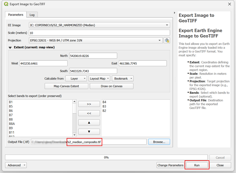
 The course starts with Python fundamentals and covers fundamentals of Jupyter notebooks, variables, data structures, string operations, for-loops, conditionals, and functions - all while focusing on problems in the geospatial domain. (2/n)
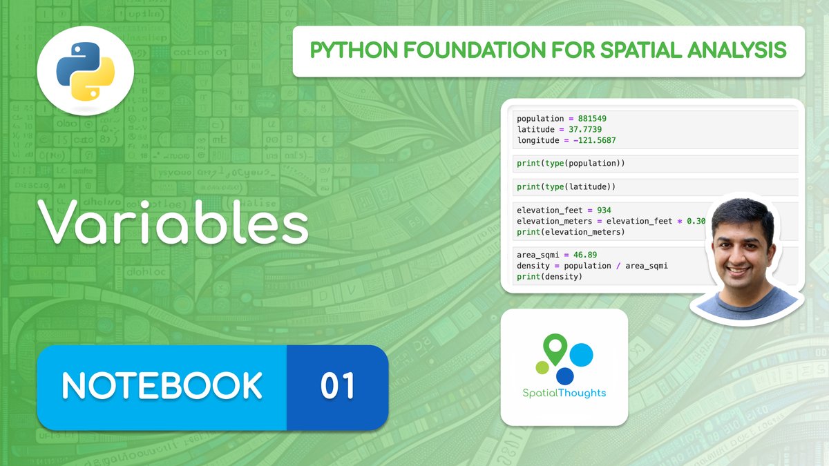


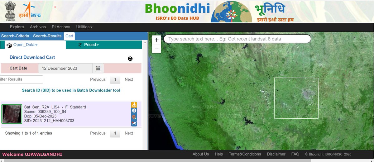 LISS4 sensor has 3 bands (NIR/Red/Green) at 5m GSD. The download comes with 3 GeoTIFFs and a metadata file. The pixels are DNs that need to be converted to reflectances. After conversion - there's a close match to Sentinel-2. You can see the improvement in resolution (2/n)
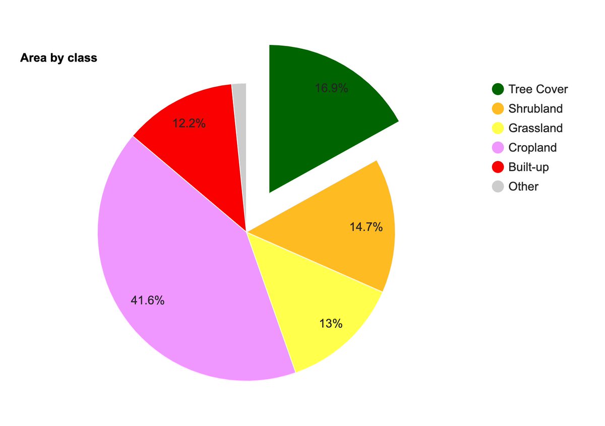
 The workshop focused on understanding and using the #DynamicWorld dataset for monitoring applications. The key takeaway is that the probability bands provide a way to build monitoring applications with simple rule-based models at the global scale at high temporal frequency. (2/n)

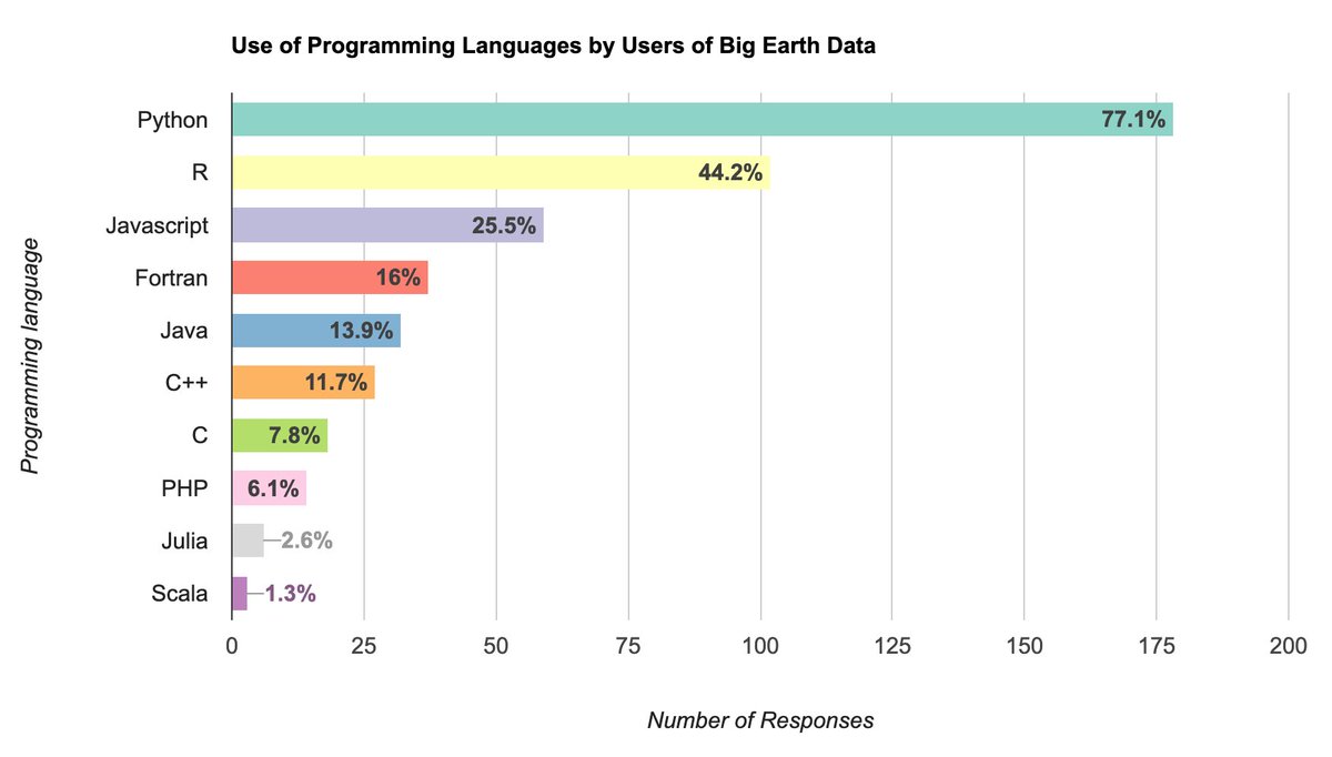
 The workshop starts with an introduction to the GEE charting API. Module 1 covers Time-Series charts with a focus on learning the API and customization options. We work with Weather Forecast (GFS), Climate (TerraClimate), Precipitation (CHIRPS), and MODIS datasets. (2/n)


