Google Earth imagery in #Nigeria's #BornoState shows systematic destruction of countless traditional villages and urban areas - victims of the war against #BokoHaram
medium.com/@benjamindbrow…
medium.com/@benjamindbrow…
Villages like Mutube near the Sambisi Forest have disappeared without a trace as a result of the Boko Haram insurgency in 2017. 


These two small traditional villages that once sat on the southern side of the Sambisi were erased between 2016 and 2017.

These buildings sitting on an integral junction of a highway in #Nigeria's north, just south of #Bama, show signs of their destruction.


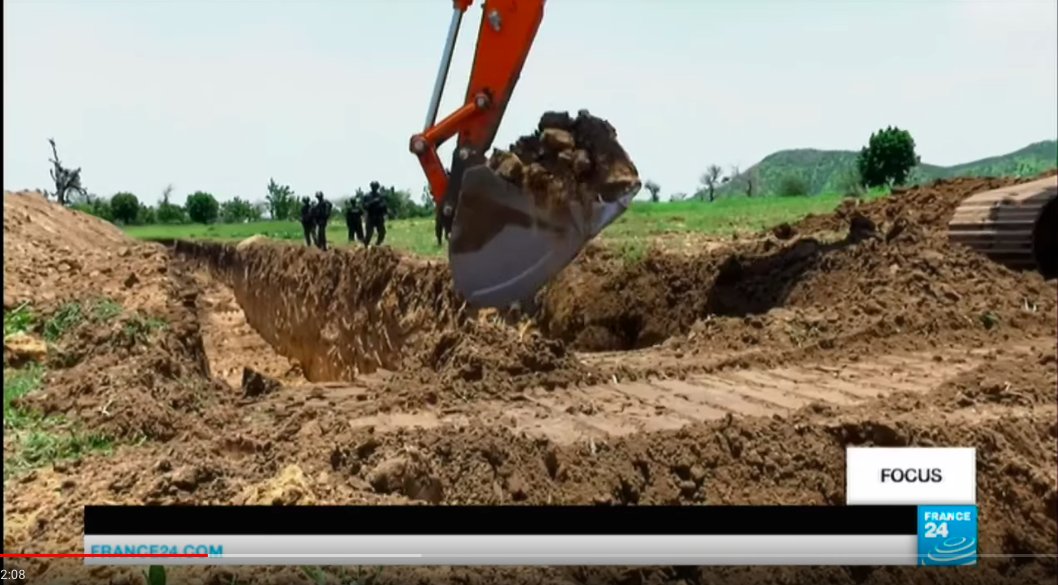
Defensive measures from the constant barrage of #BokoHaram suicide bombings and attacks have been trenches. This strategic highway junction south of Nguro-Soye is guarded with this tactic. The YouTube clip from a Nigerian city shows how deep they are.


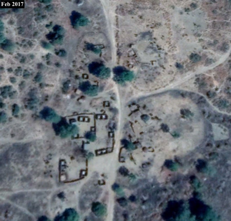
Nguro Soye, 10km south-east of Bama in Nigeria's north, was quite an active town. Satellite imagery from March, 2018, shows its current destructive state.


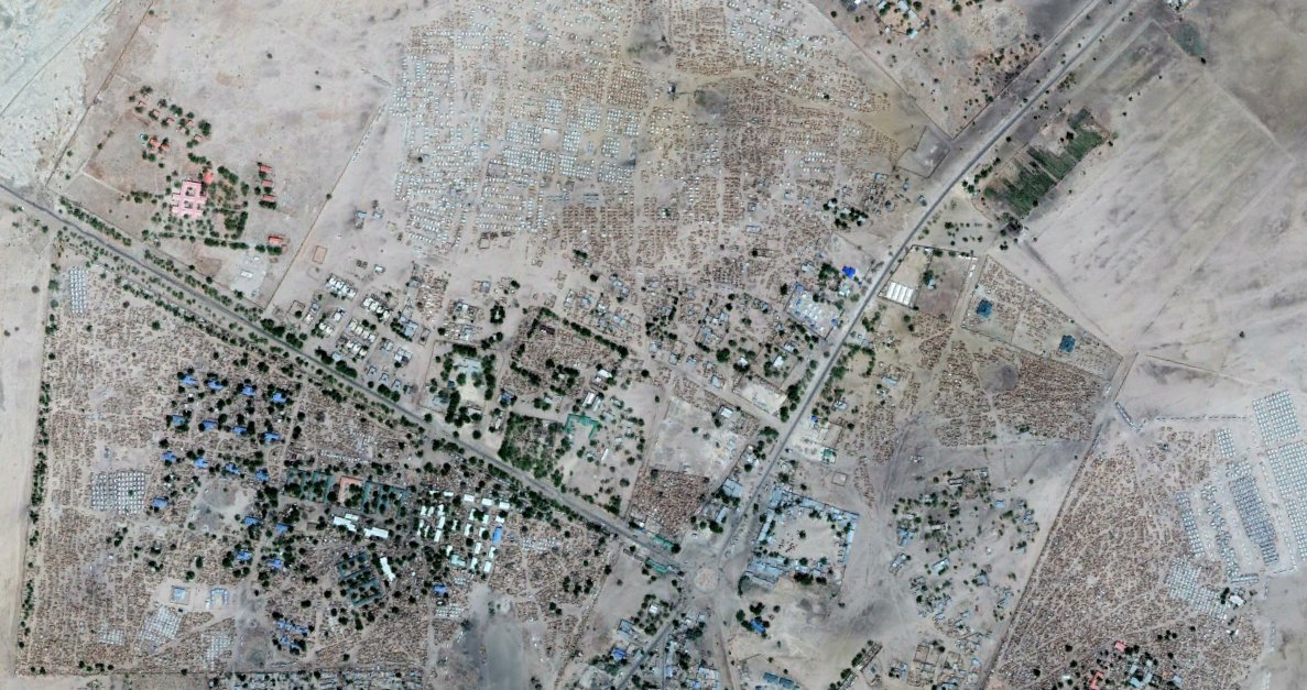
These two satellite images show the scale of displaced Nigerians seeking refuge in #Dikwa (Satellite images from Nov, 2016 and March 2018).


Many displaced Nigerians cross the border into #Cameroon seeking refuge. Satellite images show #Minawao Refugee Camp in the #MayoTsanaga region of Cameroon growing into a city with more than 95,000 refugees since 2014.


Far North Cameroon's Kolofata has also started implementing Nigeria's trench protection system as of Spetember last year, as a way to stop Boko Haram suicide bombers from enterring the town.


Satellite images from the garrison town Monguno, Nigeria (2015/2018). This is another one of Nigeria's safe havens, protected by a trench encircling the town.

Google Earth from the north-east area of Monguno, Nigeria (2015/2018). This protected town, and others like it, offer refuge for more than 1 million displaced Nigerians.
goo.gl/maps/tE38ci6C4…
goo.gl/maps/tE38ci6C4…


Nigeria's President: Boko Haram militants 'technically defeated' (December 2015). bbc.com/news/world-afr…
This is Monguno, in Nigeria's Borno State (2015 and 2018). This is not what winning a war looks like. @AmnestyNigeria
This is Monguno, in Nigeria's Borno State (2015 and 2018). This is not what winning a war looks like. @AmnestyNigeria

Some villages in the Borno State, despite their neighboring communities being destroyed, have expanded in recent years. This #Nigeria village's development was quite interesting, given the rest of the villages in the area have been wiped out by #BokoHaram

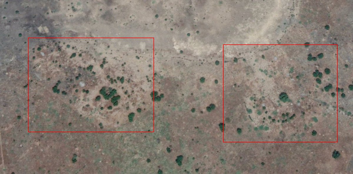
On August 10, this developed village (above) was bombed by Nigerian Air Force as a suspected #BokoHaram hotspot.
Location: goo.gl/maps/JwAz5nxug…
Location: goo.gl/maps/JwAz5nxug…
A second village, further South of the first strike, was bombed by a #Nigeria Air Force gunship on August 10. This village had only begun to exist since 2014 and was suspected to be a lead #BokoHaram stronghold.
Location of suspected BH camp: goo.gl/maps/PTZbFj9ge…
Location of suspected BH camp: goo.gl/maps/PTZbFj9ge…
Freely available satellite imagery can indentify human rights abuses, war, and assist journalists in their verification of details. Two tools are @googleearth and @sentinel_hub. Here's a quick run through on them from me in my first @bellingcat article.
bellingcat.com/resources/how-…
bellingcat.com/resources/how-…
• • •
Missing some Tweet in this thread? You can try to
force a refresh