Mike Lydon Profile picture
Mar 29, 2020 3 tweets 2 min read Read on X
I've started an open @googlephotos album to help us all document and share what our cityscape looks like during this historic period of time. All public realm imagery is welcome, but inspirational shots are particularly welcome! #COVID19 #urbanism

photos.app.goo.gl/ED6kU3PzPHVBpq…
@googlephotos Here in #NYC I've catalogued a number of empty streets and public spaces while out for a run or walk, with more to come. There's also streets/public spaces that are struggling to accommodate demand as business as usual is no longer feasible with social distancing norms in place.
And to be clear, I’m seeking images beyond NYC. Cities and towns, large and small, share your pics!

• • •

Missing some Tweet in this thread? You can try to force a refresh
 

Keep Current with Mike Lydon

Mike Lydon Profile picture

Stay in touch and get notified when new unrolls are available from this author!

Read all threads

This Thread may be Removed Anytime!

PDF

Twitter may remove this content at anytime! Save it as PDF for later use!

Try unrolling a thread yourself!

how to unroll video
  1. Follow @ThreadReaderApp to mention us!

  2. From a Twitter thread mention us with a keyword "unroll"
@threadreaderapp unroll

Practice here first or read more on our help page!

More from @MikeLydon

Nov 14, 2023
So, what does it take to change a New York City street? An imperfect thread about the recently completed @ParkToPark103 SIP project.
Image
Image
In late 2019 @StreetPlans joined up with @OpenPlans and local resident @pfrishauf to undertake a study about West 103rd Street. The goal was to improve safety and connectivity between between Central Park and Riverside Park. Image
@StreetPlans @OpenPlans @pfrishauf It was dubbed "Park to Park, with Douglass (NYCHA campus) at Its Heart." In early 2020 we began measuring and analyzing just a single block, West 103rd between Broadway and West End Avenue. Image
Read 26 tweets
Sep 20, 2020
1/x: One year since the adoption of the 2020 #LetsRideJC Bike Master Plan, we’ve led / contributed to implementation plans for more than 7 (street) miles of protected bike lanes, with most of these miles built in or set to be installed in 2020. Here’s a quick review. Image
2/x: Let’s start w/ Grove St, the 1st segment built, a two-way PBL, fittingly in front of City Hall. As I tweeted Friday, the conversion of the southbound travel to outdoor dining has made this one of the best streets in JC. And Grove now connects to directional PBLs on Grand St ImageImageImageImage
3/x: Washington Blvd followed in 2019, but was not finished before the City decided to repave the full street, which allowed us to learn from shortcomings in the initial design. These directional lanes extend to Marin Blvd, and will soon connect to Observer Highway in Hoboken. ImageImage
Read 16 tweets
Sep 18, 2020
1/X: These are the headlines from my #OpenStreets Google alert.

"Open streets for restaurant service coming more sections of the city as relief for business owners" - @amNewYork
@amNewYork "Open Streets Macon returns this weekend." @41NBC
@amNewYork @41NBC "City moves toward permanent closure of Pine Avenue, possibly other streets" - @LongBeachPost
Read 8 tweets
Jul 19, 2020
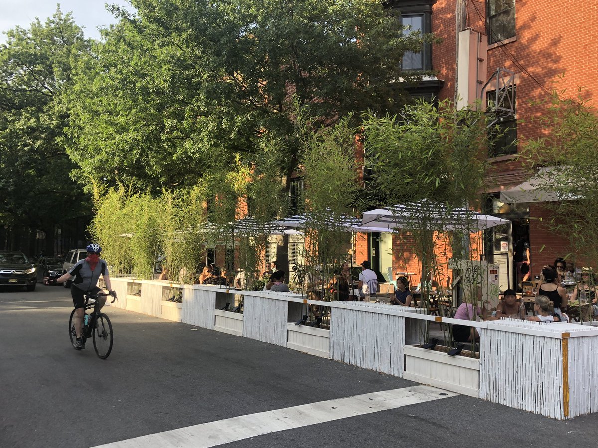
1/5: We left NYC for California to see family for a few weeks just as restaurants were allowed to convert the curbside. I took a stroll along Dekalb Avenue tonight and found my neighborhood transformed. ImageImageImageImage
A number of restaurants stood out to me, including Imani Kitchen. They had the funkiest set up an diners there look like they were having the most fun. ImageImage
Evelina wins on scale of intervention and greenery. ImageImage
Read 5 tweets
Mar 16, 2020
1/X: I thrive on traveling and learning/collaborating with others. The coming weeks will be a challenge in this regard, so I'm going to attempt to satisfy my wanderlust by sharing a daily image and observation from inspiring streets and public spaces I've visited globally.
2/X: Here's Angel Place (2014), a laneway in the heart of Sydney that gained international fame thanks to Artist Michael Thomas Hill's "Forgotten Songs" installation. Part of a temporary laneway activation program, the 2009 art work proved so popular it was made permanent. Image
3/X: Via Orologio, Palermo, Italy (2019). The humane streets of many Italian cities are as socially dynamic as they are beautiful. A reduced social life here must be particularly painful because streets like these were not designed to the lesser standard of functional mobility. Image
Read 10 tweets
Dec 14, 2019
Back to NYC - thanks to @sotonobaplace for such an inspiring week exploring #tacticalurbanism, #placemaking in Japan. Here are some thoughts from my time here, with recognition that one week is hardly the time required to understand a city as complex as Tokyo. Image
I was utterly surprised at how little congestion there is in Tokyo. The transit system, walking, and cycling really ease the pressure on the arterial street network. Speaking of which, we felt such streets are largely overbuilt and should be given back to other uses. Image
The city has a 15% cycling mode share with almost zero bike infrastructure. What? I think this is largely due to the stark contrast in the city’s street network. Once off the car sewers most streets are narrow, slow, and shared. Additionally, people are allowed to sidewalk ride. Image
Read 13 tweets

Did Thread Reader help you today?

Support us! We are indie developers!


This site is made by just two indie developers on a laptop doing marketing, support and development! Read more about the story.

Become a Premium Member ($3/month or $30/year) and get exclusive features!

Become Premium

Don't want to be a Premium member but still want to support us?

Make a small donation by buying us coffee ($5) or help with server cost ($10)

Donate via Paypal

Or Donate anonymously using crypto!

Ethereum

0xfe58350B80634f60Fa6Dc149a72b4DFbc17D341E copy

Bitcoin

3ATGMxNzCUFzxpMCHL5sWSt4DVtS8UqXpi copy

Thank you for your support!

Follow Us!

:(