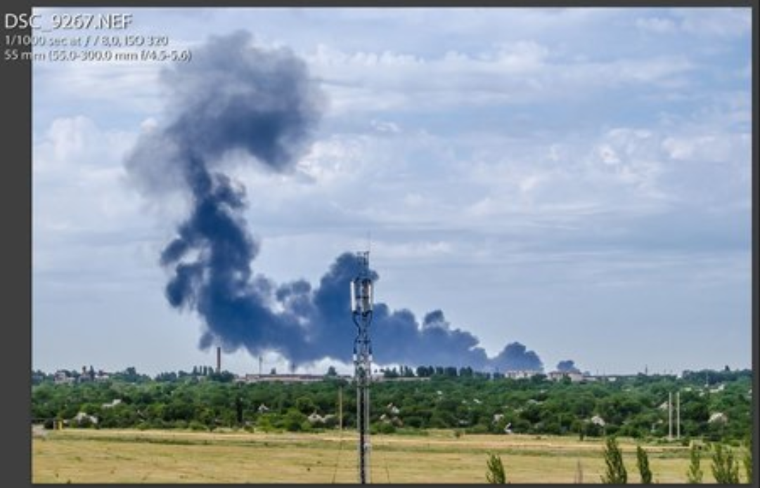
Today 6 years ago the tragedy of #MH17 happened. Only minutes later, Russia was declared guilty. Since then, a battle of information has raged with little "evidence". One of the most convincing evidence is this photo, isn't it? 
Based on this photo, the alleged launch site of a BUK missile was quickly found. First it was a burnt piece of grass at the western edge of the field, later Bellingcat moved its launch site to the tree, because the BUK tracks were supposedly visible there.


To consider the tracks as "BUK tracks" is questionable. They are located opposite a passageway to the neighbouring field and became first visible when the harvest had started on this neighbouring field. In 2015 the tracks disappeared, 2016 similar tracks were visible again.


The fire theory is equally questionable, because at that time countless fields in the south of Snizhne were burnt.
These theories are almost forgotten today, but the launch spot remained.
These theories are almost forgotten today, but the launch spot remained.


It is therefore worth taking a new look at the data that has proven to be reliable over the years. First, the foto!
It is part of a series. Two photos show the smoke tail of a missile, so they say, the rest show smoke from the debris field.
It is part of a series. Two photos show the smoke tail of a missile, so they say, the rest show smoke from the debris field.


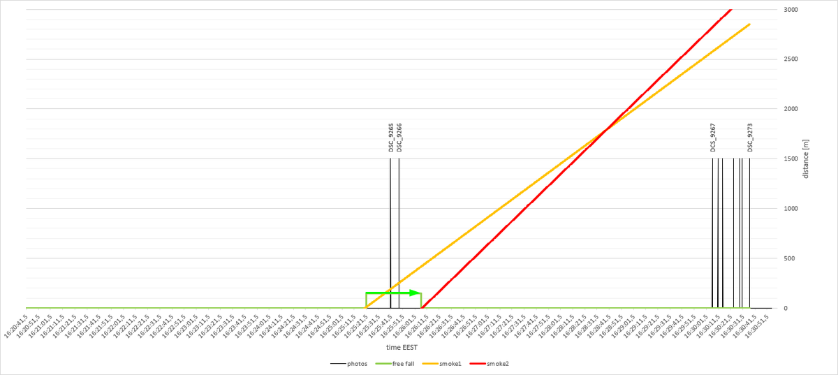
For some reason the camera's clock went wrong, but all the photos in this series are at least relative to each other in time.
SC_9265 - 07/17/2014 16: 25: 41
SC_9266 - 07/17/2014 16: 25: 48
SC_9267 - 07/17/2014 16: 30: 06
...
SC_9273 - 07/17/2014 16: 30: 37
SC_9265 - 07/17/2014 16: 25: 41
SC_9266 - 07/17/2014 16: 25: 48
SC_9267 - 07/17/2014 16: 30: 06
...
SC_9273 - 07/17/2014 16: 30: 37

So the chronological sequence of the photos looks like this:

We know, the wind blew pretty much east-west.

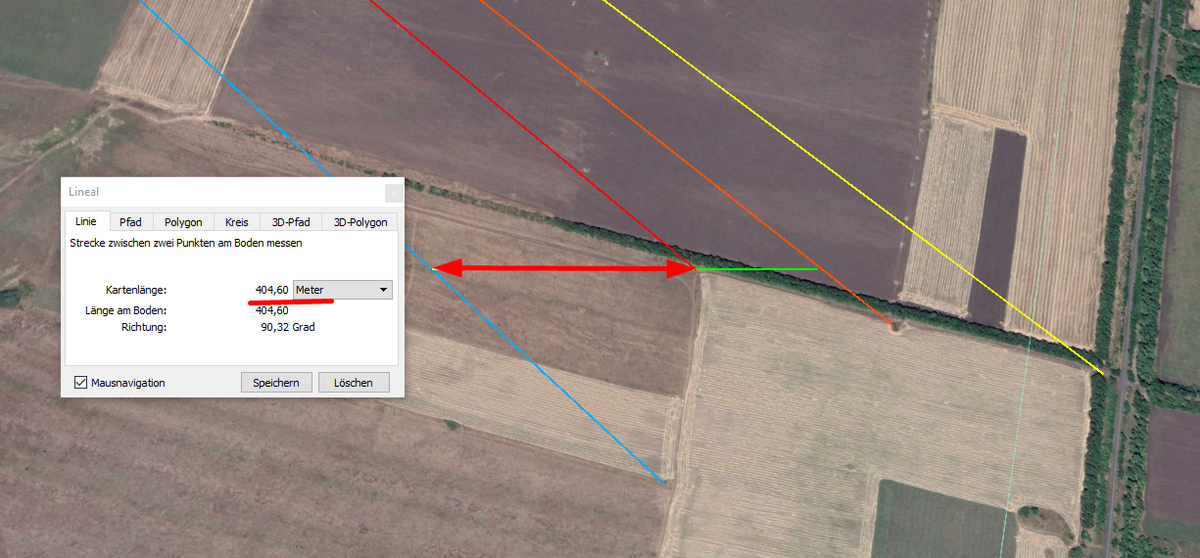
And by means of geolocation (which Bellingcat did not invent, even if some people think so) it can be said quite accurately that the smoke from the debris between photo 9267 and 9273 moved about 360 meters. docdro.id/UAFE5RZ
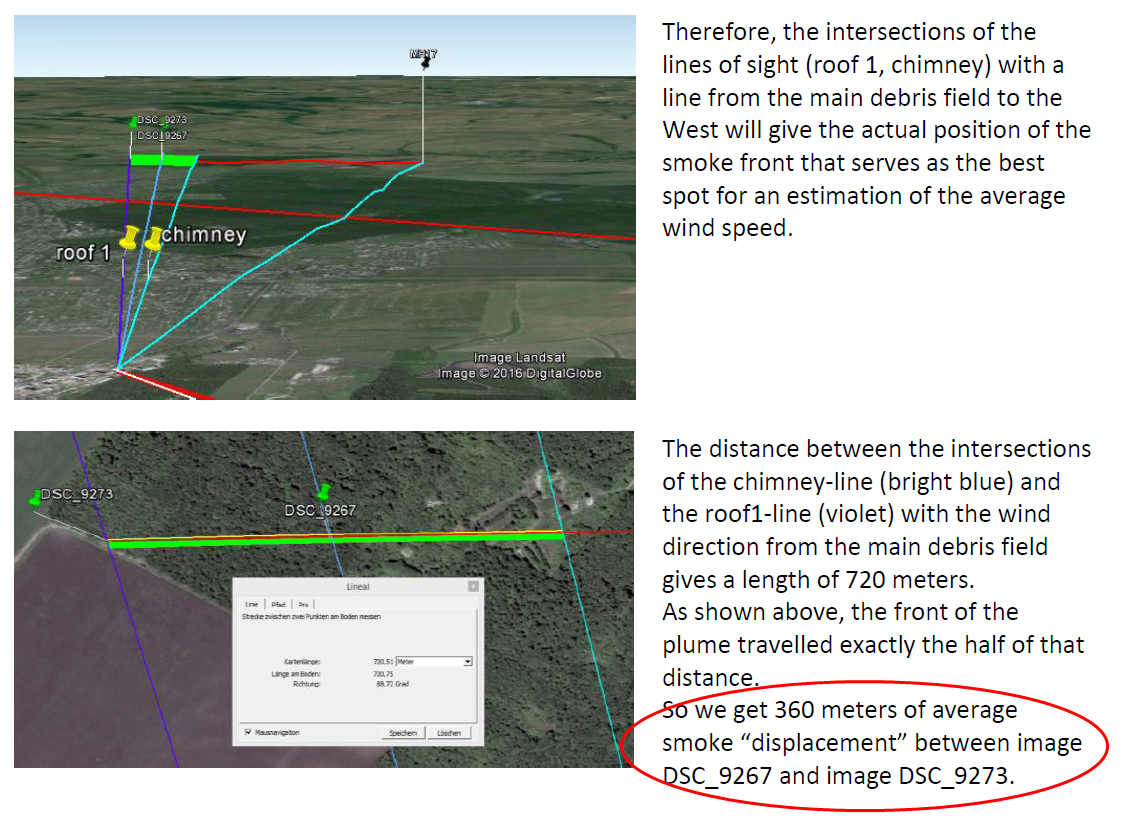
In our diagram with the photos we can introduce an axis for the travelled distance of the smoke. The 360m movement of the debris smoke then looks like this.

But since we also know where this smoke originated, we can say with equal certainty that the smoke had already moved 2820 meters with the wind before photo 9267 was taken.
In other words, the place-time diagram looks like this and we can say with reasonable accuracy how much time before the photo the tanks of the plane exploded on the ground.
And we know a lot more...
And we know a lot more...

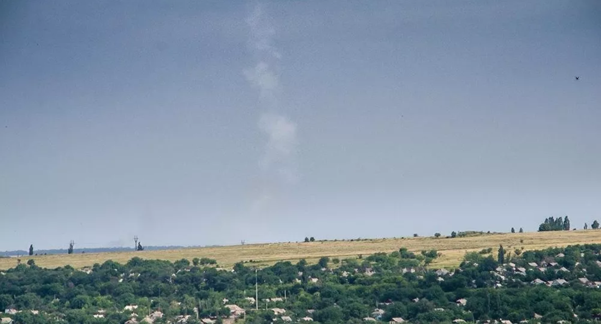
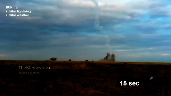
Let's assume that the field south of Snizhne (12km southeast of the photographer) is the launch site of the missile. If so, then this column of smoke has a diameter of about 100 meters and moved about 60 meters to the west between photo 9265 and 9266.

Like this:

What else do we know?
We know, for example, that the plane was hit at an altitude of 30,000 feet. In a vacuum the debris would fall for 45 seconds and there is no faster way out of horizontal flight without propulsion.
We know, for example, that the plane was hit at an altitude of 30,000 feet. In a vacuum the debris would fall for 45 seconds and there is no faster way out of horizontal flight without propulsion.

Logically, this means that during this time the rocket could not have been launched. So we have to move the smoke column of the missile to the left on the timeline.
Like this:
Like this:
But we also know that the flight of a BUK missile from this field would have taken about 33-35 seconds.

That means we also have to take into account the flight time of the rocket and move the graph of the smoke column further to the left.

We have now considered the minimum of time! In this case the smoke column would move 480m with the wind before the first photo 9265 was taken.
But this also means that the burnt western edge of the field would not even be possible if the debris would fall in a vacuum.
But this also means that the burnt western edge of the field would not even be possible if the debris would fall in a vacuum.


So the big question now is how long the debris actually fell against the air resistance. The experts' opinions differ widely on this.
Some say 60-90 seconds - in other words, almost vacuum.
Others say 3-5 minutes.
Some say 60-90 seconds - in other words, almost vacuum.
Others say 3-5 minutes.


The fact is that the fall speed depends on the active area and a coefficient. And if the plane falls nose down, then this area is very small but...

With increasing speed, the "lift" on the wings would also increase. This would force the aircraft back into a horizontal position or the wings would break off.
Except for the tip of the left wing, the "Center Structure" with the tanks hit the ground in one piece and exploded.
Except for the tip of the left wing, the "Center Structure" with the tanks hit the ground in one piece and exploded.

This also means that the fall of the fuselage lasted much longer than a free fall, although perhaps not 5 minutes.
Who remembers this picture? ...the diving hook?
The Russians thought they recognized a fighter jet and the really smart people screamed "LIE, it's the wreckage!"
Who remembers this picture? ...the diving hook?
The Russians thought they recognized a fighter jet and the really smart people screamed "LIE, it's the wreckage!"

Bellingcat, Stopfake, Putin@war and all those Russian-lie strategists will certainly remember. After all, they have written numerous articles about it. I borrowed the above picture here:

However, there is a video of this data recorded by Rostov and it literally shows how the fuselage turned and descended in a large screw to the main debris field. ...and it still transmitted data!
The last data show a ground speed of 202km/h.
The last data show a ground speed of 202km/h.

Investigator Marcel van den Berg had taken the trouble to meticulously write down every data blip. And he made an amazing discovery.
whathappenedtoflightmh17.com/mh17-speed-and…
whathappenedtoflightmh17.com/mh17-speed-and…
After the time when the black boxes allegedly stopped recording (17:20:02 Moskow time / 16:20:02 EEST) MH17 flew a few more seconds until there was a jolt which slowed the plane down by 300km/h in 5 seconds. This jolt was probably the break of the cockpit.

We also see how the speed decreases up to a final speed of about 200km/h (55m/s). The final trajectory is the most vertical of that fall. So 55m/s can be assumed as terminal velocity of the vertical movement.
In other words, the fall took 180+ seconds!!!
In other words, the fall took 180+ seconds!!!
...if the fuselage would have just fallen. But we can't rule out that some of the initial horizontal velocity increased the initial fall.
I only mention this because 120 second fall time, as shown by the Rostov data, does not seem doubtful at all.
I only mention this because 120 second fall time, as shown by the Rostov data, does not seem doubtful at all.
Back to our free fall diagram, which is based on a vacuum fall of 45 sec. Instead, we have to use the only reliable data available: 120 sec after the explosion of the warhead that pierced the cockpit and finally led to the disintegration due to air resistance.

The point is, the only meaningful data - let's call it facts - result in a first photo of the smoke column taken about 2 minutes after the alleged missile launch. ...on that field? The column of smoke must have moved about 1150m with the wind.

So where exactly was that BUK?

I have no idea how it happened that someone took a photo of a 12km distant straight smoke column of 100m diameter ~2 minutes after launch on a windy day.
No idea.
Really.
No idea.
Really.


...should be air speed, not ground speed.
(final explanation: the above images are screenshots of an uncut video of a BUK launch. The conditions are similar. After 20sec that smoke column almost disappeared and it never reached a diameter of 100m)