
#CAFires2020 Tues Thread
My Sources
My main go-to map - has many layers of info
bit.ly/3l9aziW
#FireMappers
CA Road Conditions: quickmap.dot.ca.gov
Map of temp. shelters: bit.ly/3i3vjHd
Help with Critters: @halterproject
/1
My Sources
My main go-to map - has many layers of info
bit.ly/3l9aziW
#FireMappers
CA Road Conditions: quickmap.dot.ca.gov
Map of temp. shelters: bit.ly/3i3vjHd
Help with Critters: @halterproject
/1
#CAFires2020 Tues Thread
My Sources cont.
(not all) CA Counties EVAC Maps:
bit.ly/2D249B3
Mariposa Co is also covering for #CreekFire
bit.ly/3bzXVVO
Mendo EVAC map
tinyurl.com/MendoEvac
Live cams: alertwildfire.org
/2
My Sources cont.
(not all) CA Counties EVAC Maps:
bit.ly/2D249B3
Mariposa Co is also covering for #CreekFire
bit.ly/3bzXVVO
Mendo EVAC map
tinyurl.com/MendoEvac
Live cams: alertwildfire.org
/2
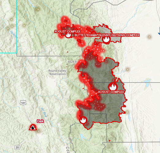
#CAFires2020 Tues Thread
#AugustComplexFire - Shasta-Tehama-Glenn-Mendo-Lake Co.s
MAP: bit.ly/3gzPtqt
#FireMappers
Tehama Co EVAC map: bit.ly/2D249B3
Lake Co. EVAC Map: bit.ly/3jeurzk
/3
#AugustComplexFire - Shasta-Tehama-Glenn-Mendo-Lake Co.s
MAP: bit.ly/3gzPtqt
#FireMappers
Tehama Co EVAC map: bit.ly/2D249B3
Lake Co. EVAC Map: bit.ly/3jeurzk
/3
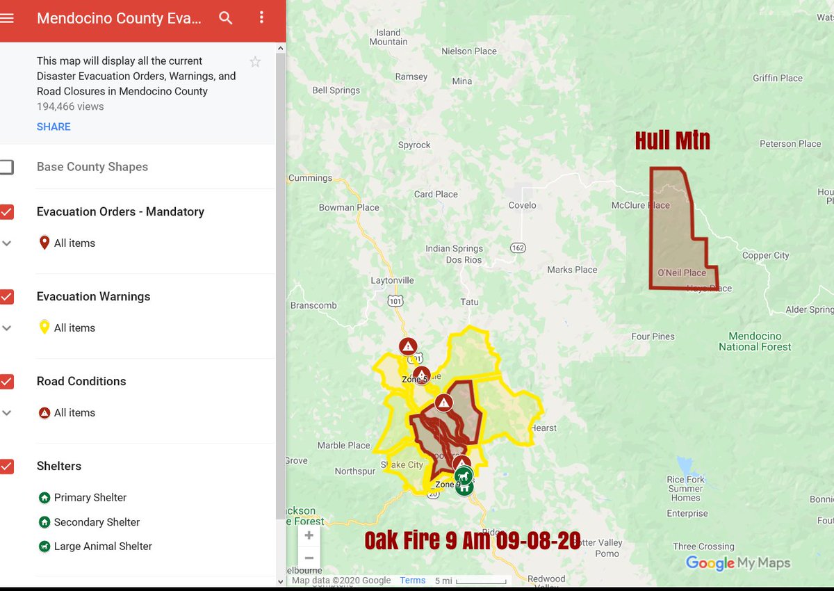
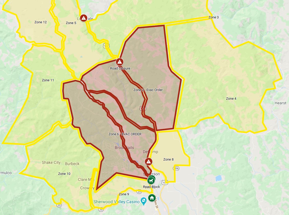
#CAFires2020 Tues Thread
Mendocino Co.
#OakFire - Willits, Brooktrails
#HullFire - #AugustComplexFire
Hearst, CA in between
Mendo EVAC Map: tinyurl.com/MendoEVAC
live cams alertwildfire.org
Big MAP: bit.ly/3gzPtqt
#FireMappers
/4
Mendocino Co.
#OakFire - Willits, Brooktrails
#HullFire - #AugustComplexFire
Hearst, CA in between
Mendo EVAC Map: tinyurl.com/MendoEVAC
live cams alertwildfire.org
Big MAP: bit.ly/3gzPtqt
#FireMappers
/4
#NorCalFires2020 - New Starts in Shasta Co.

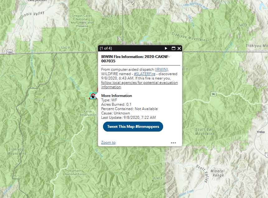
#NorCalFires2020 - Siskiyou Co. Thread
#SlaterFire
EVAC ORDER UNDERWAY- Happy Camp
MAP: arcg.is/1DXbeu
#FireMappers
#SlaterFire
EVAC ORDER UNDERWAY- Happy Camp
MAP: arcg.is/1DXbeu
#FireMappers

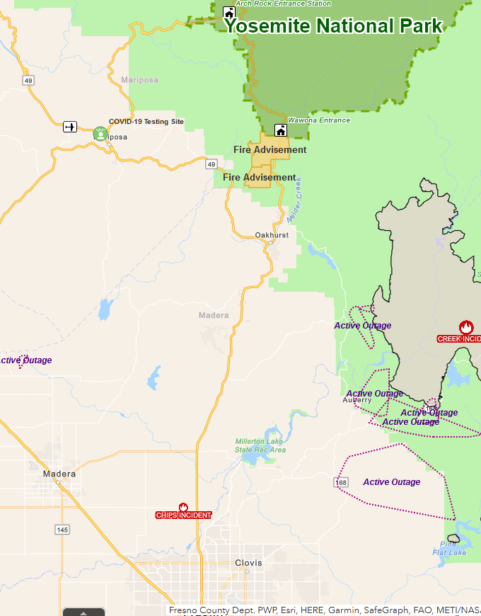
#CAFires2020 - #CreekFire
EVAC Map: bit.ly/3bzXVVO
(Mariposa Co. is covering Madera & Fresno Co.s)
US Map: bit.ly/3l9aziW
#FireMappers
Road Conditions: quickmap.dot.ca.gov
EVAC Map: bit.ly/3bzXVVO
(Mariposa Co. is covering Madera & Fresno Co.s)
US Map: bit.ly/3l9aziW
#FireMappers
Road Conditions: quickmap.dot.ca.gov
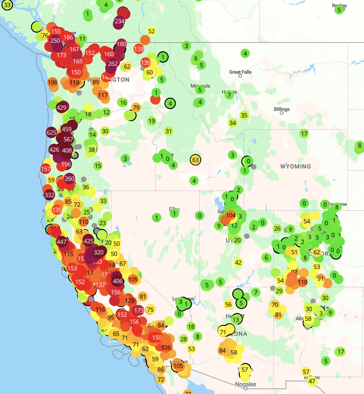
#CAFires2020 - Air Quality
The front from the NE is pushing high winds (& heavy smoke)
purpleair.com map
The front from the NE is pushing high winds (& heavy smoke)
purpleair.com map
#NorCalFires2020 - #BearFire / #NorthComplex THREAD
Plumas Co.
Incident info: inciweb.nwcg.gov/incident/6997/
Map: arcg.is/10OCSn0
#FireMappers
Plumas Co.
Incident info: inciweb.nwcg.gov/incident/6997/
Map: arcg.is/10OCSn0
#FireMappers

#CAFires2020
If you get CalFresh & a wildfire or power outage caused you to lose food that you got with CalFresh, you can request replacement benefits thru Sept 14.
Lake-Mendo-Yolo-Napa-Sonoma-Solano-San Mateo-Santa Cruz
Mariposa, Tuolomne till Sept 21
If you get CalFresh & a wildfire or power outage caused you to lose food that you got with CalFresh, you can request replacement benefits thru Sept 14.
Lake-Mendo-Yolo-Napa-Sonoma-Solano-San Mateo-Santa Cruz
Mariposa, Tuolomne till Sept 21
#NorCalFires2020 - #NorthComplexFire
Butte & Plumas Co.s
EVAC ORDER Update 3:30 PM
Map: bit.ly/3l9aziW
Road Conditions: quickmap.dot.ca.gov
Butte & Plumas Co.s
EVAC ORDER Update 3:30 PM
Map: bit.ly/3l9aziW
Road Conditions: quickmap.dot.ca.gov
#CAFires2020 - #CreekFire
EXPANDED EVAC ORDER 3: 50 PM
EVAC Map: bit.ly/3bzXVVO
(Mariposa Co. is covering Madera & Fresno Co.s)
US Map: bit.ly/3l9aziW
#FireMappers
Road Conditions: quickmap.dot.ca.gov
EXPANDED EVAC ORDER 3: 50 PM
EVAC Map: bit.ly/3bzXVVO
(Mariposa Co. is covering Madera & Fresno Co.s)
US Map: bit.ly/3l9aziW
#FireMappers
Road Conditions: quickmap.dot.ca.gov
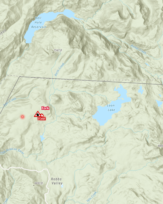
#NorCalFires2020 - Placer Co. #ForkFire
EVAC ORDER: Hell Hole reservoir/campground,French Meadows reservoir/campground&Oxbow reservoir/campground.
All Tahoe NF campgrounds are shut down due to #ForkFire . Rubicon Trail also shutdown to traffic.
EVAC ORDER: Hell Hole reservoir/campground,French Meadows reservoir/campground&Oxbow reservoir/campground.
All Tahoe NF campgrounds are shut down due to #ForkFire . Rubicon Trail also shutdown to traffic.
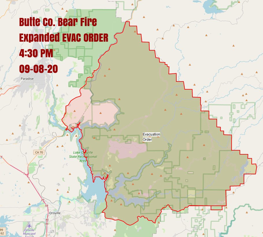
#NorCalFires2020 - #BearFire / #NorthComplex
4:30 PM
EVAC ORDER ZONE MAP:
sartopo.com/m/BD55
Road Conditions: quickmap.dot.ca.gov
4:30 PM
EVAC ORDER ZONE MAP:
sartopo.com/m/BD55
Road Conditions: quickmap.dot.ca.gov

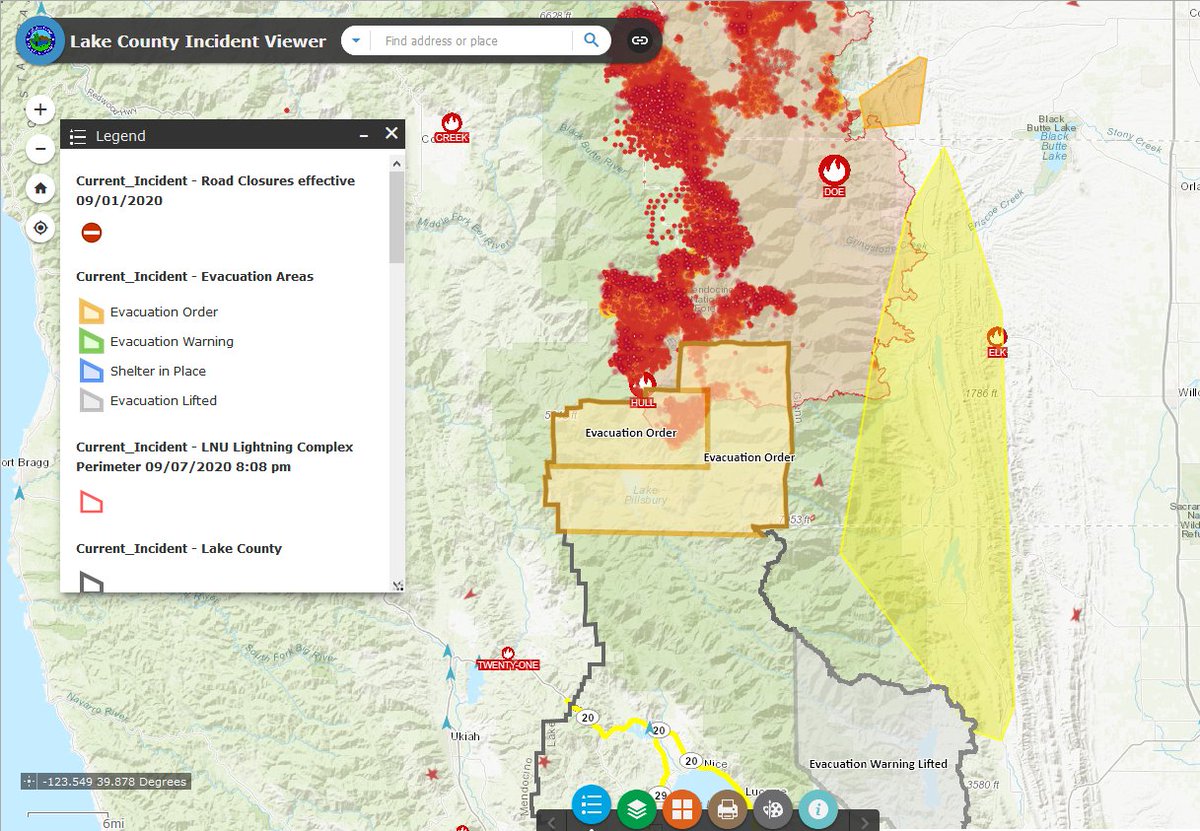
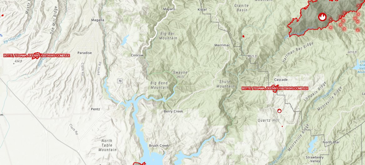
#NorCalFires2020 - Mendocino-Lake-Tehama-Glenn Co. s
#OakFire-#AugustComplexFire
MAP: bit.ly/3gzPtqt
#FireMappers
#OakFire-#AugustComplexFire
MAP: bit.ly/3gzPtqt
#FireMappers
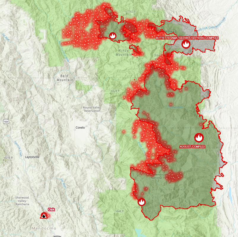
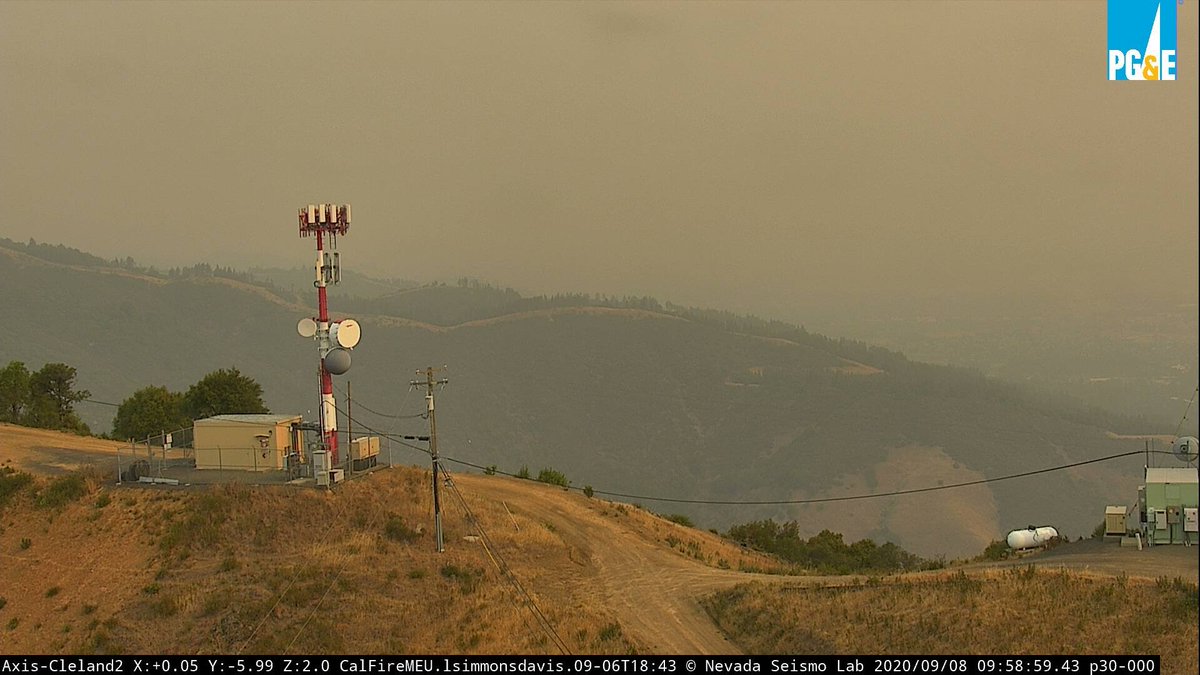
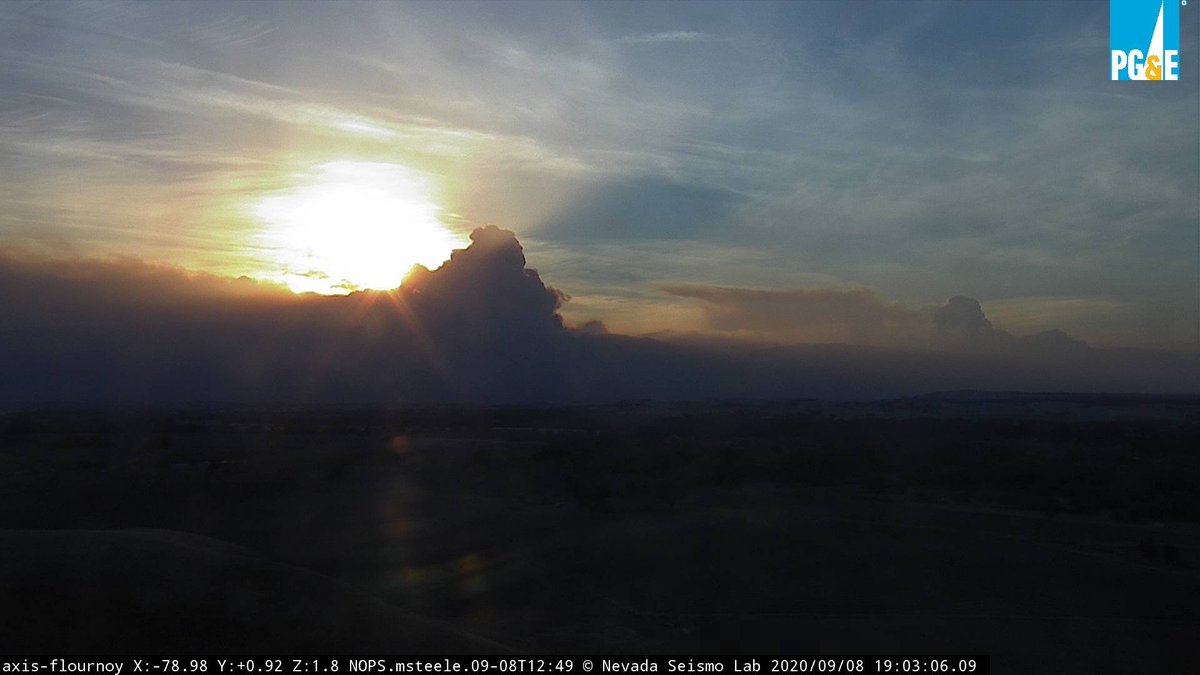
#NorCalFires2020 - Mendocino-Lake-Tehama-Glenn Co. s
#AugustComplexFire & #RedSalmonComplexFire as viewed facing the setting sun in the West from the valley.
alertwildfire.org Flournoy Cam (Shasta-Modoc region)
#AugustComplexFire & #RedSalmonComplexFire as viewed facing the setting sun in the West from the valley.
alertwildfire.org Flournoy Cam (Shasta-Modoc region)
#NorCalFires2020 - Mendocino Co. #OakFire Update
Power to be restored beginning Weds Sept 9 per Sen Mike McGuire 10 PM
Power to be restored beginning Weds Sept 9 per Sen Mike McGuire 10 PM
#CAFires2020 - #CreekFire
Shelter info Update below
EVAC Map: bit.ly/3bzXVVO
(Mariposa Co. is covering Madera & Fresno Co.s)
US Map: bit.ly/3l9aziW
#FireMappers
Road Conditions: quickmap.dot.ca.gov
Shelter info Update below
EVAC Map: bit.ly/3bzXVVO
(Mariposa Co. is covering Madera & Fresno Co.s)
US Map: bit.ly/3l9aziW
#FireMappers
Road Conditions: quickmap.dot.ca.gov
#NorCalFires2020 - #BearFire / #NorthComplex
11:00 PM Update
EVAC ORDER ZONE MAP:
sartopo.com/m/BD55
11:00 PM Update
EVAC ORDER ZONE MAP:
sartopo.com/m/BD55
@threadreaderapp unroll please


