150 Years of All India Summer Monsoon Rainfall.
Count the drought and wet years during the last 20 years. When was the last time that we got a wet year?
Data Source: IMD. Compiled by IITM.
1/5
Count the drought and wet years during the last 20 years. When was the last time that we got a wet year?
Data Source: IMD. Compiled by IITM.
1/5

All India Rainfall (AIR) shows multi-decadal variations, with a slump in recent decades. Decline in rainfall is more evident at regional levels—denoted by the blue colors.
Reference: nature.com/articles/ncomm…
2/5
Reference: nature.com/articles/ncomm…
2/5

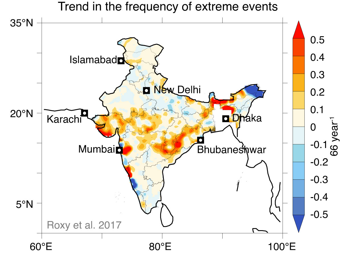
The decline in total rainfall coincides with an increase in heavy rains across many parts of India—denoted by the yellow-red colors.
Reference: nature.com/articles/s4146…
3/5
Reference: nature.com/articles/s4146…
3/5

Over central India, the changes in the monsoon are evident. There's a decline in total rainfall—along with a threefold rise in extreme rains. This means that we are having longer dry periods intermittent with shorter spells of heavy rains.
Reference: nature.com/articles/s4146…
4/5
Reference: nature.com/articles/s4146…
4/5

There are but regions where both the total rainfall and heavy rains are increasing—like Gujarat and Odisha.
5/5
5/5
Data for the 150 years of All India Rainfall is available here:
mol.tropmet.res.in/images//iitm_a…
mol.tropmet.res.in/images//iitm_a…
During the last 20 years of Monsoon (All India Rainfall).
Drought years = 5. That's one in every four years.
Wet years = ZERO.
The last time that we got a wet year = 1994.
Drought years = 5. That's one in every four years.
Wet years = ZERO.
The last time that we got a wet year = 1994.
• • •
Missing some Tweet in this thread? You can try to
force a refresh


