Thread: Varahamihira, the 6th century polymath has 125 verses on groundwater in Brihat Samhita:
"Even as there are veins in the human body, so too are in the earth, some of them running higher, some lower."
So true, esp for hard-rock aquifers! From a book by EAV Prasad PhD.
"Even as there are veins in the human body, so too are in the earth, some of them running higher, some lower."
So true, esp for hard-rock aquifers! From a book by EAV Prasad PhD.
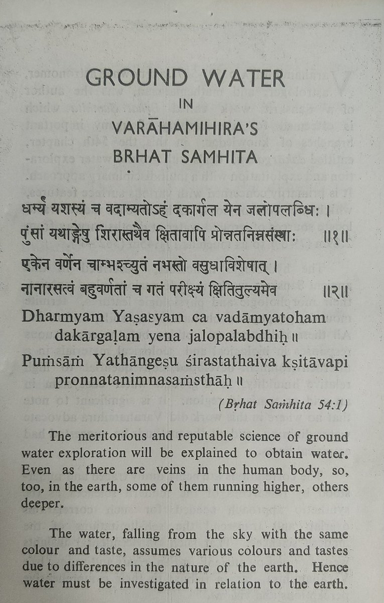
Varahamihira lived in Avanti (MP), and wrote the encyclopedic 'Brhat Samhita' (~The Vast Collection). Its 54th chapter is called 'Dakargalam' (~Groundwater Exploration).
Amazingly, there's no water dowsing! Instead it uses ecological patterns as indicators of GW.
Amazingly, there's no water dowsing! Instead it uses ecological patterns as indicators of GW.
Most emphasis is on certain vegetation as an indication of shallow GW.
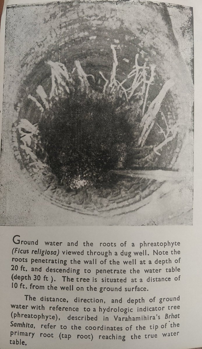
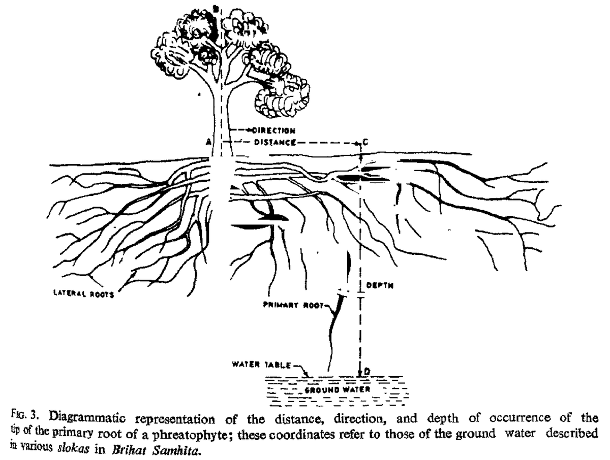
Phreatophytes are plants that depend on water from saturated zone (below water table). Here is the piture of a Pipal tree, seeking water.
In US, Cottonwood trees are a similarly used as GW indicators.
Phreatophytes are plants that depend on water from saturated zone (below water table). Here is the piture of a Pipal tree, seeking water.
In US, Cottonwood trees are a similarly used as GW indicators.
Varahamihira describes tens of trees, and factors like their branching patterns etc to predict the direction and depth of groundwater.
Predictions include precise directions and numbers, which are questionable. But it must not be harshly judged by today's standards.
Predictions include precise directions and numbers, which are questionable. But it must not be harshly judged by today's standards.
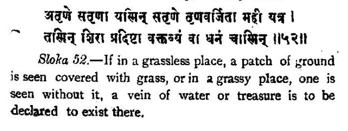
The lack of grass in a grassy area in this shlok, may be alluding to water logging.
It talks about other factors like palm trees with two crowns, thornless individual in the midst of thorny trees, glossy leaves, unusual fruits etc.
It mentions whiteness in certain sap-exuding trunks, which may be due to higher root pressure.
It mentions whiteness in certain sap-exuding trunks, which may be due to higher root pressure.
Termites are also mentioned widely to predict the presence of groundwater.
There have been some (not too rigorous) modern studies which corroborate that termites have a strong preference for sub-surface water. It probably prevents them from desiccation.
There have been some (not too rigorous) modern studies which corroborate that termites have a strong preference for sub-surface water. It probably prevents them from desiccation.
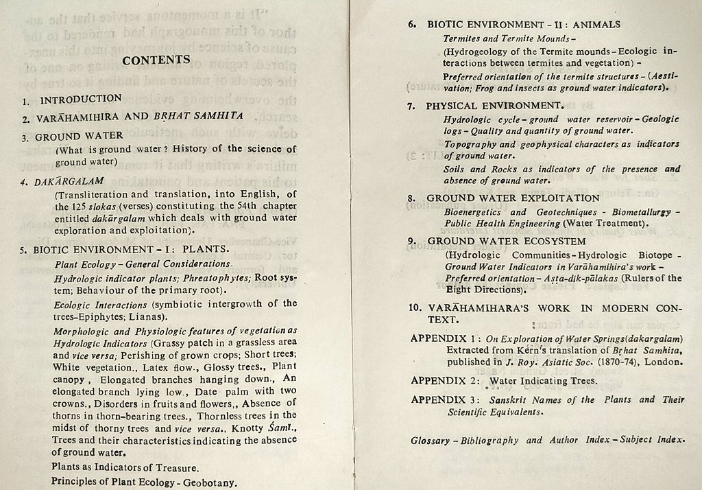
EAV Prasad has written a book and numerous on the subject. Someone handed me down this decades old booklet which contains reviews for the book.
There is much to be learn from traditional ecological knowledge for sure.
There is much to be learn from traditional ecological knowledge for sure.
An open paper (1980) by EAV Prasad: journal.library.iisc.ernet.in/index.php/iisc…
Accessible translation of Brhat Samhita' (see 54th chapter): archive.org/details/Brihat…
Accessible translation of Brhat Samhita' (see 54th chapter): archive.org/details/Brihat…
• • •
Missing some Tweet in this thread? You can try to
force a refresh