Groundwater Resources of India Profile picture
A microblog collating scientific & journalistic information on India's aquifers. Links to some interesting past threads👇🏽. #SciComm
Jul 6, 2021 9 tweets 3 min read
Thread: Varahamihira, the 6th century polymath has 125 verses on groundwater in Brihat Samhita:

"Even as there are veins in the human body, so too are in the earth, some of them running higher, some lower."

So true, esp for hard-rock aquifers! From a book by EAV Prasad PhD. 
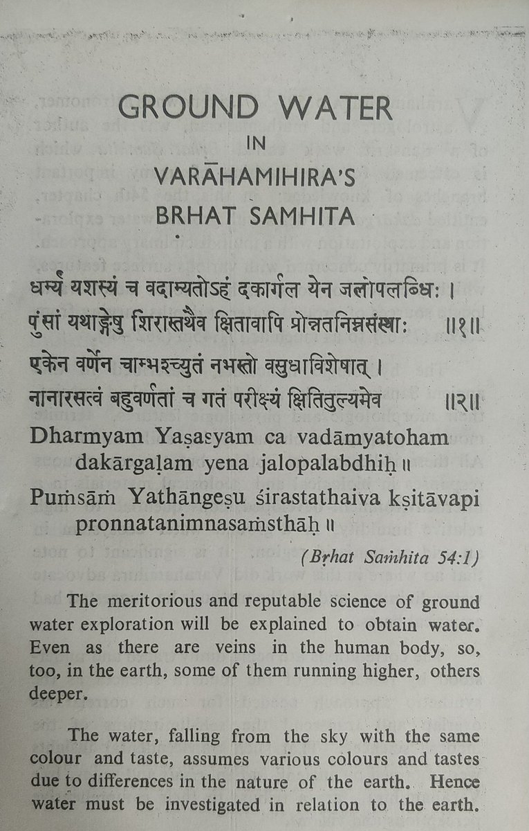
Varahamihira lived in Avanti (MP), and wrote the encyclopedic 'Brhat Samhita' (~The Vast Collection). Its 54th chapter is called 'Dakargalam' (~Groundwater Exploration).

Amazingly, there's no water dowsing! Instead it uses ecological patterns as indicators of GW.
Feb 17, 2021 8 tweets 8 min read
#Thread: Peninsular rivers in India are drying up at a phenomenal rate. Some of them dry up immediately after a flood! This not natural for India's relatively wet climate.

Here's an explainer on the contribution of Groundwater baseflow in keeping our rivers flowing. 
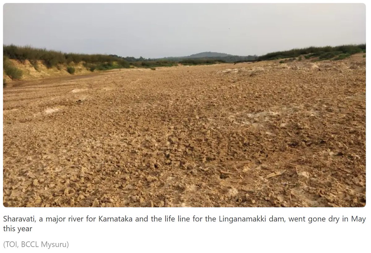
These pictures illustrate the plight of some of our major rivers:
PC: bit.ly/2OJCLNQ
Dec 23, 2020 10 tweets 5 min read
Thread:
What do our aquifer's rocks look like, when dry?
What are the different aquifer types in India?

Here is an aquifer map of India by ACWADAM. The pink Indian Craton is the base, overlain by the green volcanics, blue sediments, & yellow alluvium.

<Gross Generalizations> 
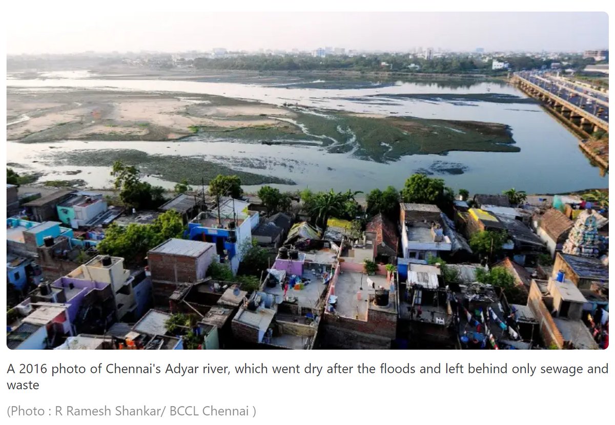
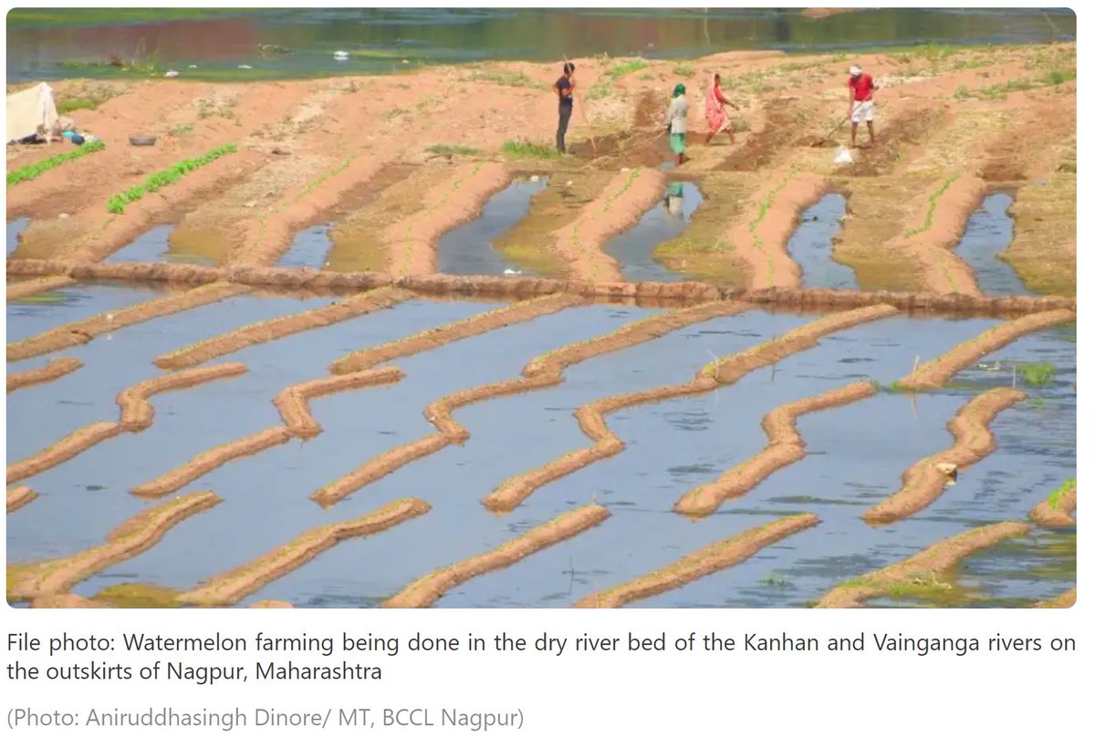
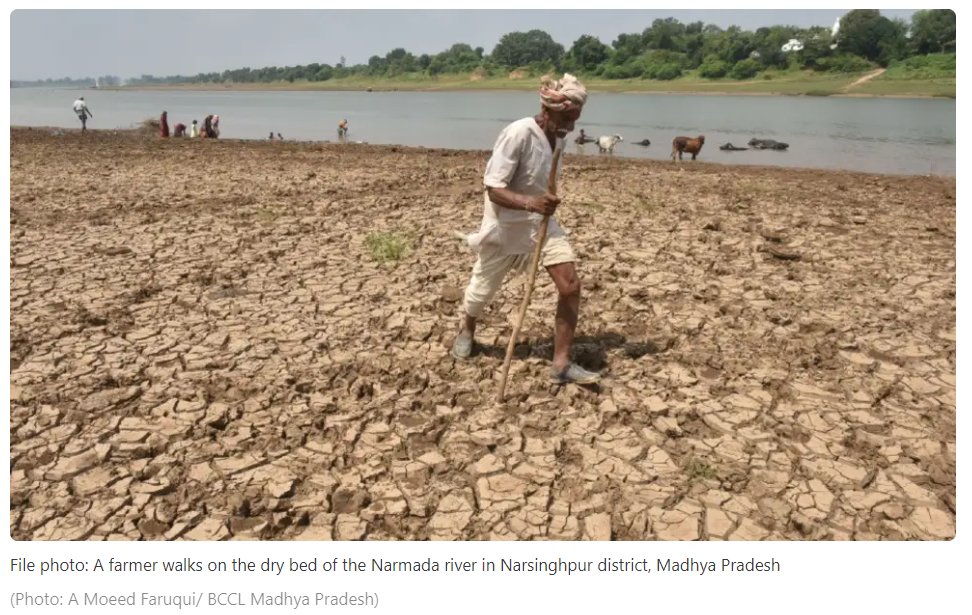
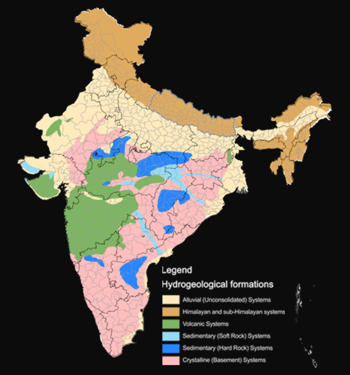
Indus-Ganga Plains aquifer is the most prolific, consisting of alluvium (गाद). The most recent, the thickest, the most porous, & most transmissive!

Contrasting other types, this is "soft rock". When saturated, ~10% is filled with water (CGWB).

Pic: Columbia University
Dec 22, 2020 4 tweets 2 min read
#Factcheck: Is road-side Eucalyptus plantation really bad for GW?

NGT in 2015 ruled against ban on Eucalyptus. This @CSEINDIA report suggests it for Agroforestry.

Water use in L/kg of biomass:
Eucalyptus: 785
Acacia: 1,323
Dalbergia: 1,484
Paddy: 2,000
downtoearth.org.in/blog/water/why… This tweet is based only on the CSE report.

The findings are not undisputed and should be taken with a pinch of salt as stated here by @veenas_water:
Aug 31, 2020 7 tweets 3 min read
While the 2018 NITI Aayog report saying Delhi will run out of groundwater by 2020 was a misunderstanding, a district less than 100 km from Delhi has almost exhausted its freshwater.

Here is a #thread on salinisation of GW of Mewat/Nuh district of Haryana. Dilli zyada door nahi: 
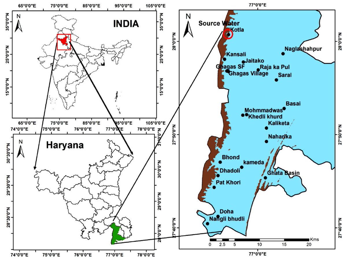
Map from a recent paper by Krishan et al (2020) in the reputed Journal of Hydrology.

Salinity of more than 2 gm/L is considered unfit of drinking & general irrigation.

Only blue in map is freshwater and it REDUCES from 14% to 1% of the area over the monsoon! Why reduce?
Aug 6, 2020 6 tweets 3 min read
#Thread on India's #CarbonateAquifers:

Aquifers may be divided as unconsolidated (alluvial) or consolidated (hard-rock).

Among the consolidated - carbonate aquifers (made of Limestone/Dolomite) are special, as they are often very productive. Map - Shah et al (2018).

#Retweet Image 
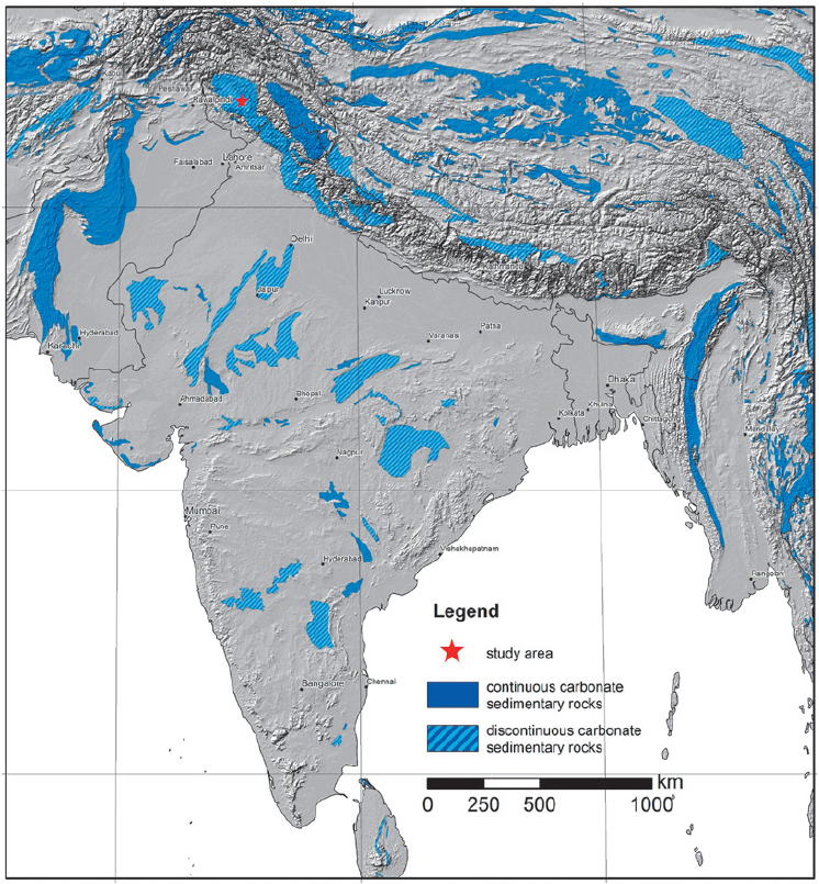
Limestone often dissolves in the groundwater (a process called karstification), creating much more space & hydraulic conductivity. Space for water is denoted by Specific yield = % of vol of water/rock.

@CGWB_CHQ here gives values for Specific Yield for as carbonates 2-15%: Image
Jun 30, 2020 8 tweets 3 min read
Thread: Delhi has a lot of GW, as its on a thick alluvial aquifer formed by Yamuna. But the GW situation is grave because most of the GW is salty (Orange in map) & unusable!

Snippets from the recent National Project for Aquifer Management (NAQUIM) report by @CGWB_CHQ 
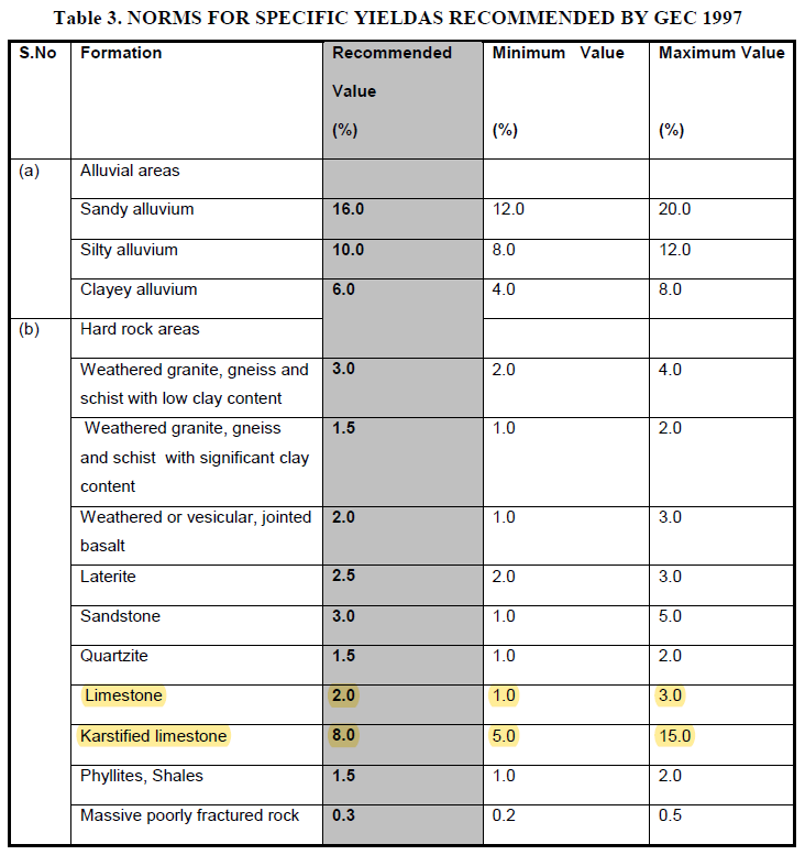
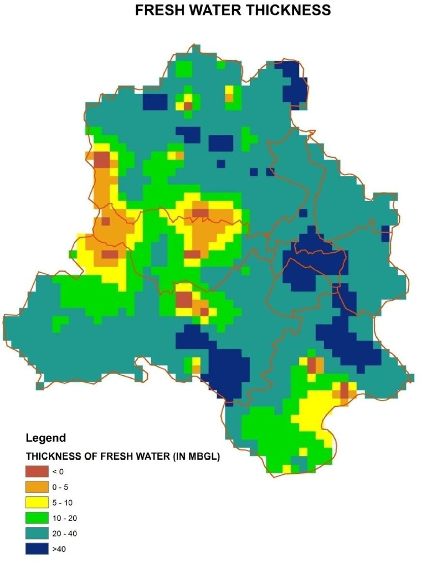
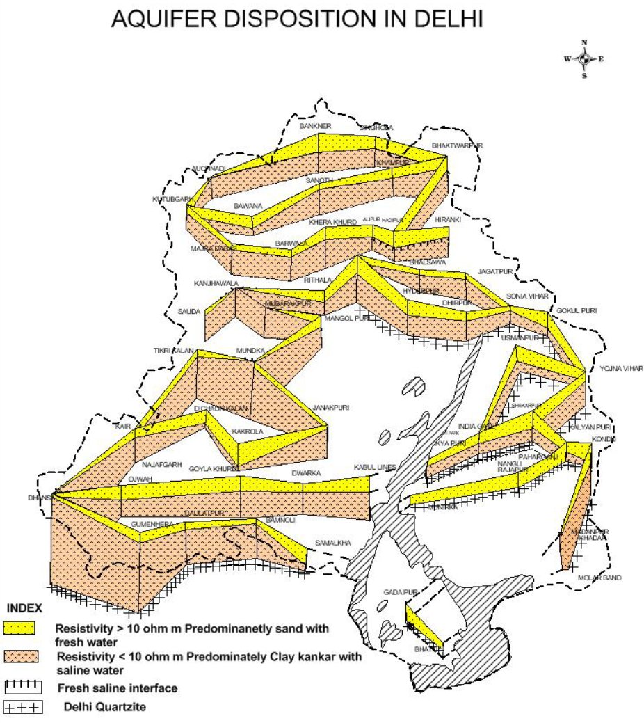
This map shows thickness of fresh-water left. If you have lived in areas of west Delhi like Dwarka you would know how salty the groundwater is.