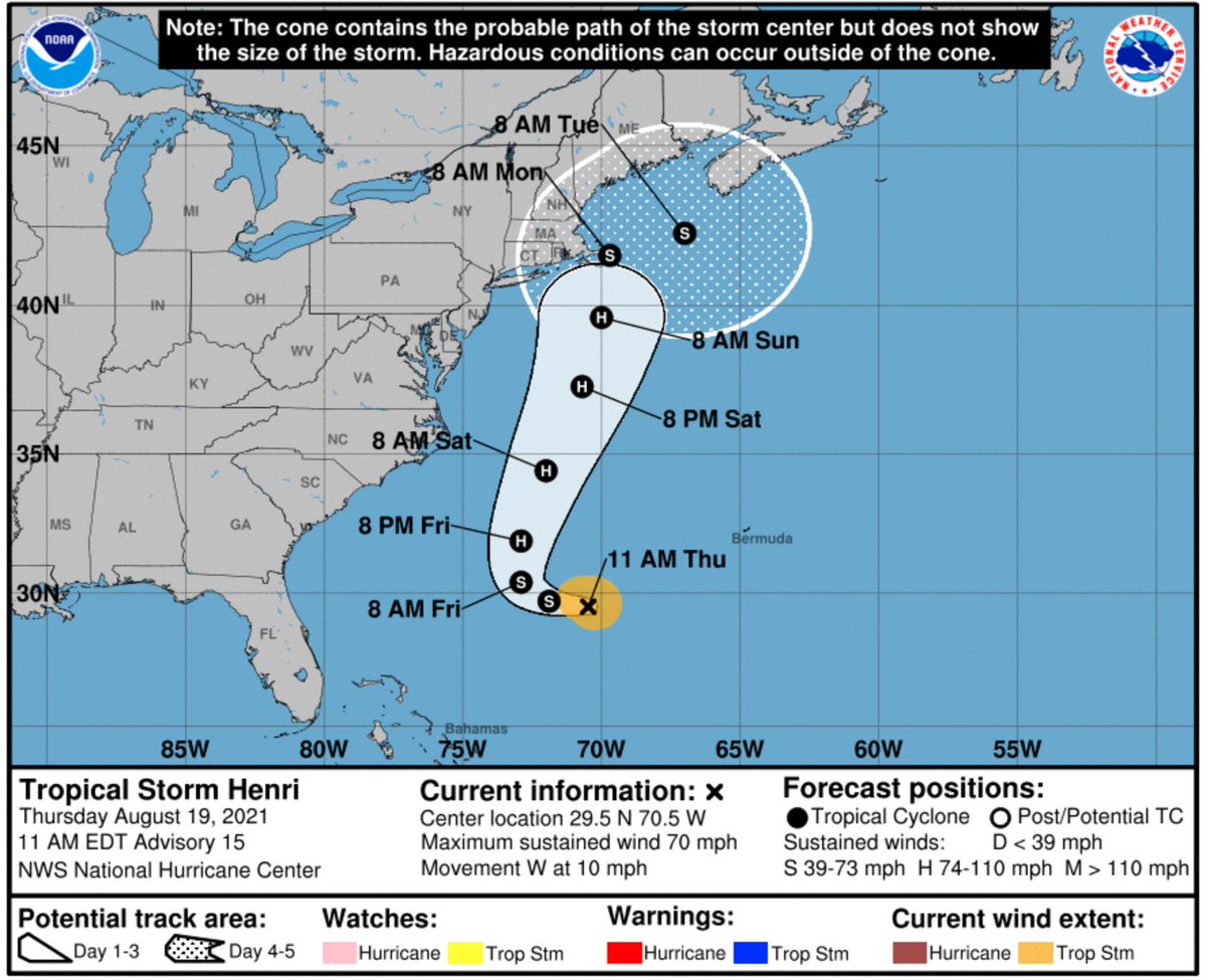
Getting very very extra worried about inland flooding potential from #Henri.
8-10 inches of rain in the Catskills would be on par with what the region received during Hurricane Irene in 2011 — one of the worst inland floods in US history creating damage of $15.8B.
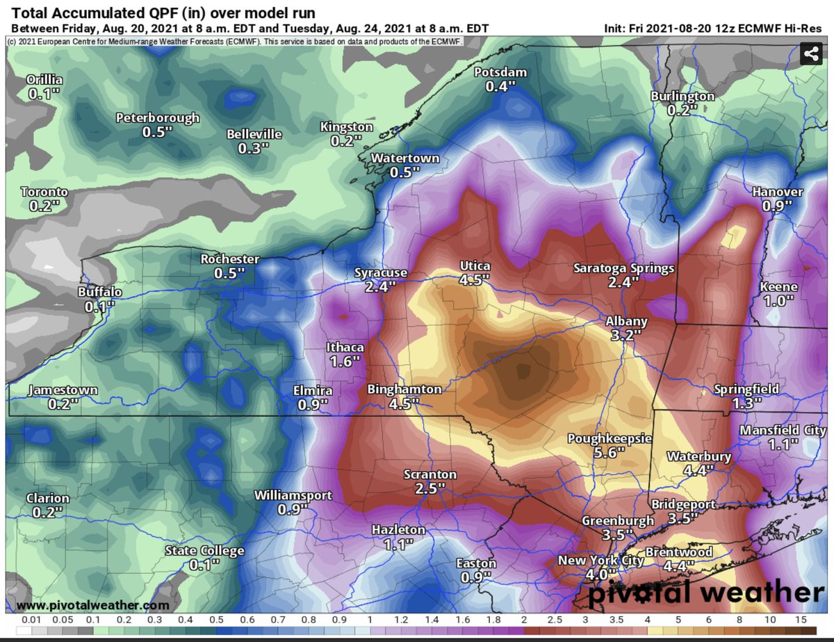
#Henri's very heavy rainfall will be falling in a region where the ground is already saturated. This summer has been very wet in New England, and another tropical system (Fred) moved through just *yesterday*.
#Henri's rain has nowhere to go but worsen the flood situation.
Water (not wind) is the deadliest part of any tropical cyclone. In the case of #Henri, inland flooding will probably be (much) worse than coastal flooding.
Looks like the NOAA hurricane hunter plane just passed through #Ida's eye again and found it even stronger: 145kt flight level, 131kt SFMR estimated surface winds.
If that holds, #Ida would now have winds equivalent to Laura (2020), Louisiana's strongest-ever hurricane landfall.
This supports an increase in #Ida's sustained winds to 150mph, just 10mph below Category 5.
We'll wait for @NHC_Atlantic to confirm in about 30 minutes.
New dropsonde data from this NOAA hurricane hunter center pass inside #Ida show winds of 161kt about 1000 ft above the surface, and a central pressure of 936mb. That might be enough for an upgrade to Category 5.
Our Founding Members serve as an informal advisory group, and help us incorporate new projects to establish truly interactive, care-focused weather and climate conversations for folks who are systematically underserved.
— Talking about weather and climate in languages other than English
— Focusing our efforts on places outside of the United States
— Stories about climate solutions that can transform the system on an emergency timeline
Tropical Storm #Henri struggled to strengthen overnight, which is great news because a weaker storm will be more likely to stay out to sea.
Sure enough, the latest forecast track from @NHC_Atlantic has shifted a bit further offshore of New England:
TS #Henri update:
No major changes this morning from @NHC_Atlantic, other than the fact that the NYC metro area is now outside the cone again — good news.
TS #Henri update, 5pm:
Another nudge back towards land. Of note is that @NHC_Atlantic is now expecting Henri to be near hurricane force for a full 24 hours on its closest approach to Cape Cod and the islands off of Massachusetts. That's a recipe for severe coastal flooding.