No TLEs for China's TJS-7 satellite since Aug 25. Plausible that it made an apogee burn around Aug 25 0800 UTC over ~ 112E. I suspect it to be a successor to TJS-3 and not a Huoyan sat as originally reported (despite the Huoyan-like image in the launch animation).
Meanwhile TJS-3 departed 87E on Aug 30 heading west. TJS-3 Subsat remains on station at 59.0E as it has done since launch. I wonder if the reports that TJS-7 will dock with TJS-6 couud be a mistake for a planned docking with TJS-3 . Just speculation, we'll have to watch the TLEs
Recap (1): TJS (Tongxin Shiyan Weixing, Communications Experiment Satellite) is a cover name for at least 3 series of satellites
Recap (2): TJS-2, 5 and 6 are thought to actually be Huoyan-1 01, Huoyan-1 02, and Huoyan-1 03, infrared missile launch warning satellites from SAST/Shanghai. currently at 66E, 107E and 178E in GEO.
Recap (3): TJS-1 and 4 are thought to be Qianshao-3 01 and Qianshao-3 02, signals intelligence satellites from CAST/Beijing, at 155E and 83E in GEO.
Recap (4): TJS-3 is something different. It was launched to 59E with a subsatellite (misleadingly dubbed "TJS-3 Apogee ick Motor" by Space Force). The subsat, which I will call TJS-3B for now, remains at 59E. TJS-3 itself moved to 173E in Jun 2019 and then to 87E in Jan 2021
TJS-3 then started moving again on Aug 30, less than a week after TJS-7 was launched.
• • •
Missing some Tweet in this thread? You can try to
force a refresh
I made some fake TLEs consistent with a successful orbit for the Astra launch to illustrate its intended path SE from Kodiak: (planned orbit was 415 x 415 km x 70 deg)
I then worked back from these to make TLEs for the actual flight based on the best estimate apogee and velocity
These TLEs give a formal orbit of -6350 x 31 km x 64.1 deg. A couple points here: the apogee is conventionally given relative to a spherical 6378 km Earth. The actual apogee of this orbit above the surface, because of Earth's polar flatting, is 47.5 km. Also, ...
Astra rocket - looks like a problem at Max Q. Something fell off and then "Terminate Sent".
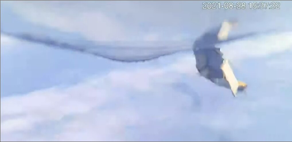
Launch failure confirmed. Fatal problem happened at 33 km altitude at 22:37:32 UTC, 2.5 min into flight. But amazing it got that far after the initial sideways skid at launch
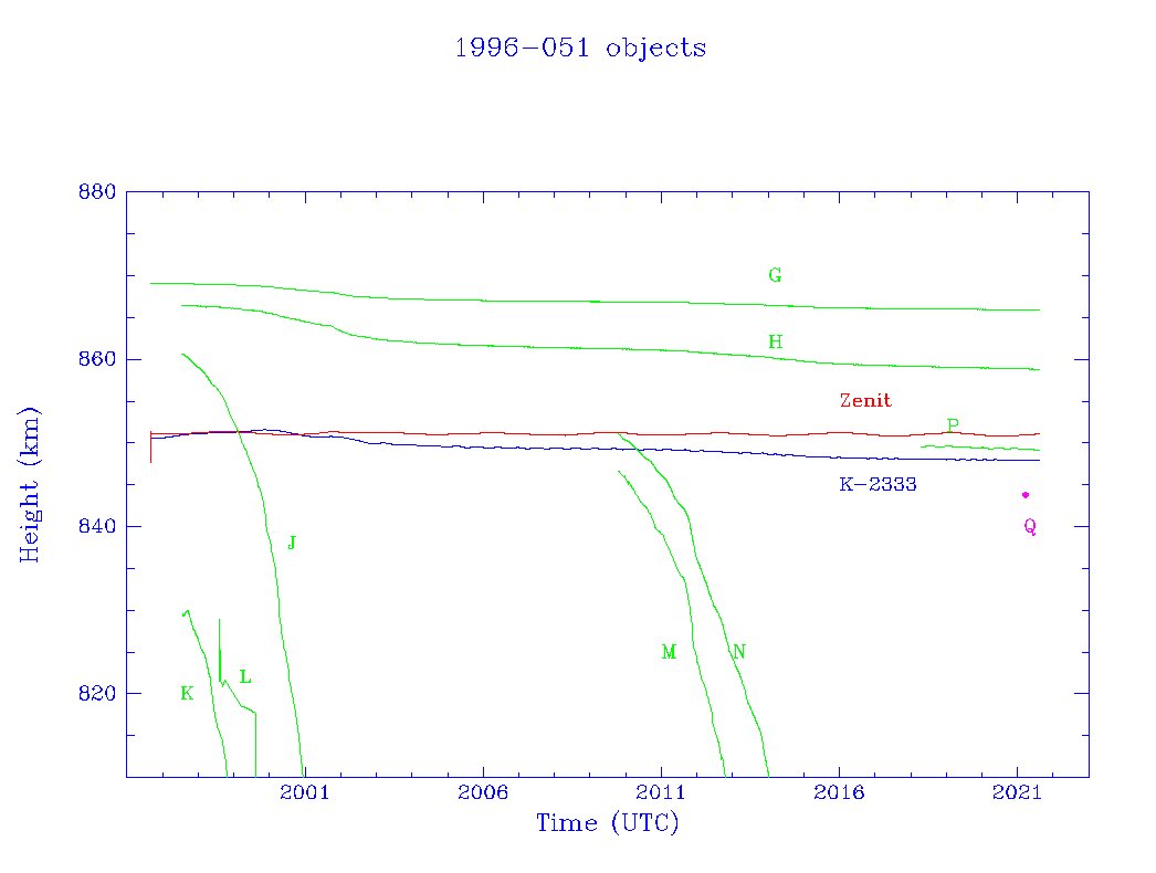
So where did this debris object come from? The large 9-tonne Zenit second stages in the higher part of LEO have long been identified as a major source of collision risk. But this wasn't the stage itself but a piece that came off it. Let's look at the objects from this 1996 launch
Object A was Kosmos-2333, a Tselina-2 spy sat. Object B is the Zenit rocket stage that put it in orbit. Objects C,D,E,F are small separation motor covers ejected to a higher orbit. Let's look at the remaining debris objects G to Q.
G,H, J, K, L appear to have come off at launch. G and H must be fairly dense and their orbits have not decayed much. J, K and L were light things that have now reentered.
Space-Track catalog updated today with a note for object 48078, 1996-051Q: "Collided with satellite".
This is a new kind of comment entry - haven't seen such a comment for any other satellites before. Let's look a bit closer:
48078 is a small debris object from the Zenit-2 rocket that launched a Tselina-2 electronic spy sat in Sep 1996. Between 1997 and 2021, 8 debris objects were tracked from the rocket. This one, added to the catalog in Mar 2021, has only a single element set, epoch 2021 Mar 16
I conclude that they probably only spotted in tin the data after it collided with something and that's why there's only one set of orbital data. So the collision probably happened shortly after the epoch of the orbit. What did it hit?
ESA's Solar Orbiter entered Venus' graviational sphere of influence at 0446 UTC Aug 8 and will fly past the planet at an altitude of 7994 km at 0442 UTC Aug 9. It will reenter solar orbit at 0441 UTC Aug 10 . The flyby will increase the orbit from 0.49 x 0.95 AU to 0.59 x 1.21 AU
Meanwhile the ESA-JAXA Bepi-Colombo probe enters the Venus grav sphere at 0338 UTC Aug 9 and departs 0010 UTC Aug 12. The 552 km flyby at 1351 UTC Aug 10 sets it on course for Mercury
Here are the trajectories of the probes compared to the Venus Hill Sphere
OK I found a much better solution for the Starship flight. I was starting it off with SECO at much too high an altitude.
Better solution: about 50 x 250 km
The GoogleEarth path doesn't look dramatically different, the ground track is pretty much identical
This solution satisfies the 250 km max altitude, low perigee, and Hawaii range. I'm much happier now!