1/7 It is the first anniversary of the 2020 Downslope Wind Storm that impacted much of northern Utah. This event goes down as one of the most widespread, impactful weather events the state has experienced in many years. This thread details some of the impacts. #utwx 

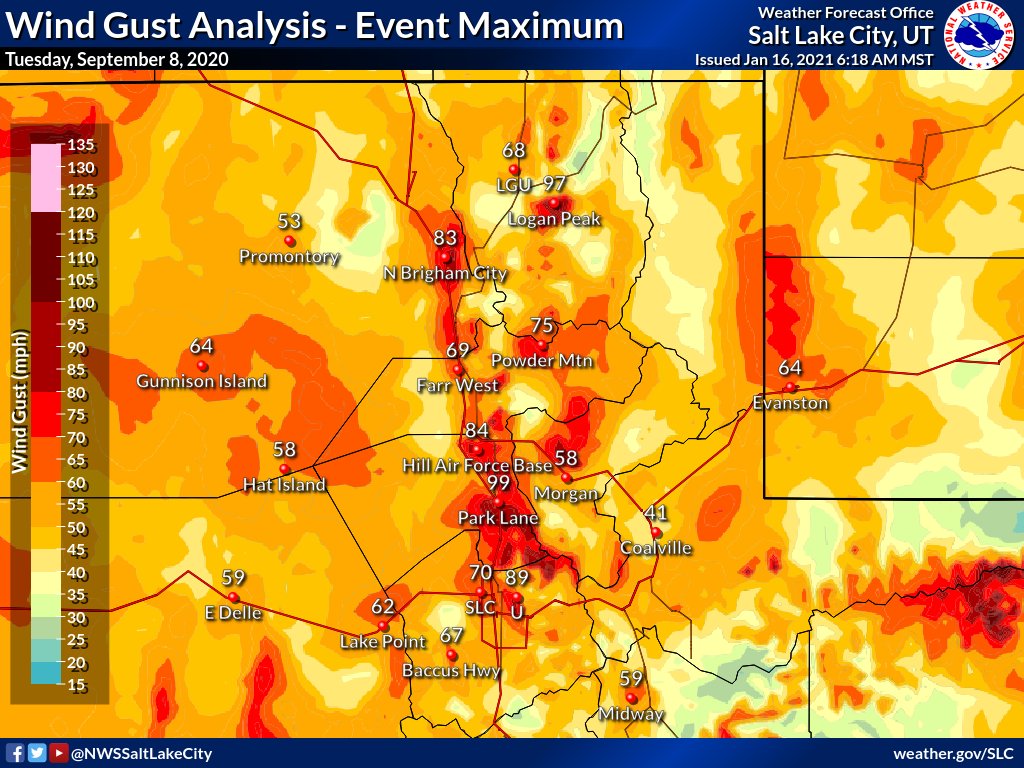
2/7 Here are the peak wind gusts for the event across northern Utah. Wind gusts as high as 99 mph were reported (with unofficial reports near the U over 100 mph). 

3/7 Initial reports estimated more than 4500 trees were damaged or downed during the event across mainly Salt Lake, Davis and Weber Counties. Liberty Park lost near 70 trees. Some of these tress were up to 100 years old. Tree damage was especially severe due full leaf canopies.
4/7 At the height of the storm, over 180,000 customers were without power, with some of these outages lasting for days. Schools were cancelled in Salt Lake, Davis and Weber Counties. The Univ. of Utah, Weber State and the State Capitol also shut down
5/7 Transportation was severely impacted. I-15, US-89 and other major north-south routes across the northern Wasatch Front had periods of closures. Over 50 semi-trucks were overturned. TRAX and Frontrunner were also heavily impacted.
6/7 This event also featured very strong winds in Cache and Morgan County, with a wind gust to 68 mph reported at Logan Airport. 13,000 customers lost power in the Cache Valley with significant tree damage. Some trees were up to 140 years old.
7/7 While the 2011 Downslope Windstorm saw higher gusts (up to 103 mph), the 2020 Downslope Windstorm impacted a significantly larger area and population. #utwx
• • •
Missing some Tweet in this thread? You can try to
force a refresh


