A 2nd thread on Lake Powell from this weekend. See earlier thread for Tweets 1-14.
/15 Here's the bottom of the Wahweap Stateline ramp, now closed.
/16 This is the recently opened Stateline replacement ramp. It opened just days ago.
/17 View of Wahweap Marina from the access road. The white areas across the reservoir center and right were underwater until recently.
/18 Same area as 18, but looking to right. Boats now have to navigate new S-Bend to access main part of lake. Backside of Glen Canyon Dam visible in distance.
/19 Backside of dam. White band is 155' tall.
/20 Dam. Note cut on far bank for side channel spillway.
/21 Dam.
/22 Top of walkway to Antelope Point Marina. In the far distance, horizontal lines of bushes make previous lake shores.
/23 Looking at the Antelope Point walkway from the bottom. Note the cliff where the wide walkway ends, and the new, narrow, extension needed to overcome the cliff. The Marina also had to excavate a new path for their service vehicles. END.
• • •
Missing some Tweet in this thread? You can try to
force a refresh
/1 I spent the weekend looking at various locations on Lake Powell. A short thread follows on what I saw and my impressions. Lake Powell is the 2nd largest reservoir in the US. Since 2000 flows in #ColoradoRiver are down by 20%, half due to #climatechange.
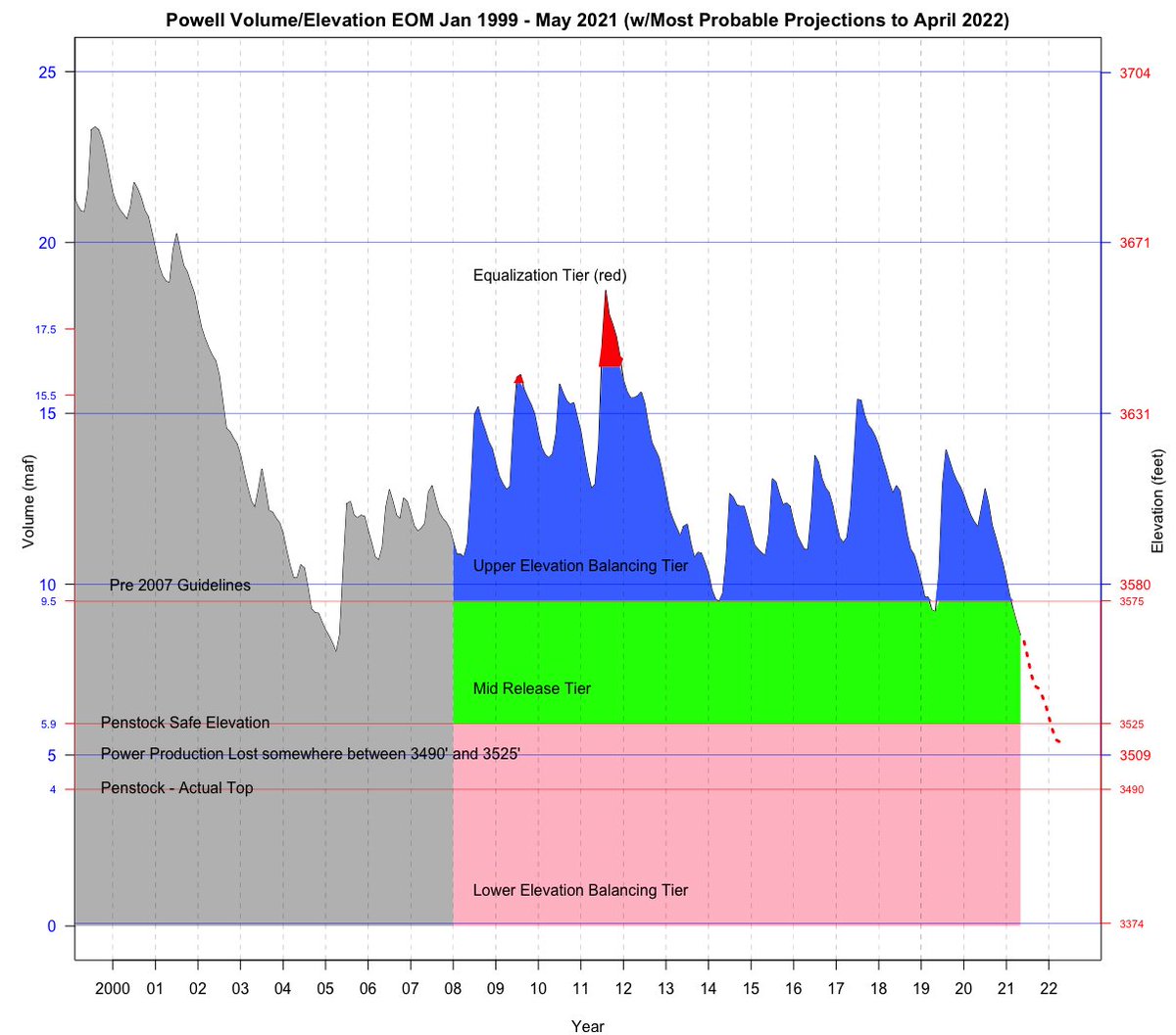
/2 Here's a look at Powell contents since 2000. We're at 3545 (right axis) now, about 7 maf out of 25 maf possible. It is stunning how low the lake is.
/3 I visited Bullfrog Marina, the overlook that shows Hite Marina and the river now down cutting through 50-year-old lake sediments, the new Cataract Canyon takeout, Wahweap Marina, Glen Canyon Dam, and Antelope Point Marina.
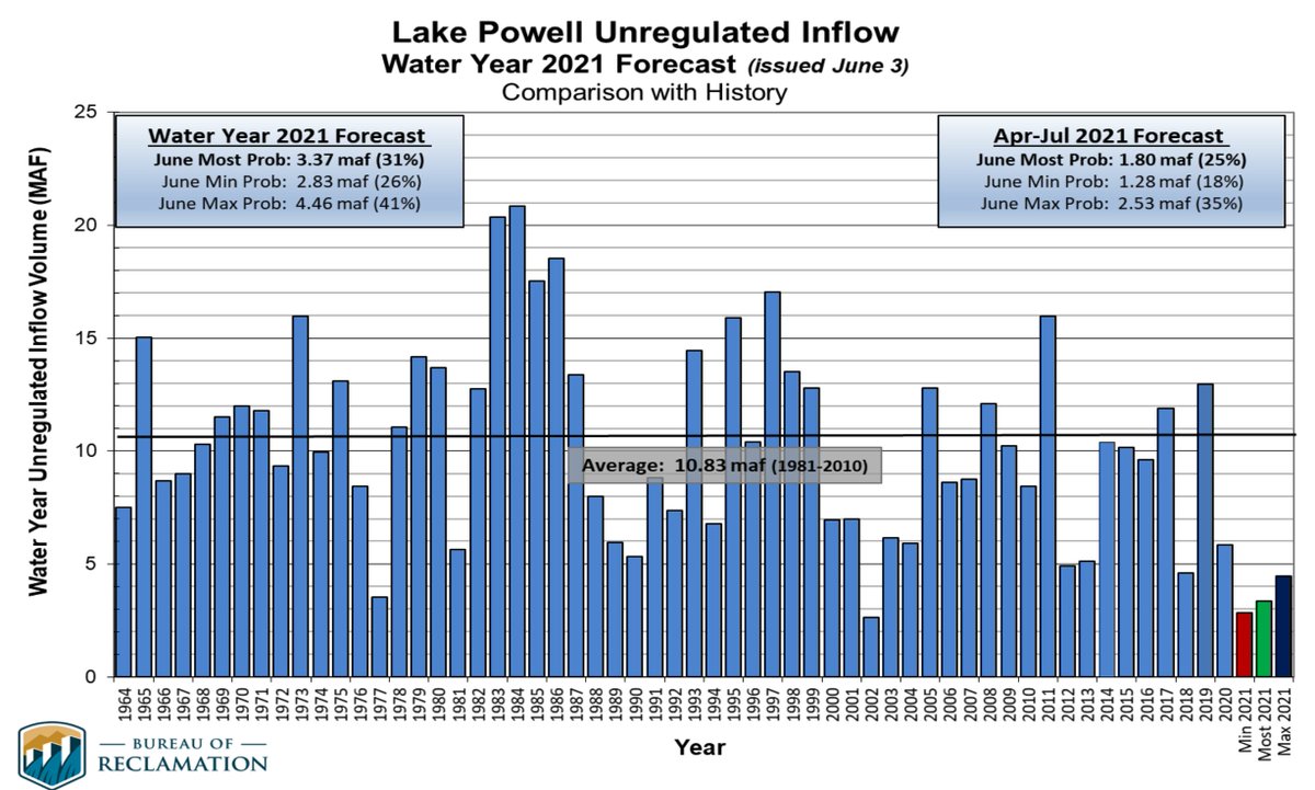
2. Reclamation’s ‘unregulated inflows’ into Lake Powell show that 2021 will be the 2nd worst year after only 2002 going back to 1964. 2021 will be the RED bar most likely. This is a really grim year for runoff.
3. 2021 Inflow will be only ~3 maf, compared to the 1981-2010 average of 10.3 maf or the 2000-2021 average of 8.3 maf (20% less than 1981-2010 average).
(maf = million acrefeet)
4. Considering that Powell will release / evap ~ 8.5 maf, the lake will lose ~ 5 maf this year or ~55 feet of elevation.