
Senior Water and Climate Research Scientist/Scholar, Colorado State University. Climate Change and Water. @brad_udall
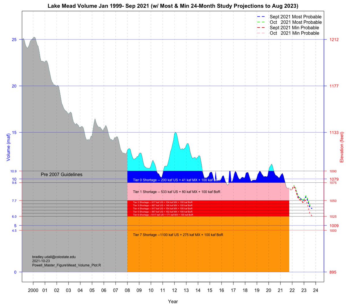
 2. This shows the combined contents back to 1935 when only Mead existed. In 1963 Lake Powell begins to fill. By 1983 the two are totally full -- even over full for a bit as Lake Powell had temp plywood boards installed to prevent downstream flooding.
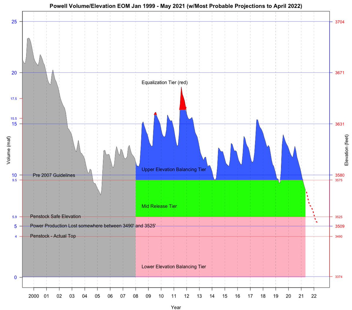
 2. The Min Probable projections for both Sep and Oct are well below safe minimum power elevation of 3525 for most of the projections and even below the top of the penstocks at 3490 for some time.

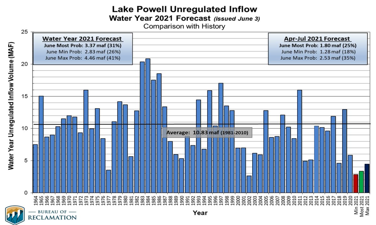 3. 2021 Inflow will be only ~3 maf, compared to the 1981-2010 average of 10.3 maf or the 2000-2021 average of 8.3 maf (20% less than 1981-2010 average).