Looking forward to reading this! First, a point of caution to breathless reporters - this is about MARITIME claims, not TERRITORIAL claims.
https://twitter.com/StateDeptSpox/status/1481394976424660998
It judges Chinese claims against UNCLOS - the UN Convention on the Law of the Sea - which China ratified in 1996. It finds four types of Chinese claims that are 'unlawful' - ie incompatible with UNCLOS
1. Sovereignty claims to reefs and other features that lie entirely underwater.
2. Drawing straight baselines around very spread-out groups of islands
3. Claiming to own everything within those baselines
4. Unspecified 'historic rights' that go beyond UNCLOS
2. Drawing straight baselines around very spread-out groups of islands
3. Claiming to own everything within those baselines
4. Unspecified 'historic rights' that go beyond UNCLOS
"No provision of the Convention contains the term “historic rights,” nor is there a uniform understanding of what, specifically, the term means as a matter of international law." p9
The idea of 'historic rights' in the South China Sea was invented by Prof Kuen-Chen and other nationalist 'New Party' politicians in Taiwan in the late 1980s and 1990s. I tell the story here:
tandfonline.com/doi/abs/10.108…
tandfonline.com/doi/abs/10.108…
"the advent of exclusive jurisdiction of a coastal State over fisheries within 200 [nautical miles] of its coast overrides the prior usage and rights of other States in that area."
In other words, UNCLOS trumps what went before
In other words, UNCLOS trumps what went before
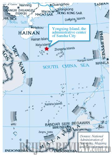
PRC asserts sovereignty over... “Nanhai Zhudao” or the South China Sea islands and other features that consist of “Dongsha Qundao” “Xisha Qundao” “Zhongsha Qundao” & “Nansha Qundao.”China Geographical Names Committee has issued a list of geographic features associated with each
The Chinese Society for International Law... states that “[s]overeignty over an archipelago as a unit naturally covers sovereignty over each and every component part,” namely “all component features and the interconnecting waters.”
This is VERY BAD for international law
This is VERY BAD for international law
The original reason why China claimed underwater features as territory is because its officials didn't have a clue what was what. They were motivated by nationalism not measurement.
Another plug for my telling this story of ignorance and cockup:
journals.sagepub.com/doi/abs/10.117…
Another plug for my telling this story of ignorance and cockup:
journals.sagepub.com/doi/abs/10.117…
The 'Zhongsha Qundao' (the middle sands archipelago) doesn't actually exist. Apart from Scarborough Shoal, all its features (such as Macclesfield Bank) are underwater. Yet Chinese officials continue to claim that it does, making themselves look VERY SILLY.
Then we turn to straight baselines. China asserted baselines around the Paracels in 1996. They aren't compatible with the rules of UNCLOS, as this map demonstrates 

Next it's the Spratlys, and another useful map of what might be (but is not confirmed to be) a Chinese claim of hypothetical straight baselines around all the features named by PRC documents. All the outlying features here are UNDERWATER and therefore NOT TERRITORY 

This is what the claims to territorial waters around actual (above water) rocks and reefs should look like. Note that the US is not taking a position on who legitimately owns these rocks or the blobs of sea around them 

There's a bit of legal argument pushing back against PRC attempts to justify straight baselines. It asserts "there are no customary international rules that provide a different, and more permissive, legal framework for establishing baselines pertaining to outlying island groups"
It points out that Article 47 of UNCLOS defines the maximum ratio of water area to land area that may be enclosed within archipelagic baselines as 9-to-1. The ratio within China's Paracels baselines is 37-to-1 and within the hypothetical Spratly baselines it's 950-to-1!
Moving to 'historic rights' (p27), "Although the PRC has not provided specific information regarding the geographic extent of its historic rights claim, it appears that this claim may coincide with the dashed lines on PRC maps"
"it is not known what specific rights are claimed by the PRC, or whether such rights are exclusive or, alternatively, rights that are shared with other coastal States. The PRC... has not provided a legal justification for such a claim."
BECAUSE THEY CAN'T!
BECAUSE THEY CAN'T!
At this very moment, officials and lawyers in the PRC (and the ones China pays elsewhere) are trying to reverse engineer a logical 'historical rights' claim out of the legal nonsense spun by Prof Fu Kuen-chen, which was, unfortunately, incorporated into the PRC's 1998 EEZ law
And then the conclusion (p30)
"The overall effect of these maritime claims is that the PRC unlawfully claims sovereignty or some form of exclusive jurisdiction over most of the South China Sea."
"The overall effect of these maritime claims is that the PRC unlawfully claims sovereignty or some form of exclusive jurisdiction over most of the South China Sea."
My view (if anyone cares) - it's very good. It's clear, balanced, based on good evidence and well argued. It will be a standard reference for future discussions on the legality of China's claims in the South China Sea.
Congrats to the authors Kevin Baumert, Amy Stern, and Amanda Williams
• • •
Missing some Tweet in this thread? You can try to
force a refresh


